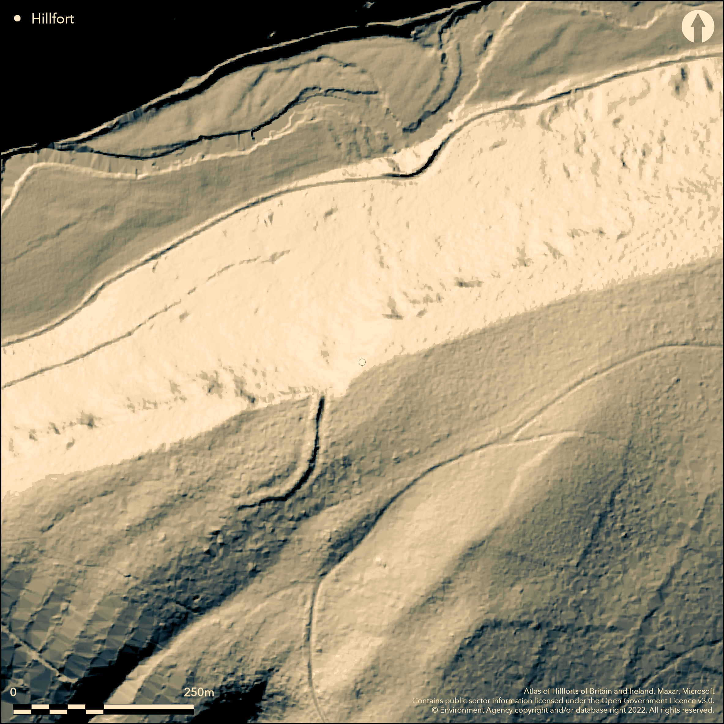
LiDAR 1m DTM Hillshade
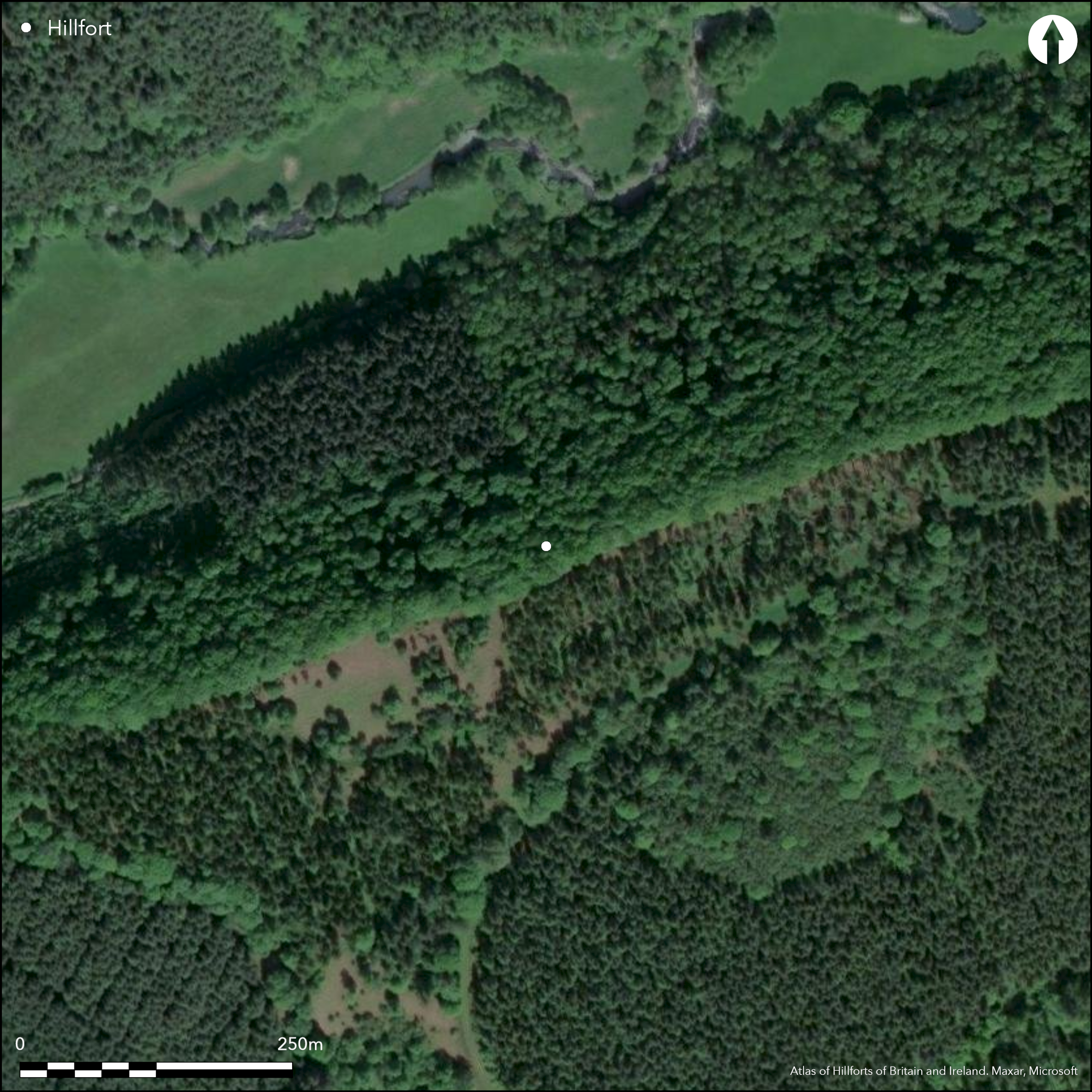
Satellite Imagery
LiDAR 1m DTM Hillshade
Satellite Imagery
Scroll left/right to view further images.
HER: Herefordshire MHE10563 (30297)
NMR: None (None)
SM: None
NGR: SO 406655
X: 340650 Y: 265550 (OSGB36)
Univallate, possible level terrain fort, only recorded in 1999 and not on OS map. Area determined from dimensions. D-shaped and forming a near complete half circle abutting the steep slopes to the N, the site is 150m in diameter and located in a Forestry Commission plantation of Mere Wood. The single bank with ditch is up to 2m in height and width. Possible SW entrance. Three trenches opened in interior following geophysics and bank and ditch investigation (Ray and Hoverd 2000). This showed no sign of occupation and suggested that site was unfinished, no dating evidence. Possible gang working found at 17m intervals as result of topographical survey. Forestry Commission plantation cleared in 2011, the site now managed with scrub clearance once a year. Generally improving situation.
Citizen Science: ✗
Reliability of Data: Confirmed
Reliability of Interpretation: Confirmed
X: -319653 Y: 6851793 (EPSG: 3857)
Longitude: -2.8714909008487344 Latitude: 52.28483766094059 (EPSG:4326)
Country: England
Current County or Unitary Authority: Herefordshire
Historic County: Herefordshire
Current Parish/Community/Council/Townland: Aymestry
Forestry Commission plantation cleared in 2011, the site now managed with scrub clearance once a year. Generally improving situation.
| Extant | ✓ |
| Cropmark | ✗ |
| Likely Destroyed | ✗ |
Sited within a Forestry Commission plantation with free public access. Now pasture.
| Woodland | ✗ |
| Commercial Forestry Plantation | ✓ |
| Parkland | ✗ |
| Pasture (Grazing) | ✓ |
| Arable | ✗ |
| Scrub/Bracken | ✓ |
| Bare Outcrop | ✗ |
| Heather/Moorland | ✗ |
| Heath | ✗ |
| Built-up | ✗ |
| Coastal Grassland | ✗ |
| Other | ✗ |
The three hillforts of Mere Hill, Pyon Wood (Atlas No 0029) and Croft Ambrey (Atlas No 0012) are located in a line along the River Lugg. Mere Hill located at the edge of steep escarpment overlooking valley of River Lugg in vicinity of Pyon Wood and Croft Ambrey.
| Contour Fort | ✗ |
| Partial Contour Fort | ✗ |
| Promontory Fort | ✗ |
| Hillslope Fort | ✗ |
| Level Terrain Fort | ✓ |
| Marsh Fort | ✗ |
| Multiple Enclosure Fort | ✗ |
| Hilltop | ✓ |
| Coastal Promontory | ✗ |
| Inland Promontory | ✗ |
| Valley Bottom | ✗ |
| Knoll/Hillock/Outcrop | ✗ |
| Ridge | ✗ |
| Cliff/Plateau-edge/Scarp | ✓ |
| Hillslope | ✗ |
| Lowland | ✗ |
| Spur | ✗ |
Dominant Topographic Feature: Cliff edge location.
| North | ✗ |
| Northeast | ✗ |
| East | ✗ |
| Southeast | ✗ |
| South | ✗ |
| Southwest | ✗ |
| West | ✗ |
| Northwest | ✗ |
| Level | ✓ |
Altitude: 238.6m
N/A
None
Reliability: D - None
| Pre 1200BC | ✗ |
| 1200BC - 800BC | ✗ |
| 800BC - 400BC | ✗ |
| 400BC - AD50 | ✗ |
| AD50 - AD400 | ✗ |
| AD400 - AD 800 | ✗ |
| Post AD800 | ✗ |
| Unknown | ✓ |
| Pre Hillfort: | None |
| Post Hillfort: | None |
Excavation and topographical survey by Herefordshire Archaeology (Ray and Hoverd 2000); all three trenches devoid of archaeology. Herefordshire Council survey 2012.
| Excavation (2000): | Excavation by Herefordshire Archaeology. |
| Earthwork Survey (2000): | Recent topographical survey by Herefordshire Archaeology. |
| Other (2012): | Herefordshire Council survey. |
No archaeology found in interior excavation. Excavation followed geophysical survey - no details.
None recorded in the interior.
| None | ✓ |
| Spring | ✗ |
| Stream | ✗ |
| Pool | ✗ |
| Flush | ✗ |
| Well | ✗ |
| Other | ✗ |
None
| No Known Features | ✓ |
| Round Stone Structures | ✗ |
| Rectangular Stone Structures | ✗ |
| Curvilinear Platforms | ✗ |
| Other Roundhouse Evidence | ✗ |
| Pits | ✗ |
| Quarry Hollows | ✗ |
| Other | ✗ |
No archaeology found in interior excavation.
| No Known Excavation | ✗ |
| Pits | ✗ |
| Postholes | ✗ |
| Roundhouses | ✗ |
| Rectangular Structures | ✗ |
| Roads/Tracks | ✗ |
| Quarry Hollows | ✗ |
| Other | ✓ |
| Nothing Found | ✗ |
Excavation followed geophysical survey - no details.
| No Known Geophysics | ✗ |
| Pits | ✗ |
| Roundhouses | ✗ |
| Rectangular Structures | ✗ |
| Roads/Tracks | ✗ |
| Quarry Hollows | ✗ |
| Other | ✓ |
| Nothing Found | ✗ |
None
| No Known Finds | ✓ |
| Pottery | ✗ |
| Metal | ✗ |
| Metalworking | ✗ |
| Human Bones | ✗ |
| Animal Bones | ✗ |
| Lithics | ✗ |
| Environmental | ✗ |
| Other | ✗ |
None
| APs Not Checked | ✓ |
| None | ✗ |
| Roundhouses | ✗ |
| Rectangular Structures | ✗ |
| Pits | ✗ |
| Postholes | ✗ |
| Roads/Tracks | ✗ |
| Other | ✗ |
Possible entrance on the SW. No detail recorded.
| 1: | No modern gaps. |
| 2: | Possible entrance on the SW side. |
Guard Chambers: ✗
Chevaux de Frise: ✗
| 1. Simple Gap (South west): | No detail recorded. Simple gap default. |
The single rampart is discontinuous to the W, but intact to the E. The precipitous slope to the N is definition enough, one ditch.
| Area 1: | 0.9ha. |
| Total: | 0.9ha. |
Total Footprint Area: Noneha.
None
| ✗ | Area determined from dimensions. |
| ✗ | N line defended by steep slopes with no defence. |
| NE Quadrant: | 0 |
| SE Quadrant: | 1 |
| SW Quadrant: | 1 |
| NW Quadrant: | 0 |
| Total: | 1 |
| Partial Univallate | ✓ |
| Univallate | ✗ |
| Partial Bivallate | ✗ |
| Bivallate | ✗ |
| Partial Multivallate | ✗ |
| Multivallate | ✗ |
| Unknown | ✗ |
| Partial Univallate | ✗ |
| Univallate | ✗ |
| Partial Bivallate | ✗ |
| Bivallate | ✗ |
| Partial Multivallate | ✗ |
| Multivallate | ✗ |
Detailed survey of bank and ditch suggested enclosure possibly unfinished.
| None | ✗ |
| Earthen Bank | ✓ |
| Stone Wall | ✗ |
| Rubble | ✗ |
| Wall-walk | ✗ |
| Evidence of Timber | ✗ |
| Vitrification | ✗ |
| Other Burning | ✗ |
| Palisade | ✗ |
| Counter Scarp Bank | ✗ |
| Berm | ✗ |
| Unfinished | ✓ |
| Other | ✗ |
Detailed investigation of bank and ditch suggested enclosure possibly unfinished.
| None | ✗ |
| Earthen Bank | ✗ |
| Stone Wall | ✗ |
| Murus Duplex | ✗ |
| Timber-framed | ✗ |
| Timber-laced | ✗ |
| Vitrification | ✗ |
| Other Burning | ✗ |
| Palisade | ✗ |
| Counter Scarp Bank | ✗ |
| Berm | ✗ |
| Unfinished | ✓ |
| No Known Excavation | ✗ |
| Other | ✓ |
| ✓ | Possible gang working found at 17m intervals as result of topographical survey. |
| ✓ | None |
Number of Ditches: 1
| ✗ | None |
Dorling, P. and Wigley, A. 2012. Assessment of the archaeological and conservation status of major later prehistoric enclosures in Herefordshire and Shropshire, EH PNUM, Version 3.2, Hereford and Shrewsbury: Herefordshire Council/Shropshire Council.
Ray, K. and Hoverd , T. 2000: Investigations at Mere Hill, Aymestrey, Herefordshire, Hereford: Archaeology Reports No 2.
Atlas of Hillforts:
Wikidata:
This work is licensed under CC BY-SA 4.0![]()
![]()
![]() and should be cited as:
and should be cited as:
Lock, Gary and Ralston, Ian. 2024. Atlas of Hillforts of Britain and Ireland. Available at: https://hillforts.arch.ox.ac.uk
Document Version 1.1