
LiDAR 1m DTM Hillshade
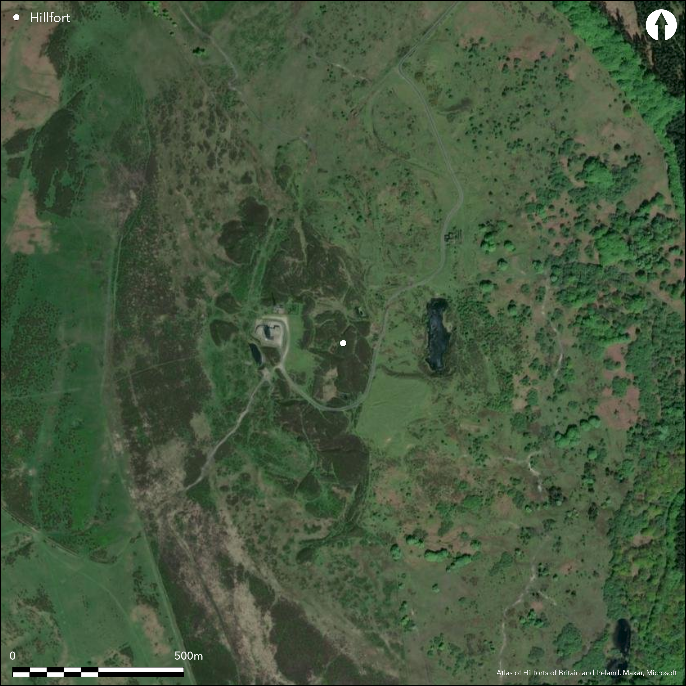
Satellite Imagery
LiDAR 1m DTM Hillshade
Satellite Imagery
Scroll left/right to view further images.
HER: Shropshire 182 (None)
NMR: SO 58 NE 1 (111174)
SM: None
NGR: SO 595866
X: 359505 Y: 286605 (OSGB36)
Site now destroyed by quarry and mining, but on the OS 1st Ed map (1885-1900). Formerly located on one of the three summits of the Clees (Abdon, Brown and Titterstone) that dominate SE Shropshire. High, steep and prominent Abdon Burf overlooked the valleys of the River Corve to the W and the River Rea/Rea Brooks to the E. Small excavations by C.H. Hartshorne 1840 and rescue excavation in advance of quarrying by G.R. Harding-Webster 1929-30. Former found rampart 19.8m wide at base, 2.4m wide at top and 3.6m high above interior, with large number (44) of stone circles, now identified as possible bell-pits. Latter excavation found entrance (on E?) to be inturned with outworks, possibly remodelled on more than one occasion, with single ditch defence and a possible hut circle at E entrance. Features examined in the interior probably remnants of coal working, but with no dating evidence. Coal and ironstone working from late 19th century destroyed the site and now just moor and heath.
Citizen Science: ✗
Reliability of Data: Irreconciled issues
Reliability of Interpretation: Confirmed
X: -289169 Y: 6886624 (EPSG: 3857)
Longitude: -2.5976512032111403 Latitude: 52.47583426019821 (EPSG:4326)
Country: England
Current County or Unitary Authority: Shropshire
Historic County: Shropshire
Current Parish/Community/Council/Townland: Abdon
Destroyed by quarrying and mining.
| Extant | ✗ |
| Cropmark | ✗ |
| Likely Destroyed | ✓ |
Destroyed by quarrying and mining. Now moorland and heath vegetation. SSSI.
| Woodland | ✗ |
| Commercial Forestry Plantation | ✗ |
| Parkland | ✗ |
| Pasture (Grazing) | ✗ |
| Arable | ✗ |
| Scrub/Bracken | ✗ |
| Bare Outcrop | ✗ |
| Heather/Moorland | ✓ |
| Heath | ✓ |
| Built-up | ✗ |
| Coastal Grassland | ✗ |
| Other | ✓ |
Fort destroyed by quarrying and mining. Formerly the site probably followed the contours. Formerly on one of the three summits of the Clees (Abdon, Brown and Titterstone) that dominate SE Shropshire. High, steep and prominent Abdon Burf overlooked the valleys of the River Corve to the W and the River Rea/Rea Brooks to the E.
| Contour Fort | ✓ |
| Partial Contour Fort | ✗ |
| Promontory Fort | ✗ |
| Hillslope Fort | ✗ |
| Level Terrain Fort | ✗ |
| Marsh Fort | ✗ |
| Multiple Enclosure Fort | ✗ |
| Hilltop | ✓ |
| Coastal Promontory | ✗ |
| Inland Promontory | ✗ |
| Valley Bottom | ✗ |
| Knoll/Hillock/Outcrop | ✗ |
| Ridge | ✗ |
| Cliff/Plateau-edge/Scarp | ✗ |
| Hillslope | ✗ |
| Lowland | ✗ |
| Spur | ✗ |
Dominant Topographic Feature: The prominent Abdon Burf hill.
| North | ✗ |
| Northeast | ✗ |
| East | ✗ |
| Southeast | ✗ |
| South | ✗ |
| Southwest | ✗ |
| West | ✗ |
| Northwest | ✗ |
| Level | ✓ |
Altitude: 530.0m
N/A
Probably an Iron Age site, but this is conjecture. No dating evidence from excavations.
Reliability: D - None
| Pre 1200BC | ✗ |
| 1200BC - 800BC | ✗ |
| 800BC - 400BC | ✗ |
| 400BC - AD50 | ✗ |
| AD50 - AD400 | ✗ |
| AD400 - AD 800 | ✗ |
| Post AD800 | ✗ |
| Unknown | ✓ |
| Pre Hillfort: | None |
| Post Hillfort: | None |
On 1st Ed. OS map (1885-1900). Small excavations C.H. Hartshorne 1840 and G.R. Harding-Webster 1929-30. Shropshire Council survey of 2012.
| Excavation (1840): | C.H. Hartshorne. |
| Other (2012): | Shropshire Council survey. |
| 1st Identified Map Depiction (None): | OS map. |
| Excavation (None): | G.R. Harding-Webster. |
Interior features possible from excavations probably vestiges of mining activity. No other evidence other than spring on former site. Hillfort destroyed.
Spring on former site.
| None | ✗ |
| Spring | ✓ |
| Stream | ✗ |
| Pool | ✗ |
| Flush | ✗ |
| Well | ✗ |
| Other | ✗ |
Site destroyed.
| No Known Features | ✓ |
| Round Stone Structures | ✗ |
| Rectangular Stone Structures | ✗ |
| Curvilinear Platforms | ✗ |
| Other Roundhouse Evidence | ✗ |
| Pits | ✗ |
| Quarry Hollows | ✗ |
| Other | ✗ |
Interior features possible from excavations probably vestiges of mining activity.
| No Known Excavation | ✗ |
| Pits | ✗ |
| Postholes | ✗ |
| Roundhouses | ✗ |
| Rectangular Structures | ✗ |
| Roads/Tracks | ✗ |
| Quarry Hollows | ✗ |
| Other | ✓ |
| Nothing Found | ✗ |
None
| No Known Geophysics | ✓ |
| Pits | ✗ |
| Roundhouses | ✗ |
| Rectangular Structures | ✗ |
| Roads/Tracks | ✗ |
| Quarry Hollows | ✗ |
| Other | ✗ |
| Nothing Found | ✗ |
None
| No Known Finds | ✓ |
| Pottery | ✗ |
| Metal | ✗ |
| Metalworking | ✗ |
| Human Bones | ✗ |
| Animal Bones | ✗ |
| Lithics | ✗ |
| Environmental | ✗ |
| Other | ✗ |
None
| APs Not Checked | ✓ |
| None | ✗ |
| Roundhouses | ✗ |
| Rectangular Structures | ✗ |
| Pits | ✗ |
| Postholes | ✗ |
| Roads/Tracks | ✗ |
| Other | ✗ |
All former entrances destroyed, but excavation 1929-30 found entrance (on E?) to be inturned with outworks, possibly remodelled at more than one occasion,
| None: | Not defined - destroyed. |
| 2: | None |
Guard Chambers: ✗
Chevaux de Frise: ✗
| 1. In-turned (East): | Defined as former possible site on E? before destruction. |
| 1. Outworks (East): | Possible outworks. |
All destroyed, but single ditch confirmed and probably stone-walled site.
| Area 1: | 7.6ha. |
| Total: | 7.6ha. |
Total Footprint Area: Noneha.
None
| ✓ | Site destroyed and area estimated. Entrance possibly remodelled on more than one occasion suggests phasing and possibly univallate in prehistory. |
| ✗ | Site destroyed, but possibly univallate in prehistory. |
| NE Quadrant: | 0 |
| SE Quadrant: | 0 |
| SW Quadrant: | 0 |
| NW Quadrant: | 0 |
| Total: | 0 |
| Partial Univallate | ✗ |
| Univallate | ✗ |
| Partial Bivallate | ✗ |
| Bivallate | ✗ |
| Partial Multivallate | ✗ |
| Multivallate | ✗ |
| Unknown | ✓ |
| Partial Univallate | ✗ |
| Univallate | ✓ |
| Partial Bivallate | ✗ |
| Bivallate | ✗ |
| Partial Multivallate | ✗ |
| Multivallate | ✗ |
No present evidence, site destroyed, but probably stone-walled site.
| None | ✗ |
| Earthen Bank | ✗ |
| Stone Wall | ✓ |
| Rubble | ✗ |
| Wall-walk | ✗ |
| Evidence of Timber | ✗ |
| Vitrification | ✗ |
| Other Burning | ✗ |
| Palisade | ✗ |
| Counter Scarp Bank | ✗ |
| Berm | ✗ |
| Unfinished | ✗ |
| Other | ✗ |
Single ditch confirmed. Possibly stone-walled site.
| None | ✗ |
| Earthen Bank | ✗ |
| Stone Wall | ✓ |
| Murus Duplex | ✗ |
| Timber-framed | ✗ |
| Timber-laced | ✗ |
| Vitrification | ✗ |
| Other Burning | ✗ |
| Palisade | ✗ |
| Counter Scarp Bank | ✗ |
| Berm | ✗ |
| Unfinished | ✗ |
| No Known Excavation | ✗ |
| Other | ✓ |
| ✗ | None |
| ✓ | None. Site destroyed, but former single ditch confirmed by excavation. |
Number of Ditches: 1
| ✗ | None |
Dorling, P. and Wigley, A. 2012: Assessment of the archaeological and conservation status of major later prehistoric enclosures in Herefordshire and Shropshire, EH PNUM, Version 3.2, Hereford and Shrewsbury: Herefordshire Council/Shropshire Council.
Hannaford, H.R. and Ward, P.A. 2014. Shropshire Mineral Resources Assessment for Shropshire and Telford and Wrekin, Unpublished SCAS rep. 357, 38.
Harding-Webster, G.R. 1929-30. Abdon Burf Camp. Trans Shropshire Archaeol Soc, 45, 85-96.
Hartshorne, C.H. 1841. Salopia Antiqua, 3-21.
Page, W. ed. 1908. Victoria County History of Shropshire, 1, 359, Institute of Historical Research.
Rowley, T. 2001. The Welsh Border, 200, 202, Stroud: Tempus.
Atlas of Hillforts:
Wikidata:
This work is licensed under CC BY-SA 4.0![]()
![]()
![]() and should be cited as:
and should be cited as:
Lock, Gary and Ralston, Ian. 2024. Atlas of Hillforts of Britain and Ireland. Available at: https://hillforts.arch.ox.ac.uk
Document Version 1.1