LiDAR 1m DTM Hillshade
Satellite Imagery
LiDAR 1m DTM Hillshade
Satellite Imagery
Scroll left/right to view further images.
HER: Lake District National Park 2973 (None)
NMR: NY 33 SW 1 (10501)
SM: 1011592
NGR: NY 34275 33641
X: 334275 Y: 533641 (OSGB36)
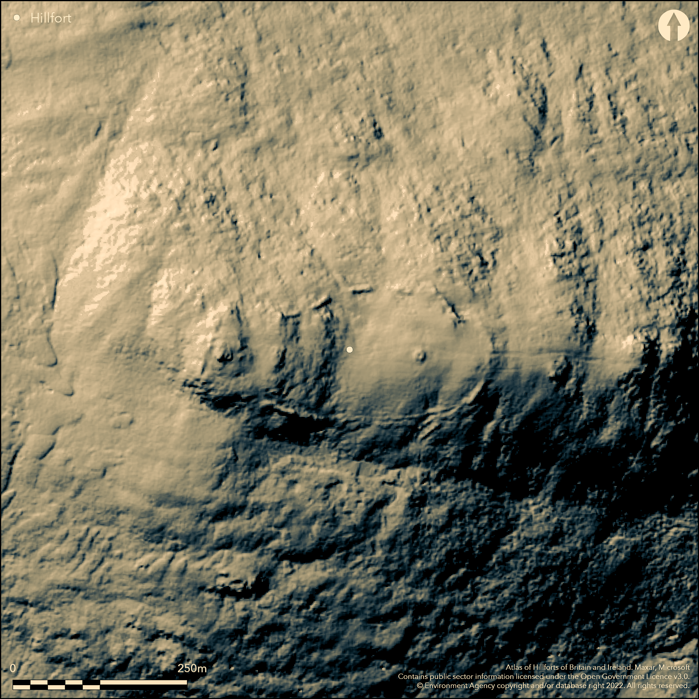
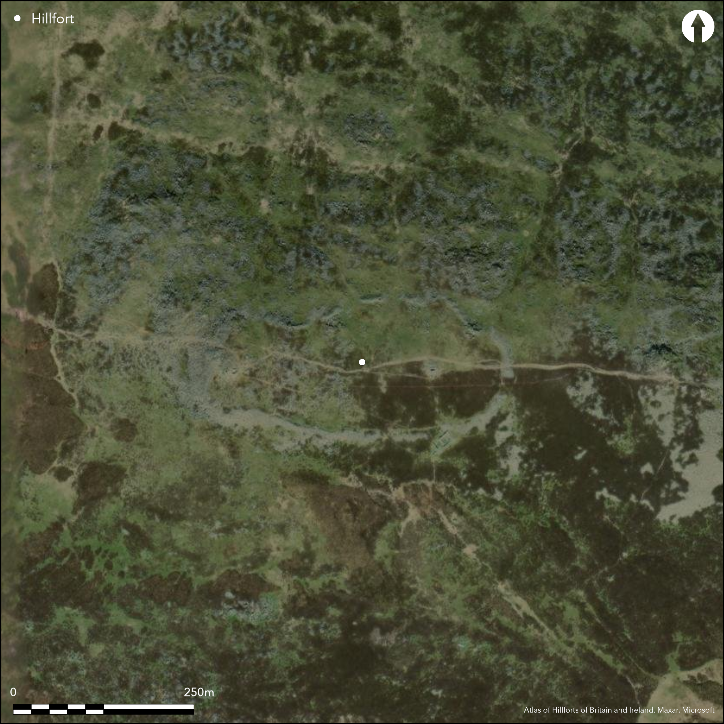
Lying to the N of the River Caldew on the summit of the EW ridge of Carrock Fell at approximately 640m OD, a large oval univallate enclosure, possibly a hillfort. It measures 350m EW by 100m NS enclosing 1.94ha. The site is defined by an unditched drystone wall 2-7m thick which approximately follows the contours of the hill and encloses two adjoining summits. The rampart has tumbled with a recorded spread of up to 17m in places and a medieval shieling, built into the outer face of the rampart, was constructed with stones from the rampart. Traces of a discontinuous ditch, possibly for a palisade, has been recorded within the interior in the S. The location of the original entrance is unclear, although Hogg (1975) considered breaks in the S and W to be original. A survey by RCHME noted most of the terminals on either side of the breaks were rounded suggesting they were part of the original construction. No certain internal features are known. The lack of settlement evidence, the proximity of the site to an important source of Neolithic stone axes and its form, offers parallels with Neolithic causewayed enclosures and it could be earlier than Iron Age, but it is currently unexcavated and undated. Recorded on 1885-1900 OS mapping.
Citizen Science: ✗
Reliability of Data: Confirmed
Reliability of Interpretation: Unconfirmed
X: -336321 Y: 7302609 (EPSG: 3857)
Longitude: -3.0212266549491007 Latitude: 54.69351538291415 (EPSG:4326)
Country: England; None
Current County or Unitary Authority: Cumbria
Historic County: Cumberland
Current Parish/Community/Council/Townland: Caldbeck; Mungrisdale
Upstanding but the surrounding drystone rampart has tumbled with a recorded spread of up to 17m in places.
| Extant | ✓ |
| Cropmark | ✗ |
| Likely Destroyed | ✗ |
None
| Woodland | ✗ |
| Commercial Forestry Plantation | ✗ |
| Parkland | ✗ |
| Pasture (Grazing) | ✗ |
| Arable | ✗ |
| Scrub/Bracken | ✗ |
| Bare Outcrop | ✗ |
| Heather/Moorland | ✗ |
| Heath | ✗ |
| Built-up | ✗ |
| Coastal Grassland | ✗ |
| Other | ✓ |
A partial contour fort located on an irregular E-W double summit ridge of Carrock Fell at approximately 640m OD. The highest part of the enclosure is a rocky knoll lying at the western end, descending gradually eastwards in a series of steps beyond which it rises again to a smooth rounded knoll in the east.
| Contour Fort | ✗ |
| Partial Contour Fort | ✓ |
| Promontory Fort | ✗ |
| Hillslope Fort | ✓ |
| Level Terrain Fort | ✗ |
| Marsh Fort | ✗ |
| Multiple Enclosure Fort | ✗ |
| Hilltop | ✓ |
| Coastal Promontory | ✗ |
| Inland Promontory | ✗ |
| Valley Bottom | ✗ |
| Knoll/Hillock/Outcrop | ✗ |
| Ridge | ✗ |
| Cliff/Plateau-edge/Scarp | ✗ |
| Hillslope | ✗ |
| Lowland | ✗ |
| Spur | ✗ |
Dominant Topographic Feature: EW summit ridge of Carrock Fell
| North | ✗ |
| Northeast | ✗ |
| East | ✗ |
| Southeast | ✗ |
| South | ✗ |
| Southwest | ✗ |
| West | ✗ |
| Northwest | ✗ |
| Level | ✓ |
Altitude: 640.0m
The parish boundaries of Caldbeck and Mungrisdale run centrally E-W within the enclosure
Boundary Type: Parish/Townland
The lack of settlement evidence, the proximity of the site to an important source of Neolithic stone axes, and its form, offers parallels with Neolithic causewayed enclosures and it could be earlier than Iron Age. Within the interior on the eastern knoll, an undated round cairn with a cist at its centre is presumed Bronze Age. Immediately E of the western knoll at the hillfort's highest point is the remains of a round cairn 11m in diameter. A medieval shieling impinges on the SE side of the hillfort. There are also traces of quarrying.
Reliability: D - None
| Pre 1200BC | ✗ |
| 1200BC - 800BC | ✗ |
| 800BC - 400BC | ✗ |
| 400BC - AD50 | ✗ |
| AD50 - AD400 | ✗ |
| AD400 - AD 800 | ✗ |
| Post AD800 | ✗ |
| Unknown | ✓ |
| Pre Hillfort: | None |
| Post Hillfort: | Medieval shieling |
General reference in Hutchinson (1794). Recorded on 1st Ed OS map (1885-1900). The site was surveyed by Collingwood (1938) and RCHME in 1996, ref. no. 1078991. Surveyed at 1:1000 scale in 1986 by the Cumbria and Lancashire Archaeological Unit as part of the Lake District National Park Survey. OS field investigation in 1973. Scheduled in 1978
| 1st Identified Written Reference (1794): | None |
| Earthwork Survey (1938): | Collingwood |
| Other (1968): | Scheduled |
| Other (1973): | OS Field investigation |
| Earthwork Survey (1996): | RCHME survey in June 1996 includes a plan of the enclosure and associated remains |
| 1st Identified Map Depiction (None): | OS one-inch 1885-1900 |
No contemporary structures are known, Neolithic stone axe recovered from surface.
None
| None | ✓ |
| Spring | ✗ |
| Stream | ✗ |
| Pool | ✗ |
| Flush | ✗ |
| Well | ✗ |
| Other | ✗ |
None
| No Known Features | ✓ |
| Round Stone Structures | ✗ |
| Rectangular Stone Structures | ✗ |
| Curvilinear Platforms | ✗ |
| Other Roundhouse Evidence | ✗ |
| Pits | ✗ |
| Quarry Hollows | ✗ |
| Other | ✗ |
None
| No Known Excavation | ✓ |
| Pits | ✗ |
| Postholes | ✗ |
| Roundhouses | ✗ |
| Rectangular Structures | ✗ |
| Roads/Tracks | ✗ |
| Quarry Hollows | ✗ |
| Other | ✗ |
| Nothing Found | ✗ |
None
| No Known Geophysics | ✓ |
| Pits | ✗ |
| Roundhouses | ✗ |
| Rectangular Structures | ✗ |
| Roads/Tracks | ✗ |
| Quarry Hollows | ✗ |
| Other | ✗ |
| Nothing Found | ✗ |
Langdale Axe
| No Known Finds | ✗ |
| Pottery | ✗ |
| Metal | ✗ |
| Metalworking | ✗ |
| Human Bones | ✗ |
| Animal Bones | ✗ |
| Lithics | ✓ |
| Environmental | ✗ |
| Other | ✗ |
None
| APs Not Checked | ✓ |
| None | ✗ |
| Roundhouses | ✗ |
| Rectangular Structures | ✗ |
| Pits | ✗ |
| Postholes | ✗ |
| Roads/Tracks | ✗ |
| Other | ✗ |
At least 8 breaks are shown around the circuit in Collingwood's drawn survey of 1938. Hogg (1975) considered two breaks to be original. In the W the entrance measures 3m wide; in the S, the entrance lies slightly to the E of centre and measures 4.4m wide. RCHME suggest the majority of the breaks could be original
| 8: | None |
| 2: | None |
Guard Chambers: ✗
Chevaux de Frise: ✗
| 1. Simple Gap (West): | None |
| 2. Simple Gap (South): | None |
Enclosed by a drystone walled rampart which survives up to 1.7m high and 2m wide. There is no trace of a ditch, although traces of a discontinuous trench, possibly for a palisade, has been recorded on the southern side of the interior
| Area 1: | 1.94ha. |
| Total: | 1.94ha. |
Total Footprint Area: Noneha.
Enclosed by a drystone rampart which survives up to 1.7m high and 2m wide. There is no trace of a ditch, although traces of a discontinuous trench, possibly for a palisade, has been recorded on the southern side of the interior
| ✓ | Possible earlier palisade? |
| ✗ | Discontinuous |
| NE Quadrant: | 1 |
| SE Quadrant: | 1 |
| SW Quadrant: | 1 |
| NW Quadrant: | 1 |
| Total: | 1 |
| Partial Univallate | ✗ |
| Univallate | ✓ |
| Partial Bivallate | ✗ |
| Bivallate | ✗ |
| Partial Multivallate | ✗ |
| Multivallate | ✗ |
| Unknown | ✗ |
| Partial Univallate | ✗ |
| Univallate | ✗ |
| Partial Bivallate | ✗ |
| Bivallate | ✗ |
| Partial Multivallate | ✗ |
| Multivallate | ✗ |
Drystone wall
| None | ✗ |
| Earthen Bank | ✗ |
| Stone Wall | ✓ |
| Rubble | ✗ |
| Wall-walk | ✗ |
| Evidence of Timber | ✗ |
| Vitrification | ✗ |
| Other Burning | ✗ |
| Palisade | ✓ |
| Counter Scarp Bank | ✗ |
| Berm | ✗ |
| Unfinished | ✗ |
| Other | ✗ |
None
| None | ✗ |
| Earthen Bank | ✗ |
| Stone Wall | ✗ |
| Murus Duplex | ✗ |
| Timber-framed | ✗ |
| Timber-laced | ✗ |
| Vitrification | ✗ |
| Other Burning | ✗ |
| Palisade | ✗ |
| Counter Scarp Bank | ✗ |
| Berm | ✗ |
| Unfinished | ✗ |
| No Known Excavation | ✓ |
| Other | ✗ |
| ✗ | None |
| ✗ | Possible discontinuous palisade trench |
Number of Ditches: None
| ✗ | None |
Collingwood R.G. 1938, The Hill fort on Carock Fell. Trans Cumberland Westmorland Antiq Archaeol Soc 32-41
Collingwood, W.G. 1923 An Inventory of the Ancient Monuments in Cumberland. Trans Cumberland Westmorland Antiq Archaeol Soc New Series 23; 241
Hutchinson, W. 1794. History of the County of Northumberland II, 381-7
RCHME: Industry and enclosure in the Neolithic project: Carrock Fell survey, June 1996.
Atlas of Hillforts:
Wikidata:
This work is licensed under CC BY-SA 4.0![]()
![]()
![]() and should be cited as:
and should be cited as:
Lock, Gary and Ralston, Ian. 2024. Atlas of Hillforts of Britain and Ireland. Available at: https://hillforts.arch.ox.ac.uk
Document Version 1.1