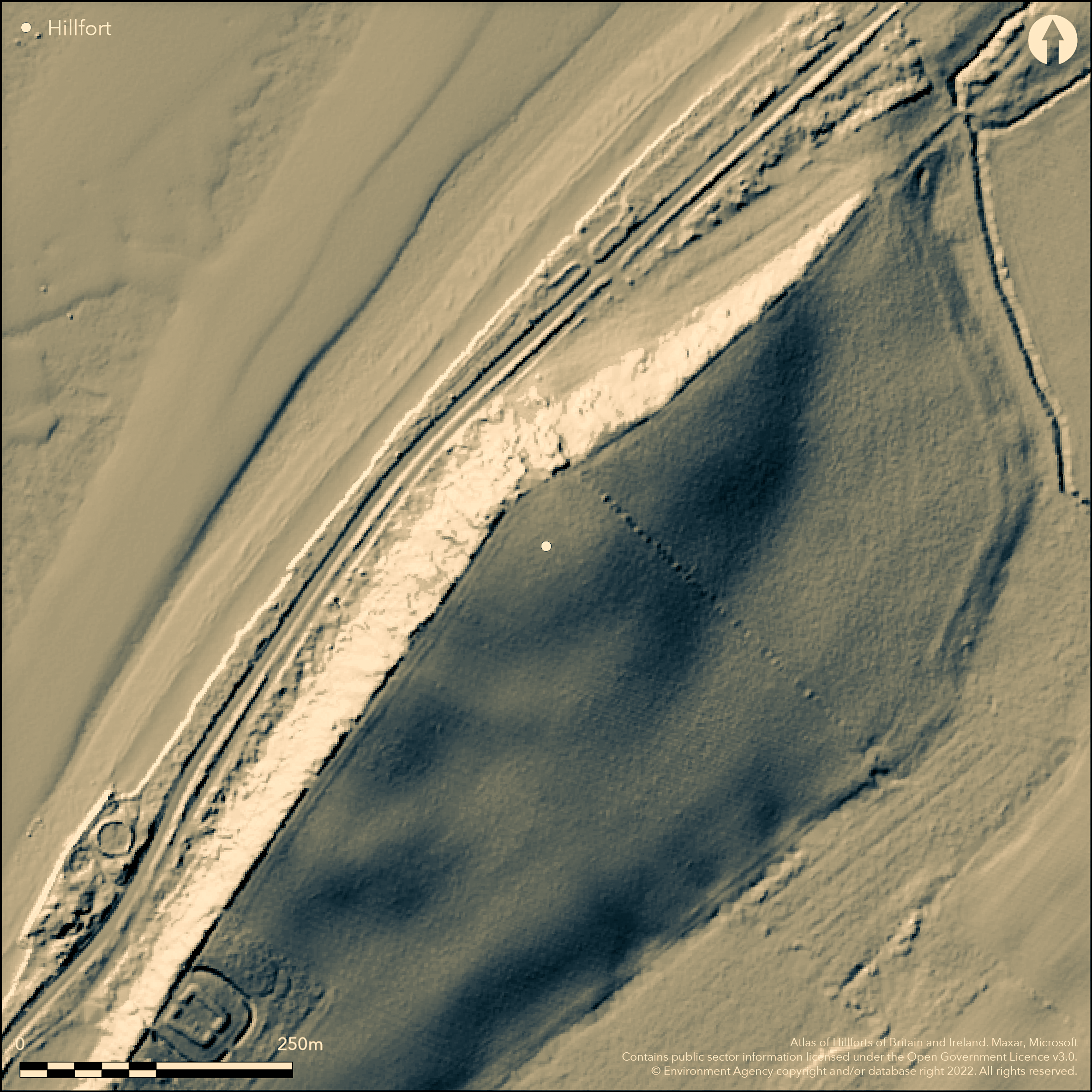
LiDAR 1m DTM Hillshade
Satellite Imagery
LiDAR 1m DTM Hillshade
Satellite Imagery
Scroll left/right to view further images.
HER: Cumbria 609 (None)
NMR: NY 04 SE 6 (9143)
SM: 1014914
NGR: NY 06920 40289
X: 306920 Y: 540289 (OSGB36)
Overlooking Allonby Bay, Swarthy Hill hillfort is the only currently known coastal Iron Age hillfort in Cumbria. The site was identified from cropmarks on aerial photographs taken by St Joseph in 1949 which showed a small triple-ditched enclosure measuring approximately 140m SW-NE by 80m NW-SE, located on the summit and SE slope of Swarthy Hill. The hillfort has been lost through erosion of the cliff edge in the NW. Two narrow entrances through the outer ditch can be seen on aerial photographs on the SE side. It is uncertain if any internal features survive. A small-scale excavation between 1986-8 (Bewley 1992) showed the inner ditch approximately 5m wide by 1.3m deep and the outer ditch approximately 3m wide by 0.8m deep. Turf and clay slumped into the ditch were seen by Bewley to show that the ramparts were situated on the inner edge. Flint flakes and vitrified sandstone were found and charcoal recovered from the fill of the inner ditch produced a radiocarbon date of 601-394 Cal BC (Bewley 1992, 39). The site is not recorded on OS mapping, but was mapped as part of the Hadrian's Wall National Mapping Programme. No further investigation has been carried out. Scheduled.
Citizen Science: ✗
Reliability of Data: Confirmed
Reliability of Interpretation: Confirmed
X: -383789 Y: 7313289 (EPSG: 3857)
Longitude: -3.4476323909234945 Latitude: 54.74892216786971 (EPSG:4326)
Country: England; None
Current County or Unitary Authority: Cumbria
Historic County: Cumberland
Current Parish/Community/Council/Townland: Crosscanonby; Oughterside and Allerby
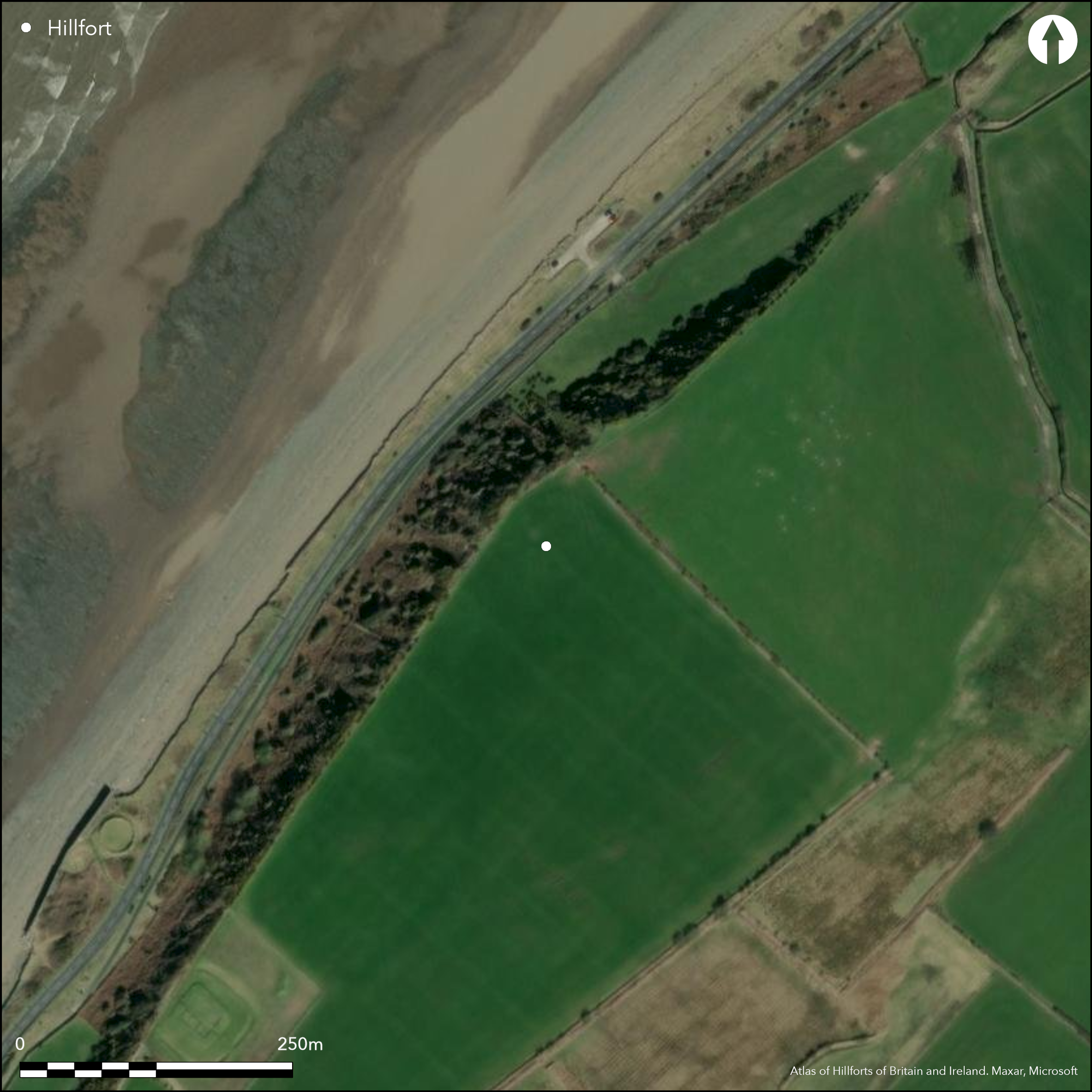
The site has been deep ploughed since the 1940's and it is uncertain if any internal features survive (Bewley 1992, 37-8). Coastal erosion has also resulted in subsidence in the NW and is at risk of further erosion
| Extant | ✗ |
| Cropmark | ✓ |
| Likely Destroyed | ✗ |
Deep ploughed since the 1940's.
| Woodland | ✗ |
| Commercial Forestry Plantation | ✗ |
| Parkland | ✗ |
| Pasture (Grazing) | ✗ |
| Arable | ✓ |
| Scrub/Bracken | ✗ |
| Bare Outcrop | ✗ |
| Heather/Moorland | ✗ |
| Heath | ✗ |
| Built-up | ✗ |
| Coastal Grassland | ✗ |
| Other | ✗ |
A triple ditched enclosure lying at 31m OD on the summit and SE slope of Swarthy Hill on a large outcropping of Devensian Till and Sand, overlooking Allonby Bay
| Contour Fort | ✗ |
| Partial Contour Fort | ✓ |
| Promontory Fort | ✗ |
| Hillslope Fort | ✗ |
| Level Terrain Fort | ✗ |
| Marsh Fort | ✗ |
| Multiple Enclosure Fort | ✗ |
| Hilltop | ✗ |
| Coastal Promontory | ✗ |
| Inland Promontory | ✗ |
| Valley Bottom | ✗ |
| Knoll/Hillock/Outcrop | ✗ |
| Ridge | ✗ |
| Cliff/Plateau-edge/Scarp | ✓ |
| Hillslope | ✓ |
| Lowland | ✗ |
| Spur | ✗ |
Dominant Topographic Feature: On the summit and SE slope of Swarthy Hill
| North | ✗ |
| Northeast | ✗ |
| East | ✗ |
| Southeast | ✓ |
| South | ✗ |
| Southwest | ✗ |
| West | ✗ |
| Northwest | ✗ |
| Level | ✗ |
Altitude: 31.0m
Parish boundary of Crosscanonby and Oughterside and Allerby to the E
Boundary Type: Parish/Townland
One C-14 date
Reliability: B - Medium
| Pre 1200BC | ✗ |
| 1200BC - 800BC | ✗ |
| 800BC - 400BC | ✓ |
| 400BC - AD50 | ✓ |
| AD50 - AD400 | ✗ |
| AD400 - AD 800 | ✗ |
| Post AD800 | ✗ |
| Unknown | ✗ |
| Pre Hillfort: | None |
| Post Hillfort: | None |
| C14: | Charcoal recovered from the fill of the inner ditch has produced a radiocarbon date of 601-394 Cal BC (Bewley 1992: 39) |
Discovered from aerial photographs in 1949. Limited excavations across two of the ditches by Bewley in 1988 and 1989. Excavation confirmed that the site dates to the Iron Age and has a good level of preservation of all three boundary ditches (Bewley 1992). RCHME: Cumberland Coast Project 1993. Scheduled
| Other (1965): | Scheduled |
| Other (1967): | Field investigation |
| Other (1993): | Cumberland Coast Project |
| Other (2010): | Hadrian's Wall National Mapping Programme Project |
| Excavation (None): | Limited excavation across the ditches |
No known internal features
Brunsow Beck lies approximately 220m to the E of the enclosure
| None | ✓ |
| Spring | ✗ |
| Stream | ✗ |
| Pool | ✗ |
| Flush | ✗ |
| Well | ✗ |
| Other | ✗ |
Plough-levelled
| No Known Features | ✓ |
| Round Stone Structures | ✗ |
| Rectangular Stone Structures | ✗ |
| Curvilinear Platforms | ✗ |
| Other Roundhouse Evidence | ✗ |
| Pits | ✗ |
| Quarry Hollows | ✗ |
| Other | ✗ |
None
| No Known Excavation | ✓ |
| Pits | ✗ |
| Postholes | ✗ |
| Roundhouses | ✗ |
| Rectangular Structures | ✗ |
| Roads/Tracks | ✗ |
| Quarry Hollows | ✗ |
| Other | ✗ |
| Nothing Found | ✗ |
None
| No Known Geophysics | ✓ |
| Pits | ✗ |
| Roundhouses | ✗ |
| Rectangular Structures | ✗ |
| Roads/Tracks | ✗ |
| Quarry Hollows | ✗ |
| Other | ✗ |
| Nothing Found | ✗ |
None
| No Known Finds | ✓ |
| Pottery | ✗ |
| Metal | ✗ |
| Metalworking | ✗ |
| Human Bones | ✗ |
| Animal Bones | ✗ |
| Lithics | ✗ |
| Environmental | ✗ |
| Other | ✗ |
None
| APs Not Checked | ✗ |
| None | ✓ |
| Roundhouses | ✗ |
| Rectangular Structures | ✗ |
| Pits | ✗ |
| Postholes | ✗ |
| Roads/Tracks | ✗ |
| Other | ✗ |
Two simple gaps in the SE.
| None: | None |
| 2: | Both in the SE |
Guard Chambers: ✗
Chevaux de Frise: ✗
| 1. Simple Gap (South east): | None |
| 2. Simple Gap (South east): | None |
Small triple-ditched enclosure measuring approximately 140m SW-NE by 80m NW-SE. Lost through erosion of the cliff edge in the NW. A small-scale excavation between 1986-8 (Bewley 1992) showed the outer ditch was approximately 3m wide by 0.8m deep and the inner ditch approximately 5m wide by 1.3m deep. Turf and clay slumped into the ditch were seen to show that the ramparts were situated on the inner edge.
| Area 1: | 1.0ha. |
| Total: | 1.0ha. |
Total Footprint Area: Noneha.
None
| ✗ | Enclosed area approximate |
| ✗ | Semi-circular and triple-ditched but plough-levelled and lost through cliff-edge erosion in the N-W. No upstanding ramparts, but excavation suggests a rampart might have existed on the inner side of the ditch |
| NE Quadrant: | 3 |
| SE Quadrant: | 3 |
| SW Quadrant: | 3 |
| NW Quadrant: | None |
| Total: | 3 |
| Partial Univallate | ✗ |
| Univallate | ✗ |
| Partial Bivallate | ✗ |
| Bivallate | ✗ |
| Partial Multivallate | ✓ |
| Multivallate | ✗ |
| Unknown | ✗ |
| Partial Univallate | ✗ |
| Univallate | ✗ |
| Partial Bivallate | ✗ |
| Bivallate | ✗ |
| Partial Multivallate | ✗ |
| Multivallate | ✗ |
Destroyed
| None | ✓ |
| Earthen Bank | ✗ |
| Stone Wall | ✗ |
| Rubble | ✗ |
| Wall-walk | ✗ |
| Evidence of Timber | ✗ |
| Vitrification | ✗ |
| Other Burning | ✗ |
| Palisade | ✗ |
| Counter Scarp Bank | ✗ |
| Berm | ✗ |
| Unfinished | ✗ |
| Other | ✗ |
Vitrified sandstone recovered during excation
| None | ✗ |
| Earthen Bank | ✓ |
| Stone Wall | ✗ |
| Murus Duplex | ✗ |
| Timber-framed | ✗ |
| Timber-laced | ✗ |
| Vitrification | ✓ |
| Other Burning | ✗ |
| Palisade | ✗ |
| Counter Scarp Bank | ✗ |
| Berm | ✗ |
| Unfinished | ✗ |
| No Known Excavation | ✗ |
| Other | ✗ |
| ✗ | None |
| ✓ | None |
Number of Ditches: 3
| ✗ | None |
Bewley, R. H. 1992. Excavations on two crop-mark sites in the Solway Plain, Cumbria, Ewanrigg Settlement and Swarthy Hill, 1986-1988. Trans Cumberland Westmorland Antiq Archaeol Soc 92, 23-47.
Atlas of Hillforts:
Wikidata:
This work is licensed under CC BY-SA 4.0![]()
![]()
![]() and should be cited as:
and should be cited as:
Lock, Gary and Ralston, Ian. 2024. Atlas of Hillforts of Britain and Ireland. Available at: https://hillforts.arch.ox.ac.uk
Document Version 1.1