LiDAR 1m DTM Hillshade
Satellite Imagery
LiDAR 1m DTM Hillshade
Satellite Imagery
Scroll left/right to view further images.
HER: Oxfordshire 2016 (MOX69)
NMR: SU 68 SE 9 (241908)
SM: 1006336
NGR: SU 6832 8101
X: 468300 Y: 181000 (OSGB36)
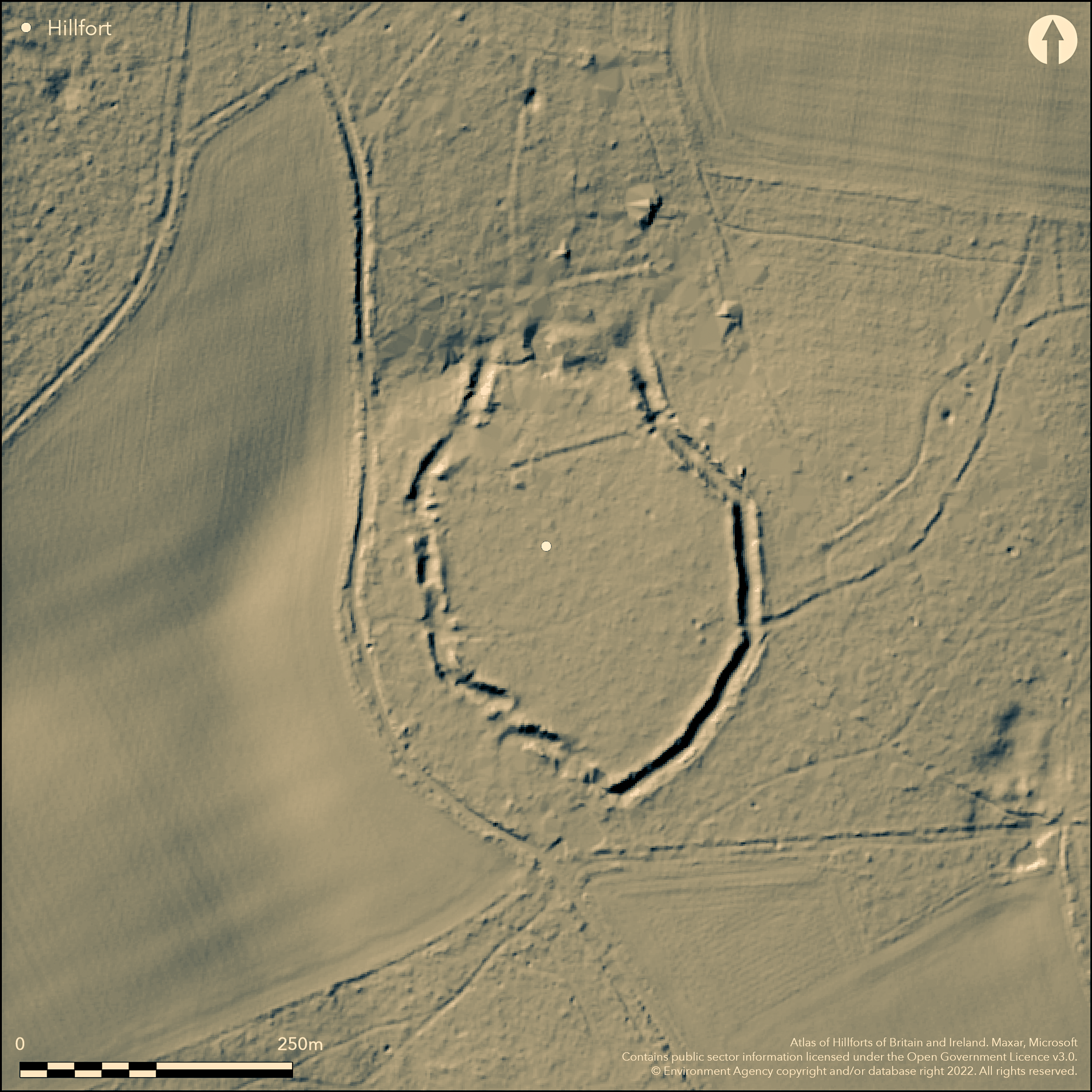
West of Sonning Common within Wyfold Wood, situated on a slight rise, an irregular oval shaped site enclosing c. 2.1ha. On the 1st ED. OS map. Univallate with a counterscarp bank, damaged by some gravel quarrying and tree planting especially to the N and W, and by a woodland boundary bank on the SE side. Rampart survives to c2. high in places, counterscarp bank to c.1m. Original entrance at the SE, an oblique passage way, ramparts to the N appear to enclose a spring, now a pond. Possible internal quarry hollows. No interventions and no dating evidence.
Citizen Science: ✓
Reliability of Data: Confirmed
Reliability of Interpretation: Confirmed
X: -113204 Y: 6714466 (EPSG: 3857)
Longitude: -1.0169266064127613 Latitude: 51.52374346710792 (EPSG:4326)
Country: England
Current County or Unitary Authority: Oxfordshire
Historic County: Oxfordshire
Current Parish/Community/Council/Townland: Checkendon
None
| Extant | ✓ |
| Cropmark | ✗ |
| Likely Destroyed | ✗ |
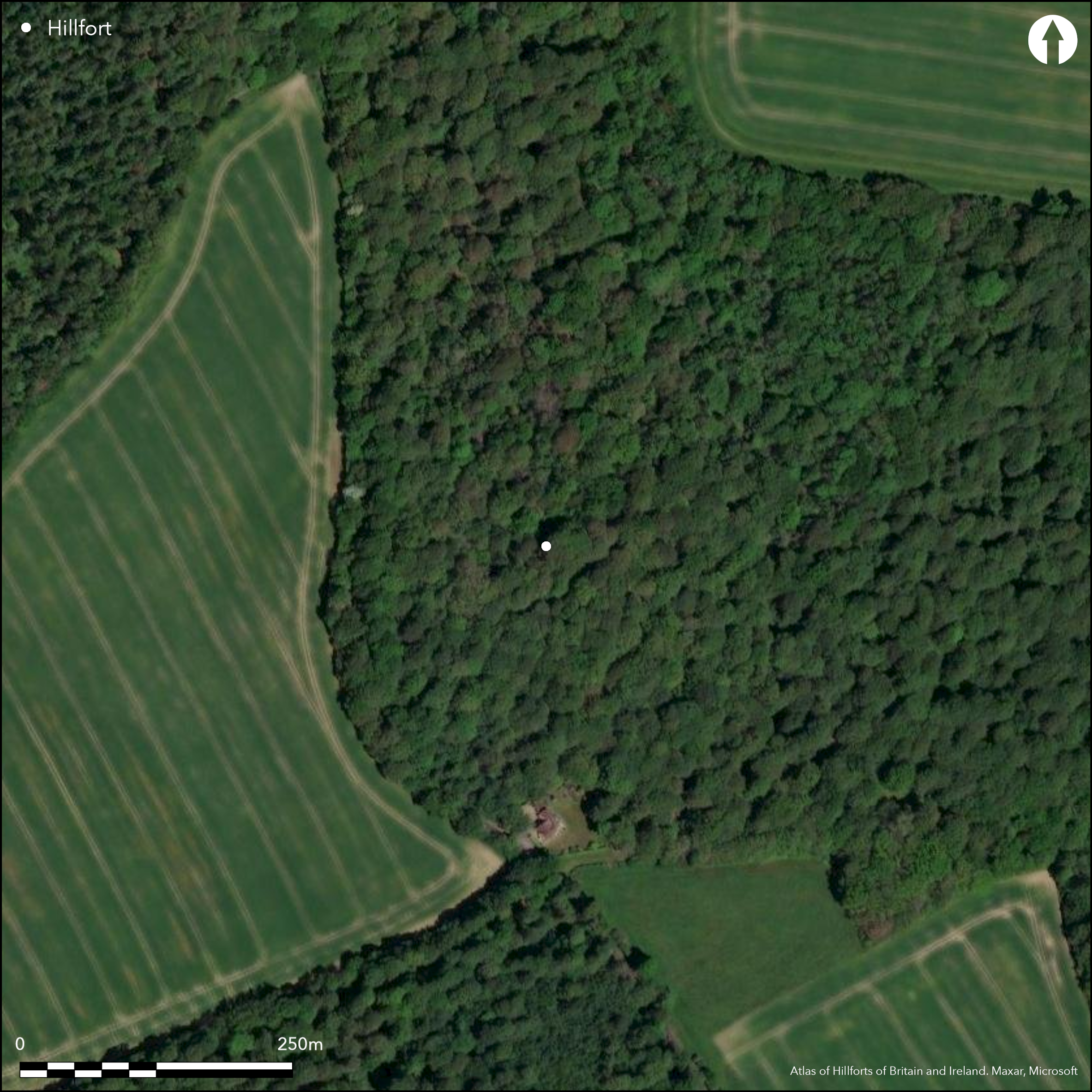
Extensively mutilated by gravel digging and tree-felling, especially to the N and W. Along the SE side, the counter-scarp of the ditch has been destroyed by the construction of a woodland boundary bank. The N part of the earthwork, much reduced and masked by rhododendron bushes. Tree and brush cover over most of the site.
| Woodland | ✓ |
| Commercial Forestry Plantation | ✗ |
| Parkland | ✗ |
| Pasture (Grazing) | ✗ |
| Arable | ✗ |
| Scrub/Bracken | ✓ |
| Bare Outcrop | ✗ |
| Heather/Moorland | ✗ |
| Heath | ✗ |
| Built-up | ✗ |
| Coastal Grassland | ✗ |
| Other | ✗ |
Roughly follows the contours of an irregular oval shaped hill on a slight elevation on a plateau
| Contour Fort | ✗ |
| Partial Contour Fort | ✓ |
| Promontory Fort | ✗ |
| Hillslope Fort | ✗ |
| Level Terrain Fort | ✗ |
| Marsh Fort | ✗ |
| Multiple Enclosure Fort | ✗ |
Roughly follows the contours of an irregular oval shaped hill on a slight elevation on a plateau
| Hilltop | ✗ |
| Coastal Promontory | ✗ |
| Inland Promontory | ✗ |
| Valley Bottom | ✗ |
| Knoll/Hillock/Outcrop | ✗ |
| Ridge | ✗ |
| Cliff/Plateau-edge/Scarp | ✗ |
| Hillslope | ✗ |
| Lowland | ✓ |
| Spur | ✗ |
Dominant Topographic Feature: Would have good views in all directions
| North | ✗ |
| Northeast | ✗ |
| East | ✗ |
| Southeast | ✗ |
| South | ✗ |
| Southwest | ✗ |
| West | ✗ |
| Northwest | ✗ |
| Level | ✓ |
Altitude: 120.0m
N/A
No evidence
Reliability: D - None
| Pre 1200BC | ✗ |
| 1200BC - 800BC | ✗ |
| 800BC - 400BC | ✗ |
| 400BC - AD50 | ✗ |
| AD50 - AD400 | ✗ |
| AD400 - AD 800 | ✗ |
| Post AD800 | ✗ |
| Unknown | ✓ |
| Pre Hillfort: | None |
| Post Hillfort: | None |
| Morphology/Earthwork/Typology: | Appears to be Iron Age |
Appears on 1st ED. OS map, no other investigations.
| 1st Identified Map Depiction (None): | 1st Ed. OS |
Possible internal quarry hollows, spring inside.
The northern ramparts appear to have enclosed a spring, now a pond.
| None | ✗ |
| Spring | ✓ |
| Stream | ✗ |
| Pool | ✗ |
| Flush | ✗ |
| Well | ✗ |
| Other | ✗ |
None
| No Known Features | ✓ |
| Round Stone Structures | ✗ |
| Rectangular Stone Structures | ✗ |
| Curvilinear Platforms | ✗ |
| Other Roundhouse Evidence | ✗ |
| Pits | ✗ |
| Quarry Hollows | ✓ |
| Other | ✗ |
None
| No Known Excavation | ✓ |
| Pits | ✗ |
| Postholes | ✗ |
| Roundhouses | ✗ |
| Rectangular Structures | ✗ |
| Roads/Tracks | ✗ |
| Quarry Hollows | ✗ |
| Other | ✗ |
| Nothing Found | ✗ |
None
| No Known Geophysics | ✓ |
| Pits | ✗ |
| Roundhouses | ✗ |
| Rectangular Structures | ✗ |
| Roads/Tracks | ✗ |
| Quarry Hollows | ✗ |
| Other | ✗ |
| Nothing Found | ✗ |
None
| No Known Finds | ✓ |
| Pottery | ✗ |
| Metal | ✗ |
| Metalworking | ✗ |
| Human Bones | ✗ |
| Animal Bones | ✗ |
| Lithics | ✗ |
| Environmental | ✗ |
| Other | ✗ |
None
| APs Not Checked | ✓ |
| None | ✗ |
| Roundhouses | ✗ |
| Rectangular Structures | ✗ |
| Pits | ✗ |
| Postholes | ✗ |
| Roads/Tracks | ✗ |
| Other | ✗ |
Single verified entrance, at SW, oblique passageway, at least four other breaks all modern
| 4: | at least 4 |
| 2: | None |
Guard Chambers: ✗
Chevaux de Frise: ✗
| 1. Passage-way/Corridor (South west): | verified entrance, at SW, oblique passageway |
Uivallate with external ditch and counter-scarp bank, rampart c.2m high in places, counter-scarp c.1m.
| Area 1: | 2.1ha. |
| Total: | 2.1ha. |
Total Footprint Area: Noneha.
Uivallate with external ditch and counter-scarp bank, rampart c.2m high in places, counter-scarp c.1m.
| ✗ | None |
| ✓ | None |
| NE Quadrant: | 1 |
| SE Quadrant: | 1 |
| SW Quadrant: | 1 |
| NW Quadrant: | 1 |
| Total: | 1 |
| Partial Univallate | ✗ |
| Univallate | ✓ |
| Partial Bivallate | ✗ |
| Bivallate | ✗ |
| Partial Multivallate | ✗ |
| Multivallate | ✗ |
| Unknown | ✗ |
| Partial Univallate | ✗ |
| Univallate | ✗ |
| Partial Bivallate | ✗ |
| Bivallate | ✗ |
| Partial Multivallate | ✗ |
| Multivallate | ✗ |
Earthen bank with counterscarp bank, damaged by gravel quarrying and tree planting to N and W, and by medieval boundary bank along some of the SE side
| None | ✗ |
| Earthen Bank | ✓ |
| Stone Wall | ✗ |
| Rubble | ✗ |
| Wall-walk | ✗ |
| Evidence of Timber | ✗ |
| Vitrification | ✗ |
| Other Burning | ✗ |
| Palisade | ✗ |
| Counter Scarp Bank | ✓ |
| Berm | ✗ |
| Unfinished | ✗ |
| Other | ✗ |
No excavation
| None | ✓ |
| Earthen Bank | ✗ |
| Stone Wall | ✗ |
| Murus Duplex | ✗ |
| Timber-framed | ✗ |
| Timber-laced | ✗ |
| Vitrification | ✗ |
| Other Burning | ✗ |
| Palisade | ✗ |
| Counter Scarp Bank | ✗ |
| Berm | ✗ |
| Unfinished | ✗ |
| No Known Excavation | ✗ |
| Other | ✗ |
| ✗ | None |
| ✓ | Single ditch |
Number of Ditches: 1
| ✗ | None |
Manning, P. and Leeds, E.T. 1921. An archaeological survey of Oxfordshire. London: Society of Antiquaries.
Page, W. (ed) 1907. The Victoria History of the County of Oxford, Vol II. London, 333.
Sutton, J.E.G. 1966. Iron-Age hill-forts and some other earthworks in Oxfordshire, Oxoniensia, 31, 28-42.
Atlas of Hillforts:
Wikidata:
This work is licensed under CC BY-SA 4.0![]()
![]()
![]() and should be cited as:
and should be cited as:
Lock, Gary and Ralston, Ian. 2024. Atlas of Hillforts of Britain and Ireland. Available at: https://hillforts.arch.ox.ac.uk
Document Version 1.1