LiDAR 1m DTM Hillshade
Satellite Imagery
LiDAR 1m DTM Hillshade
Satellite Imagery
Scroll left/right to view further images.
HER: Oxfordshire 12849.01 (MOX11022)
NMR: SU 49 NE 9 (233902)
SM: None
NGR: SU 499 972
X: 449950 Y: 197250 (OSGB36)
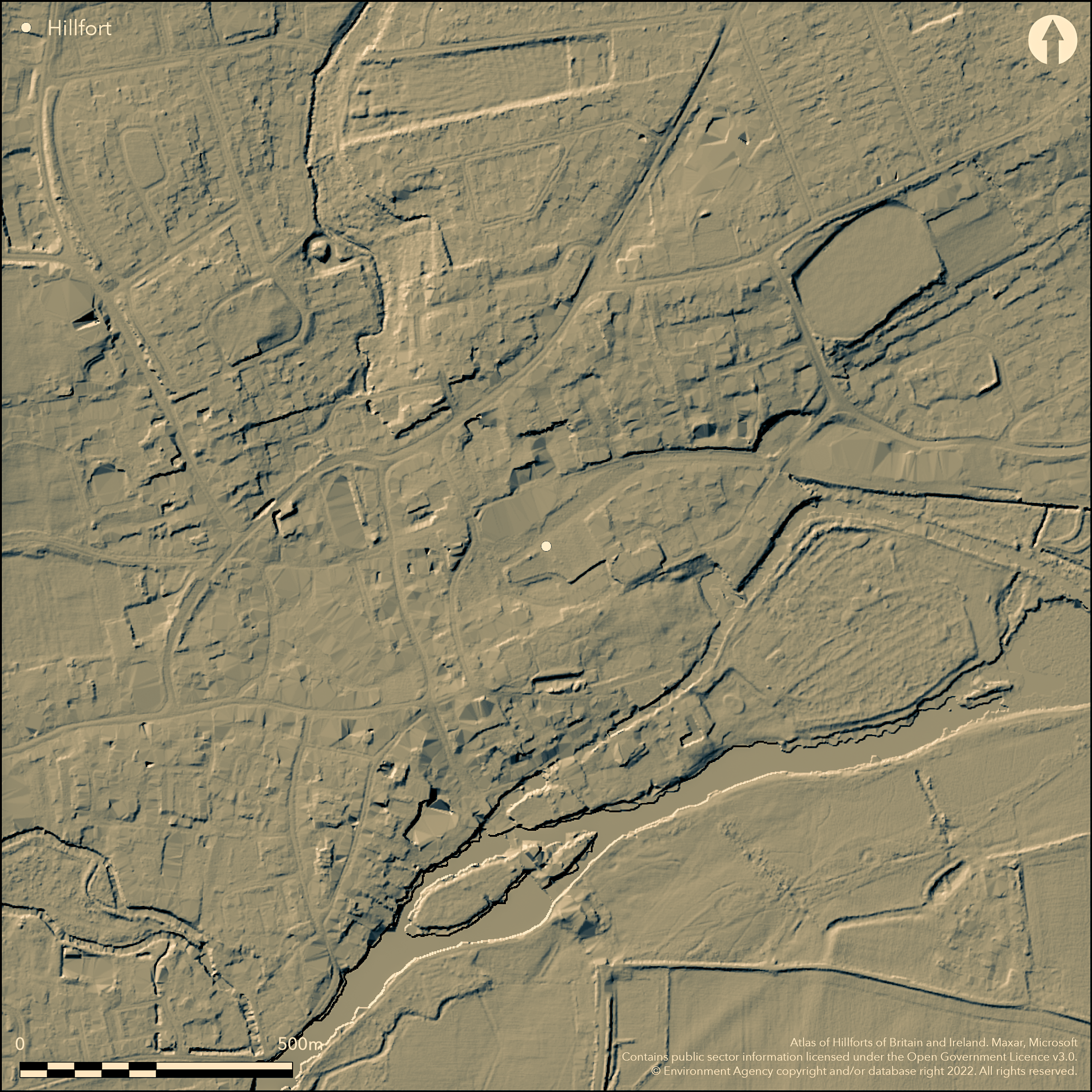
Known only through excavation prior to development within Abingdon (Allen 1991; 1993; 1994). Three curving ditches joining the Rivers Ock and Thames. The two main inner and outer ditches were 10-12m wide and 2.6m deep and originally flowed with water, probably diverting the River Stert. A strip 10m wide on the inner side of the inner ditch was devoid of occupation features and may represent the bank. No evidence for an entrance. Excavations in the interior covered c.1ha and revealed a dense sequence of inter-cutting pits, ditches and gullies, dating back to the early Iron Age but with an important late Iron Age/early Romano-British component contemporary with the ditches. A large selection of material culture recovered. Ditches dated to 200 cal BC - 55 cal AD from primary fills, eventually the site developed into a small late Romano-British town. This may be a promontory fort or an enclosed oppidum, the latter argued based on parallels such as Dyke Hills, the density of occupation features, coins and in this case the late Iron Age radiocarbon dates.
Citizen Science: ✗
Reliability of Data: Confirmed
Reliability of Interpretation: Unconfirmed
X: -142388 Y: 6740992 (EPSG: 3857)
Longitude: -1.279089275250278 Latitude: 51.67176186923492 (EPSG:4326)
Country: England
Current County or Unitary Authority: Oxfordshire
Historic County: Berkshire
Current Parish/Community/Council/Townland: Abingdon
None
| Extant | ✗ |
| Cropmark | ✗ |
| Likely Destroyed | ✓ |
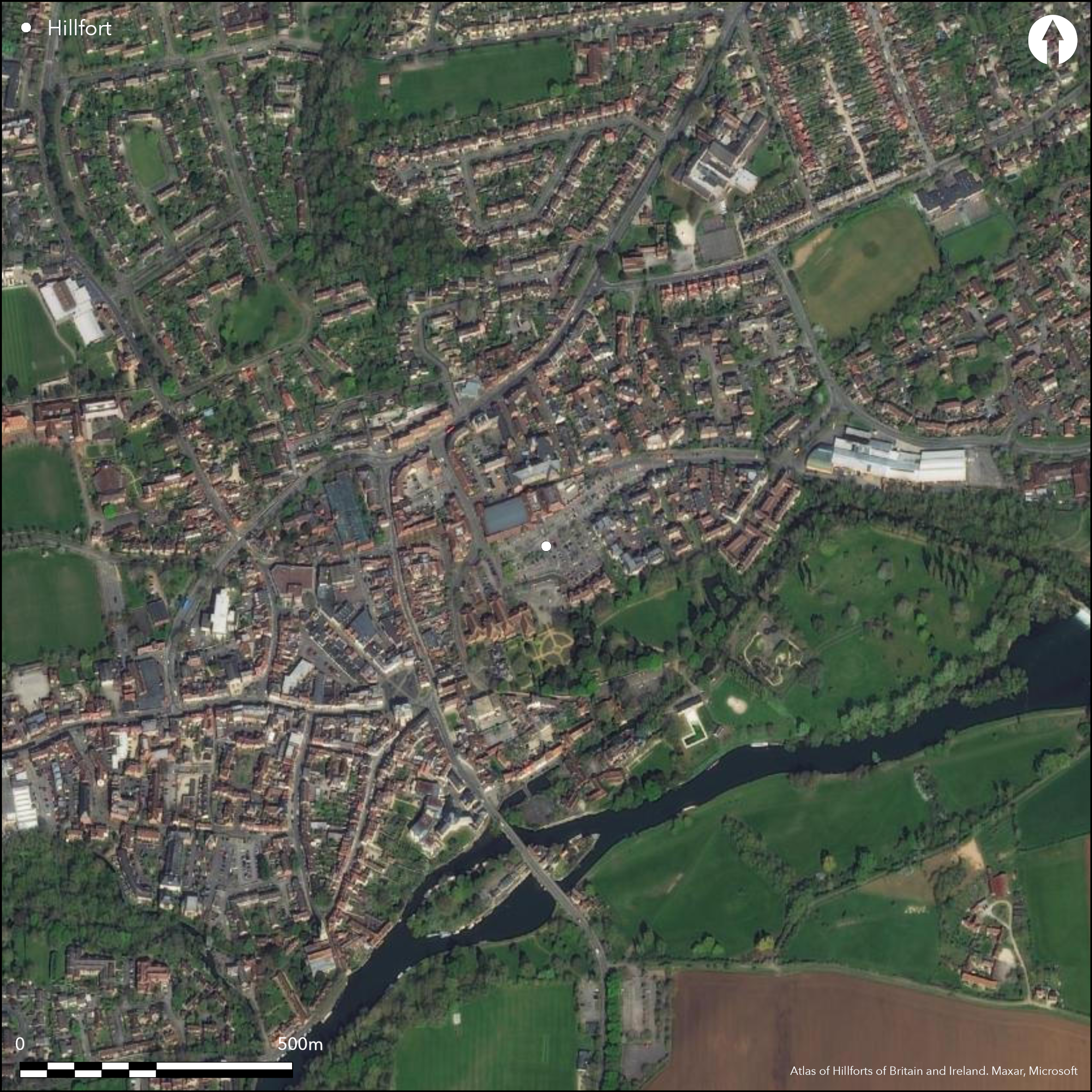
Within Abingdon, only known through excavation prior to development
| Woodland | ✗ |
| Commercial Forestry Plantation | ✗ |
| Parkland | ✗ |
| Pasture (Grazing) | ✗ |
| Arable | ✗ |
| Scrub/Bracken | ✗ |
| Bare Outcrop | ✗ |
| Heather/Moorland | ✗ |
| Heath | ✗ |
| Built-up | ✓ |
| Coastal Grassland | ✗ |
| Other | ✗ |
At the confluence of the Rivers Thames and Ock
| Contour Fort | ✗ |
| Partial Contour Fort | ✗ |
| Promontory Fort | ✓ |
| Hillslope Fort | ✗ |
| Level Terrain Fort | ✗ |
| Marsh Fort | ✗ |
| Multiple Enclosure Fort | ✗ |
| Hilltop | ✗ |
| Coastal Promontory | ✗ |
| Inland Promontory | ✗ |
| Valley Bottom | ✓ |
| Knoll/Hillock/Outcrop | ✗ |
| Ridge | ✗ |
| Cliff/Plateau-edge/Scarp | ✗ |
| Hillslope | ✗ |
| Lowland | ✗ |
| Spur | ✗ |
Dominant Topographic Feature: On a bend in the River Thames
| North | ✗ |
| Northeast | ✗ |
| East | ✗ |
| Southeast | ✗ |
| South | ✗ |
| Southwest | ✗ |
| West | ✗ |
| Northwest | ✗ |
| Level | ✓ |
Altitude: 58.0m
N/A
Enclosing ditches and banks dated to 200 cal BC - 55 cal AD from primary fills of ditches. Early and middle Iron Age features and artefacts in the interior, develops into a Romano-British settlement.
Reliability: A - High
| Pre 1200BC | ✗ |
| 1200BC - 800BC | ✗ |
| 800BC - 400BC | ✗ |
| 400BC - AD50 | ✓ |
| AD50 - AD400 | ✓ |
| AD400 - AD 800 | ✗ |
| Post AD800 | ✗ |
| Unknown | ✗ |
| Pre Hillfort: | None |
| Post Hillfort: | None |
| C14: | From lower fills of ditches |
Series of excavations by Oxford Archaeological Unit prior to development (Allen 1991; 1993; 1994)
| Excavation (None): | None |
Excavations in the interior covered c.1ha and revealed a dense sequence of inter-cutting pits, ditches and gullies, dating back to the early Iron Age but with an important late Iron Age/early Romano-British component contemporary with the ditches. A large selection of material culture recovered.
At the confluence of the Rivers Thames and Ock, River Stert may have been diverted to flow through the ditch.
| None | ✓ |
| Spring | ✗ |
| Stream | ✗ |
| Pool | ✗ |
| Flush | ✗ |
| Well | ✗ |
| Other | ✗ |
None
| No Known Features | ✓ |
| Round Stone Structures | ✗ |
| Rectangular Stone Structures | ✗ |
| Curvilinear Platforms | ✗ |
| Other Roundhouse Evidence | ✗ |
| Pits | ✗ |
| Quarry Hollows | ✗ |
| Other | ✗ |
None
| No Known Excavation | ✗ |
| Pits | ✓ |
| Postholes | ✓ |
| Roundhouses | ✓ |
| Rectangular Structures | ✗ |
| Roads/Tracks | ✗ |
| Quarry Hollows | ✗ |
| Other | ✗ |
| Nothing Found | ✗ |
None
| No Known Geophysics | ✓ |
| Pits | ✗ |
| Roundhouses | ✗ |
| Rectangular Structures | ✗ |
| Roads/Tracks | ✗ |
| Quarry Hollows | ✗ |
| Other | ✗ |
| Nothing Found | ✗ |
Iron Age coins
| No Known Finds | ✗ |
| Pottery | ✓ |
| Metal | ✓ |
| Metalworking | ✗ |
| Human Bones | ✗ |
| Animal Bones | ✓ |
| Lithics | ✗ |
| Environmental | ✓ |
| Other | ✓ |
None
| APs Not Checked | ✗ |
| None | ✓ |
| Roundhouses | ✗ |
| Rectangular Structures | ✗ |
| Pits | ✗ |
| Postholes | ✗ |
| Roads/Tracks | ✗ |
| Other | ✗ |
No information on entrances
| None: | None |
| 2: | None |
Guard Chambers: ✗
Chevaux de Frise: ✗
Three curving ditches joining the Rivers Ock and Thames. The two main inner and outer ditches were 10-12m wide and 2.6m deep and originally flowed with water, probably diverting the River Stert. A strip 10m wide on the inner side of the inner ditch was devoid of occupation features and may represent the bank.
| Area 1: | 33.0ha. |
| Total: | 33.0ha. |
Total Footprint Area: Noneha.
None
| ✗ | None |
| ✗ | None |
| NE Quadrant: | 3 |
| SE Quadrant: | 0 |
| SW Quadrant: | 0 |
| NW Quadrant: | 3 |
| Total: | 3 |
| Partial Univallate | ✗ |
| Univallate | ✗ |
| Partial Bivallate | ✗ |
| Bivallate | ✗ |
| Partial Multivallate | ✓ |
| Multivallate | ✗ |
| Unknown | ✗ |
| Partial Univallate | ✗ |
| Univallate | ✗ |
| Partial Bivallate | ✗ |
| Bivallate | ✗ |
| Partial Multivallate | ✗ |
| Multivallate | ✗ |
None
| None | ✓ |
| Earthen Bank | ✗ |
| Stone Wall | ✗ |
| Rubble | ✗ |
| Wall-walk | ✗ |
| Evidence of Timber | ✗ |
| Vitrification | ✗ |
| Other Burning | ✗ |
| Palisade | ✗ |
| Counter Scarp Bank | ✗ |
| Berm | ✗ |
| Unfinished | ✗ |
| Other | ✗ |
None
| None | ✗ |
| Earthen Bank | ✓ |
| Stone Wall | ✗ |
| Murus Duplex | ✗ |
| Timber-framed | ✗ |
| Timber-laced | ✗ |
| Vitrification | ✗ |
| Other Burning | ✗ |
| Palisade | ✗ |
| Counter Scarp Bank | ✗ |
| Berm | ✗ |
| Unfinished | ✗ |
| No Known Excavation | ✗ |
| Other | ✗ |
| ✗ | None |
| ✓ | None |
Number of Ditches: 3
| ✗ | None |
Allen, T. 1991. An 'oppidum' at Abingdon, Oxfordshire. S Midlands Archaeol, 21, 97-9.
Allen, T. 1993. Abingdon, Abingdon Vineyard 1992: Areas 2 and 3, the early defences. S Midlands Archaeol, 23, 64-6.
Allen, T. 1994. Abingdon, Abingdon Vineyard, Area 3. S Midlands Archaeol, 24, 33.
Lambrick, G. 2009. Thames Through Time. The archaeology of the gravel terraces of the upper and middle Thames. Late prehistory 1500 BC - AD 50. Oxford: Oxford Archaeology, Thames Valley Landscapes Monograph No. 29, 362-5.
Atlas of Hillforts:
Wikidata:
This work is licensed under CC BY-SA 4.0![]()
![]()
![]() and should be cited as:
and should be cited as:
Lock, Gary and Ralston, Ian. 2024. Atlas of Hillforts of Britain and Ireland. Available at: https://hillforts.arch.ox.ac.uk
Document Version 1.1