LiDAR 1m DTM Hillshade
Satellite Imagery
LiDAR 1m DTM Hillshade
Satellite Imagery
Scroll left/right to view further images.
HER: Shropshire 59 (None)
NMR: SJ 50 NW 1 (70078)
SM: 1006251
NGR: SJ501080
X: 350104 Y: 308093 (OSGB36)
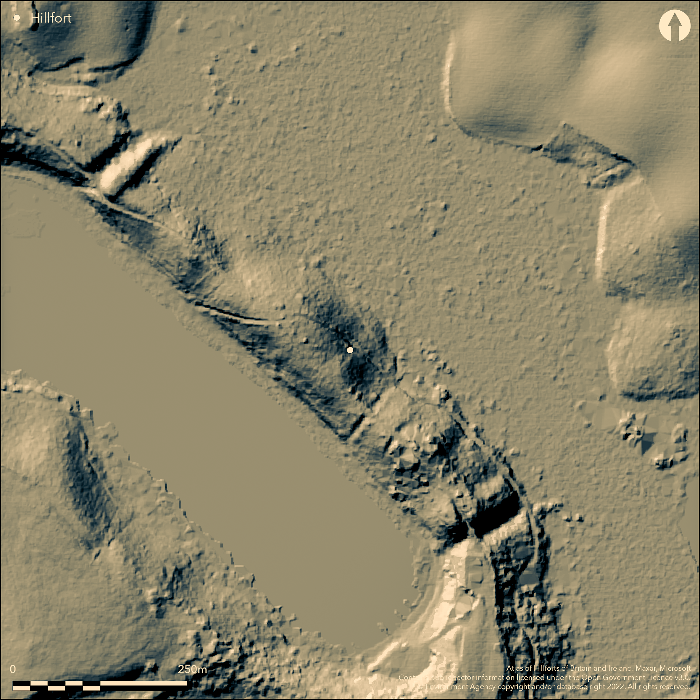
Scheduled as an Iron Age settlement, a univallate, possible marsh fort located on a glacial terminal morraine on the NW edge of the present Bomere Pool in Bomere Wood to the NW of Cound Brook, and c. 2km SE of The Burgs hillfort (Atlas No 0085) on Bayston Hill, Shrewsbury. Area not defeined. The morraine forms a high, long and narrow ridge and the site consists of two substantial banks and exterior ditches thrown across the ends of the ridge, from the water's edge of the Bomere Pool to an area of marsh on the other side, thus cutting off the approach from the NW and SE. The ditches average some 20m in width and have a minimum depth of 3m. To the NW the inner bank is c. 1.5m high, but is barely traceable on the SE. Although the banks are relatively slight now, the scale of the ditches and the natural form of the sites, makes the defences formidable. No internal features are visible. It has been suggested that the S ditch was possibly intended to connect the Bomere Pool with a now marshy area on the NE side of the ridge and therefore embellish the site with water defence. Betton and Shomere Pools are located nearby, and it is possible, that, in prehistory, this ridge was surrounded by marsh and fen, as would have been found in large areas of Shropshire at the time, and that the site was, in fact, a marsh fort. Undated.
Citizen Science: ✗
Reliability of Data: Unconfirmed
Reliability of Interpretation: Unconfirmed
X: -304937 Y: 6921861 (EPSG: 3857)
Longitude: -2.7392931635510696 Latitude: 52.668215323104974 (EPSG:4326)
Country: England
Current County or Unitary Authority: Shropshire
Historic County: Shropshire
Current Parish/Community/Council/Townland: Bayston Hill
Bank barely traceable on the SE side.
| Extant | ✓ |
| Cropmark | ✗ |
| Likely Destroyed | ✗ |
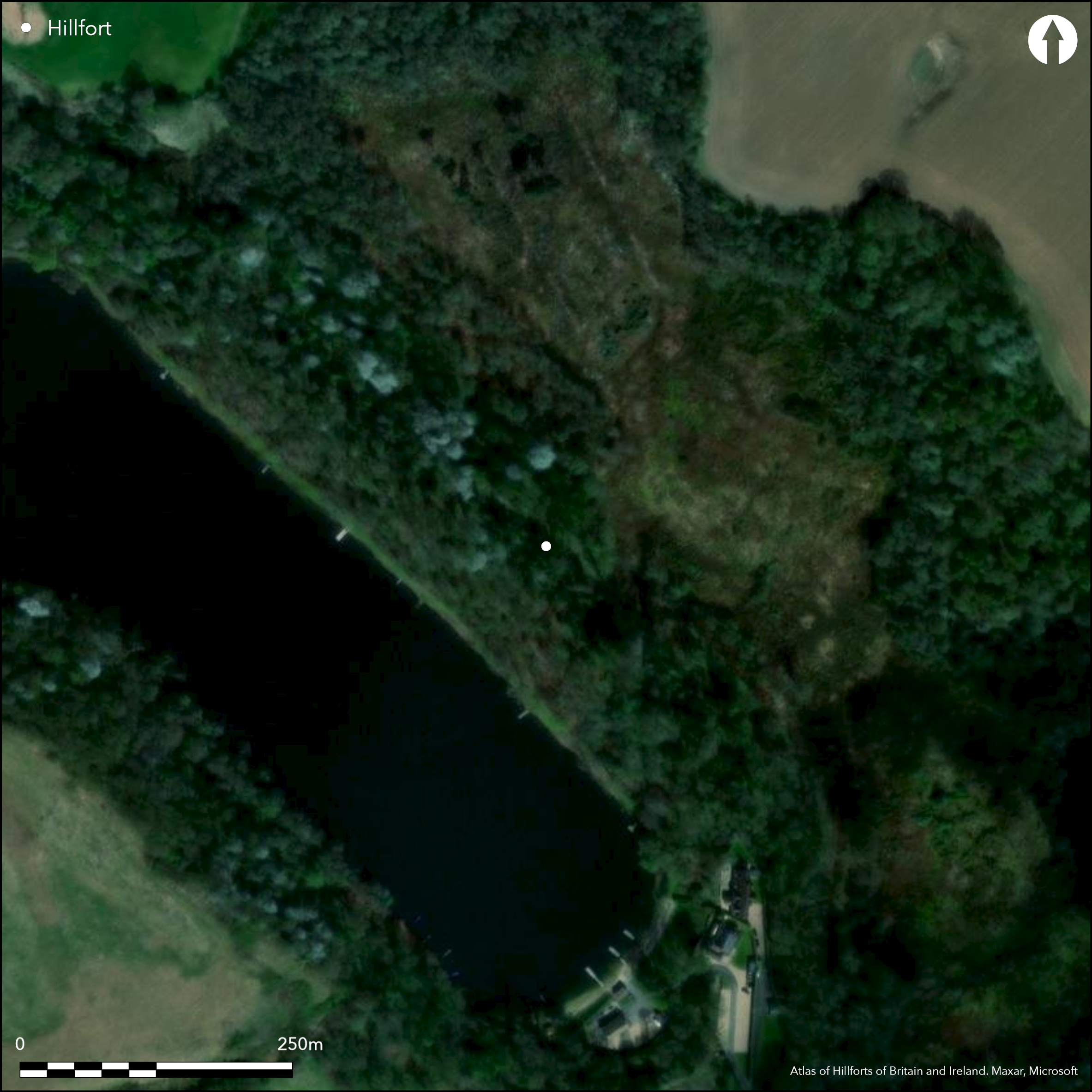
Wooded site.
| Woodland | ✓ |
| Commercial Forestry Plantation | ✗ |
| Parkland | ✗ |
| Pasture (Grazing) | ✗ |
| Arable | ✗ |
| Scrub/Bracken | ✗ |
| Bare Outcrop | ✗ |
| Heather/Moorland | ✗ |
| Heath | ✗ |
| Built-up | ✗ |
| Coastal Grassland | ✗ |
| Other | ✗ |
Possible marsh fort in prehistory, located on a glacial terminal morraine on the NW edge of the present Bomere Pool in Bomere Wood to the NW of Cound Brook, and c. 2km SE of The Burgs hillfort on Bayston Hill, Shrewsbury.
| Contour Fort | ✗ |
| Partial Contour Fort | ✗ |
| Promontory Fort | ✗ |
| Hillslope Fort | ✗ |
| Level Terrain Fort | ✗ |
| Marsh Fort | ✓ |
| Multiple Enclosure Fort | ✗ |
| Hilltop | ✗ |
| Coastal Promontory | ✗ |
| Inland Promontory | ✗ |
| Valley Bottom | ✗ |
| Knoll/Hillock/Outcrop | ✓ |
| Ridge | ✗ |
| Cliff/Plateau-edge/Scarp | ✗ |
| Hillslope | ✗ |
| Lowland | ✗ |
| Spur | ✗ |
Dominant Topographic Feature: Glacial terminal morraine which forms a high, long and narrow ridge.
| North | ✗ |
| Northeast | ✗ |
| East | ✗ |
| Southeast | ✗ |
| South | ✗ |
| Southwest | ✗ |
| West | ✗ |
| Northwest | ✗ |
| Level | ✓ |
Altitude: 75.0m
N/A
None
Reliability: D - None
| Pre 1200BC | ✗ |
| 1200BC - 800BC | ✗ |
| 800BC - 400BC | ✗ |
| 400BC - AD50 | ✗ |
| AD50 - AD400 | ✗ |
| AD400 - AD 800 | ✗ |
| Post AD800 | ✗ |
| Unknown | ✓ |
| Pre Hillfort: | None |
| Post Hillfort: | None |
Field observation Ordnance Survey 1962. Field observations Shropshire CC 1978, 1981. Field observation English Heritage1987.
| Other (1962): | Field observation OS. |
| Other (1987): | Field observation English Heritage. |
| Other (None): | Field observations Shropshire CC. |
None
The site would have had adequate surrounding water supplies.
| None | ✓ |
| Spring | ✗ |
| Stream | ✗ |
| Pool | ✗ |
| Flush | ✗ |
| Well | ✗ |
| Other | ✗ |
None
| No Known Features | ✓ |
| Round Stone Structures | ✗ |
| Rectangular Stone Structures | ✗ |
| Curvilinear Platforms | ✗ |
| Other Roundhouse Evidence | ✗ |
| Pits | ✗ |
| Quarry Hollows | ✗ |
| Other | ✗ |
None
| No Known Excavation | ✓ |
| Pits | ✗ |
| Postholes | ✗ |
| Roundhouses | ✗ |
| Rectangular Structures | ✗ |
| Roads/Tracks | ✗ |
| Quarry Hollows | ✗ |
| Other | ✗ |
| Nothing Found | ✗ |
None
| No Known Geophysics | ✓ |
| Pits | ✗ |
| Roundhouses | ✗ |
| Rectangular Structures | ✗ |
| Roads/Tracks | ✗ |
| Quarry Hollows | ✗ |
| Other | ✗ |
| Nothing Found | ✗ |
None
| No Known Finds | ✓ |
| Pottery | ✗ |
| Metal | ✗ |
| Metalworking | ✗ |
| Human Bones | ✗ |
| Animal Bones | ✗ |
| Lithics | ✗ |
| Environmental | ✗ |
| Other | ✗ |
None
| APs Not Checked | ✓ |
| None | ✗ |
| Roundhouses | ✗ |
| Rectangular Structures | ✗ |
| Pits | ✗ |
| Postholes | ✗ |
| Roads/Tracks | ✗ |
| Other | ✗ |
No entrance has been recorded.
| 0: | No entrance has been recorded. |
| 2: | None |
Guard Chambers: ✗
Chevaux de Frise: ✗
The morraine forms a high, long and narrow ridge and the site consists of two substantial banks and exterior ditches thrown across the ends of the ridge, from the water's edge of the Bomere Pool to an area of marsh on the other side, thus cutting off the approach from the NW and SE. The ditches average some 20m in width and have a minimum depth of 3m. To the NW the inner bank is c. 1.5m high, but is barely traceable on the SE. Although the banks are relatively slight now, the scale of the ditches and the natural form of the sites, makes the defences formidable.
| Area 1: | Noneha. |
| Total: | Noneha. |
Total Footprint Area: Noneha.
None
| ✗ | The enclosed area is not been determined. |
| ✗ | Ramparts cut across the ridge. Number of ramparts not determined exactly in NE and SW quarters.. |
| NE Quadrant: | 0 |
| SE Quadrant: | 2 |
| SW Quadrant: | None |
| NW Quadrant: | 2 |
| Total: | 2 |
| Partial Univallate | ✗ |
| Univallate | ✗ |
| Partial Bivallate | ✓ |
| Bivallate | ✗ |
| Partial Multivallate | ✗ |
| Multivallate | ✗ |
| Unknown | ✗ |
| Partial Univallate | ✗ |
| Univallate | ✗ |
| Partial Bivallate | ✗ |
| Bivallate | ✗ |
| Partial Multivallate | ✗ |
| Multivallate | ✗ |
None
| None | ✗ |
| Earthen Bank | ✓ |
| Stone Wall | ✗ |
| Rubble | ✗ |
| Wall-walk | ✗ |
| Evidence of Timber | ✗ |
| Vitrification | ✗ |
| Other Burning | ✗ |
| Palisade | ✗ |
| Counter Scarp Bank | ✗ |
| Berm | ✗ |
| Unfinished | ✗ |
| Other | ✗ |
None
| None | ✗ |
| Earthen Bank | ✗ |
| Stone Wall | ✗ |
| Murus Duplex | ✗ |
| Timber-framed | ✗ |
| Timber-laced | ✗ |
| Vitrification | ✗ |
| Other Burning | ✗ |
| Palisade | ✗ |
| Counter Scarp Bank | ✗ |
| Berm | ✗ |
| Unfinished | ✗ |
| No Known Excavation | ✓ |
| Other | ✗ |
| ✗ | None |
| ✓ | External ditches substantial features and average some 20m in width and have a minimum depth of 3m. It has been suggested that the S ditch was possibly intended to connect the Bomere Pool with a now marshy area on the NE side. |
Number of Ditches: 2
| ✗ | None |
Page, W. ed. 1908. Victoria County History of Shropshire, 1, 198, Institute of Historical Research.
Atlas of Hillforts:
Wikidata:
This work is licensed under CC BY-SA 4.0![]()
![]()
![]() and should be cited as:
and should be cited as:
Lock, Gary and Ralston, Ian. 2024. Atlas of Hillforts of Britain and Ireland. Available at: https://hillforts.arch.ox.ac.uk
Document Version 1.1