LiDAR 1m DTM Hillshade
Satellite Imagery
LiDAR 1m DTM Hillshade
Satellite Imagery
Scroll left/right to view further images.
HER: Wiltshire and Swindon MWI170 (None)
NMR: ST 82 NE 5 (206321)
SM: 1005698
NGR: ST88762509
X: 388769 Y: 125090 (OSGB36)
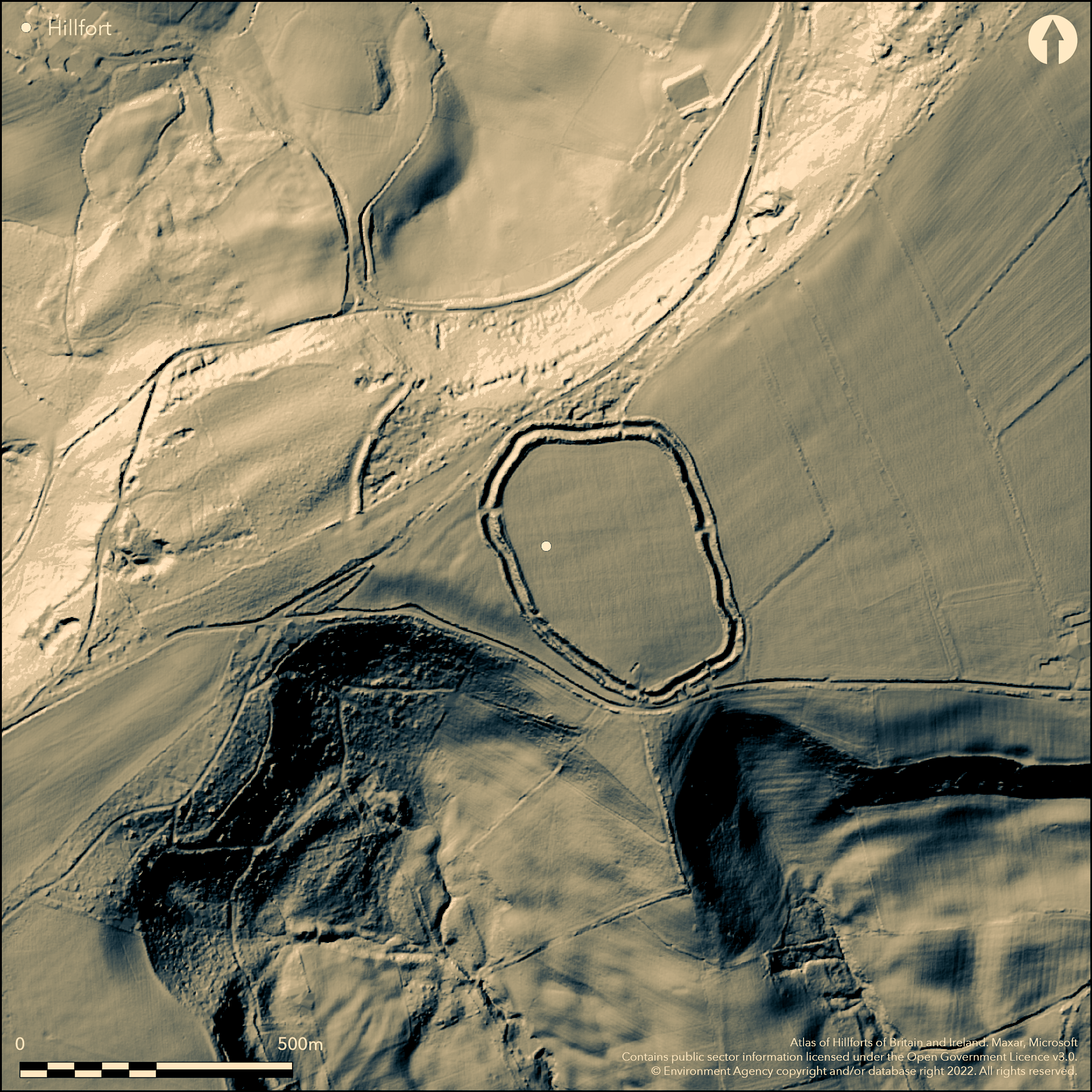
Univallate, roughly oval, partial contour hillfort located in hills above the headwaters of the Rivers Sem and Nadder. Rampart with substantial exterior ditch, 16m wide and up to 4.4m deep, and strong counterscarp bank, averaging 5m wide and up to 1.5m high on N and E perimeter to 3.1m high external on SW. As result hillfort could be mistaken for bivallate. Site measures 320m N-S by 200m, enclosing 5.2 ha. The rampart 2.8m high in Crates Wood, with ditch 0.4m deep. Best preserved on W, immediately S of entrance. Five gaps through ramparts, all but two modern. Larger gaps on W and E possibly the original entrances. Level interior cultivated for considerable time; certainly since early 19th century as Colt-Hoare's plan of 1812 shows it divided into three fields. As result no internal features visible. No surface finds. Modern plough lynchet up to c. 0.9m high runs immediately within inner face of rampart for much of the circuit. The plough-denuded remains of earthworks visible in field to W of hillfort of hollow c. 80m in length flanked by intermittent bank aligned SW-NE running towards W entrance. To the SW of this, a lynchet c. 0.5m in height runs for c 60m, again towards the W entrance. Their function unknown. Cross-ridge dyke c. 280m in length runs c. 280m to W of, and follows line of, hillfort defences. Best preserved in woodland to NW of hillfort, where c. 2m high and c. 6m wide. The bank is immediately fronted to the W by ditch c 3m-5m wide and c. 2m-5m deep. It is tempting to suggest some relationship of these features with the hillfort, but there is no evidence for this. Interior features destroyed by cultivation. Ramparts tree and scrub covered. Undated. On Ist Ed. OS map (1887-88).
Citizen Science: ✗
Reliability of Data: Confirmed
Reliability of Interpretation: Confirmed
X: -240621 Y: 6625719 (EPSG: 3857)
Longitude: -2.1615344292837877 Latitude: 51.025008203268314 (EPSG:4326)
Country: England; None
Current County or Unitary Authority: Wiltshire
Historic County: Wiltshire
Current Parish/Community/Council/Townland: Donhead St. Mary; Sedgehill and Semley
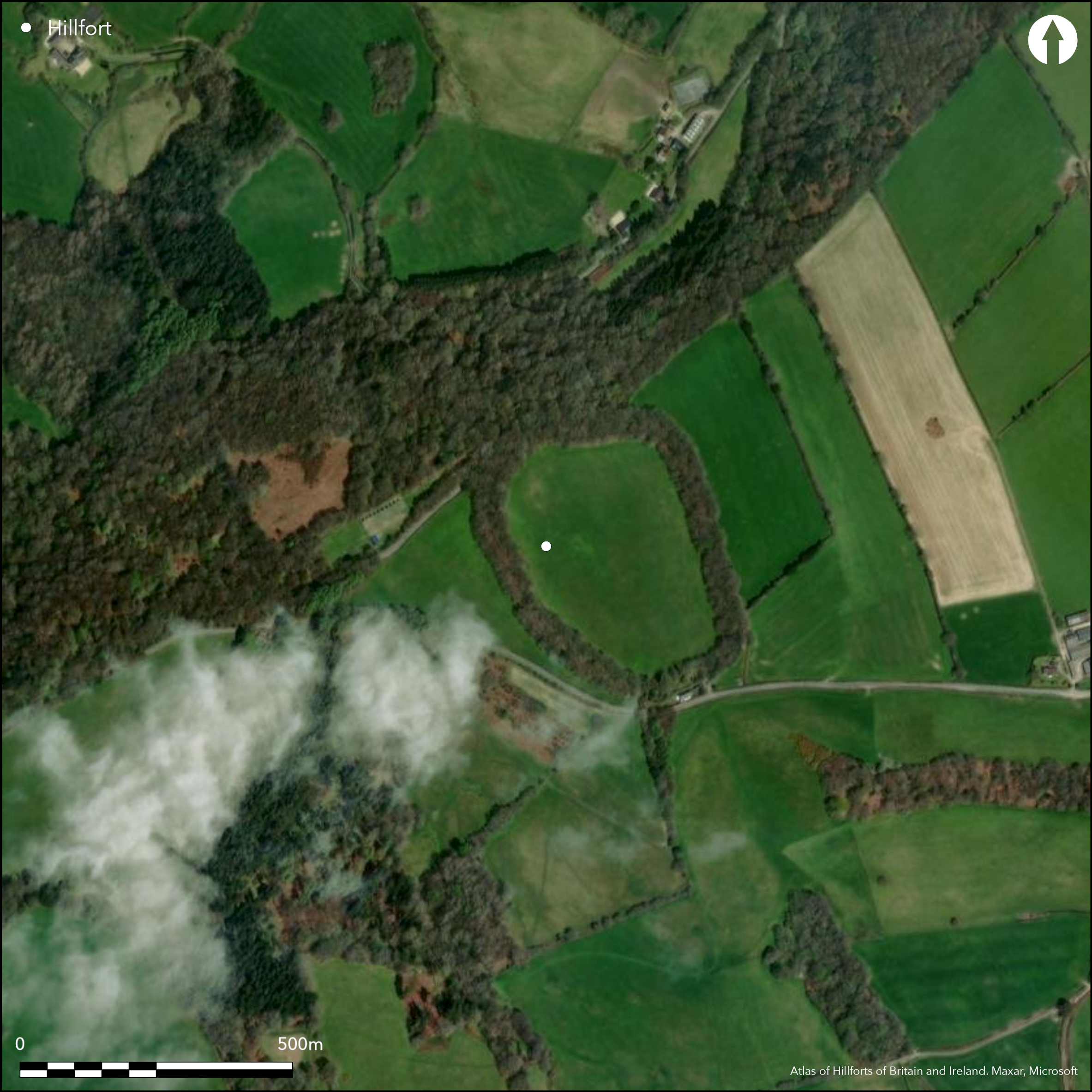
Interior features destroyed by cultivation. Ramparts tree and scrub covered.
| Extant | ✓ |
| Cropmark | ✗ |
| Likely Destroyed | ✗ |
Interior cultivated. Ramparts tree and scrub covered.
| Woodland | ✓ |
| Commercial Forestry Plantation | ✗ |
| Parkland | ✗ |
| Pasture (Grazing) | ✓ |
| Arable | ✓ |
| Scrub/Bracken | ✓ |
| Bare Outcrop | ✗ |
| Heather/Moorland | ✗ |
| Heath | ✗ |
| Built-up | ✗ |
| Coastal Grassland | ✗ |
| Other | ✗ |
Univallate, roughly oval, partial contour hillfort (cutting across the 230m contour NW-SE), located in hills above the headwaters of the Rivers Sem and Nadder.
| Contour Fort | ✗ |
| Partial Contour Fort | ✓ |
| Promontory Fort | ✗ |
| Hillslope Fort | ✗ |
| Level Terrain Fort | ✗ |
| Marsh Fort | ✗ |
| Multiple Enclosure Fort | ✗ |
| Hilltop | ✓ |
| Coastal Promontory | ✗ |
| Inland Promontory | ✗ |
| Valley Bottom | ✗ |
| Knoll/Hillock/Outcrop | ✗ |
| Ridge | ✗ |
| Cliff/Plateau-edge/Scarp | ✗ |
| Hillslope | ✗ |
| Lowland | ✗ |
| Spur | ✗ |
Dominant Topographic Feature: Hill top
| North | ✗ |
| Northeast | ✗ |
| East | ✗ |
| Southeast | ✗ |
| South | ✗ |
| Southwest | ✗ |
| West | ✗ |
| Northwest | ✗ |
| Level | ✓ |
Altitude: 230.0m
Boundary Type: Parish/Townland
None.
Reliability: D - None
| Pre 1200BC | ✗ |
| 1200BC - 800BC | ✗ |
| 800BC - 400BC | ✗ |
| 400BC - AD50 | ✗ |
| AD50 - AD400 | ✗ |
| AD400 - AD 800 | ✗ |
| Post AD800 | ✗ |
| Unknown | ✓ |
| Pre Hillfort: | None |
| Post Hillfort: | None |
On Ist Ed. OS map (1887-88). Measured survey RCHME: South Wiltshire Project, ref. no. 831573. Watching Brief for 11Kv cabling Wessex Archaeology 1997.
| 1st Identified Map Depiction (1812): | R. Colt Hoare plan. |
| 1st Identified Written Reference (1812): | R. Colt Hoare. |
| Other (1997): | Watching Brief Wessex Archaeology. |
| Other (None): | OS map |
| Earthwork Survey (None): | Measured survey RCHME: South Wiltshire Project. |
None.
None
| None | ✓ |
| Spring | ✗ |
| Stream | ✗ |
| Pool | ✗ |
| Flush | ✗ |
| Well | ✗ |
| Other | ✗ |
None
| No Known Features | ✓ |
| Round Stone Structures | ✗ |
| Rectangular Stone Structures | ✗ |
| Curvilinear Platforms | ✗ |
| Other Roundhouse Evidence | ✗ |
| Pits | ✗ |
| Quarry Hollows | ✗ |
| Other | ✗ |
None
| No Known Excavation | ✓ |
| Pits | ✗ |
| Postholes | ✗ |
| Roundhouses | ✗ |
| Rectangular Structures | ✗ |
| Roads/Tracks | ✗ |
| Quarry Hollows | ✗ |
| Other | ✗ |
| Nothing Found | ✗ |
None
| No Known Geophysics | ✓ |
| Pits | ✗ |
| Roundhouses | ✗ |
| Rectangular Structures | ✗ |
| Roads/Tracks | ✗ |
| Quarry Hollows | ✗ |
| Other | ✗ |
| Nothing Found | ✗ |
None
| No Known Finds | ✓ |
| Pottery | ✗ |
| Metal | ✗ |
| Metalworking | ✗ |
| Human Bones | ✗ |
| Animal Bones | ✗ |
| Lithics | ✗ |
| Environmental | ✗ |
| Other | ✗ |
None
| APs Not Checked | ✓ |
| None | ✗ |
| Roundhouses | ✗ |
| Rectangular Structures | ✗ |
| Pits | ✗ |
| Postholes | ✗ |
| Roads/Tracks | ✗ |
| Other | ✗ |
Five gaps through ramparts, all but two modern. Larger simple gaps on E and W possibly the original entrances.
| 5: | Three modern gaps. |
| 2: | None |
Guard Chambers: ✗
Chevaux de Frise: ✗
| 1. Simple Gap (East): | None |
| 2. Simple Gap (West): | None |
Rampart with substantial exterior ditch, 16m wide and up to 4.4m deep, and strong counterscarp bank, averaging 5m wide and up to 1.5m high on N and E perimeter to 3.1m high external on SW. As result hillfort could be mistaken for bivallate. The rampart 2.8m high in Crates Wood, with ditch 0.4m deep. Best preserved on W, immediately S of entrance.
| Area 1: | 5.2ha. |
| Total: | 5.2ha. |
Total Footprint Area: Noneha.
None
| ✗ | None |
| ✓ | None |
| NE Quadrant: | 1 |
| SE Quadrant: | 1 |
| SW Quadrant: | 1 |
| NW Quadrant: | 1 |
| Total: | 1 |
| Partial Univallate | ✗ |
| Univallate | ✓ |
| Partial Bivallate | ✗ |
| Bivallate | ✗ |
| Partial Multivallate | ✗ |
| Multivallate | ✗ |
| Unknown | ✗ |
| Partial Univallate | ✗ |
| Univallate | ✗ |
| Partial Bivallate | ✗ |
| Bivallate | ✗ |
| Partial Multivallate | ✗ |
| Multivallate | ✗ |
None
| None | ✗ |
| Earthen Bank | ✓ |
| Stone Wall | ✗ |
| Rubble | ✗ |
| Wall-walk | ✗ |
| Evidence of Timber | ✗ |
| Vitrification | ✗ |
| Other Burning | ✗ |
| Palisade | ✗ |
| Counter Scarp Bank | ✓ |
| Berm | ✗ |
| Unfinished | ✗ |
| Other | ✗ |
None
| None | ✗ |
| Earthen Bank | ✗ |
| Stone Wall | ✗ |
| Murus Duplex | ✗ |
| Timber-framed | ✗ |
| Timber-laced | ✗ |
| Vitrification | ✗ |
| Other Burning | ✗ |
| Palisade | ✗ |
| Counter Scarp Bank | ✗ |
| Berm | ✗ |
| Unfinished | ✗ |
| No Known Excavation | ✓ |
| Other | ✗ |
| ✗ | None |
| ✓ | Exterior ditch. |
Number of Ditches: 1
| ✗ | None |
Colt Hoare, R.W. 1812. The ancient history of Wiltshire, I, London: Miller, 253.
Pugh, R.B. and Crittall, E. eds 1957. A history of Wiltshire, 1.1, The Victoria history of the counties of England, Oxford: OUP, 265.
Sumner, H. 1913: Ancient earthworks in Cranborne Chase, 23-4.
Atlas of Hillforts:
Wikidata:
This work is licensed under CC BY-SA 4.0![]()
![]()
![]() and should be cited as:
and should be cited as:
Lock, Gary and Ralston, Ian. 2024. Atlas of Hillforts of Britain and Ireland. Available at: https://hillforts.arch.ox.ac.uk
Document Version 1.1