LiDAR 1m DTM Hillshade
Satellite Imagery
LiDAR 1m DTM Hillshade
Satellite Imagery
Scroll left/right to view further images.
HER: Somerset 33306 (None)
NMR: ST 13 NE 2 (189456)
SM: 1010494
NGR: ST16023912
X: 316020 Y: 139120 (OSGB36)
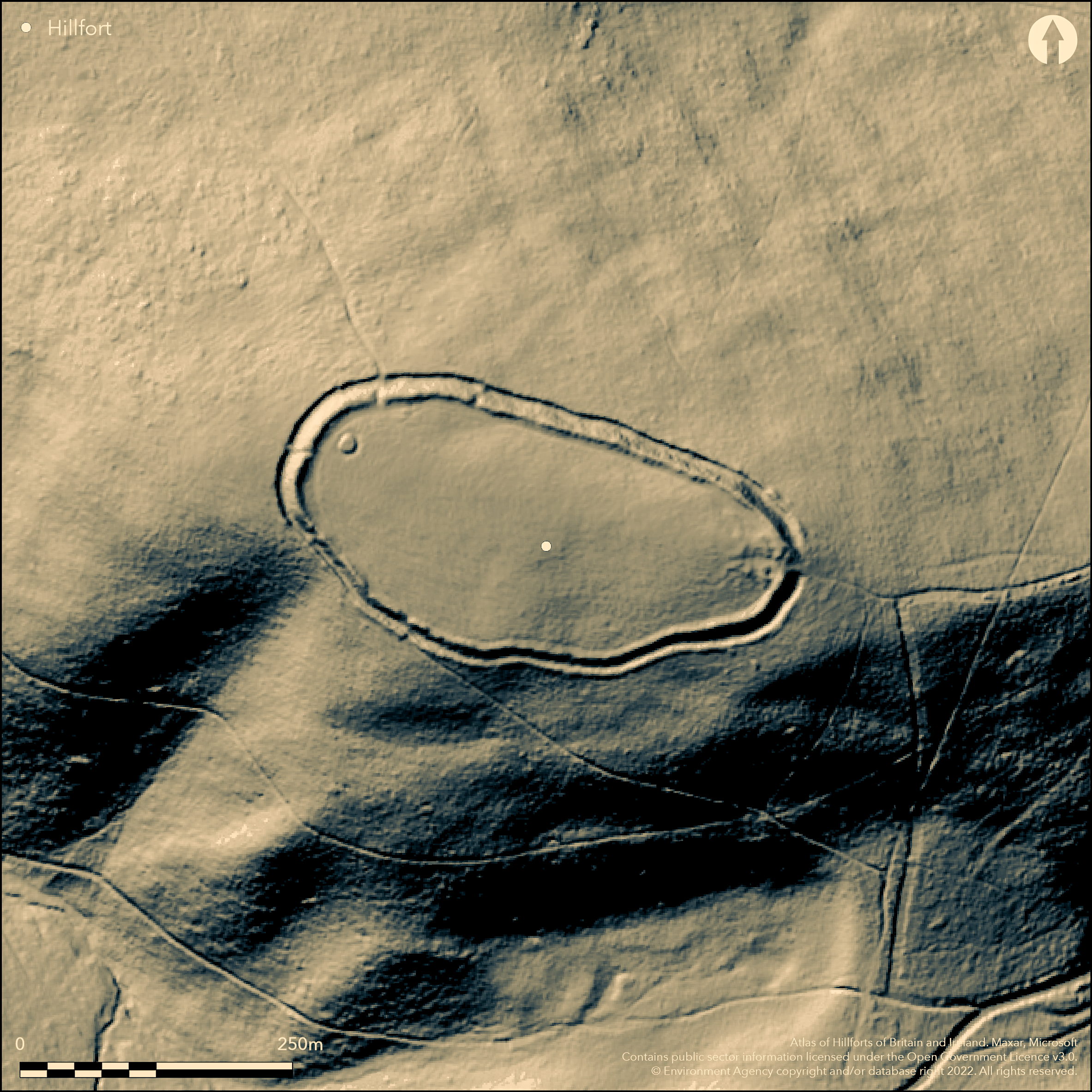
Contour hillfort located on the summit of a high hill in N Quantocks above Holford combe to NW and inland from the sea.. Extensive views to the Bristol Channel coastline. On the 1st Ed OS map (1885-1900). Steep slopes on all sides, but especially on the SW. A long, elongated oval in plan, stone bank and ditch runs roughly along the 325m contour, with a stone bank and ditch with counterscarp bank to 1m high below which, although intermittent in places, as on the N and NW, completes the circuit. The rampart of stone and earth reaches up to 1.2m in height and to 1.5m width, with deep narrow outer ditch, 1m wide, creating a 2m-4m drop. Of the four entrances, two appear to be possibly original - to NW and E, the latter definitely so with passageway and possible guard chambers. A mound inside the NW entrance may be a barrow or a possible fire beacon site. A shallow round hollow may be evidence of charcoal burning and a post formally commemorated the Coronation of George V. Possible WWII use. Minimal investigations.
Citizen Science: ✗
Reliability of Data: Confirmed
Reliability of Interpretation: Confirmed
X: -356442 Y: 6647001 (EPSG: 3857)
Longitude: -3.2019697445610102 Latitude: 51.145105657807534 (EPSG:4326)
Country: England
Current County or Unitary Authority: Somerset
Historic County: Somerset
Current Parish/Community/Council/Townland: Holford
Bank much eroded on N side and part demolished along the S face from the W. Erosion becoming more pronounced on the NE where there is a viewpoint. Erosion works undertaken, eg. 2001 on path to the N. On Heritage at Risk Register (2015).
| Extant | ✓ |
| Cropmark | ✗ |
| Likely Destroyed | ✗ |
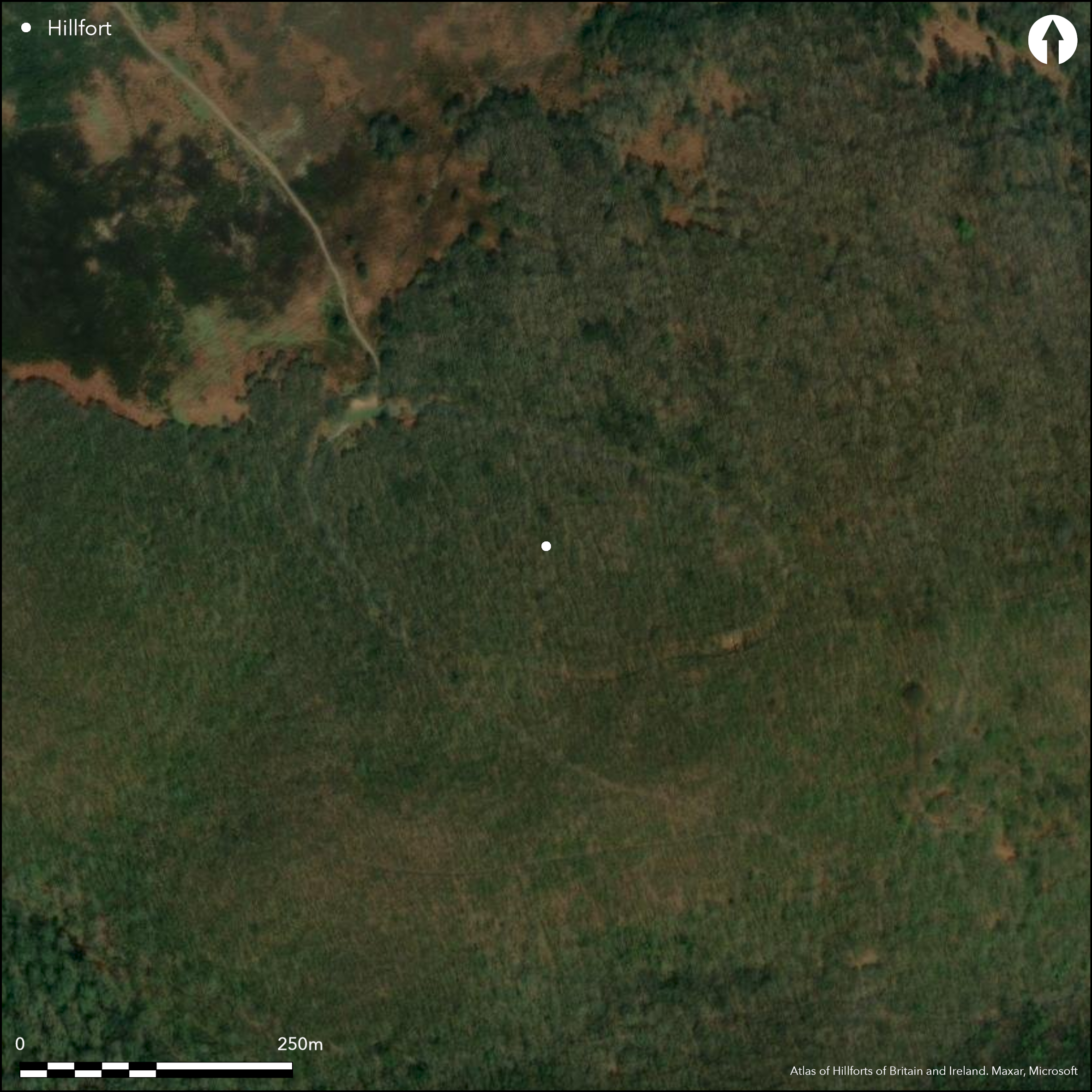
Generally overgrown and wooded apart from 30m on N side where bank much eroded. Post formally commemorated the Coronation of George V. SSSI.
| Woodland | ✓ |
| Commercial Forestry Plantation | ✗ |
| Parkland | ✗ |
| Pasture (Grazing) | ✗ |
| Arable | ✗ |
| Scrub/Bracken | ✓ |
| Bare Outcrop | ✗ |
| Heather/Moorland | ✗ |
| Heath | ✗ |
| Built-up | ✗ |
| Coastal Grassland | ✗ |
| Other | ✓ |
Contour hillfort located on the summit of a high hill in N Quantocks above Holford combe to NW and inland from the sea. Extensive views to the Bristol Channel coastline.
| Contour Fort | ✓ |
| Partial Contour Fort | ✗ |
| Promontory Fort | ✗ |
| Hillslope Fort | ✗ |
| Level Terrain Fort | ✗ |
| Marsh Fort | ✗ |
| Multiple Enclosure Fort | ✗ |
| Hilltop | ✓ |
| Coastal Promontory | ✗ |
| Inland Promontory | ✗ |
| Valley Bottom | ✗ |
| Knoll/Hillock/Outcrop | ✗ |
| Ridge | ✗ |
| Cliff/Plateau-edge/Scarp | ✗ |
| Hillslope | ✗ |
| Lowland | ✗ |
| Spur | ✗ |
Dominant Topographic Feature: High hilltop of N Quantock Hills.
| North | ✗ |
| Northeast | ✗ |
| East | ✗ |
| Southeast | ✗ |
| South | ✗ |
| Southwest | ✗ |
| West | ✗ |
| Northwest | ✗ |
| Level | ✓ |
Altitude: 325.0m
N/A
None.
Reliability: D - None
| Pre 1200BC | ✗ |
| 1200BC - 800BC | ✗ |
| 800BC - 400BC | ✗ |
| 400BC - AD50 | ✗ |
| AD50 - AD400 | ✗ |
| AD400 - AD 800 | ✗ |
| Post AD800 | ✗ |
| Unknown | ✓ |
| Pre Hillfort: | Possible round barrow, but not determined. |
| Post Hillfort: | Mound inside the NW entrance may be a barrow or a possible fire beacon site. A shallow round hollow may be evidence of charcoal burning and a post formally commemorated the Coronation of George V. Possible WWII use. |
In Aubrey's Monumenta Britannica (1665-1693). On the 1st Ed OS map (1885-1900). AP investigation as part of English Heritage Quantocks AONB National Mapping Programme. Measured archaeological survey of the Quantock Hills AONB - English Heritage, Exeter.
| Other (1989): | Visited by Hillfort Study Group |
| 1st Identified Written Reference (None): | In Aubrey's Monumenta Britannica. |
| 1st Identified Map Depiction (None): | 1st Ed OS map |
| Earthwork Survey (None): | Measured archaeological survey of the Quantock Hills AONB - English Heritage, Exeter (Riley). |
| Other (None): | AP investigation as part of English Heritage Quantocks AONB National Mapping Programme. |
A mound inside the NW entrance may be a barrow or a possible fire beacon site. A shallow round hollow may be evidence of charcoal burning and a post formally commemorated the coronation of George V. Mining trial pits in interior and these could explain the 6.6m x 3.6m hollow set behind the S rampart, although could be building. Possible WWII use. AP investigation as part of English Heritage Quantocks AONB National Mapping Programme.
None
| None | ✓ |
| Spring | ✗ |
| Stream | ✗ |
| Pool | ✗ |
| Flush | ✗ |
| Well | ✗ |
| Other | ✗ |
A mound inside the NW entrance may be a round barrow or a possible fire beacon site. A shallow round hollow may be evidence of charcoal burning and a post formally commemorated the Coronation of George V. Mining trial pits in interior and these could explain the 6.6m by 3.6m hollow set behind the S rampart, although could be building.
| No Known Features | ✗ |
| Round Stone Structures | ✗ |
| Rectangular Stone Structures | ✗ |
| Curvilinear Platforms | ✗ |
| Other Roundhouse Evidence | ✗ |
| Pits | ✗ |
| Quarry Hollows | ✗ |
| Other | ✓ |
None
| No Known Excavation | ✓ |
| Pits | ✗ |
| Postholes | ✗ |
| Roundhouses | ✗ |
| Rectangular Structures | ✗ |
| Roads/Tracks | ✗ |
| Quarry Hollows | ✗ |
| Other | ✗ |
| Nothing Found | ✗ |
None
| No Known Geophysics | ✓ |
| Pits | ✗ |
| Roundhouses | ✗ |
| Rectangular Structures | ✗ |
| Roads/Tracks | ✗ |
| Quarry Hollows | ✗ |
| Other | ✗ |
| Nothing Found | ✗ |
None
| No Known Finds | ✓ |
| Pottery | ✗ |
| Metal | ✗ |
| Metalworking | ✗ |
| Human Bones | ✗ |
| Animal Bones | ✗ |
| Lithics | ✗ |
| Environmental | ✗ |
| Other | ✗ |
AP investigation as part of English Heritage Quantocks AONB National Mapping Programme.
| APs Not Checked | ✓ |
| None | ✗ |
| Roundhouses | ✗ |
| Rectangular Structures | ✗ |
| Pits | ✗ |
| Postholes | ✗ |
| Roads/Tracks | ✗ |
| Other | ✗ |
Four gaps, but only two possibly original to SW (possible) and to E (definite). SW is eroded simple gap with causeway. On E more complex on E apex tip from ridge. S rampart here slightly inturned, that on N possibly also, but ditch filled and disturbed. Leads between ramparts with a passageway and two possible circular guard chambers, although these may be evidence of mining trials. has possible guard chambers
| 4: | All general gaps in ramparts. |
| 2: | Two possible original entrances. |
Guard Chambers: ✓
Chevaux de Frise: ✗
| 1. In-turned (East): | Passageway with slight inturns. |
| 1. Passage-way/Corridor (East): | None |
| 1. Recesses/Guard Chambers (East): | Two possible circular guard chambers, although these may be evidence of mining trials. |
| 2. Simple Gap (South west): | Possible site of entrance. Eroded with causeway. |
A long, elongated oval in plan, stone bank and ditch runs roughly along the 325m contour, with a stone bank and ditch with counterscarp bank to 1m high below which, although intermittent in places, as on the N and NW, completes the circuit. The rampart of stone and earth reaches up to 1.2m in height and to 1.5m width with deep narrow outer ditch, 1m wide, creating a 2m-3m drop.
| Area 1: | 2.0ha. |
| Total: | 2.0ha. |
Total Footprint Area: Noneha.
None
| ✗ | None |
| ✓ | Bank with counterscarp around the circuit. |
| NE Quadrant: | 1 |
| SE Quadrant: | 1 |
| SW Quadrant: | 1 |
| NW Quadrant: | 1 |
| Total: | 1 |
| Partial Univallate | ✗ |
| Univallate | ✓ |
| Partial Bivallate | ✗ |
| Bivallate | ✗ |
| Partial Multivallate | ✗ |
| Multivallate | ✗ |
| Unknown | ✗ |
| Partial Univallate | ✗ |
| Univallate | ✗ |
| Partial Bivallate | ✗ |
| Bivallate | ✗ |
| Partial Multivallate | ✗ |
| Multivallate | ✗ |
Earthen and stone bank.
| None | ✗ |
| Earthen Bank | ✓ |
| Stone Wall | ✗ |
| Rubble | ✓ |
| Wall-walk | ✗ |
| Evidence of Timber | ✗ |
| Vitrification | ✗ |
| Other Burning | ✗ |
| Palisade | ✗ |
| Counter Scarp Bank | ✓ |
| Berm | ✗ |
| Unfinished | ✗ |
| Other | ✗ |
None
| None | ✗ |
| Earthen Bank | ✗ |
| Stone Wall | ✗ |
| Murus Duplex | ✗ |
| Timber-framed | ✗ |
| Timber-laced | ✗ |
| Vitrification | ✗ |
| Other Burning | ✗ |
| Palisade | ✗ |
| Counter Scarp Bank | ✗ |
| Berm | ✗ |
| Unfinished | ✗ |
| No Known Excavation | ✓ |
| Other | ✗ |
| ✗ | None |
| ✓ | Deep narrow outer ditch, 1m wide, creating a 2m-4m drop from rampart. |
Number of Ditches: 1
| ✗ | None |
Burrow, E.J. 1924. Ancient earthworks and camps of Somerset, Cheltenham: E.J. Burrow, 80-81.
Page, W. (ed) 1911. The Victoria County History of the County of Somerset, 2, 492, London: St Catherine Press.
Atlas of Hillforts:
Wikidata:
This work is licensed under CC BY-SA 4.0![]()
![]()
![]() and should be cited as:
and should be cited as:
Lock, Gary and Ralston, Ian. 2024. Atlas of Hillforts of Britain and Ireland. Available at: https://hillforts.arch.ox.ac.uk
Document Version 1.1