LiDAR 1m DTM Hillshade
Satellite Imagery
LiDAR 1m DTM Hillshade
Satellite Imagery
Scroll left/right to view further images.
HER: Somerset 12041 (None)
NMR: ST 75 SW (None)
SM: None
NGR: ST72395151
X: 372390 Y: 151510 (OSGB36)
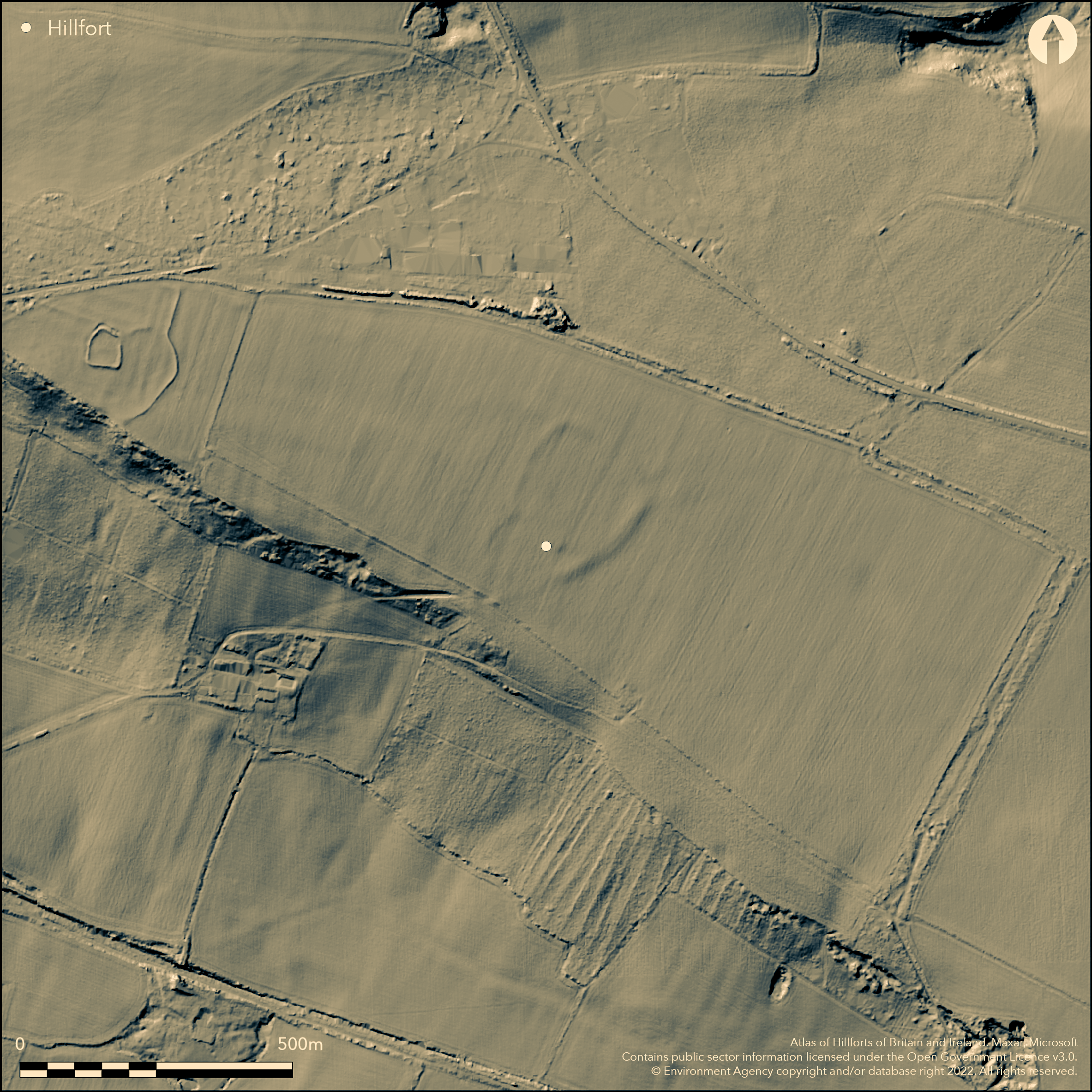
Large, ploughed-down and complex, hillslope fort sited in arable fields on Mells Down above the headwaters of the River Frome and to SE of Kingsdown Camp (Atlas No 0463). Main enclosure possibly triple or quadruple ditched in places, all enclosing c. 11ha. Formerly bank to 1m high and 10m wide in places, but present extent not determined. Visible on aerial photographs, possible, larger, single-ditched enclosure attached to W of main. To assess plough damage, two trenches opened in 1998 revealing possible dry-stone wall along inner edge of buried ditch which found to be U-shaped. Finds included butchered animal bone, early Iron Age pottery and Roman Savernake ware. Most of pottery abraded and local origin. In early phase possible farmstead or enclosed settlement suggested and therefore site phased construction. Possible two entrances, on NE, a simple break in bank and on NW more complex with associated outworks. In arable fields. Unscheduled and not detailed in NMR. No further details.
Citizen Science: ✗
Reliability of Data: Unconfirmed
Reliability of Interpretation: Unconfirmed
X: -266845 Y: 6667774 (EPSG: 3857)
Longitude: -2.39710718040874 Latitude: 51.262020298760625 (EPSG:4326)
Country: England; None
Current County or Unitary Authority: Somerset
Historic County: Somerset
Current Parish/Community/Council/Townland: Mells; Kilmersdon
Ploughed-down. Formerly bank to 1m high and 10m wide in places, but present extent not determined and probably no longer visible.
| Extant | ✗ |
| Cropmark | ✗ |
| Likely Destroyed | ✓ |
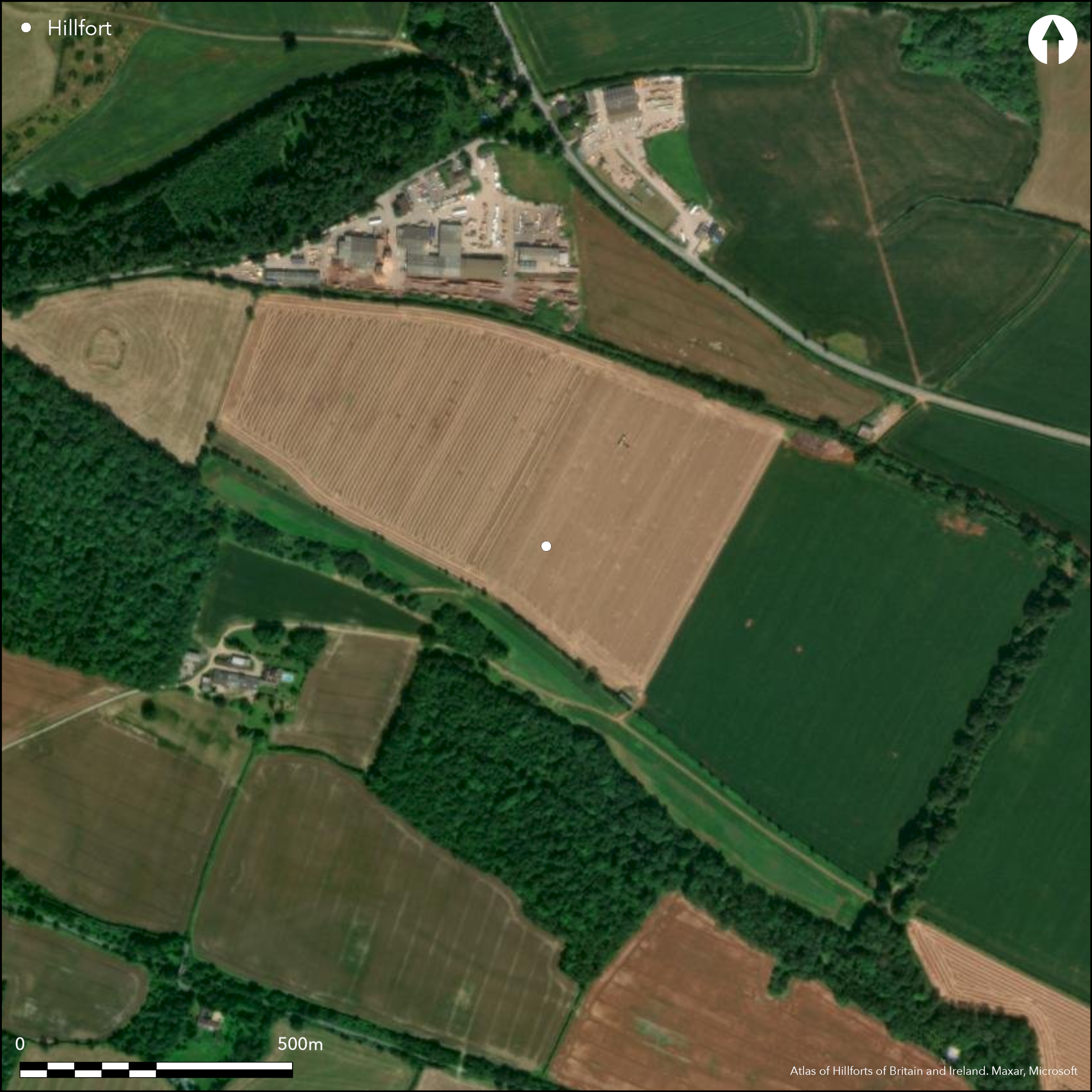
Under arable.
| Woodland | ✗ |
| Commercial Forestry Plantation | ✗ |
| Parkland | ✗ |
| Pasture (Grazing) | ✗ |
| Arable | ✓ |
| Scrub/Bracken | ✗ |
| Bare Outcrop | ✗ |
| Heather/Moorland | ✗ |
| Heath | ✗ |
| Built-up | ✗ |
| Coastal Grassland | ✗ |
| Other | ✗ |
Large ploughed-down hillslope earthwork sited on Mells Down above the headwaters of the River Frome.
| Contour Fort | ✗ |
| Partial Contour Fort | ✗ |
| Promontory Fort | ✗ |
| Hillslope Fort | ✓ |
| Level Terrain Fort | ✗ |
| Marsh Fort | ✗ |
| Multiple Enclosure Fort | ✗ |
| Hilltop | ✗ |
| Coastal Promontory | ✗ |
| Inland Promontory | ✗ |
| Valley Bottom | ✗ |
| Knoll/Hillock/Outcrop | ✗ |
| Ridge | ✗ |
| Cliff/Plateau-edge/Scarp | ✗ |
| Hillslope | ✓ |
| Lowland | ✗ |
| Spur | ✗ |
Dominant Topographic Feature: Downland slopes.
| North | ✗ |
| Northeast | ✗ |
| East | ✗ |
| Southeast | ✗ |
| South | ✓ |
| Southwest | ✗ |
| West | ✗ |
| Northwest | ✗ |
| Level | ✗ |
Altitude: 175.0m
Boundary Type: Parish/Townland
Possible long period of occupation. Finds from trenches included butchered animal bone, early Iron Age pottery and Roman Savernake ware. Most of pottery abraded and local origin. Possible early phase of farmstead or enclosed settlement.
Reliability: B - Medium
| Pre 1200BC | ✗ |
| 1200BC - 800BC | ✗ |
| 800BC - 400BC | ✓ |
| 400BC - AD50 | ✓ |
| AD50 - AD400 | ✗ |
| AD400 - AD 800 | ✗ |
| Post AD800 | ✗ |
| Unknown | ✗ |
| Pre Hillfort: | None |
| Post Hillfort: | None |
| Artefactual: | Finds from trenches included butchered animal bone, early Iron Age pottery and Roman Savernake ware. Most of pottery abraded and local origin. |
Two trenches opened Somerset County Council 1998.
| Excavation (1998): | Two trenches opened Somerset County Council. |
Finds from trenches included butchered animal bone, early Iron Age pottery and Roman Savernake ware. Most of pottery abraded and local origin.
None
| None | ✓ |
| Spring | ✗ |
| Stream | ✗ |
| Pool | ✗ |
| Flush | ✗ |
| Well | ✗ |
| Other | ✗ |
None
| No Known Features | ✓ |
| Round Stone Structures | ✗ |
| Rectangular Stone Structures | ✗ |
| Curvilinear Platforms | ✗ |
| Other Roundhouse Evidence | ✗ |
| Pits | ✗ |
| Quarry Hollows | ✗ |
| Other | ✗ |
None
| No Known Excavation | ✗ |
| Pits | ✗ |
| Postholes | ✗ |
| Roundhouses | ✗ |
| Rectangular Structures | ✗ |
| Roads/Tracks | ✗ |
| Quarry Hollows | ✗ |
| Other | ✗ |
| Nothing Found | ✓ |
None
| No Known Geophysics | ✓ |
| Pits | ✗ |
| Roundhouses | ✗ |
| Rectangular Structures | ✗ |
| Roads/Tracks | ✗ |
| Quarry Hollows | ✗ |
| Other | ✗ |
| Nothing Found | ✗ |
Finds from trenches included butchered animal bone, early Iron Age pottery and Roman Savernake ware. Most of pottery abraded and local origin.
| No Known Finds | ✗ |
| Pottery | ✓ |
| Metal | ✗ |
| Metalworking | ✗ |
| Human Bones | ✗ |
| Animal Bones | ✓ |
| Lithics | ✗ |
| Environmental | ✗ |
| Other | ✗ |
None
| APs Not Checked | ✓ |
| None | ✗ |
| Roundhouses | ✗ |
| Rectangular Structures | ✗ |
| Pits | ✗ |
| Postholes | ✗ |
| Roads/Tracks | ✗ |
| Other | ✗ |
Possibly two entrances, on NE, a simple break in bank and on NW more complex with associated outworks.
| None: | Not determined, no longer visible. |
| 2: | Possibly two. |
Guard Chambers: ✗
Chevaux de Frise: ✗
| 1. Simple Gap (North east): | None |
| 2. Outworks (North west): | None |
Main enclosure possibly triple or quadruple ditched in places, all enclosing c. 11ha. Formerly bank to 1m high and 10m wide in places, but present extent not determined. Visible on aerial photographs, possible, larger, single-ditched enclosure attached to W of main. To assess plough damage, two trenches opened 1998 revealing possible dry-stone wall along inner edge of buried ditch which found to be U-shaped.
| Area 1: | 11.0ha. |
| Total: | 11.0ha. |
Total Footprint Area: Noneha.
None
| ✓ | In early phase possible farmstead or enclosed settlement suggested and therefore site phased construction. |
| ✗ | Former circuit estimated only. |
| NE Quadrant: | 1 |
| SE Quadrant: | 1 |
| SW Quadrant: | 1 |
| NW Quadrant: | 1 |
| Total: | 1 |
| Partial Univallate | ✗ |
| Univallate | ✓ |
| Partial Bivallate | ✗ |
| Bivallate | ✗ |
| Partial Multivallate | ✗ |
| Multivallate | ✗ |
| Unknown | ✗ |
| Partial Univallate | ✗ |
| Univallate | ✗ |
| Partial Bivallate | ✗ |
| Bivallate | ✗ |
| Partial Multivallate | ✗ |
| Multivallate | ✗ |
Possible bank only.
| None | ✗ |
| Earthen Bank | ✓ |
| Stone Wall | ✗ |
| Rubble | ✗ |
| Wall-walk | ✗ |
| Evidence of Timber | ✗ |
| Vitrification | ✗ |
| Other Burning | ✗ |
| Palisade | ✗ |
| Counter Scarp Bank | ✗ |
| Berm | ✗ |
| Unfinished | ✗ |
| Other | ✗ |
Ramparts not excavated, but, to assess plough damage, two trenches opened 1998 revealing possible dry-stone wall along inner edge of buried ditch which found to be U-shaped.
| None | ✗ |
| Earthen Bank | ✗ |
| Stone Wall | ✗ |
| Murus Duplex | ✗ |
| Timber-framed | ✗ |
| Timber-laced | ✗ |
| Vitrification | ✗ |
| Other Burning | ✗ |
| Palisade | ✗ |
| Counter Scarp Bank | ✗ |
| Berm | ✗ |
| Unfinished | ✗ |
| No Known Excavation | ✗ |
| Other | ✓ |
| ✗ | None |
| ✓ | Up to three or four ditches possible. To assess plough damage, two trenches opened 1998 revealing possible drystone wall along inner edge of buried ditch which found to be U-shaped. |
Number of Ditches: 4
| ✓ | Possible, but not verified, larger, single-ditched enclosure attached to W of main. |
Powlesland, I, 1998. A Survey of the Prehistoric/Roman landscape of the East Somerset Area, No 9, unpublished report Somerset County Council.
Powlesland, I. Undated. Fieldwork at Mells Down, Beeches Grove and Downhead 1997-2000; Survey, excavation and fieldwalking. (2005), unpublished report Somerset County Council.
Atlas of Hillforts:
Wikidata:
This work is licensed under CC BY-SA 4.0![]()
![]()
![]() and should be cited as:
and should be cited as:
Lock, Gary and Ralston, Ian. 2024. Atlas of Hillforts of Britain and Ireland. Available at: https://hillforts.arch.ox.ac.uk
Document Version 1.1