
LiDAR 1m DTM Hillshade
Satellite Imagery
LiDAR 1m DTM Hillshade
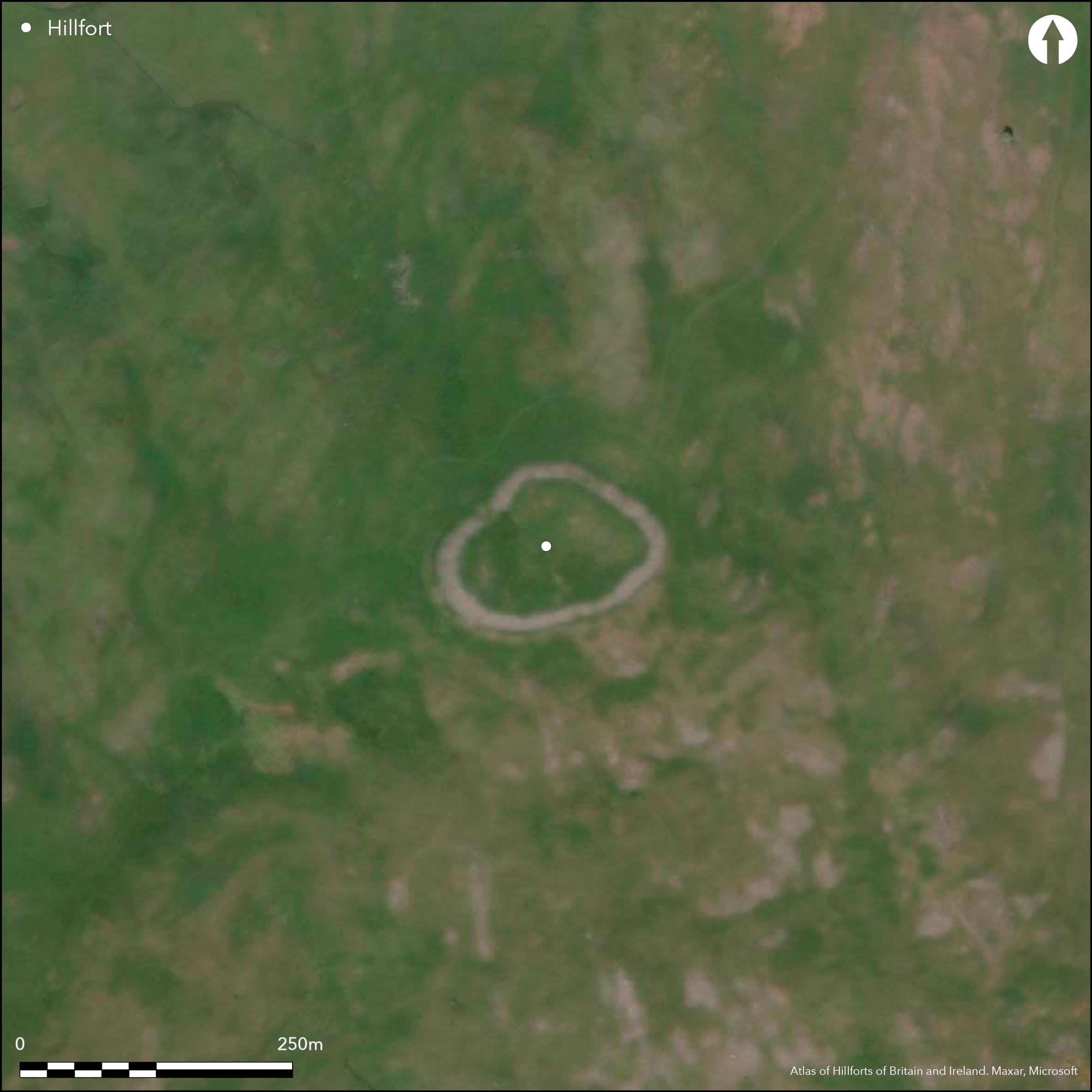
Satellite Imagery
Scroll left/right to view further images.
HER: Northumberland 611 (None)
NMR: NT 82 NE 47 (784)
SM: 1014508
NGR: NT 8855 2740
X: 388550 Y: 627400 (OSGB36)
Within the Northumberland National Park, lying to the SW of Hethpool in the College Valley, a sub-oval contour-type hillfort lying on the summit of Great Hetha at 343m OD. The hillfort survives in good condition with steep slopes in all directions except in the SW where the ridge extends from the hill. Here the slope of the hill has been cut back to enhance the appearance of the defences. The ramparts appear to have been constructed in three-phases, with the earliest phase comprising an oval, low earthen bank which follows the contours, enclosing 1.1ha with a possible entrance in the NW. This was later partially overlain by a stony bank, probably originally a wall, enclosing 0.8ha with the phase 1 rampart protruding on the NE and SW. No evidence for ditches. Entrances for the second phase lie in the NE and NW. A massive inner stone bank, now tumbled, was constructed in the final phase enclosing 0.4ha with long stretches of external facing stones remaining in situ. A single entrance in the NW lies slightly off-set from the phase 2 entrance. A space up to 30m wide lies between the phase 2 and 3 ramparts in the NE and might in the final phase have been a bivallate hillfort. Nine circular hut platforms have been identified within the interior. A more recent shelter and animal pen have been constructed within the space between the ramparts in the NE. The hillfort was first surveyed by MacLauchlan and the Ordnance Survey in 1860 with further investigation by Jobey in the 1960's. The survey by English Heritage in 1998-2004 reinterpreted it as multi-phase, with stone-built ramparts in the latest two phases. An area of 8ha was surveyed at that time (Pearson and Lax 2008). A possible denuded cross-ridge dyke lies 130m to the W of the hillfort. The hillfort is unexcavated and undated, but presumed Iron Age and scheduled as a defended settlement. Recorded on 1856-65 OS mapping. Quarrying has occurred within and around the hillfort.
Citizen Science: ✗
Reliability of Data: Confirmed
Reliability of Interpretation: Confirmed
X: -243009 Y: 7467425 (EPSG: 3857)
Longitude: -2.182988463819709 Latitude: 55.54021483611423 (EPSG:4326)
Country: England
Current County or Unitary Authority: Northumberland
Historic County: Northumberland
Current Parish/Community/Council/Townland: Kirknewton
Quarrying within and around the hillfort, walls have tumbled in places
| Extant | ✓ |
| Cropmark | ✗ |
| Likely Destroyed | ✗ |
Short grassland, most probably grazed
| Woodland | ✗ |
| Commercial Forestry Plantation | ✗ |
| Parkland | ✗ |
| Pasture (Grazing) | ✓ |
| Arable | ✗ |
| Scrub/Bracken | ✗ |
| Bare Outcrop | ✗ |
| Heather/Moorland | ✗ |
| Heath | ✗ |
| Built-up | ✗ |
| Coastal Grassland | ✗ |
| Other | ✗ |
A multi-phase contour fort, lying at 343m OD on the summit of Great Hetha
| Contour Fort | ✓ |
| Partial Contour Fort | ✗ |
| Promontory Fort | ✗ |
| Hillslope Fort | ✗ |
| Level Terrain Fort | ✗ |
| Marsh Fort | ✗ |
| Multiple Enclosure Fort | ✗ |
| Hilltop | ✓ |
| Coastal Promontory | ✗ |
| Inland Promontory | ✗ |
| Valley Bottom | ✗ |
| Knoll/Hillock/Outcrop | ✗ |
| Ridge | ✗ |
| Cliff/Plateau-edge/Scarp | ✗ |
| Hillslope | ✗ |
| Lowland | ✗ |
| Spur | ✗ |
Dominant Topographic Feature: On the summit of Great Hetha
| North | ✗ |
| Northeast | ✗ |
| East | ✗ |
| Southeast | ✗ |
| South | ✗ |
| Southwest | ✗ |
| West | ✗ |
| Northwest | ✗ |
| Level | ✓ |
Altitude: 343.0m
N/A
Undated, presumed Iron Age based on its form and method of construction
Reliability: D - None
| Pre 1200BC | ✗ |
| 1200BC - 800BC | ✗ |
| 800BC - 400BC | ✗ |
| 400BC - AD50 | ✗ |
| AD50 - AD400 | ✗ |
| AD400 - AD 800 | ✗ |
| Post AD800 | ✗ |
| Unknown | ✓ |
| Pre Hillfort: | None |
| Post Hillfort: | Post medieval summit cairn, OS trig point |
Recorded on 1856-65 OS mapping. Surveyed by MacLauchlan and the Ordnance Survey in 1860 with further investigation by Jobey in the 1960's. The survey by English Heritage in 1998 reinterpreted it as multi-phased, with stone-built ramparts in the latest two phases. Field investigations in 1955 and 1967. Field survey by G. Jobey in 1965. Scheduled
| Earthwork Survey (1860): | MacLauchlan |
| Earthwork Survey (1860): | None |
| Other (1935): | Scheduled |
| Other (1955): | Field investigation |
| Other (1965): | Field survey (G. Jobey) |
| Other (1967): | Field investigation |
| Earthwork Survey (1998): | Analytical Survey 'Discovering our Hillfort Heritage' Project |
| Other (2002): | Visited by Hillfort Study Group |
| 1st Identified Map Depiction (None): | None |
Nine roundhouse platforms are visible within the interior but no investigation has been carried out. There is no known water source within the interior
Streams lie in the valleys surrounding Great Hetha
| None | ✓ |
| Spring | ✗ |
| Stream | ✗ |
| Pool | ✗ |
| Flush | ✗ |
| Well | ✗ |
| Other | ✗ |
Nine hut platforms have been identified
| No Known Features | ✗ |
| Round Stone Structures | ✗ |
| Rectangular Stone Structures | ✗ |
| Curvilinear Platforms | ✓ |
| Other Roundhouse Evidence | ✗ |
| Pits | ✗ |
| Quarry Hollows | ✗ |
| Other | ✗ |
None
| No Known Excavation | ✓ |
| Pits | ✗ |
| Postholes | ✗ |
| Roundhouses | ✗ |
| Rectangular Structures | ✗ |
| Roads/Tracks | ✗ |
| Quarry Hollows | ✗ |
| Other | ✗ |
| Nothing Found | ✗ |
None
| No Known Geophysics | ✓ |
| Pits | ✗ |
| Roundhouses | ✗ |
| Rectangular Structures | ✗ |
| Roads/Tracks | ✗ |
| Quarry Hollows | ✗ |
| Other | ✗ |
| Nothing Found | ✗ |
None
| No Known Finds | ✓ |
| Pottery | ✗ |
| Metal | ✗ |
| Metalworking | ✗ |
| Human Bones | ✗ |
| Animal Bones | ✗ |
| Lithics | ✗ |
| Environmental | ✗ |
| Other | ✗ |
None
| APs Not Checked | ✓ |
| None | ✗ |
| Roundhouses | ✗ |
| Rectangular Structures | ✗ |
| Pits | ✗ |
| Postholes | ✗ |
| Roads/Tracks | ✗ |
| Other | ✗ |
Four entrances in total constructed during three phases, all simple gaps, three to NW, one to NE
| 4: | None |
| 2: | None |
Guard Chambers: ✗
Chevaux de Frise: ✗
| 1. Simple Gap (North west): | Phase 1 |
| 2. Simple Gap (North east): | Phase 2 |
| 3. Simple Gap (North west): | Phase 2 |
| 4. Simple Gap (North west): | Phase 3 |
The hillfort was constructed in three phases, with the earliest being an oval, low earthen bank of 1.1 ha. Phase 2 and 3 were both of stone wall construction, 0.8ha and 0.4ha respectively, with evidence for facing stones in both phases. No evidence of ditches.
| Area 1: | 1.1ha. |
| Area 2: | 0.8ha. |
| Area 3: | 0.4ha. |
| Total: | 1.1ha. |
Total Footprint Area: Noneha.
None
| ✓ | Phase 1, 1.1ha; phase 2, 0.8ha; phase 3, 0.4ha. |
| ✓ | None |
| NE Quadrant: | 2 |
| SE Quadrant: | 1 |
| SW Quadrant: | 1 |
| NW Quadrant: | 2 |
| Total: | 2 |
| Partial Univallate | ✓ |
| Univallate | ✗ |
| Partial Bivallate | ✓ |
| Bivallate | ✗ |
| Partial Multivallate | ✗ |
| Multivallate | ✗ |
| Unknown | ✗ |
| Partial Univallate | ✗ |
| Univallate | ✓ |
| Partial Bivallate | ✗ |
| Bivallate | ✓ |
| Partial Multivallate | ✗ |
| Multivallate | ✗ |
None
| None | ✗ |
| Earthen Bank | ✓ |
| Stone Wall | ✓ |
| Rubble | ✗ |
| Wall-walk | ✗ |
| Evidence of Timber | ✗ |
| Vitrification | ✗ |
| Other Burning | ✗ |
| Palisade | ✗ |
| Counter Scarp Bank | ✗ |
| Berm | ✗ |
| Unfinished | ✗ |
| Other | ✗ |
None
| None | ✗ |
| Earthen Bank | ✗ |
| Stone Wall | ✗ |
| Murus Duplex | ✗ |
| Timber-framed | ✗ |
| Timber-laced | ✗ |
| Vitrification | ✗ |
| Other Burning | ✗ |
| Palisade | ✗ |
| Counter Scarp Bank | ✗ |
| Berm | ✗ |
| Unfinished | ✗ |
| No Known Excavation | ✓ |
| Other | ✗ |
| ✗ | None |
| ✗ | None |
Number of Ditches: None
| ✗ | None |
Jobey, G. 1965. Hill Forts and Settlements in Northumberland, Archaeologia Aeliana, 4th series, 43.
MacLauchlan, H. 1919-22. Notes on camps in the parishes of Branxton, Carham, Ford, Kirknewton and Wooler in Northumberland. Hist Berwickshire Natur Club 24, 467-8.
Oswald, A. Ainsworth, S. and Pearson, T 2006 Hillforts: Prehistoric Strongholds of Northumberland National Park. English Heritage
Oswald, A, Ainsworth, A and Pearson, T, 2008. Iron Age hillforts in their landscape contexts: a fresh look at the field evidence in the Northumberland Cheviots', Archaeologia Aeliana 5th series 37, 1-45.
Pearson, T. and Lax, A. 2001 An Iron Age Hillfort on Great Hetha, Northumberland. Survey Report. English Heritage. Unpublished
Atlas of Hillforts:
Wikidata:
This work is licensed under CC BY-SA 4.0![]()
![]()
![]() and should be cited as:
and should be cited as:
Lock, Gary and Ralston, Ian. 2024. Atlas of Hillforts of Britain and Ireland. Available at: https://hillforts.arch.ox.ac.uk
Document Version 1.1