LiDAR 1m DTM Hillshade
Satellite Imagery
LiDAR 1m DTM Hillshade
Satellite Imagery
Scroll left/right to view further images.
HER: Northumberland 2752 (None)
NMR: NU 00 NE 3 (4323)
SM: 1011090
NGR: NU 06028 09720
X: 406028 Y: 609720 (OSGB36)
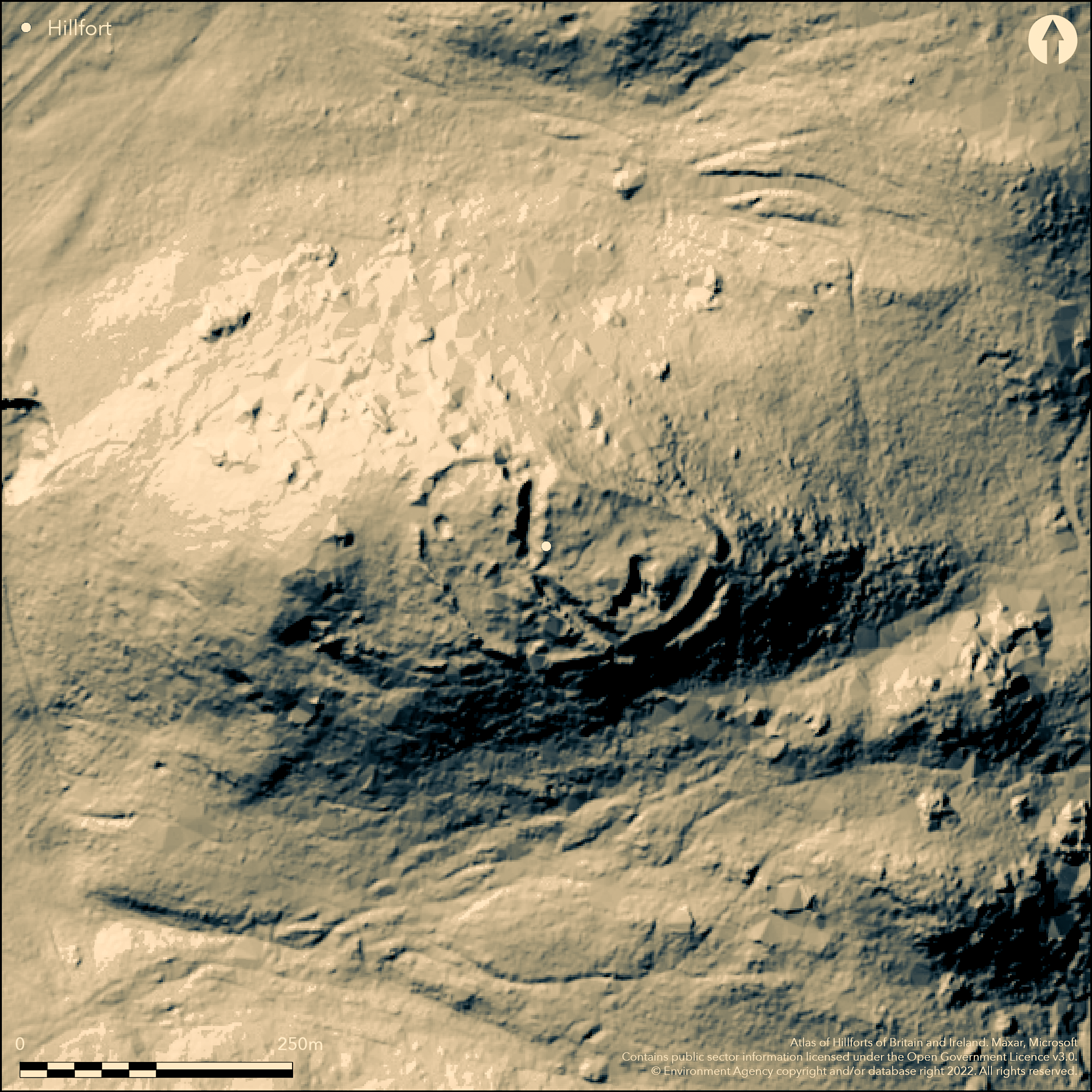
Lying within woodland at 213m OD in a dominant position on Castle Hill, Callaly, a univallate hillfort and medieval tower. The main earthwork is sub-rectangular measuring 80m E-W by 50m N-S enclosing 0.4ha. It is defended in the N by a steeply scarped bank and elsewhere by a bank, rock-cut ditch and counterscarp bank. The internal bank is 3m wide and 0.8m high showing walling in places, the ditch 12-17m wide and 3-7m deep, and the counterscarp banks 4m wide and 2-3 high. It was proposed during a scheduling amendment in 1994 that the strong ditch might be a later medieval feature associated with the castle. Opposing entrances in the E and W allow access to the interior via a causeway across the ditch. Within the interior two rectangular buildings 15m by 13m and 15m by 8m are possibly the remains of old Callaly Castle. Two contiguous annexes lie to the W of the main enclosure. The innermost annex has a bank 7m wide with a central gap that provides access between the annexes and the hillfort. The outer annex has a 4m wide bank. The combined measurement of the hillfort and annexes is 225m E-W by 115m N-S (2.6ha). It is recorded on 1856-65 OS mapping and is unexcavated and undated.
Citizen Science: ✗
Reliability of Data: Confirmed
Reliability of Interpretation: Confirmed
X: -212220 Y: 7436252 (EPSG: 3857)
Longitude: -1.906405941921756 Latitude: 55.38144921196044 (EPSG:4326)
Country: England; None
Current County or Unitary Authority: Northumberland
Historic County: Northumberland
Current Parish/Community/Council/Townland: Whittingham and Callaly; Whittingham
Well preserved
| Extant | ✓ |
| Cropmark | ✗ |
| Likely Destroyed | ✗ |
None
| Woodland | ✓ |
| Commercial Forestry Plantation | ✗ |
| Parkland | ✗ |
| Pasture (Grazing) | ✗ |
| Arable | ✗ |
| Scrub/Bracken | ✗ |
| Bare Outcrop | ✗ |
| Heather/Moorland | ✗ |
| Heath | ✗ |
| Built-up | ✗ |
| Coastal Grassland | ✗ |
| Other | ✗ |
A univallate contour fort lying at 213m OD on the summit of Castle HIll, Callaly
| Contour Fort | ✓ |
| Partial Contour Fort | ✗ |
| Promontory Fort | ✗ |
| Hillslope Fort | ✗ |
| Level Terrain Fort | ✗ |
| Marsh Fort | ✗ |
| Multiple Enclosure Fort | ✗ |
| Hilltop | ✓ |
| Coastal Promontory | ✗ |
| Inland Promontory | ✗ |
| Valley Bottom | ✗ |
| Knoll/Hillock/Outcrop | ✗ |
| Ridge | ✗ |
| Cliff/Plateau-edge/Scarp | ✗ |
| Hillslope | ✗ |
| Lowland | ✗ |
| Spur | ✗ |
Dominant Topographic Feature: Summit of steeply wooded Castle Hill
| North | ✗ |
| Northeast | ✗ |
| East | ✗ |
| Southeast | ✗ |
| South | ✗ |
| Southwest | ✗ |
| West | ✗ |
| Northwest | ✗ |
| Level | ✓ |
Altitude: 213.0m
Parish boundary between Callaly and Whittingham lies approximately 170m to the E
Boundary Type: Parish/Townland
The site is undated presumed Iron Age with the earthworks possibly adapted for the castle in the medieval period
Reliability: D - None
| Pre 1200BC | ✗ |
| 1200BC - 800BC | ✗ |
| 800BC - 400BC | ✗ |
| 400BC - AD50 | ✗ |
| AD50 - AD400 | ✗ |
| AD400 - AD 800 | ✗ |
| Post AD800 | ✗ |
| Unknown | ✓ |
| Pre Hillfort: | None |
| Post Hillfort: | Possible remains of Callaly Castle; medieval tower |
No known excavations have taken place. The site is recorded on 1856-65 OS mapping and underwent field investigations in 1957, 1972 and 1976. It was first scheduled in 1947
| Other (1947): | Scheduled |
| Other (1957): | Field investigation |
| Other (1972): | Field investigation |
| Other (1976): | Field investigations |
| 1st Identified Map Depiction (None): | OS mapping |
Two rectangular buildings 15m by 13m and 15m by 8m are possibly the medieval remains of old Callaly Castle.
None
| None | ✓ |
| Spring | ✗ |
| Stream | ✗ |
| Pool | ✗ |
| Flush | ✗ |
| Well | ✗ |
| Other | ✗ |
Rectangular buildings 15m by 13m and 15m by 8m are possibly the remains of old Callaly Castle
| No Known Features | ✗ |
| Round Stone Structures | ✗ |
| Rectangular Stone Structures | ✓ |
| Curvilinear Platforms | ✗ |
| Other Roundhouse Evidence | ✗ |
| Pits | ✗ |
| Quarry Hollows | ✗ |
| Other | ✗ |
None
| No Known Excavation | ✓ |
| Pits | ✗ |
| Postholes | ✗ |
| Roundhouses | ✗ |
| Rectangular Structures | ✗ |
| Roads/Tracks | ✗ |
| Quarry Hollows | ✗ |
| Other | ✗ |
| Nothing Found | ✗ |
None
| No Known Geophysics | ✓ |
| Pits | ✗ |
| Roundhouses | ✗ |
| Rectangular Structures | ✗ |
| Roads/Tracks | ✗ |
| Quarry Hollows | ✗ |
| Other | ✗ |
| Nothing Found | ✗ |
None
| No Known Finds | ✓ |
| Pottery | ✗ |
| Metal | ✗ |
| Metalworking | ✗ |
| Human Bones | ✗ |
| Animal Bones | ✗ |
| Lithics | ✗ |
| Environmental | ✗ |
| Other | ✗ |
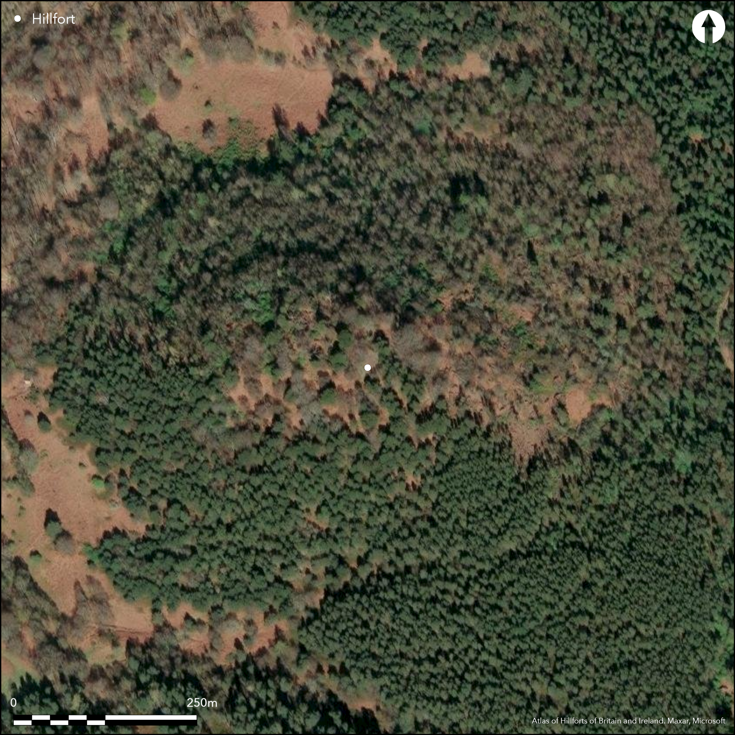
Wooded
| APs Not Checked | ✓ |
| None | ✗ |
| Roundhouses | ✗ |
| Rectangular Structures | ✗ |
| Pits | ✗ |
| Postholes | ✗ |
| Roads/Tracks | ✗ |
| Other | ✗ |
Opposing entrances in the E and W allow access to the interior via a causeway across the ditch
| 3: | None |
| 2: | None |
Guard Chambers: ✗
Chevaux de Frise: ✗
| 1. Simple Gap (East): | None |
| 2. Simple Gap (West): | None |
| 3. Simple Gap (West): | Between the inner and outer annex. Aligns with the main enclosure entrance in the W |
Univallate, measuring 80m E-W by 50m N-S. Defended in the N by a steeply scarped bank and elsewhere by an internal bank 3m wide and 0.8m high showing walling in places, a ditch 12-17m wide and 3-7m deep and a counterscarp bank 4m wide and 2-3 high.
| Area 1: | 0.4ha. |
| Total: | 0.4ha. |
Total Footprint Area: 2.6ha.
None
| ✓ | The ditch is possibly a later medieval feature associated with the castle. Several Bronze Age stone coffins were discovered during quarrying on the N side of Castle Hill In the late 19th century |
| ✓ | Naturally defended in the N by a steep scarp |
| NE Quadrant: | 1 |
| SE Quadrant: | 1 |
| SW Quadrant: | 1 |
| NW Quadrant: | 1 |
| Total: | 1 |
| Partial Univallate | ✗ |
| Univallate | ✓ |
| Partial Bivallate | ✗ |
| Bivallate | ✗ |
| Partial Multivallate | ✗ |
| Multivallate | ✗ |
| Unknown | ✗ |
| Partial Univallate | ✗ |
| Univallate | ✗ |
| Partial Bivallate | ✗ |
| Bivallate | ✗ |
| Partial Multivallate | ✗ |
| Multivallate | ✗ |
None
| None | ✗ |
| Earthen Bank | ✓ |
| Stone Wall | ✓ |
| Rubble | ✗ |
| Wall-walk | ✗ |
| Evidence of Timber | ✗ |
| Vitrification | ✗ |
| Other Burning | ✗ |
| Palisade | ✗ |
| Counter Scarp Bank | ✓ |
| Berm | ✗ |
| Unfinished | ✗ |
| Other | ✗ |
None
| None | ✗ |
| Earthen Bank | ✗ |
| Stone Wall | ✗ |
| Murus Duplex | ✗ |
| Timber-framed | ✗ |
| Timber-laced | ✗ |
| Vitrification | ✗ |
| Other Burning | ✗ |
| Palisade | ✗ |
| Counter Scarp Bank | ✗ |
| Berm | ✗ |
| Unfinished | ✗ |
| No Known Excavation | ✓ |
| Other | ✗ |
| ✗ | None |
| ✓ | None |
Number of Ditches: 1
| ✓ | Two contiguous annexes lie to the W of the main enclosure. The innermost annex has a bank 7m wide with a central gap that provides access between the annexes and the hillfort. The outer annex has a 4m wide bank. |
Jobey, G. 1965. Hill Forts and Settlements in Northumberland, Archaeologia Aeliana, 4th series, 43, 43-4, 62 no.80
Atlas of Hillforts:
Wikidata:
This work is licensed under CC BY-SA 4.0![]()
![]()
![]() and should be cited as:
and should be cited as:
Lock, Gary and Ralston, Ian. 2024. Atlas of Hillforts of Britain and Ireland. Available at: https://hillforts.arch.ox.ac.uk
Document Version 1.1