LiDAR 1m DTM Hillshade
Satellite Imagery
LiDAR 1m DTM Hillshade
Satellite Imagery
Scroll left/right to view further images.
HER: Northumberland 10919 (None)
NMR: None (None)
SM: None
NGR: NZ 1040 6480
X: 410400 Y: 564800 (OSGB36)
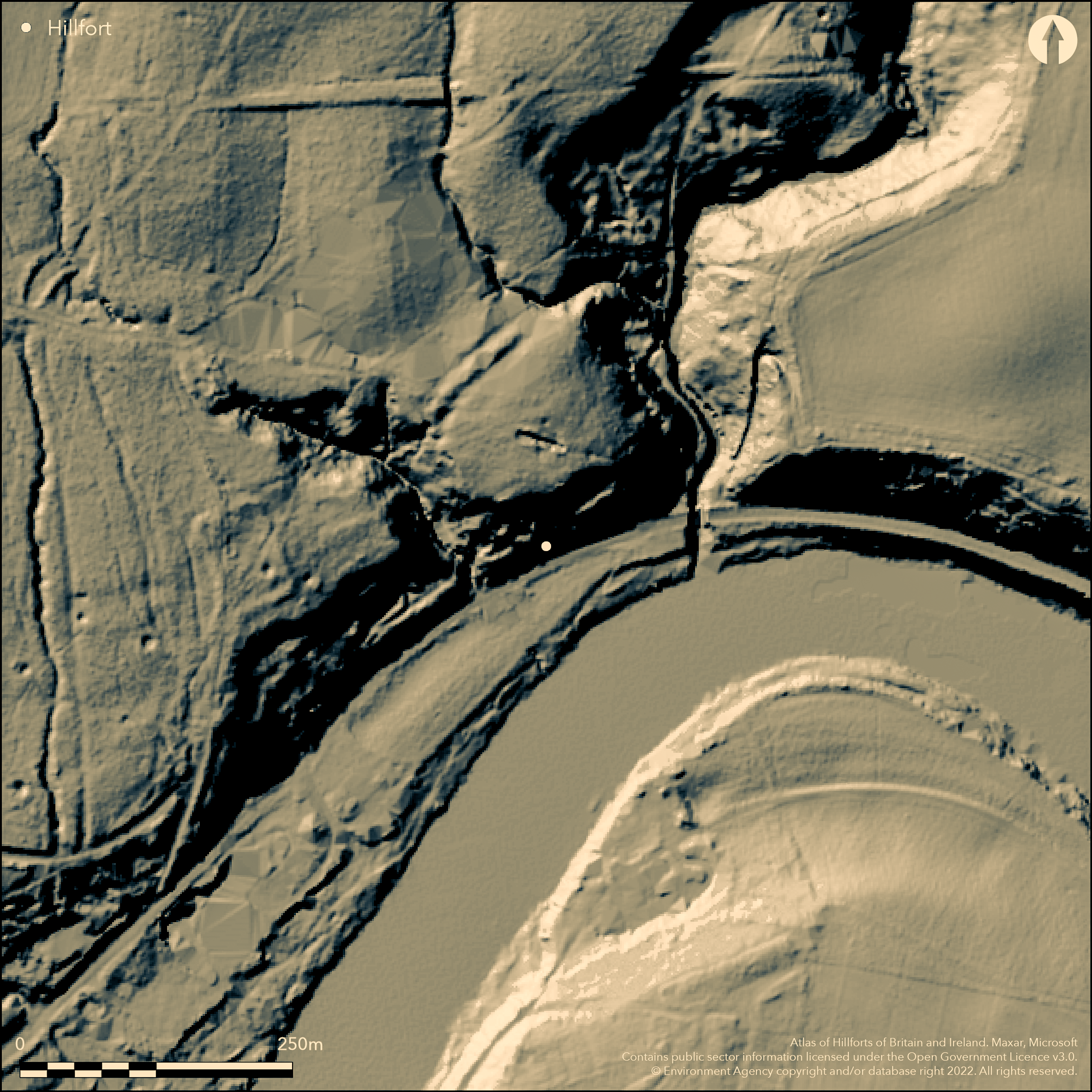
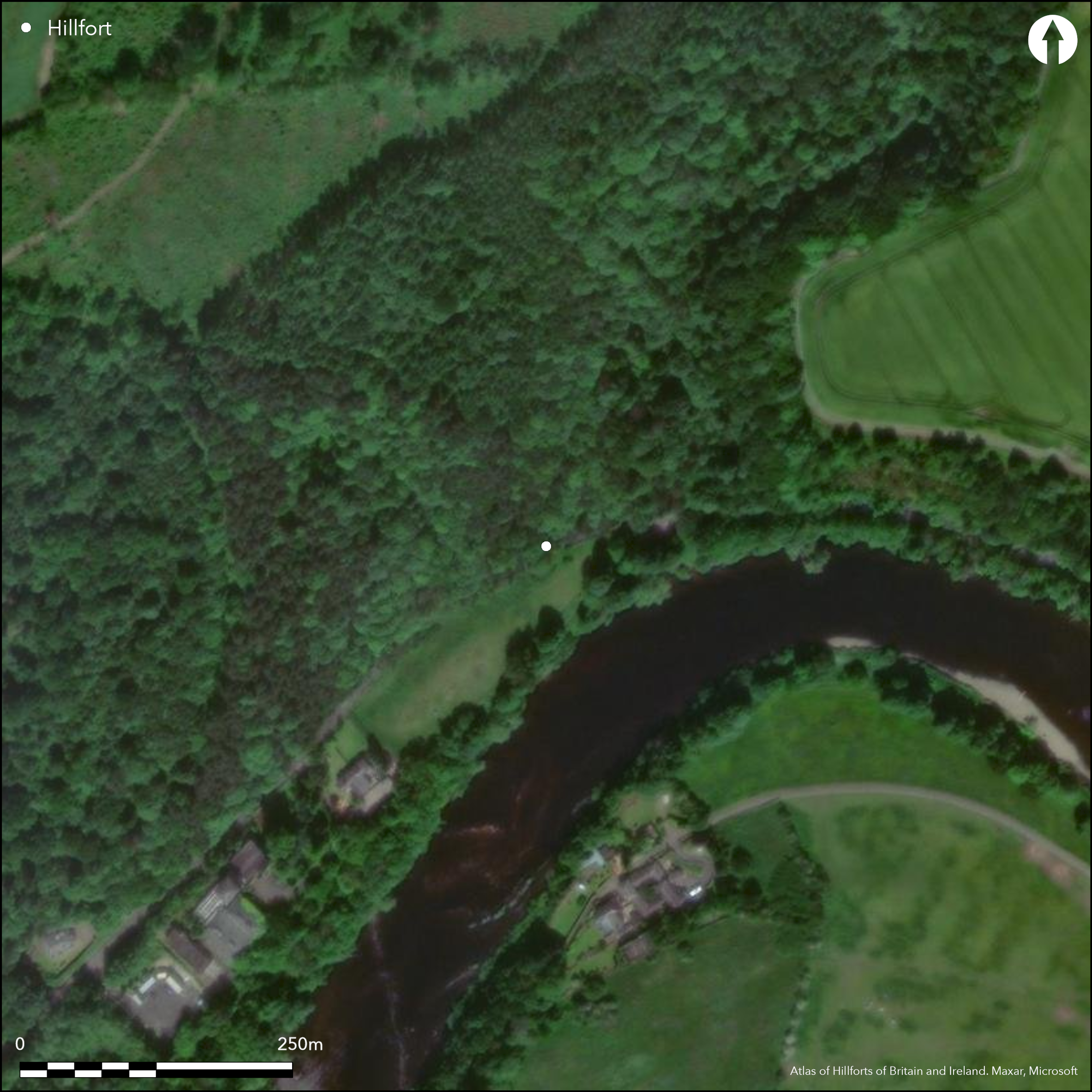
Lying at 30m OD on a steep south-easterly facing spur in Horsley Wood, a promontory fort discovered during the survey of ancient woodland in 1989. The area is enclosed by a bank in the NW measuring 13m wide and 1.25m high which cuts off the neck of the promontory, enclosing an area 90m by 93m (0.84ha) with steep natural slopes on all other sides. A ditch lies externally measuring 9m wide with a slight counterscarp bank. A 5m wide quarry ditch lies internally. The promontory overlooks the Howdene Burn close to its confluence with the River Tyne and it would have commanded views of the Tyne Valley. A modern track which provides a 6-7m wide break in the ramparts in the S is possibly the location of the original entrance. The site is not recorded on historic OS mapping. Minimal investigations, undated.
Citizen Science: ✗
Reliability of Data: Confirmed
Reliability of Interpretation: Confirmed
X: -204721 Y: 7357544 (EPSG: 3857)
Longitude: -1.8390395629834435 Latitude: 54.97772408106554 (EPSG:4326)
Country: England; None
Current County or Unitary Authority: Northumberland
Historic County: Northumberland
Current Parish/Community/Council/Townland: Horsley; Prudhoe; Wylam
None
| Extant | ✓ |
| Cropmark | ✗ |
| Likely Destroyed | ✗ |
Woodland, in an area of old coal pits
| Woodland | ✓ |
| Commercial Forestry Plantation | ✗ |
| Parkland | ✗ |
| Pasture (Grazing) | ✗ |
| Arable | ✗ |
| Scrub/Bracken | ✗ |
| Bare Outcrop | ✗ |
| Heather/Moorland | ✗ |
| Heath | ✗ |
| Built-up | ✗ |
| Coastal Grassland | ✗ |
| Other | ✗ |
An inland promontory fort lying at 30m OD on a south-easterly facing spur
| Contour Fort | ✗ |
| Partial Contour Fort | ✗ |
| Promontory Fort | ✓ |
| Hillslope Fort | ✗ |
| Level Terrain Fort | ✗ |
| Marsh Fort | ✗ |
| Multiple Enclosure Fort | ✗ |
| Hilltop | ✗ |
| Coastal Promontory | ✗ |
| Inland Promontory | ✓ |
| Valley Bottom | ✗ |
| Knoll/Hillock/Outcrop | ✗ |
| Ridge | ✗ |
| Cliff/Plateau-edge/Scarp | ✗ |
| Hillslope | ✗ |
| Lowland | ✗ |
| Spur | ✗ |
Dominant Topographic Feature: Spur
| North | ✗ |
| Northeast | ✗ |
| East | ✗ |
| Southeast | ✓ |
| South | ✗ |
| Southwest | ✗ |
| West | ✗ |
| Northwest | ✗ |
| Level | ✗ |
Altitude: 30.0m
The River Tyne 70m to the SE forms the parish boundary between Horsley and Prudhoe. Parish boundary between Horsley and Wylam lies 70m to the E
Boundary Type: Parish/Townland
Undated, presumed Iron Age
Reliability: D - None
| Pre 1200BC | ✗ |
| 1200BC - 800BC | ✗ |
| 800BC - 400BC | ✗ |
| 400BC - AD50 | ✗ |
| AD50 - AD400 | ✗ |
| AD400 - AD 800 | ✗ |
| Post AD800 | ✗ |
| Unknown | ✓ |
| Pre Hillfort: | None |
| Post Hillfort: | None |
| Morphology/Earthwork/Typology: | None |
Discovered during a survey of ancient woodland in 1989 (Tolan-Smith, 1987)
| 1st Identified Written Reference (1989): | None |
No internal features are recorded
None
| None | ✓ |
| Spring | ✗ |
| Stream | ✗ |
| Pool | ✗ |
| Flush | ✗ |
| Well | ✗ |
| Other | ✗ |
None
| No Known Features | ✓ |
| Round Stone Structures | ✗ |
| Rectangular Stone Structures | ✗ |
| Curvilinear Platforms | ✗ |
| Other Roundhouse Evidence | ✗ |
| Pits | ✗ |
| Quarry Hollows | ✗ |
| Other | ✗ |
None
| No Known Excavation | ✓ |
| Pits | ✗ |
| Postholes | ✗ |
| Roundhouses | ✗ |
| Rectangular Structures | ✗ |
| Roads/Tracks | ✗ |
| Quarry Hollows | ✗ |
| Other | ✗ |
| Nothing Found | ✗ |
None
| No Known Geophysics | ✓ |
| Pits | ✗ |
| Roundhouses | ✗ |
| Rectangular Structures | ✗ |
| Roads/Tracks | ✗ |
| Quarry Hollows | ✗ |
| Other | ✗ |
| Nothing Found | ✗ |
None
| No Known Finds | ✓ |
| Pottery | ✗ |
| Metal | ✗ |
| Metalworking | ✗ |
| Human Bones | ✗ |
| Animal Bones | ✗ |
| Lithics | ✗ |
| Environmental | ✗ |
| Other | ✗ |
In woodland
| APs Not Checked | ✓ |
| None | ✗ |
| Roundhouses | ✗ |
| Rectangular Structures | ✗ |
| Pits | ✗ |
| Postholes | ✗ |
| Roads/Tracks | ✗ |
| Other | ✗ |
A break in the SE occupying a modern track possibly an original entrance
| 1: | None |
| 2: | None |
Guard Chambers: ✗
Chevaux de Frise: ✗
| 1. Simple Gap (South east): | Uncertain if original |
Enclosed by a bank in the NW measuring 13m wide and 1.25m high which cuts off the neck of the promontory, enclosing an area 90m by 93m which is naturally defended on all other sides. External ditch measures 9m wide with a slight counterscarp.
| Area 1: | 0.84ha. |
| Total: | 0.84ha. |
Total Footprint Area: Noneha.
None
| ✗ | Enclosed area estimated |
| ✗ | None |
| NE Quadrant: | None |
| SE Quadrant: | None |
| SW Quadrant: | None |
| NW Quadrant: | 1 |
| Total: | 1 |
| Partial Univallate | ✓ |
| Univallate | ✗ |
| Partial Bivallate | ✗ |
| Bivallate | ✗ |
| Partial Multivallate | ✗ |
| Multivallate | ✗ |
| Unknown | ✗ |
| Partial Univallate | ✗ |
| Univallate | ✗ |
| Partial Bivallate | ✗ |
| Bivallate | ✗ |
| Partial Multivallate | ✗ |
| Multivallate | ✗ |
None
| None | ✗ |
| Earthen Bank | ✓ |
| Stone Wall | ✗ |
| Rubble | ✗ |
| Wall-walk | ✗ |
| Evidence of Timber | ✗ |
| Vitrification | ✗ |
| Other Burning | ✗ |
| Palisade | ✗ |
| Counter Scarp Bank | ✓ |
| Berm | ✗ |
| Unfinished | ✗ |
| Other | ✗ |
None
| None | ✗ |
| Earthen Bank | ✗ |
| Stone Wall | ✗ |
| Murus Duplex | ✗ |
| Timber-framed | ✗ |
| Timber-laced | ✗ |
| Vitrification | ✗ |
| Other Burning | ✗ |
| Palisade | ✗ |
| Counter Scarp Bank | ✗ |
| Berm | ✗ |
| Unfinished | ✗ |
| No Known Excavation | ✓ |
| Other | ✗ |
| ✗ | None |
| ✓ | None |
Number of Ditches: 1
| ✗ | None |
Tolan-Smith, M. 1997. A Newly Discovered Promontory Fort in the Tyne Valley. Archaeologia Aeliana (5th Series) 25, 145-7
Atlas of Hillforts:
Wikidata:
This work is licensed under CC BY-SA 4.0![]()
![]()
![]() and should be cited as:
and should be cited as:
Lock, Gary and Ralston, Ian. 2024. Atlas of Hillforts of Britain and Ireland. Available at: https://hillforts.arch.ox.ac.uk
Document Version 1.1