LiDAR 1m DTM Hillshade
Satellite Imagery
LiDAR 1m DTM Hillshade
Satellite Imagery
Scroll left/right to view further images.
HER: Northumberland 634 (None)
NMR: NT 82 NE 70 (891)
SM: 1014483
NGR: NT 88610 28050
X: 388610 Y: 628050 (OSGB36)
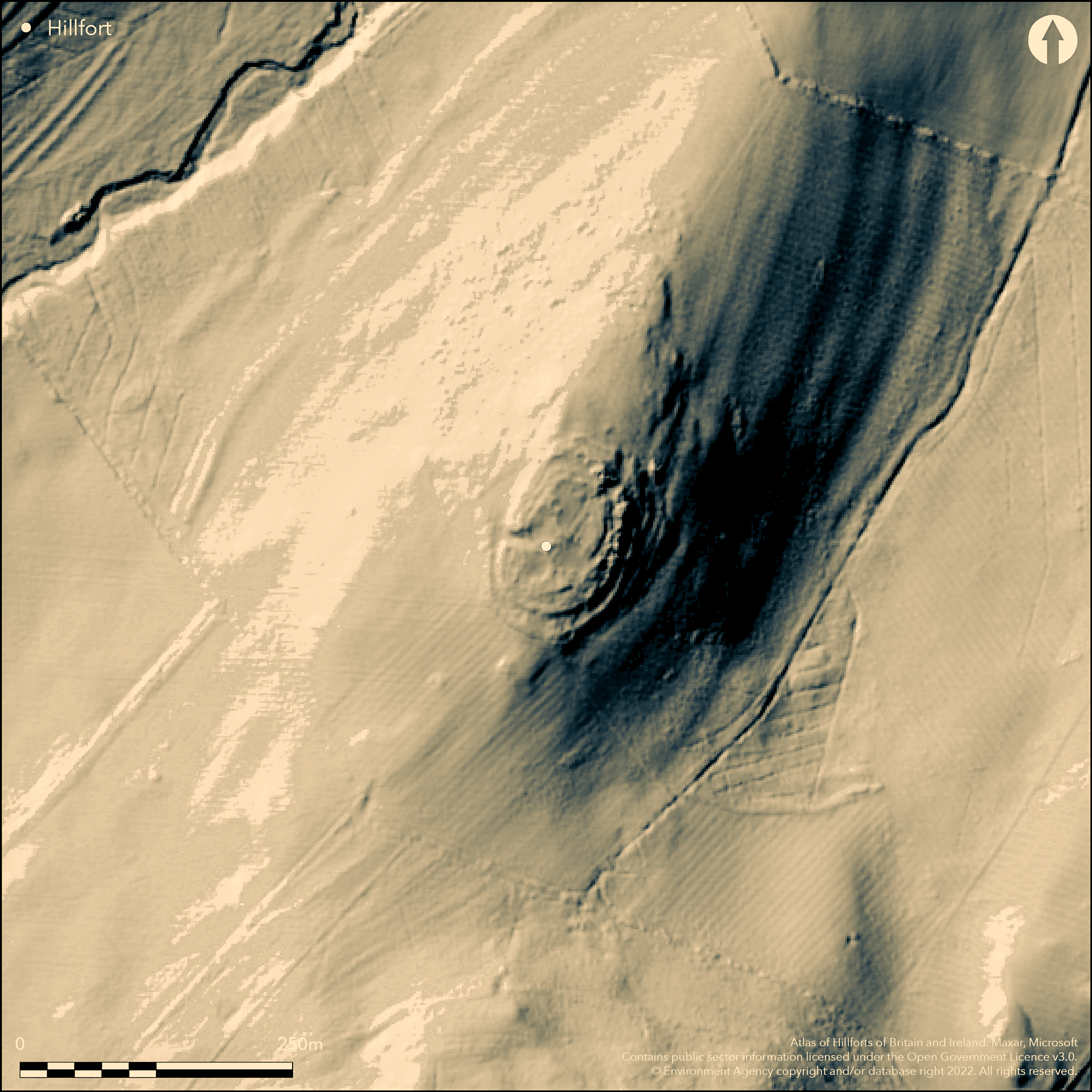
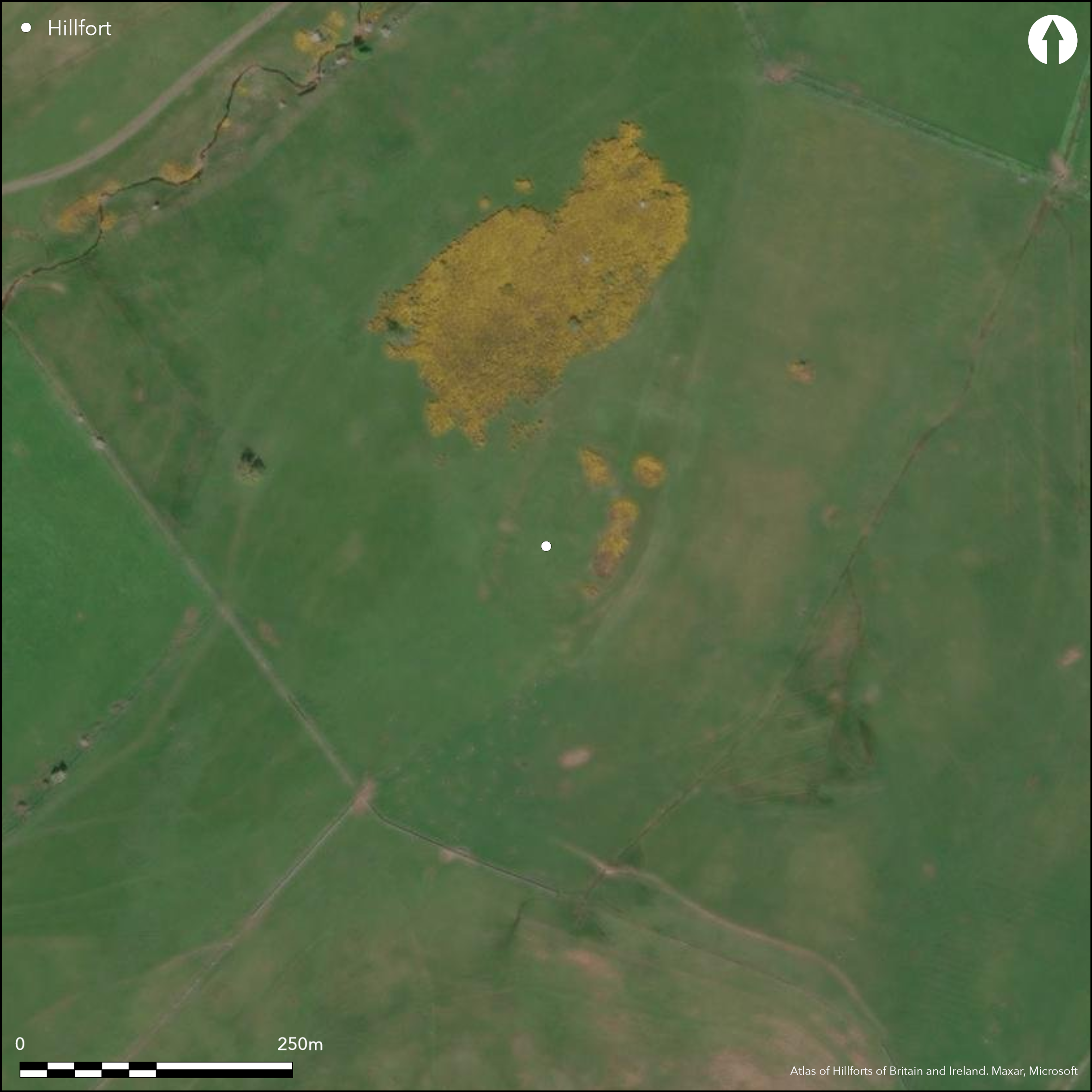
A small partially multivallate enclosure scheduled as a defended settlement lying 880m to the SE of Hethpool and 570m to the N of Great Hetha (Atlas No. 0470). It lies on the summit of a N-facing spur at 213m OD with the land dropping away steeply except in the S where there is a more gentle slope before the ground rises steeply towards Great Hetha. Oval in plan, the internal dimensions measure approximately 73m NE-SW by 55m transversely, enclosing 0.24ha. It comprises two earth and stone ramparts with revetting boulders, with a berm between. A further rampart lies in the N. Stone has been robbed from the two innermost ramparts and the outer rampart is reduced to an outward facing scarp up to 1.6m high (Topping 1999). The middle rampart measures 2.1-3.0m high and up to 9.5m wide. The NE entrance is 3m wide, marked by a large stone; the entrance in the NW 4m wide and overlapped by the outer rampart which protects it. The innermost rampart is the most disturbed, defined by a shallow platform 4.9m wide and up to 0.4m deep and only the W terminal of the NE entrance surviving. The foundations of a sub-rectangular structure, possibly a guard chamber, is set into the inner rampart to the S of the western entrance. Internally a bank of earth and stones approximately 3.7m wide and 0.4m high curves SE to NW dividing the interior. To the N of this are three 2m wide square scoops set into the northern edge from which linear earthworks extend northwards. To the S of the bank two rectangular buildings 7m by 5m and 2m by 2.5 and a wide shallow scoop 14m N-S by 12m E-W with a possible stone setting are probably the remains of medieval occupation. At least three stone-founded hut circles 2m-8m in diameter have been recorded within the interior. The site has suffered from stone robbing and is badly mutilated and the interior has been considerably disturbed, probably through quarrying. Undated but presumed Iron Age. Recorded on 1856-65 OS mapping. Scheduled.
Citizen Science: ✗
Reliability of Data: Unconfirmed
Reliability of Interpretation: Confirmed
X: -242906 Y: 7468574 (EPSG: 3857)
Longitude: -2.1820646857888617 Latitude: 55.54605682097866 (EPSG:4326)
Country: England
Current County or Unitary Authority: Northumberland
Historic County: Northumberland
Current Parish/Community/Council/Townland: Kirknewton
Disturbed by stone robbing and later settlement. Land under Entry Level plus Higher Level Stewardship
| Extant | ✓ |
| Cropmark | ✗ |
| Likely Destroyed | ✗ |
None
| Woodland | ✗ |
| Commercial Forestry Plantation | ✗ |
| Parkland | ✗ |
| Pasture (Grazing) | ✓ |
| Arable | ✗ |
| Scrub/Bracken | ✓ |
| Bare Outcrop | ✗ |
| Heather/Moorland | ✗ |
| Heath | ✗ |
| Built-up | ✗ |
| Coastal Grassland | ✗ |
| Other | ✗ |
A contour fort lying on the level summit of a spur at 213m OD
| Contour Fort | ✓ |
| Partial Contour Fort | ✗ |
| Promontory Fort | ✗ |
| Hillslope Fort | ✗ |
| Level Terrain Fort | ✗ |
| Marsh Fort | ✗ |
| Multiple Enclosure Fort | ✗ |
| Hilltop | ✓ |
| Coastal Promontory | ✗ |
| Inland Promontory | ✗ |
| Valley Bottom | ✗ |
| Knoll/Hillock/Outcrop | ✗ |
| Ridge | ✗ |
| Cliff/Plateau-edge/Scarp | ✗ |
| Hillslope | ✗ |
| Lowland | ✗ |
| Spur | ✓ |
Dominant Topographic Feature: Summit of a spur
| North | ✗ |
| Northeast | ✗ |
| East | ✗ |
| Southeast | ✗ |
| South | ✗ |
| Southwest | ✗ |
| West | ✗ |
| Northwest | ✗ |
| Level | ✓ |
Altitude: 213.0m
N/A
Undated, presumed Iron Age
Reliability: D - None
| Pre 1200BC | ✗ |
| 1200BC - 800BC | ✗ |
| 800BC - 400BC | ✗ |
| 400BC - AD50 | ✗ |
| AD50 - AD400 | ✗ |
| AD400 - AD 800 | ✗ |
| Post AD800 | ✗ |
| Unknown | ✓ |
| Pre Hillfort: | None |
| Post Hillfort: | Probable medieval settlement |
| Morphology/Earthwork/Typology: | None |
Recorded on 1856-65 OS mapping. Reference in MacLauchlan (1919-20). OS field investigations in 1955 and 1967. Included in a Project to record the archaeological sites and landscapes of the College Valley Estates (Topping 1999). Scheduled
| Other (1935): | Scheduled |
| Other (1955): | Field investigation |
| Other (1967): | Field investigation |
| Other (2002): | Visited by Hillfort Study Group |
| 1st Identified Map Depiction (None): | None |
| 1st Identified Written Reference (None): | None |
| Earthwork Survey (None): | None |
Internal bank of earth and stones approximately 3.7m wide and 0.4m high divides the interior. To the N of this are three 2m wide square scoops set into the northern edge from which linear earthworks extend northwards. To the S of the bank two rectangular buildings 7m by 5m and 2m by 2.5 and a wide shallow scoop 14m N-S by 12m transversely, with a possible stone setting, are probably the remains of medieval occupation. At least three stone-founded hut circles 2m-8m in diameter have been recorded within the interior.
Elsdon Burn lies to the NW and the College Burn to the SE
| None | ✓ |
| Spring | ✗ |
| Stream | ✗ |
| Pool | ✗ |
| Flush | ✗ |
| Well | ✗ |
| Other | ✗ |
None
| No Known Features | ✗ |
| Round Stone Structures | ✓ |
| Rectangular Stone Structures | ✓ |
| Curvilinear Platforms | ✗ |
| Other Roundhouse Evidence | ✗ |
| Pits | ✗ |
| Quarry Hollows | ✓ |
| Other | ✗ |
None
| No Known Excavation | ✓ |
| Pits | ✗ |
| Postholes | ✗ |
| Roundhouses | ✗ |
| Rectangular Structures | ✗ |
| Roads/Tracks | ✗ |
| Quarry Hollows | ✗ |
| Other | ✗ |
| Nothing Found | ✗ |
None
| No Known Geophysics | ✓ |
| Pits | ✗ |
| Roundhouses | ✗ |
| Rectangular Structures | ✗ |
| Roads/Tracks | ✗ |
| Quarry Hollows | ✗ |
| Other | ✗ |
| Nothing Found | ✗ |
None
| No Known Finds | ✓ |
| Pottery | ✗ |
| Metal | ✗ |
| Metalworking | ✗ |
| Human Bones | ✗ |
| Animal Bones | ✗ |
| Lithics | ✗ |
| Environmental | ✗ |
| Other | ✗ |
None
| APs Not Checked | ✓ |
| None | ✗ |
| Roundhouses | ✗ |
| Rectangular Structures | ✗ |
| Pits | ✗ |
| Postholes | ✗ |
| Roads/Tracks | ✗ |
| Other | ✗ |
The NE entrance is 3m wide, marked by a large stone; the 4m wide entrance in the NW is overlapped by the outer rampart which protects it. The innermost rampart is the most disturbed and only the W terminal of the NE entrance survives. Foundations of a sub-rectangular structure set into the inner rampart to the S of the NW entrance is possibly a guard chamber.
| 4: | None |
| 2: | None |
Guard Chambers: ✓
Chevaux de Frise: ✗
| 1. Simple Gap (North east): | Inner rampart |
| 1. Simple Gap (North east): | Outer rampart |
| 2. Recesses/Guard Chambers (North west): | Inner rampart |
| 2. Over-lapping (North west): | Outer rampart |
A small multivallate enclosure, oval in plan, the internal dimensions measuring approximately 73m NE-SW by 55m transversely, enclosing 0.24ha. It comprises two earth and stone ramparts with revetting boulders and a berm between. A further rampart lies in the N. Stone has been robbed from the two innermost ramparts and the outer rampart is reduced to an outward facing scarp up to 1.6m high (Topping 1999). The innermost rampart is the most disturbed, defined by a shallow platform 4.9m wide and up to 0.4m deep. The middle rampart measures 2.1-3.0m high and up to 9.5m wide.
| Area 1: | 0.24ha. |
| Total: | 0.24ha. |
Total Footprint Area: Noneha.
None
| ✗ | None |
| ✓ | None |
| NE Quadrant: | 3 |
| SE Quadrant: | 2 |
| SW Quadrant: | 2 |
| NW Quadrant: | 2 |
| Total: | 3 |
| Partial Univallate | ✗ |
| Univallate | ✗ |
| Partial Bivallate | ✓ |
| Bivallate | ✗ |
| Partial Multivallate | ✓ |
| Multivallate | ✗ |
| Unknown | ✗ |
| Partial Univallate | ✗ |
| Univallate | ✗ |
| Partial Bivallate | ✗ |
| Bivallate | ✗ |
| Partial Multivallate | ✗ |
| Multivallate | ✗ |
None
| None | ✗ |
| Earthen Bank | ✓ |
| Stone Wall | ✓ |
| Rubble | ✓ |
| Wall-walk | ✗ |
| Evidence of Timber | ✗ |
| Vitrification | ✗ |
| Other Burning | ✗ |
| Palisade | ✗ |
| Counter Scarp Bank | ✗ |
| Berm | ✓ |
| Unfinished | ✗ |
| Other | ✗ |
None
| None | ✗ |
| Earthen Bank | ✗ |
| Stone Wall | ✗ |
| Murus Duplex | ✗ |
| Timber-framed | ✗ |
| Timber-laced | ✗ |
| Vitrification | ✗ |
| Other Burning | ✗ |
| Palisade | ✗ |
| Counter Scarp Bank | ✗ |
| Berm | ✗ |
| Unfinished | ✗ |
| No Known Excavation | ✓ |
| Other | ✗ |
| ✗ | None |
| ✗ | None |
Number of Ditches: None
| ✓ | Possibly - attached to outer rampart in N although this could be the third rampart |
Jobey, G.1965. Hillforts and Settlements in Northumberland. Archaeol Aeliana (4th Series) 43
MacLauchlan, H. 1919-22. Notes on camps in the parishes of Branxton, Carham, Ford, Kirknewton and Wooler in Northumberland. Hist Berwickshire Natur Club, 468
Topping, P. 1999. A Survey of Little Hetha Hillfort, Northumberland. Northern Archaeology. 1999, 123-7
Atlas of Hillforts:
Wikidata:
This work is licensed under CC BY-SA 4.0![]()
![]()
![]() and should be cited as:
and should be cited as:
Lock, Gary and Ralston, Ian. 2024. Atlas of Hillforts of Britain and Ireland. Available at: https://hillforts.arch.ox.ac.uk
Document Version 1.1