LiDAR 1m DTM Hillshade
Satellite Imagery
LiDAR 1m DTM Hillshade
Satellite Imagery
Scroll left/right to view further images.
HER: Northumberland 8572 (None)
NMR: NY 96 NW 31 (18386)
SM: 1008425
NGR: NY 9201 6903
X: 392010 Y: 569030 (OSGB36)
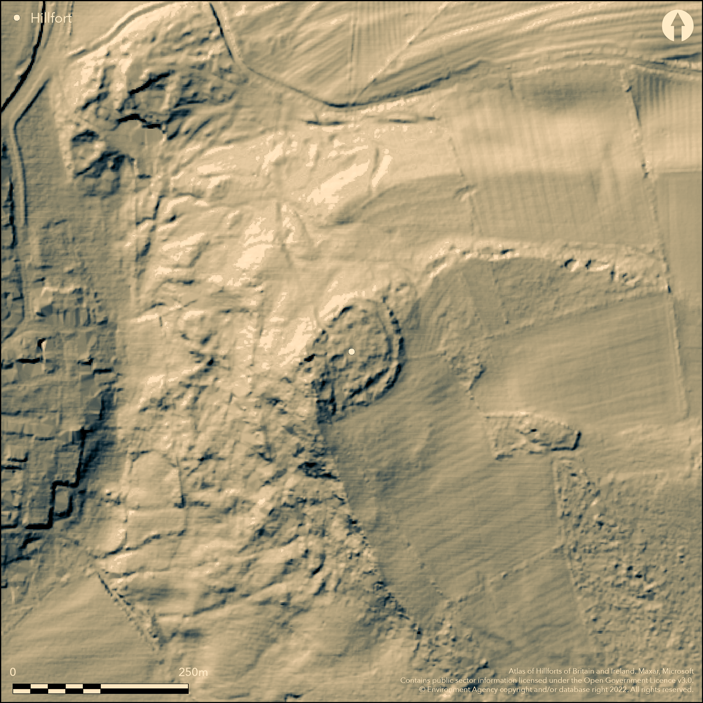
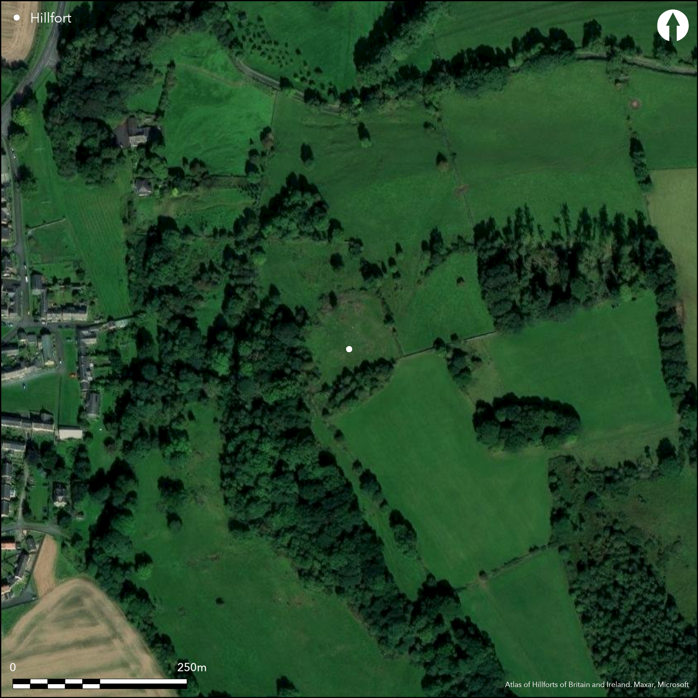
Lying 180m to the E of the outskirts of Wall, the remains of an Iron Age hillfort or defended enclosure. The enclosure is oval in plan measuring 70m NE-SW by 50m transversely, bivallate in places and enclosing 0.24ha. It lies on the edge of Wall Crags at approximately 146m OD with the escarpment to the N and W. Two stone walls or ramparts defend the NE, E and S sides separated by a 6m wide berm. A single rampart lies in the W and NW where the ground is steeper. The walls are 6m wide and survive up to 1m high but have been levelled in places. No evidence of ditches. A single 4m wide entrance and holloway lie in the NW. Directly inside the entrance to the N is a 7m square enclosure, possibly contemporary with and related to, the entrance. The interior has been disturbed by quarrying but at least six circular houses, between 6-13m in diameter, possibly representing secondary occupation, have been identified. A well-defined roundhouse 13m in diameter lies near the centre of the enclosure. It is first shown on OS mapping in the 1960's. Archaeological recording and the reinstatement of part of the rampart disturbed by a farm track was by carried out in 2005 (Dougherty 2005). On 1:2500 OS mapping (1961). The site was scheduled in 1994 as a defended settlement. Undated.
Citizen Science: ✗
Reliability of Data: Confirmed
Reliability of Interpretation: Confirmed
X: -236719 Y: 7364929 (EPSG: 3857)
Longitude: -2.1264826762421984 Latitude: 55.015777091058894 (EPSG:4326)
Country: England
Current County or Unitary Authority: Northumberland
Historic County: Northumberland
Current Parish/Community/Council/Townland: Wall
Walls have been levelled in places. Quarrying within the interior. Farm walls run N-S and E-W across the enclosure
| Extant | ✓ |
| Cropmark | ✗ |
| Likely Destroyed | ✗ |
Relatively rough ground
| Woodland | ✗ |
| Commercial Forestry Plantation | ✗ |
| Parkland | ✗ |
| Pasture (Grazing) | ✓ |
| Arable | ✗ |
| Scrub/Bracken | ✓ |
| Bare Outcrop | ✗ |
| Heather/Moorland | ✗ |
| Heath | ✗ |
| Built-up | ✗ |
| Coastal Grassland | ✗ |
| Other | ✗ |
Lying at approximately 146m OD on a westerly-facing slope on the escarpment at Wall Crags
| Contour Fort | ✗ |
| Partial Contour Fort | ✗ |
| Promontory Fort | ✗ |
| Hillslope Fort | ✓ |
| Level Terrain Fort | ✗ |
| Marsh Fort | ✗ |
| Multiple Enclosure Fort | ✗ |
| Hilltop | ✗ |
| Coastal Promontory | ✗ |
| Inland Promontory | ✗ |
| Valley Bottom | ✗ |
| Knoll/Hillock/Outcrop | ✗ |
| Ridge | ✗ |
| Cliff/Plateau-edge/Scarp | ✓ |
| Hillslope | ✓ |
| Lowland | ✗ |
| Spur | ✗ |
Dominant Topographic Feature: Wall Crags escarpment
| North | ✗ |
| Northeast | ✗ |
| East | ✗ |
| Southeast | ✗ |
| South | ✗ |
| Southwest | ✗ |
| West | ✓ |
| Northwest | ✗ |
| Level | ✗ |
Altitude: 146.0m
N/A
Undated, presume Iron Age with secondary occupation
Reliability: D - None
| Pre 1200BC | ✗ |
| 1200BC - 800BC | ✗ |
| 800BC - 400BC | ✗ |
| 400BC - AD50 | ✗ |
| AD50 - AD400 | ✗ |
| AD400 - AD 800 | ✗ |
| Post AD800 | ✗ |
| Unknown | ✓ |
| Pre Hillfort: | None |
| Post Hillfort: | Possible secondary occupation, quarrying |
| Morphology/Earthwork/Typology: | None |
Recorded on 1:2500 OS mapping (1961). Field investigation in 1960 and 1966. Watching brief and reinstatement of part of the stone walling was carried out by Tyne & Wear Museums Archaeology Department (Dougherty 2005). Scheduled.
| Other (1960): | Field investigation |
| 1st Identified Map Depiction (1961): | 1:2500 OS mapping |
| 1st Identified Written Reference (1965): | Jobey (1965) |
| Other (1966): | Field investigation |
| Other (1994): | Scheduled |
| Other (2005): | Watching brief |
At least six circular houses, between 6-13m in diameter, possibly representing secondary occupation, have been identified. A well-defined roundhouse 13m in diameter lies near the centre of the enclosure
Spring 30m to the NW of the entrance
| None | ✓ |
| Spring | ✗ |
| Stream | ✗ |
| Pool | ✗ |
| Flush | ✗ |
| Well | ✗ |
| Other | ✗ |
None
| No Known Features | ✗ |
| Round Stone Structures | ✓ |
| Rectangular Stone Structures | ✗ |
| Curvilinear Platforms | ✗ |
| Other Roundhouse Evidence | ✗ |
| Pits | ✗ |
| Quarry Hollows | ✗ |
| Other | ✗ |
None
| No Known Excavation | ✓ |
| Pits | ✗ |
| Postholes | ✗ |
| Roundhouses | ✗ |
| Rectangular Structures | ✗ |
| Roads/Tracks | ✗ |
| Quarry Hollows | ✗ |
| Other | ✗ |
| Nothing Found | ✗ |
None
| No Known Geophysics | ✓ |
| Pits | ✗ |
| Roundhouses | ✗ |
| Rectangular Structures | ✗ |
| Roads/Tracks | ✗ |
| Quarry Hollows | ✗ |
| Other | ✗ |
| Nothing Found | ✗ |
None
| No Known Finds | ✓ |
| Pottery | ✗ |
| Metal | ✗ |
| Metalworking | ✗ |
| Human Bones | ✗ |
| Animal Bones | ✗ |
| Lithics | ✗ |
| Environmental | ✗ |
| Other | ✗ |
None
| APs Not Checked | ✓ |
| None | ✗ |
| Roundhouses | ✗ |
| Rectangular Structures | ✗ |
| Pits | ✗ |
| Postholes | ✗ |
| Roads/Tracks | ✗ |
| Other | ✗ |
A single 4m wide entrance and holloway lie in the NW. Directly inside the entrance to the N is a 7m square enclosure, possibly contemporary with, and related to, the entrance.
| 1: | None |
| 2: | None |
Guard Chambers: ✓
Chevaux de Frise: ✗
| 1. Simple Gap (North west): | None |
The enclosure is oval in plan measuring 70m NE-SW by 50m transversely, bivallate in places and enclosing 0.24ha. It lies on the edge of Wall Crags at 146m OD with the escarpment to the N and W. Two stone walls or ramparts defend the NE, E and S sides, separated by a 6m wide berm. A single rampart lies in the W and NW where the ground is steeper. The walls are 6m wide and survive up to 1m high but have been levelled in places. No evidence of ditches.
| Area 1: | 0.24ha. |
| Total: | 0.24ha. |
Total Footprint Area: Noneha.
None
| ✗ | Area estimated by Hogg (1979) |
| ✓ | Bivallate in NE, E and S, univallate in W and NW |
| NE Quadrant: | 2 |
| SE Quadrant: | 2 |
| SW Quadrant: | 2 |
| NW Quadrant: | 1 |
| Total: | 2 |
| Partial Univallate | ✓ |
| Univallate | ✗ |
| Partial Bivallate | ✓ |
| Bivallate | ✗ |
| Partial Multivallate | ✗ |
| Multivallate | ✗ |
| Unknown | ✗ |
| Partial Univallate | ✗ |
| Univallate | ✗ |
| Partial Bivallate | ✗ |
| Bivallate | ✗ |
| Partial Multivallate | ✗ |
| Multivallate | ✗ |
None
| None | ✗ |
| Earthen Bank | ✗ |
| Stone Wall | ✓ |
| Rubble | ✗ |
| Wall-walk | ✗ |
| Evidence of Timber | ✗ |
| Vitrification | ✗ |
| Other Burning | ✗ |
| Palisade | ✗ |
| Counter Scarp Bank | ✗ |
| Berm | ✓ |
| Unfinished | ✗ |
| Other | ✗ |
None
| None | ✗ |
| Earthen Bank | ✗ |
| Stone Wall | ✗ |
| Murus Duplex | ✗ |
| Timber-framed | ✗ |
| Timber-laced | ✗ |
| Vitrification | ✗ |
| Other Burning | ✗ |
| Palisade | ✗ |
| Counter Scarp Bank | ✗ |
| Berm | ✗ |
| Unfinished | ✗ |
| No Known Excavation | ✓ |
| Other | ✗ |
| ✗ | None |
| ✗ | None |
Number of Ditches: None
| ✗ | None |
Dougherty, E. P. 2005. E/2005/Wall Crags Defended Settlement, Wall, Northumberland: Archaeological Recording and Re-instatement. Tyne & Wear Museums Archaeology Department. Unpublished report
Hogg, A.H.A.1979. British Hill-Forts. An Index. British Archaeological Reports, British Series 62. 141
Jobey, G.1965. Hillforts and Settlements in Northumberland. Archaeol Aeliana (4th Series) 43
Atlas of Hillforts:
Wikidata:
This work is licensed under CC BY-SA 4.0![]()
![]()
![]() and should be cited as:
and should be cited as:
Lock, Gary and Ralston, Ian. 2024. Atlas of Hillforts of Britain and Ireland. Available at: https://hillforts.arch.ox.ac.uk
Document Version 1.1