LiDAR 1m DTM Hillshade
Satellite Imagery
LiDAR 1m DTM Hillshade
Satellite Imagery
Scroll left/right to view further images.
HER: Cornwall and Scilly MCO37/38 (18163)
NMR: SW 64 SE 5 (426086)
SM: 1006704
NGR: SW686407
X: 168600 Y: 40700 (OSGB36)
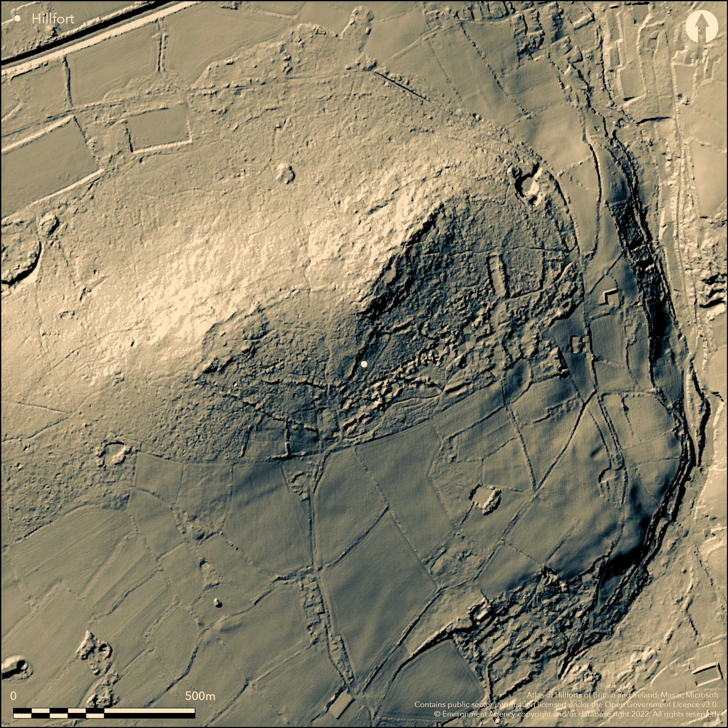
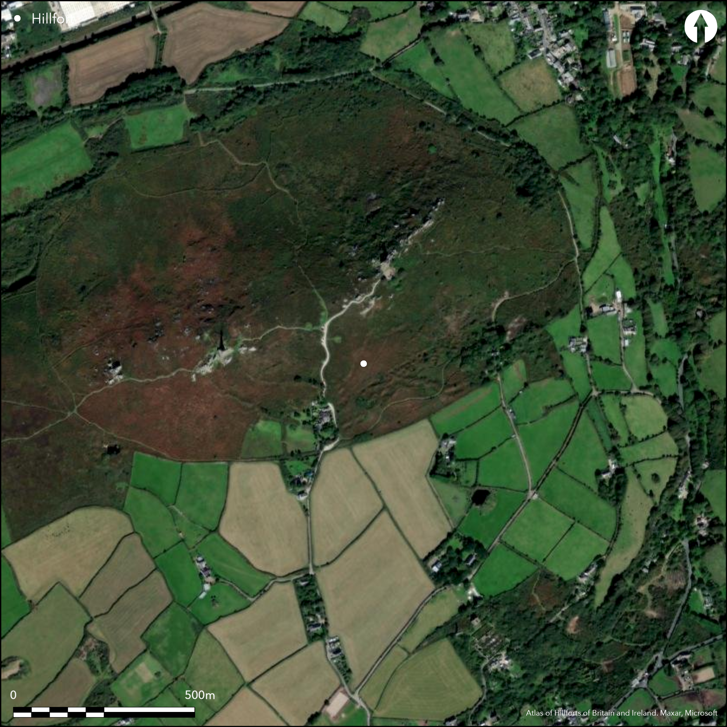
Large and complex contour hillfort located on prominent hill overlooking N coast at Redruth. Very steep surrounding slopes to N, moderate to S. Affected by Neolithic origins as tor enclosure, with multi-phased activity from Mesolithic to post-medieval. East and central summits enclosed by stony ramparts linked by paired ramparts across both and south flanks of the hill. Iron Age round houses proved in saddle between the two tops. On E summit wall links granite outcrops enclosing c. 0.7 ha, within which level platforms and terraces, seen by low walling. Circuit continuous. Possible SW entrance. Higher central W summit enclosed by ramparts and summits linked by boulder-built ramparts, with ditches to S, so enclosing c. 2.8 ha. Further, outer circuit of ramparts, damaged by mine workings to S, has ramparts enclosing c. 14 ha. Series of hut circles lie between summits. On tor enclosure surrounding E summit, pits, postholes and hearths on platforms found. Possibly attacked in the Neolithic as 750 leaf arrowheads and extensive burning unearthed. Also fragments of 550 South-Western style vessels. Outworks join the E and central summits. Different walling styles suggest phasing. but range similar to causewayed enclosures. C14 dates from E summit c. 3670-3535 cal BC, and suggested that, overall, Neolithic activity ended 3495-3080 cal BC. Much excavated from 19th century. Moorland site. Fair condition despite mining activity. On 1st Ed. OS map (1880).
Citizen Science: ✗
Reliability of Data: Confirmed
Reliability of Interpretation: Confirmed
X: -583911 Y: 6484614 (EPSG: 3857)
Longitude: -5.245360200976439 Latitude: 50.22086590391959 (EPSG:4326)
Country: England
Current County or Unitary Authority: Cornwall
Historic County: Cornwall
Current Parish/Community/Council/Townland: Carn Brea
Fairly good condition.
| Extant | ✓ |
| Cropmark | ✗ |
| Likely Destroyed | ✗ |
Moorland site.
| Woodland | ✗ |
| Commercial Forestry Plantation | ✗ |
| Parkland | ✗ |
| Pasture (Grazing) | ✗ |
| Arable | ✗ |
| Scrub/Bracken | ✗ |
| Bare Outcrop | ✗ |
| Heather/Moorland | ✓ |
| Heath | ✗ |
| Built-up | ✗ |
| Coastal Grassland | ✗ |
| Other | ✗ |
Large and complex contour hillfort located on prominent hill overlooking N coast at Redruth. Very steep surrounding slopes to N, moderate to S.
| Contour Fort | ✓ |
| Partial Contour Fort | ✗ |
| Promontory Fort | ✗ |
| Hillslope Fort | ✗ |
| Level Terrain Fort | ✗ |
| Marsh Fort | ✗ |
| Multiple Enclosure Fort | ✗ |
Hilltop site on two summits and intervening saddle
| Hilltop | ✓ |
| Coastal Promontory | ✗ |
| Inland Promontory | ✗ |
| Valley Bottom | ✗ |
| Knoll/Hillock/Outcrop | ✗ |
| Ridge | ✗ |
| Cliff/Plateau-edge/Scarp | ✗ |
| Hillslope | ✗ |
| Lowland | ✗ |
| Spur | ✗ |
Dominant Topographic Feature: Hill top
| North | ✗ |
| Northeast | ✗ |
| East | ✗ |
| Southeast | ✗ |
| South | ✗ |
| Southwest | ✗ |
| West | ✗ |
| Northwest | ✗ |
| Level | ✓ |
Altitude: 225.0m
N/A
Iron Age enclosed occupation of hillfort. Iron Age round houses proved in saddle between the two tops.
Reliability: B - Medium
| Pre 1200BC | ✗ |
| 1200BC - 800BC | ✗ |
| 800BC - 400BC | ✗ |
| 400BC - AD50 | ✓ |
| AD50 - AD400 | ✗ |
| AD400 - AD 800 | ✗ |
| Post AD800 | ✗ |
| Unknown | ✗ |
| Pre Hillfort: | None |
| Post Hillfort: | None |
| Artefactual: | Pottery |
| C14: | Neolithic dates. |
1754 W. Borlase plan. Excavation by G. Wilkinson 1860. Excavation by Cambrian Archaeological Association 1862. On 1st Ed. OS map (1880). Excavations by T.C. Peter and R. Burnard 1895. Excavations by W.G. Blight, Camborne Public Library and Museum, 1920's. Excavations by R. Mercer 1970-73. Watching Brief, Cornwall Committee for Rescue Archaeology 1979. Watching Brief Cornwall Committee for Rescue Archaeology 1985. Earthworks surveyed in 1985, and by RCHME 1996. Neolithic remains researched for project dating Early Neolithic enclosures in Britain and Ireland-no details. Evaluation Carn Brea South, Cornwall Archaeological Unit 1997.
| 1st Identified Map Depiction (1754): | W. Borlase plan. |
| Excavation (1860): | G. Wilkinson. |
| Excavation (1862): | Cambrian Archaeological Association |
| Other (1880): | OS map. |
| Excavation (1895): | T.C. Peter and R. Burnard 1895. |
| Other (1978): | Visit by Hillfort Study Group |
| Other (1996): | Earthwork survey RCHME |
| Other (1997): | Cornwall Archaeological Unit. |
| Excavation (None): | W.G. Blight. |
| Excavation (None): | R. Mercer. |
| Other (None): | Watching Briefs |
Fragments of 550 South-Western style vessels. Iron Age round houses proved in saddle between the two tops.
None
| None | ✓ |
| Spring | ✗ |
| Stream | ✗ |
| Pool | ✗ |
| Flush | ✗ |
| Well | ✗ |
| Other | ✗ |
None
| No Known Features | ✓ |
| Round Stone Structures | ✗ |
| Rectangular Stone Structures | ✗ |
| Curvilinear Platforms | ✗ |
| Other Roundhouse Evidence | ✗ |
| Pits | ✗ |
| Quarry Hollows | ✗ |
| Other | ✗ |
Iron Age roundhouses proved in saddle between the two tops. On tor enclosure surrounding E summit, pits, postholes and hearths on platforms found.
| No Known Excavation | ✗ |
| Pits | ✓ |
| Postholes | ✓ |
| Roundhouses | ✓ |
| Rectangular Structures | ✗ |
| Roads/Tracks | ✗ |
| Quarry Hollows | ✗ |
| Other | ✓ |
| Nothing Found | ✗ |
None
| No Known Geophysics | ✓ |
| Pits | ✗ |
| Roundhouses | ✗ |
| Rectangular Structures | ✗ |
| Roads/Tracks | ✗ |
| Quarry Hollows | ✗ |
| Other | ✗ |
| Nothing Found | ✗ |
Fragments of 550 South-Western style vessels.
| No Known Finds | ✗ |
| Pottery | ✓ |
| Metal | ✗ |
| Metalworking | ✗ |
| Human Bones | ✗ |
| Animal Bones | ✗ |
| Lithics | ✗ |
| Environmental | ✗ |
| Other | ✗ |
None
| APs Not Checked | ✓ |
| None | ✗ |
| Roundhouses | ✗ |
| Rectangular Structures | ✗ |
| Pits | ✗ |
| Postholes | ✗ |
| Roads/Tracks | ✗ |
| Other | ✗ |
Possible SW entrance.
| 1: | None |
| 2: | None |
Guard Chambers: ✗
Chevaux de Frise: ✗
| 1. Simple Gap (South west): | None |
On E summit wall links granite outcrops enclosing c. 0.7 ha, within which level platforms and terraces, seen by low walling. Circuit continuous. Higher central W summit enclosed by ramparts and summits linked by boulder-built ramparts, with ditches to S, so enclosing c. 2.8 ha. Further, outer circuit of ramparts, damaged by mine workings to S, has ramparts enclosing c. 14 ha.
| Area 1: | 14.0ha. |
| Total: | 14.0ha. |
Total Footprint Area: Noneha.
None
| ✓ | Possibly. Different walling styles suggest phasing, but range similar to causewayed enclosures and no direct evidence. |
| ✓ | None |
| NE Quadrant: | 3 |
| SE Quadrant: | 3 |
| SW Quadrant: | 3 |
| NW Quadrant: | 3 |
| Total: | 3 |
| Partial Univallate | ✗ |
| Univallate | ✗ |
| Partial Bivallate | ✗ |
| Bivallate | ✗ |
| Partial Multivallate | ✗ |
| Multivallate | ✓ |
| Unknown | ✗ |
| Partial Univallate | ✗ |
| Univallate | ✗ |
| Partial Bivallate | ✗ |
| Bivallate | ✗ |
| Partial Multivallate | ✗ |
| Multivallate | ✗ |
Boulder-built ramparts
| None | ✗ |
| Earthen Bank | ✗ |
| Stone Wall | ✓ |
| Rubble | ✓ |
| Wall-walk | ✗ |
| Evidence of Timber | ✗ |
| Vitrification | ✗ |
| Other Burning | ✗ |
| Palisade | ✗ |
| Counter Scarp Bank | ✗ |
| Berm | ✗ |
| Unfinished | ✗ |
| Other | ✗ |
Stone walled site.
| None | ✗ |
| Earthen Bank | ✗ |
| Stone Wall | ✓ |
| Murus Duplex | ✗ |
| Timber-framed | ✗ |
| Timber-laced | ✗ |
| Vitrification | ✗ |
| Other Burning | ✗ |
| Palisade | ✗ |
| Counter Scarp Bank | ✗ |
| Berm | ✗ |
| Unfinished | ✗ |
| No Known Excavation | ✗ |
| Other | ✗ |
| ✗ | None |
| ✓ | Number estimated. |
Number of Ditches: 2
| ✗ | None |
Burnard, R. 1896. Hill forts and camps, Plymouth Inst and Devon and Cornwall Nat Hist Soc Annual Report and Trans, 14, 1-54.
Lawson Jones, A. 1997. Shaft Capping Contract 10: Carn Brea South. Unpublsihed assessment and evaluation reports, Cornwall Archaeological Unit, Cornwall County Council.
Legge, A., Mercer, R.J., Samuels, J., Saville, A. and Smith, I.F. 1981. Excavations at Carn Brea, Illogan, Cornwall - a Neolithic fortified complex of the third century millennium BC, Cornish archaeol, 20, 1-204.
Peter, T.C. 1896. The exploration of Carn Brea, Cornish Archaeol, 13, 92-102.
Mercer, R.J. 1970. The Neolithic settlement on Carn Brea: preliminary report, Cornish archaeol, 9, 53-62.
Mercer, R. 1972. The excavation of the Neolithic settlement site at Carn Brea 1972: Interim report, Cornish archaeol, 11, 5-8.
Thomas, A.C. 1962. Unpublished material from Cornish Museum: I, Carn Brea finds in Camborne Public Library, , Cornish archaeol, 1, 104-106.
Atlas of Hillforts:
Wikidata:
This work is licensed under CC BY-SA 4.0![]()
![]()
![]() and should be cited as:
and should be cited as:
Lock, Gary and Ralston, Ian. 2024. Atlas of Hillforts of Britain and Ireland. Available at: https://hillforts.arch.ox.ac.uk
Document Version 1.1