
LiDAR 1m DTM Hillshade
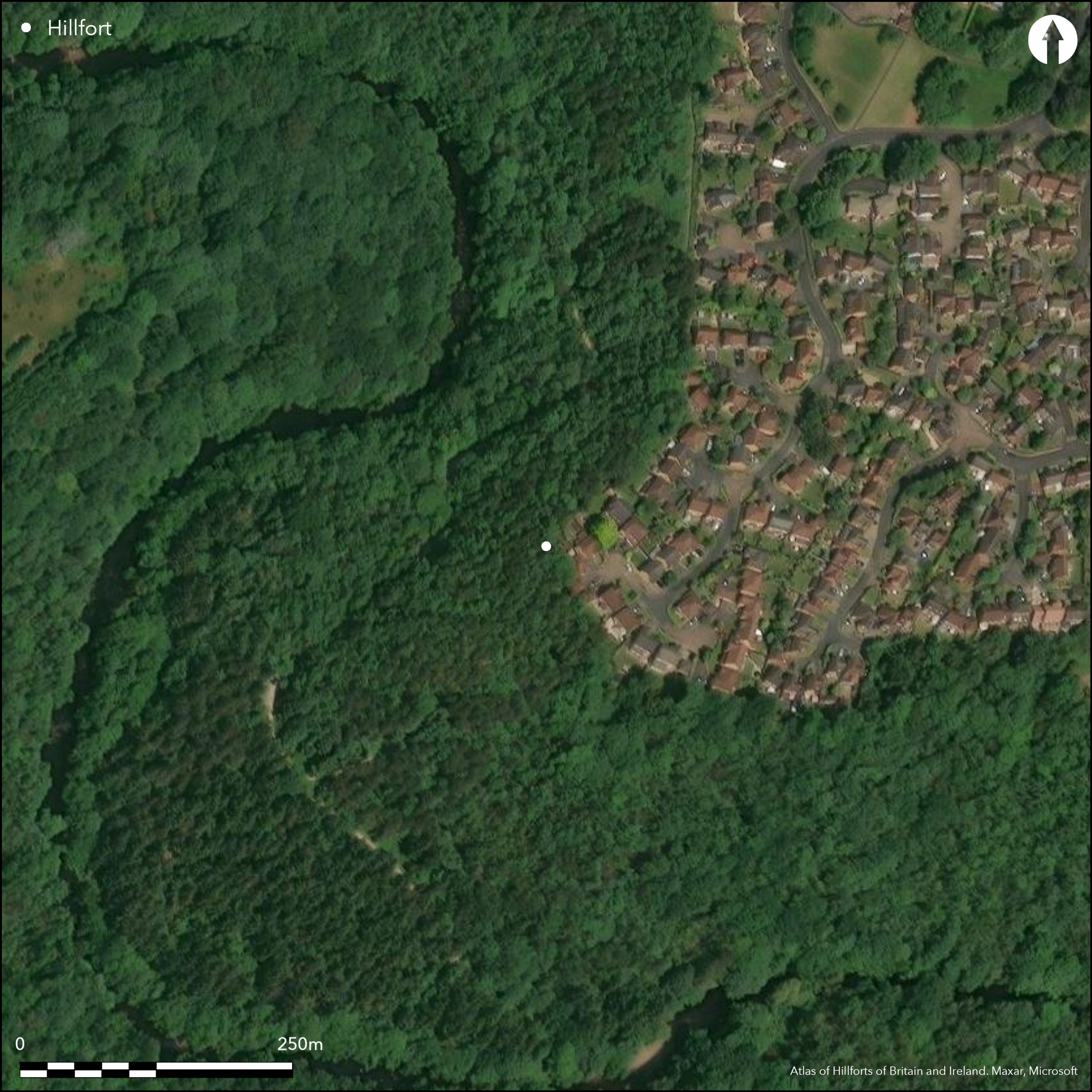
Satellite Imagery
LiDAR 1m DTM Hillshade
Satellite Imagery
Scroll left/right to view further images.
HER: North Yorkshire MNY19013 (None)
NMR: SE 35 NW 1 (53293)
SM: None
NGR: SE 33175 58009
X: 433175 Y: 458009 (OSGB36)
Lying within woodland on Gates Hill on the E bank of the River Nidd, earthworks considered to be a possible promontory fort, although rejected by the Ordnance survey when creating the 'Map of Southern Britain in the Iron Age'. The earthworks are shown on 1st Edition OS mapping as an enclosure with antenna ditches extending to the N and S. More recent maps show it as an oval enclosure. It holds a prominent position especially to the N, W and S where the cliffs are precipitous. A bank and ditch forms an irregular triangle enclosing 0.9ha, with a rampart and external ditch cutting across the level ground in the E forming the base of the triangle. In this area the bank stands at 0.3m high; the ditch is now in-filled but its line can still be traced. The arrangement of the cliff rampart differs from those cutting across the neck in that the former has the ditch inside, the latter outside. Reports of an annex at the point of the spur by earlier investigators has been described in later surveys as the remains of clearance operations or quarrying. The site is said to have been used in the Civil War during the Siege of Knaresborough and fortifications similar in form to the Civil War Battery site at Skipton and coins and shot for that period have been found there. It is included in Challis and Harding (1975) as a possible promontory fort but in Hogg (1979) as doubtful. Shown as 'Camp' on 1885-1900 OS mapping. A walkover and metal detector survey of the site involving members of the local community was undertaken by Northern Archaeological Associates in 2003. The density of tree cover prevented a detailed study, but a holloway to the S of the camp was identified. Fifteen finds, mostly iron were recovered, all of which were post-medieval in date.
Citizen Science: ✗
Reliability of Data: Unconfirmed
Reliability of Interpretation: Unconfirmed
X: -166443 Y: 7173382 (EPSG: 3857)
Longitude: -1.495182763718289 Latitude: 54.01703040901669 (EPSG:4326)
Country: England
Current County or Unitary Authority: North Yorkshire
Historic County: Yorkshire
Current Parish/Community/Council/Townland: Knaresborough
None
| Extant | ✓ |
| Cropmark | ✗ |
| Likely Destroyed | ✗ |
None
| Woodland | ✓ |
| Commercial Forestry Plantation | ✗ |
| Parkland | ✗ |
| Pasture (Grazing) | ✗ |
| Arable | ✗ |
| Scrub/Bracken | ✗ |
| Bare Outcrop | ✗ |
| Heather/Moorland | ✗ |
| Heath | ✗ |
| Built-up | ✗ |
| Coastal Grassland | ✗ |
| Other | ✗ |
A possible hillslope fort lying on a southwesterly slope at 77m OD on a promontory above the River Nidd.
| Contour Fort | ✗ |
| Partial Contour Fort | ✓ |
| Promontory Fort | ✗ |
| Hillslope Fort | ✓ |
| Level Terrain Fort | ✗ |
| Marsh Fort | ✗ |
| Multiple Enclosure Fort | ✗ |
| Hilltop | ✗ |
| Coastal Promontory | ✗ |
| Inland Promontory | ✓ |
| Valley Bottom | ✗ |
| Knoll/Hillock/Outcrop | ✗ |
| Ridge | ✗ |
| Cliff/Plateau-edge/Scarp | ✗ |
| Hillslope | ✗ |
| Lowland | ✗ |
| Spur | ✗ |
Dominant Topographic Feature: Promontory on a meander above the River Nidd to the SW
| North | ✗ |
| Northeast | ✗ |
| East | ✗ |
| Southeast | ✗ |
| South | ✗ |
| Southwest | ✓ |
| West | ✗ |
| Northwest | ✗ |
| Level | ✗ |
Altitude: 77.0m
N/A
The site is undated. Civil war (1642-1651) finds of coins and shot. Post medieval ironwork
Reliability: D - None
| Pre 1200BC | ✗ |
| 1200BC - 800BC | ✗ |
| 800BC - 400BC | ✗ |
| 400BC - AD50 | ✗ |
| AD50 - AD400 | ✗ |
| AD400 - AD 800 | ✗ |
| Post AD800 | ✗ |
| Unknown | ✓ |
| Pre Hillfort: | None |
| Post Hillfort: | The site possibly includes English Civil War fortifications. A possible platform surrounded by a bank and ditch within the camp may be the remains a Civil War battery. |
Recorded on 1885-1900 OS mapping. General reference in Speight (1906). Field investigation in 1963. Walkover and metal detecting surveys in 2004
| 1st Identified Written Reference (1912): | VCH Yorks |
| Other (1963): | Field investigation |
| Other (2003): | Walkover and metal detecting surveys |
| 1st Identified Map Depiction (None): | None |
No internal features recorded
Lies on a bend in the River Nidd
| None | ✓ |
| Spring | ✗ |
| Stream | ✗ |
| Pool | ✗ |
| Flush | ✗ |
| Well | ✗ |
| Other | ✗ |
None
| No Known Features | ✓ |
| Round Stone Structures | ✗ |
| Rectangular Stone Structures | ✗ |
| Curvilinear Platforms | ✗ |
| Other Roundhouse Evidence | ✗ |
| Pits | ✗ |
| Quarry Hollows | ✗ |
| Other | ✗ |
None
| No Known Excavation | ✓ |
| Pits | ✗ |
| Postholes | ✗ |
| Roundhouses | ✗ |
| Rectangular Structures | ✗ |
| Roads/Tracks | ✗ |
| Quarry Hollows | ✗ |
| Other | ✗ |
| Nothing Found | ✗ |
None
| No Known Geophysics | ✓ |
| Pits | ✗ |
| Roundhouses | ✗ |
| Rectangular Structures | ✗ |
| Roads/Tracks | ✗ |
| Quarry Hollows | ✗ |
| Other | ✗ |
| Nothing Found | ✗ |
Civil war (1642-1651) finds of coins and shot. Post medieval ironwork
| No Known Finds | ✗ |
| Pottery | ✗ |
| Metal | ✗ |
| Metalworking | ✗ |
| Human Bones | ✗ |
| Animal Bones | ✗ |
| Lithics | ✗ |
| Environmental | ✗ |
| Other | ✓ |
Obscured by woodland.
| APs Not Checked | ✓ |
| None | ✗ |
| Roundhouses | ✗ |
| Rectangular Structures | ✗ |
| Pits | ✗ |
| Postholes | ✗ |
| Roads/Tracks | ✗ |
| Other | ✗ |
No entrances are recorded
| None: | None recorded |
| 2: | None |
Guard Chambers: ✗
Chevaux de Frise: ✗
A bank and ditch forms an irregular triangle enclosing 0.9ha, with a rampart and external ditch cutting across the level ground in the E forming the base of the triangle. In this area the bank stands at 0.3m high; the ditch is now in-filled but its line can still be traced. The arrangement of the cliff defences differs from those cutting across the neck in that the former has the ditch inside, the latter outside.
| Area 1: | 0.9ha. |
| Total: | 0.9ha. |
Total Footprint Area: Noneha.
None
| ✗ | None |
| ✓ | None |
| NE Quadrant: | 1 |
| SE Quadrant: | 1 |
| SW Quadrant: | 1 |
| NW Quadrant: | 1 |
| Total: | 1 |
| Partial Univallate | ✗ |
| Univallate | ✓ |
| Partial Bivallate | ✗ |
| Bivallate | ✗ |
| Partial Multivallate | ✗ |
| Multivallate | ✗ |
| Unknown | ✗ |
| Partial Univallate | ✗ |
| Univallate | ✗ |
| Partial Bivallate | ✗ |
| Bivallate | ✗ |
| Partial Multivallate | ✗ |
| Multivallate | ✗ |
Possibly - no building material has been mentioned in the literature
| None | ✗ |
| Earthen Bank | ✓ |
| Stone Wall | ✗ |
| Rubble | ✗ |
| Wall-walk | ✗ |
| Evidence of Timber | ✗ |
| Vitrification | ✗ |
| Other Burning | ✗ |
| Palisade | ✗ |
| Counter Scarp Bank | ✗ |
| Berm | ✗ |
| Unfinished | ✗ |
| Other | ✗ |
None
| None | ✗ |
| Earthen Bank | ✗ |
| Stone Wall | ✗ |
| Murus Duplex | ✗ |
| Timber-framed | ✗ |
| Timber-laced | ✗ |
| Vitrification | ✗ |
| Other Burning | ✗ |
| Palisade | ✗ |
| Counter Scarp Bank | ✗ |
| Berm | ✗ |
| Unfinished | ✗ |
| No Known Excavation | ✓ |
| Other | ✗ |
| ✗ | None |
| ✓ | None |
Number of Ditches: 1
| ✗ | None |
Anon/2003/Gates Hill Camp, Nidd Gorge, Knaresborough, North Yorkshire: archaeological earthwork survey. Northern Archaeological Associates [assessment & evaluation reports]. Unpublished
Anon/2002/Gates Hill Camp, Nidd Gorge, Knaresborough, North Yorkshire. Archaeological desk-based assessment. Northern Archaeological Associates [assessment & evaluation reports]. Unpublished
Middleton, P. 2003. Nidd Gorge, Knaresborough, North Yorkshire: archaeological survey. Report No 03/11. Northern Archaeological Associates [assessment & evaluation reports]. Unpublished
Challis, A.J. and Harding, D.W., 1975. Later prehistory from the Trent to the Tyne. BAR British series 1 (1974) (ii).
Hogg, A.H.A.1979. British Hill-Forts. An Index. British Archaeological Reports, British Series 62, 144
Speight, H. 1906. Upper Nidderdale. 109
Atlas of Hillforts:
Wikidata:
This work is licensed under CC BY-SA 4.0![]()
![]()
![]() and should be cited as:
and should be cited as:
Lock, Gary and Ralston, Ian. 2024. Atlas of Hillforts of Britain and Ireland. Available at: https://hillforts.arch.ox.ac.uk
Document Version 1.1