LiDAR 1m DTM Hillshade
Satellite Imagery
LiDAR 1m DTM Hillshade
Satellite Imagery
Scroll left/right to view further images.
HER: Norfolk 2258 (None)
NMR: TM 1 9 NE 3 (389338)
SM: 1003984
NGR: TM 2004 9599
X: 620010 Y: 296000 (OSGB36)
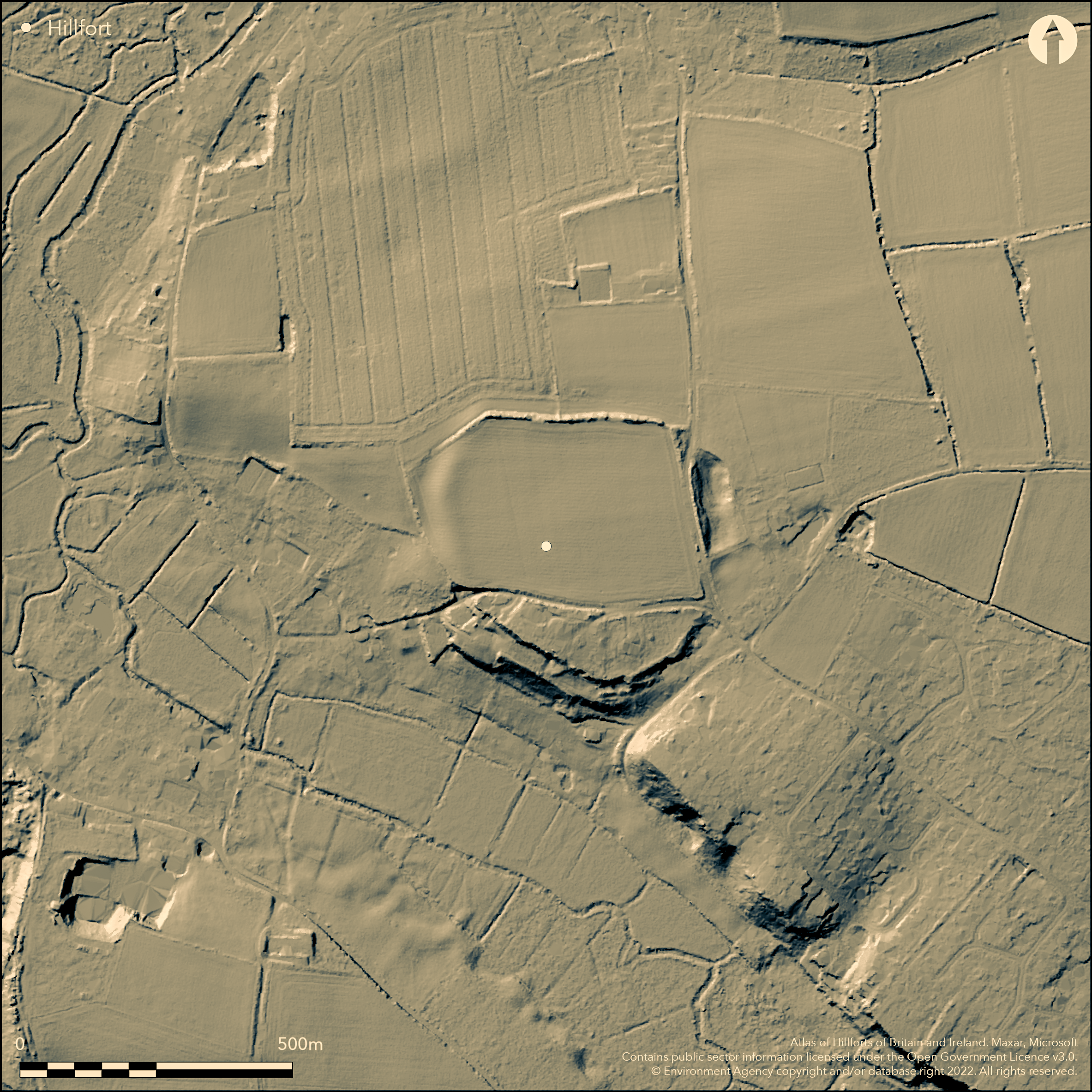
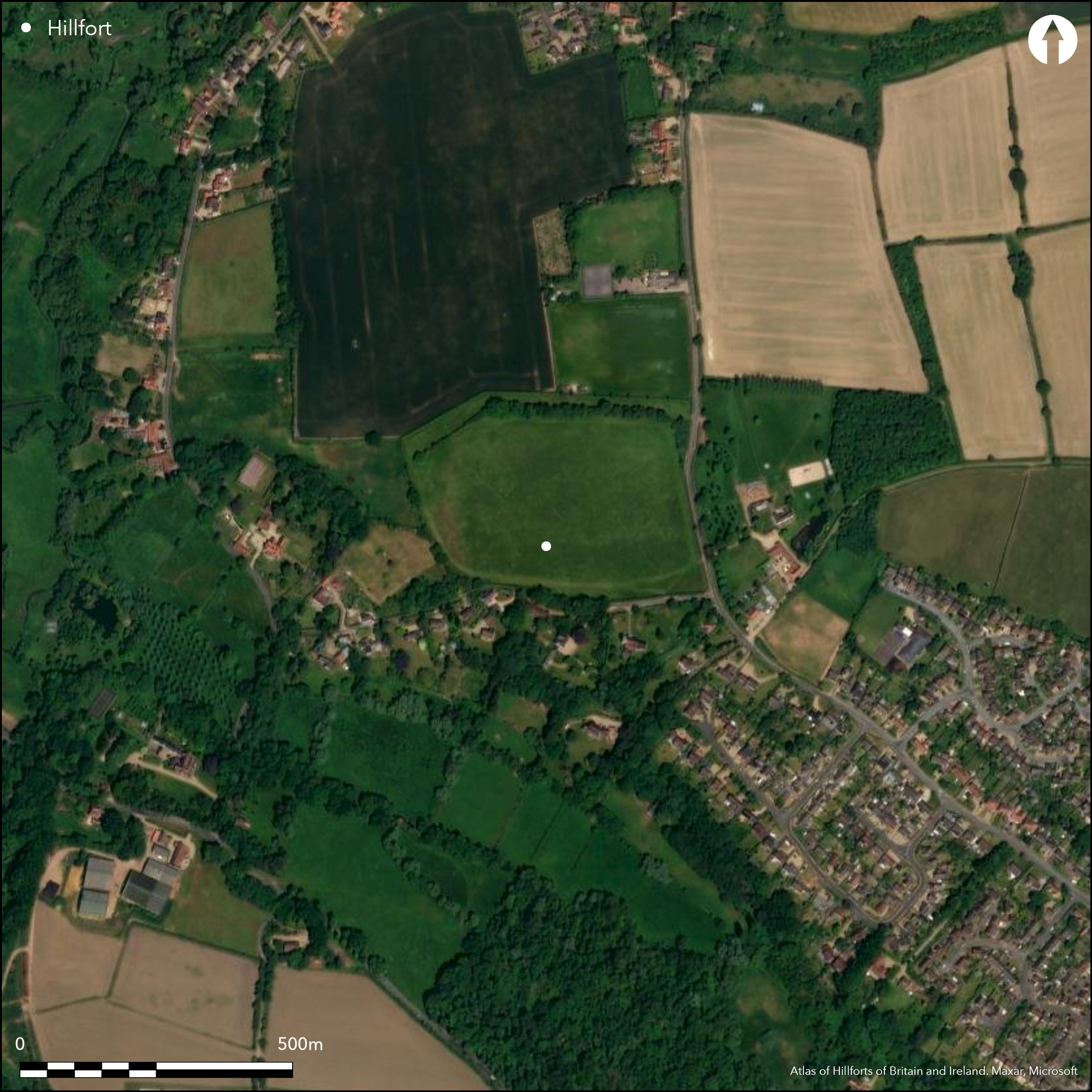
Within Tasburgh on a hilltop overlooking the valley of the River Tas and the confluence with a tributary stream. A roughly oval enclosure although its original outline has been modified, partly by quarrying, and is difficult to estimate, described in the 17th century by Camden as 'square'. A single bank and ditch enclosing approximately 6.2ha, a possible counter-scarp bank in places, most of the interior is ploughed, no evidence of an original entrance although it may be at the SE where a modern road runs. Excavations across the bank and ditch in 1948 showed a bank of loam c.12.5 m wide, perhaps with a rear revetment, surviving to a height of 1m and an external ditch 3m deep, 11m wide with a flat bottom. Dating was inconclusive. Geophysical survey in 1983 over much of the interior showed little evidence for structures. Excavations in the S of the interior in 1975-80 revealed a series of pits and slots mostly dated to the middle/late Saxon period with a small number of Iron Age sherds and possible features. The dating of the ramparts is inconclusive but it is suggested that they may be middle/late Saxon to fit the internal evidence rather than Iron Age (Rogerson and Lawson 1992). Included here as a possible hillfort due to the small amounts of pottery and on morphological grounds.
Citizen Science: ✗
Reliability of Data: Confirmed
Reliability of Interpretation: Unconfirmed
X: 138178 Y: 6894226 (EPSG: 3857)
Longitude: 1.2412730296853756 Latitude: 52.51740972495165 (EPSG:4326)
Country: England
Current County or Unitary Authority: Norfolk
Historic County: Norfolk
Current Parish/Community/Council/Townland: Tasburgh
None
| Extant | ✓ |
| Cropmark | ✗ |
| Likely Destroyed | ✓ |
None
| Woodland | ✗ |
| Commercial Forestry Plantation | ✗ |
| Parkland | ✗ |
| Pasture (Grazing) | ✗ |
| Arable | ✓ |
| Scrub/Bracken | ✓ |
| Bare Outcrop | ✗ |
| Heather/Moorland | ✗ |
| Heath | ✗ |
| Built-up | ✗ |
| Coastal Grassland | ✗ |
| Other | ✗ |
On a hilltop overlooking the confluence of the River Tas and a tributary stream, a partial contour fort
| Contour Fort | ✗ |
| Partial Contour Fort | ✓ |
| Promontory Fort | ✗ |
| Hillslope Fort | ✗ |
| Level Terrain Fort | ✗ |
| Marsh Fort | ✗ |
| Multiple Enclosure Fort | ✗ |
| Hilltop | ✓ |
| Coastal Promontory | ✗ |
| Inland Promontory | ✗ |
| Valley Bottom | ✗ |
| Knoll/Hillock/Outcrop | ✗ |
| Ridge | ✗ |
| Cliff/Plateau-edge/Scarp | ✗ |
| Hillslope | ✗ |
| Lowland | ✗ |
| Spur | ✗ |
Dominant Topographic Feature: On a hilltop overlooking the confluence of the River Tas and a tributary stream
| North | ✗ |
| Northeast | ✗ |
| East | ✗ |
| Southeast | ✗ |
| South | ✗ |
| Southwest | ✗ |
| West | ✗ |
| Northwest | ✗ |
| Level | ✓ |
Altitude: 35.0m
N/A
Dated to the Iron Age by a small number of excavated pottery sherds plus morphology of the site. Mesolithic, Neolithic and Bronze Age artefacts, middle/late Saxon pottery, artefacts and structures.
Reliability: C - Low
| Pre 1200BC | ✗ |
| 1200BC - 800BC | ✗ |
| 800BC - 400BC | ✗ |
| 400BC - AD50 | ✓ |
| AD50 - AD400 | ✗ |
| AD400 - AD 800 | ✗ |
| Post AD800 | ✗ |
| Unknown | ✗ |
| Pre Hillfort: | None |
| Post Hillfort: | None |
| Artefactual: | None |
| Morphology/Earthwork/Typology: | None |
Decsribed by Camden in the 17th century. Excavations in 1948 and 1975-80, geophysical survey in 1983.
| Excavation (1948): | None |
| Geophysical Survey (1983): | None |
| 1st Identified Written Reference (None): | None |
| Excavation (None): | None |
Geophysical survey in 1983 over much of the interior showed little evidence for structures. Excavations in the S of the interior in 1975-80 revealed a series of pits and slots mostly dated to the middle/late Saxon period with a small number of Iron Age sherds and possible features.
None
| None | ✓ |
| Spring | ✗ |
| Stream | ✗ |
| Pool | ✗ |
| Flush | ✗ |
| Well | ✗ |
| Other | ✗ |
None
| No Known Features | ✓ |
| Round Stone Structures | ✗ |
| Rectangular Stone Structures | ✗ |
| Curvilinear Platforms | ✗ |
| Other Roundhouse Evidence | ✗ |
| Pits | ✗ |
| Quarry Hollows | ✗ |
| Other | ✗ |
None
| No Known Excavation | ✗ |
| Pits | ✓ |
| Postholes | ✓ |
| Roundhouses | ✗ |
| Rectangular Structures | ✓ |
| Roads/Tracks | ✗ |
| Quarry Hollows | ✗ |
| Other | ✗ |
| Nothing Found | ✗ |
None
| No Known Geophysics | ✗ |
| Pits | ✓ |
| Roundhouses | ✗ |
| Rectangular Structures | ✗ |
| Roads/Tracks | ✗ |
| Quarry Hollows | ✗ |
| Other | ✗ |
| Nothing Found | ✗ |
None
| No Known Finds | ✗ |
| Pottery | ✓ |
| Metal | ✓ |
| Metalworking | ✗ |
| Human Bones | ✗ |
| Animal Bones | ✓ |
| Lithics | ✓ |
| Environmental | ✗ |
| Other | ✗ |
None
| APs Not Checked | ✓ |
| None | ✗ |
| Roundhouses | ✗ |
| Rectangular Structures | ✗ |
| Pits | ✗ |
| Postholes | ✗ |
| Roads/Tracks | ✗ |
| Other | ✗ |
No evidence of an original entrance although it may be at the SE where a modern road runs. Many modern breaks through the ramparts.
| None: | None |
| 2: | None |
Guard Chambers: ✗
Chevaux de Frise: ✗
| 1. Simple Gap (South east): | None |
Excavations across the bank and ditch in 1948 showed a bank of loam c.12.5 m wide, perhaps with a rear revetment, surviving to a height of 1m and an external ditch 3m deep, 11m wide with a flat bottom. Counter-scarp bank in places. Dating was inconclusive.
| Area 1: | 6.2ha. |
| Total: | 6.2ha. |
Total Footprint Area: Noneha.
None
| ✗ | None |
| ✗ | None |
| NE Quadrant: | 1 |
| SE Quadrant: | 1 |
| SW Quadrant: | 1 |
| NW Quadrant: | 1 |
| Total: | 1 |
| Partial Univallate | ✗ |
| Univallate | ✓ |
| Partial Bivallate | ✗ |
| Bivallate | ✗ |
| Partial Multivallate | ✗ |
| Multivallate | ✗ |
| Unknown | ✗ |
| Partial Univallate | ✗ |
| Univallate | ✗ |
| Partial Bivallate | ✗ |
| Bivallate | ✗ |
| Partial Multivallate | ✗ |
| Multivallate | ✗ |
None
| None | ✗ |
| Earthen Bank | ✓ |
| Stone Wall | ✗ |
| Rubble | ✗ |
| Wall-walk | ✗ |
| Evidence of Timber | ✗ |
| Vitrification | ✗ |
| Other Burning | ✗ |
| Palisade | ✗ |
| Counter Scarp Bank | ✓ |
| Berm | ✗ |
| Unfinished | ✗ |
| Other | ✗ |
None
| None | ✗ |
| Earthen Bank | ✓ |
| Stone Wall | ✗ |
| Murus Duplex | ✗ |
| Timber-framed | ✗ |
| Timber-laced | ✗ |
| Vitrification | ✗ |
| Other Burning | ✗ |
| Palisade | ✗ |
| Counter Scarp Bank | ✓ |
| Berm | ✗ |
| Unfinished | ✗ |
| No Known Excavation | ✗ |
| Other | ✗ |
| ✗ | None |
| ✓ | None |
Number of Ditches: 1
| ✗ | None |
Rogerson, A. and Lawson, A. 1992. The earthwork enclosure at Tasburgh, The Iron Age Forts of Norfolk. E Anglian Archaeol Rep. No. 54, 31-58.
Atlas of Hillforts:
Wikidata:
This work is licensed under CC BY-SA 4.0![]()
![]()
![]() and should be cited as:
and should be cited as:
Lock, Gary and Ralston, Ian. 2024. Atlas of Hillforts of Britain and Ireland. Available at: https://hillforts.arch.ox.ac.uk
Document Version 1.1