LiDAR 1m DTM Hillshade
Satellite Imagery
LiDAR 1m DTM Hillshade
Satellite Imagery
Scroll left/right to view further images.
HER: West Sussex MWS6486 (None)
NMR: SU 82 SW 1 (246847)
SM: 1015878
NGR: SU 8460 2403
X: 484626 Y: 124065 (OSGB36)
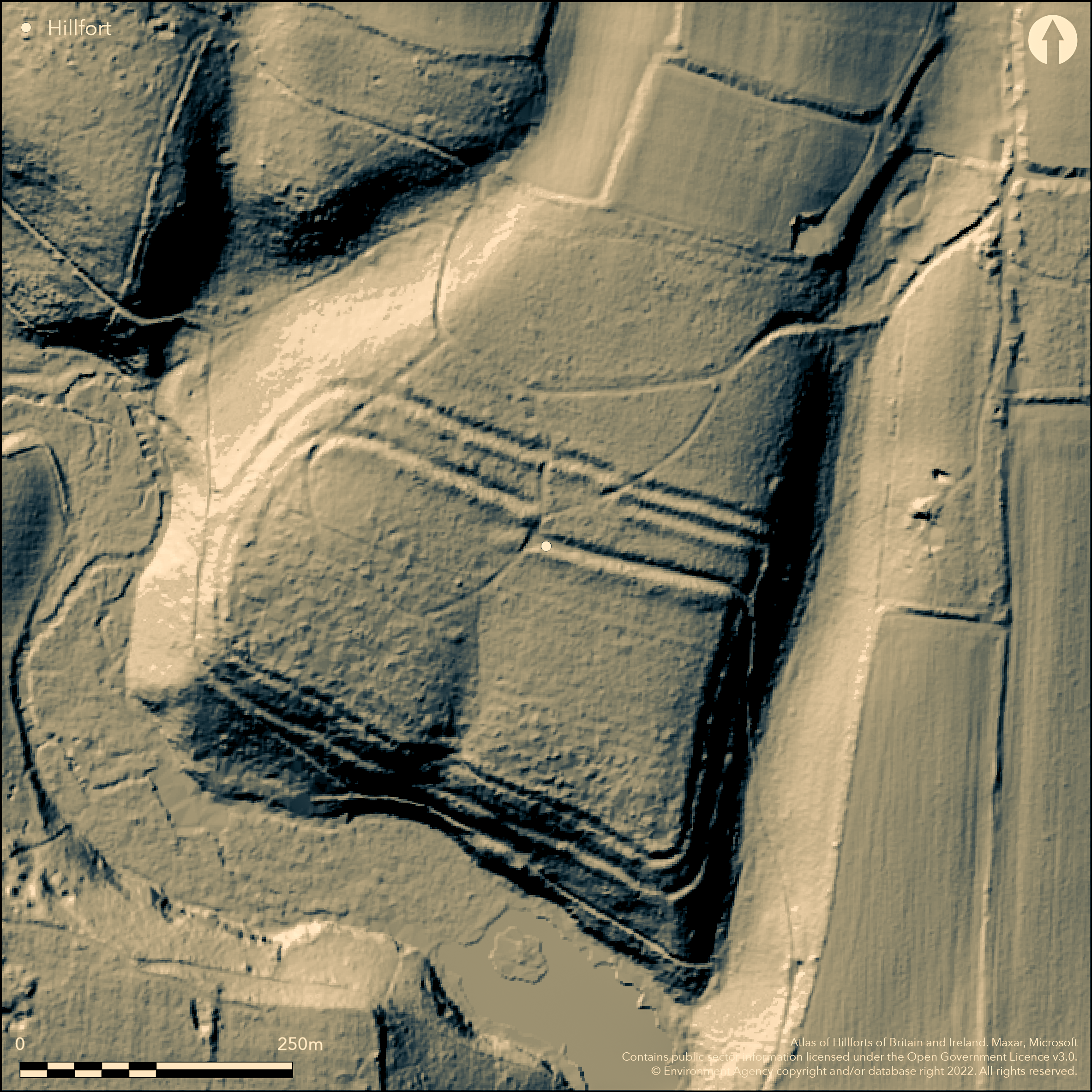
Multivallate hillslope fort situated on a SW-sloping greensand spur overlooking the River Rother c. 1.2km to S, with Hammer Stream and Hammer Pond on SE-NW quadrants. Found on aerial photographs by Ordnance Survey 1956. Steep surrounding slopes, less along spur to NE. Roughly rectangular encloses spur and aligned SE-NW with area c. 4ha. Best ramparts on the gentler sloping neck of spur on NE where two parallel banks to 11m wide, flanked by outer ditches. Part excavation (Boyden 1957) showed earthen and rubble rampart construction revetted with locally extracted ironstone slabs. Also hearths associated with early Iron Age pottery. Six charcoal burning platforms visible in and on site. Rest of ramparts smaller scale, with steeply-sided NW and SE edges of spur enclosed mostly by single bank and ditch. To SW spur-edge rampart augmented by parallel, outer bank and ditch constructed c. 15m downslope. Ramparts disturbed in places by subsequent construction and use of more recent tracks and paths. Single entrance in the middle of N side and distinctly offset. On OS 1:25,000 map (1958).
Citizen Science: ✗
Reliability of Data: Confirmed
Reliability of Interpretation: Confirmed
X: -88512 Y: 6623008 (EPSG: 3857)
Longitude: -0.7951139532642141 Latitude: 51.00969025508371 (EPSG:4326)
Country: England
Current County or Unitary Authority: West Sussex
Historic County: Sussex
Current Parish/Community/Council/Townland: Stedham with Iping
None
| Extant | ✓ |
| Cropmark | ✗ |
| Likely Destroyed | ✗ |
None
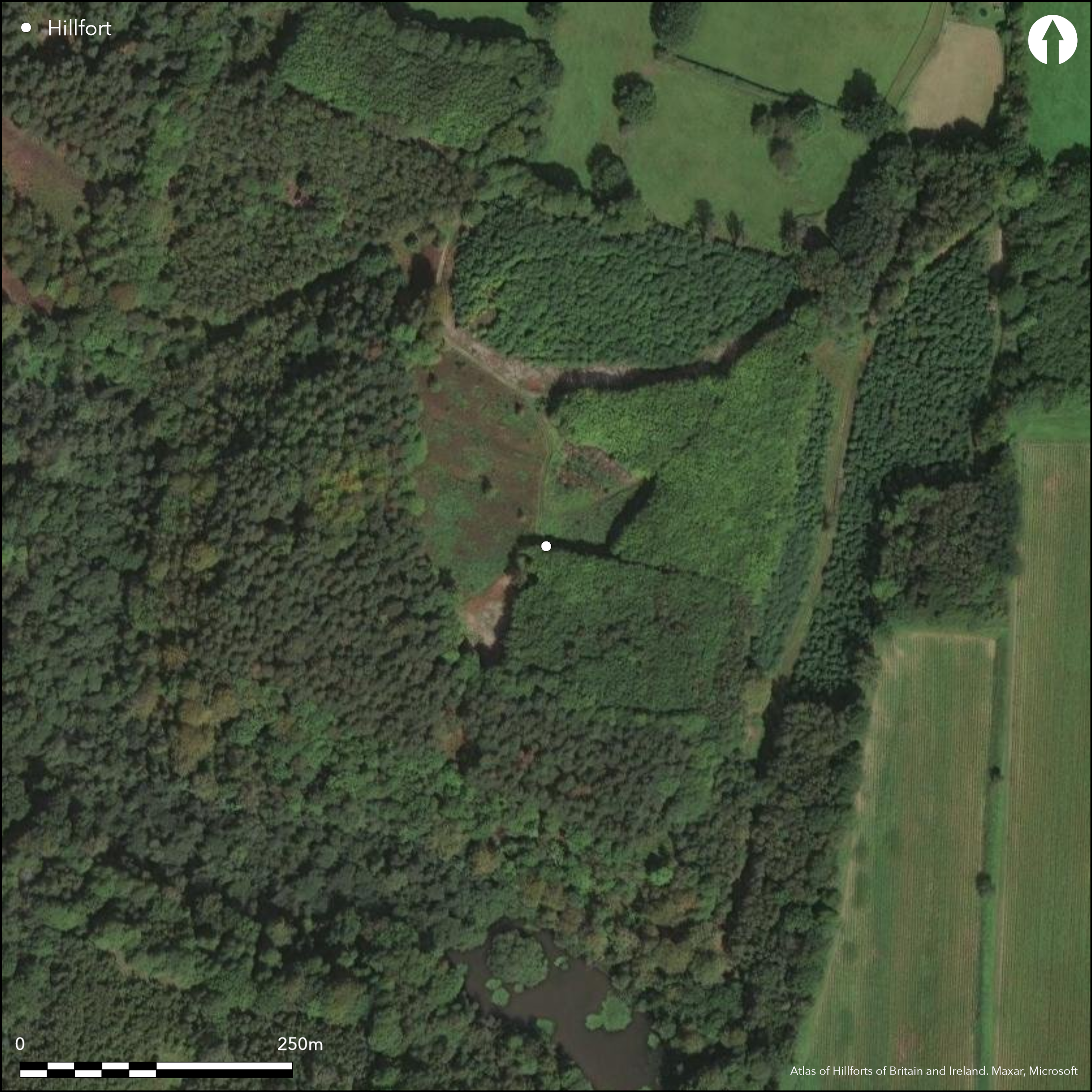
| Woodland | ✓ |
| Commercial Forestry Plantation | ✗ |
| Parkland | ✗ |
| Pasture (Grazing) | ✗ |
| Arable | ✗ |
| Scrub/Bracken | ✗ |
| Bare Outcrop | ✗ |
| Heather/Moorland | ✗ |
| Heath | ✗ |
| Built-up | ✗ |
| Coastal Grassland | ✗ |
| Other | ✗ |
Multivallate hillslope fort situated on a SW-sloping greensand spur overlooking the River Rother c. 1.2km to S, with Hammer Stream and Hammer Pond on SE-NW quadrants. Steep surrounding slopes, less along spur to NE.
| Contour Fort | ✗ |
| Partial Contour Fort | ✗ |
| Promontory Fort | ✗ |
| Hillslope Fort | ✓ |
| Level Terrain Fort | ✗ |
| Marsh Fort | ✗ |
| Multiple Enclosure Fort | ✗ |
| Hilltop | ✗ |
| Coastal Promontory | ✗ |
| Inland Promontory | ✗ |
| Valley Bottom | ✗ |
| Knoll/Hillock/Outcrop | ✗ |
| Ridge | ✗ |
| Cliff/Plateau-edge/Scarp | ✗ |
| Hillslope | ✓ |
| Lowland | ✗ |
| Spur | ✓ |
Dominant Topographic Feature: Spur
| North | ✗ |
| Northeast | ✗ |
| East | ✗ |
| Southeast | ✗ |
| South | ✗ |
| Southwest | ✓ |
| West | ✗ |
| Northwest | ✗ |
| Level | ✗ |
Altitude: 68.0m
N/A
Hearths associated with early Iron Age pottery.
Reliability: B - Medium
| Pre 1200BC | ✗ |
| 1200BC - 800BC | ✗ |
| 800BC - 400BC | ✓ |
| 400BC - AD50 | ✗ |
| AD50 - AD400 | ✗ |
| AD400 - AD 800 | ✗ |
| Post AD800 | ✗ |
| Unknown | ✗ |
| Pre Hillfort: | None |
| Post Hillfort: | None |
| Artefactual: | Early Iron Age pottery. |
Found on aerial photographs by Ordnance Survey 1956. On OS 1:25,000 map (1958). Excavations J.R. Boyden 1957.
| Other (1956): | Found on aerial photographs by Ordnance Survey. |
| Excavation (1957): | J.R. Boyden. |
| 1st Identified Map Depiction (1958): | None |
Hearths associated with Iron Age pottery. Six charcoal burning platforms visible in and on site.
None
| None | ✓ |
| Spring | ✗ |
| Stream | ✗ |
| Pool | ✗ |
| Flush | ✗ |
| Well | ✗ |
| Other | ✗ |
Six charcoal burning platforms visible in and on site.
| No Known Features | ✗ |
| Round Stone Structures | ✗ |
| Rectangular Stone Structures | ✗ |
| Curvilinear Platforms | ✗ |
| Other Roundhouse Evidence | ✗ |
| Pits | ✗ |
| Quarry Hollows | ✗ |
| Other | ✓ |
Hearths associated with Iron Age pottery. Six post-medieval charcoal platforms.
| No Known Excavation | ✗ |
| Pits | ✗ |
| Postholes | ✗ |
| Roundhouses | ✗ |
| Rectangular Structures | ✗ |
| Roads/Tracks | ✗ |
| Quarry Hollows | ✗ |
| Other | ✓ |
| Nothing Found | ✗ |
None
| No Known Geophysics | ✓ |
| Pits | ✗ |
| Roundhouses | ✗ |
| Rectangular Structures | ✗ |
| Roads/Tracks | ✗ |
| Quarry Hollows | ✗ |
| Other | ✗ |
| Nothing Found | ✗ |
Iron Age pottery.
| No Known Finds | ✗ |
| Pottery | ✓ |
| Metal | ✗ |
| Metalworking | ✗ |
| Human Bones | ✗ |
| Animal Bones | ✗ |
| Lithics | ✗ |
| Environmental | ✗ |
| Other | ✗ |
None
| APs Not Checked | ✓ |
| None | ✗ |
| Roundhouses | ✗ |
| Rectangular Structures | ✗ |
| Pits | ✗ |
| Postholes | ✗ |
| Roads/Tracks | ✗ |
| Other | ✗ |
Single entrance in the middle of N side and distinctly offset.
| 1: | None |
| 2: | None |
Guard Chambers: ✗
Chevaux de Frise: ✗
| 1. Oblique (North): | Distinctly offset. |
Best defences on the gentler sloping neck of spur on NE where two parallel banks to 11m wide, flanked by outer ditches. Part excavation by J.R. Boyden1957 showed earthern and rubble construction revetted with locally extracted ironstone slabs. Rest of defences smaller scale, with steeply-sided NW and SE edges of spur enclosed mostly by single bank and ditch. To SW spur-edge rampart augmented by parallel, outer bank and ditch constructed c. 15m downslope.
| Area 1: | 4.0ha. |
| Total: | 4.0ha. |
Total Footprint Area: Noneha.
None
| ✗ | None |
| ✓ | None |
| NE Quadrant: | 2 |
| SE Quadrant: | 1 |
| SW Quadrant: | 2 |
| NW Quadrant: | 1 |
| Total: | 2 |
| Partial Univallate | ✓ |
| Univallate | ✗ |
| Partial Bivallate | ✓ |
| Bivallate | ✗ |
| Partial Multivallate | ✗ |
| Multivallate | ✗ |
| Unknown | ✗ |
| Partial Univallate | ✗ |
| Univallate | ✗ |
| Partial Bivallate | ✗ |
| Bivallate | ✗ |
| Partial Multivallate | ✗ |
| Multivallate | ✗ |
None
| None | ✗ |
| Earthen Bank | ✓ |
| Stone Wall | ✗ |
| Rubble | ✗ |
| Wall-walk | ✗ |
| Evidence of Timber | ✗ |
| Vitrification | ✗ |
| Other Burning | ✗ |
| Palisade | ✗ |
| Counter Scarp Bank | ✗ |
| Berm | ✗ |
| Unfinished | ✗ |
| Other | ✗ |
Part excavation by J.R. Boyden1957 showed earthern and rubble construction revetted with locally extracted ironstone slabs.
| None | ✗ |
| Earthen Bank | ✓ |
| Stone Wall | ✓ |
| Murus Duplex | ✗ |
| Timber-framed | ✗ |
| Timber-laced | ✗ |
| Vitrification | ✗ |
| Other Burning | ✗ |
| Palisade | ✗ |
| Counter Scarp Bank | ✗ |
| Berm | ✗ |
| Unfinished | ✗ |
| No Known Excavation | ✗ |
| Other | ✗ |
| ✗ | None |
| ✓ | None |
Number of Ditches: 2
| ✗ | None |
Boyden, J. R. 1957. Excavations at Hammer Wood, Iping, 1957, Sussex Archaeol Collect. 96, 149-163.
Atlas of Hillforts:
Wikidata:
This work is licensed under CC BY-SA 4.0![]()
![]()
![]() and should be cited as:
and should be cited as:
Lock, Gary and Ralston, Ian. 2024. Atlas of Hillforts of Britain and Ireland. Available at: https://hillforts.arch.ox.ac.uk
Document Version 1.1