LiDAR 1m DTM Hillshade
Satellite Imagery
LiDAR 1m DTM Hillshade
Satellite Imagery
Scroll left/right to view further images.
HER: Hampshire 19992 (None)
NMR: SU 71 0SE 9 (217006)
SM: 226
NGR: SU19870393
X: 419870 Y: 103930 (OSGB36)
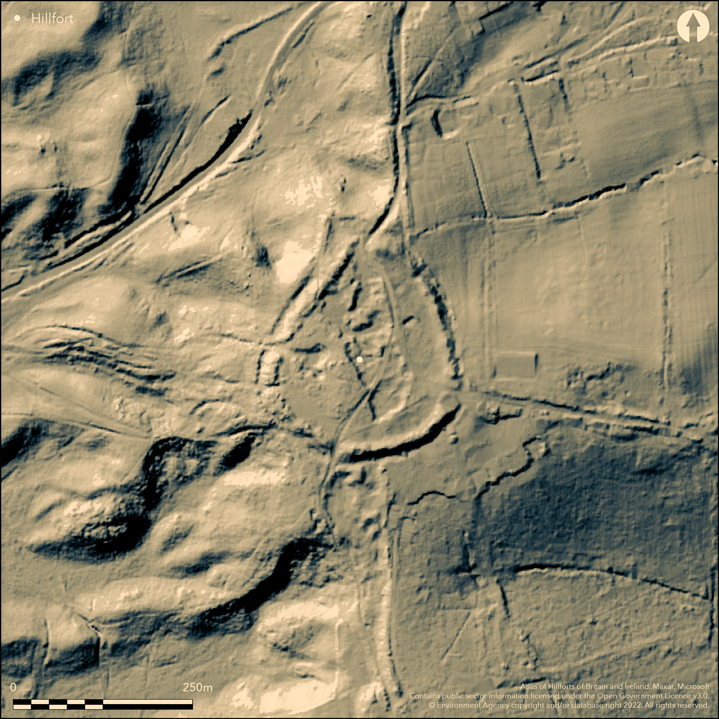
Univallate level terrain hillfort at N end of a short ridge above Ober Water to E and stream sources to SW and W. Overlooking Avon Valley in New Forest. Steep slopes to W, gentler on E. Roughly circular enclosing c. 2ha. Damaged by 19th century gravel digging, but generally well-preserved single rampart and ditch, with possible traces of counterscarp bank on W. Bank rises 0.6m-2m above interior and 2.5m-4.5m above the infilled ditch and counterscarp and W bank, following brow of escarpment, has lesser profile than on more easily accessible E and S sides. Ditch well-defined, except on part of W side, where obliterated and on NE where covered partly by hedge bank. Watching Brief (Kavannnnagh 1997) for water main through two gaps in bank and ditch found some detail. Gaps in banks produced by gravel working makes interpretation of any entrance difficult and N, S and E have been suggested, but little evidence. Unmetalled road (Castle Hill Lane) N-S through hillfort, branching to E for access to houses to SE of fort, possibly masks any entrance. Site overgrown with trees, furze and bracken, and marshy in places. On 1st Ed. OS map (1871-2).
Citizen Science: ✓
Reliability of Data: Confirmed
Reliability of Interpretation: Confirmed
X: -191383 Y: 6592071 (EPSG: 3857)
Longitude: -1.719222663849677 Latitude: 50.83450010008984 (EPSG:4326)
Country: England
Current County or Unitary Authority: Hampshire
Historic County: Hampshire and Isle of Wight
Current Parish/Community/Council/Townland: Burley
Damaged by 19th century gravel digging. Unmetalled road (Castle Hill Lane) N-S through hillfort, branching to E for access to houses to SE of fort. Between 1940-1958 10m of bank at E entrance levelled for electricity sub-station.
| Extant | ✓ |
| Cropmark | ✗ |
| Likely Destroyed | ✗ |
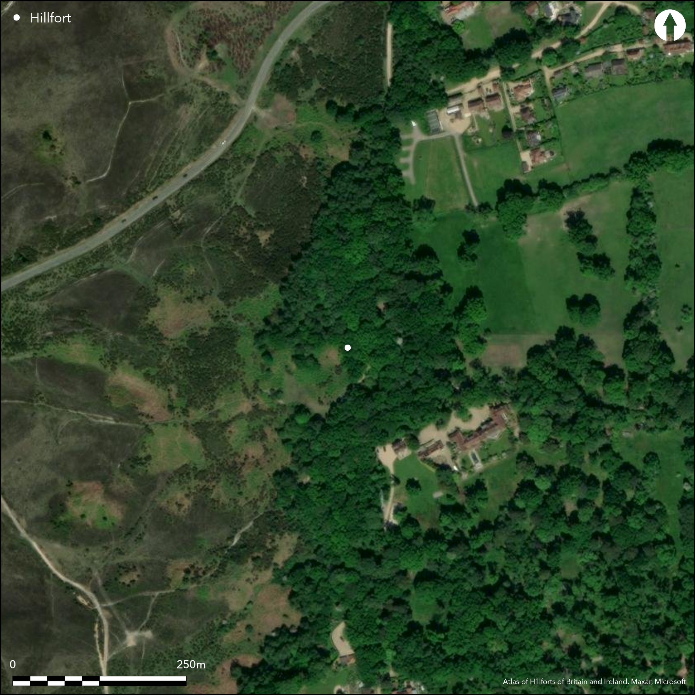
Overgrown with trees, furze and bracken, and marshy in places. Unmetalled road. Gravel diggings.
| Woodland | ✓ |
| Commercial Forestry Plantation | ✗ |
| Parkland | ✗ |
| Pasture (Grazing) | ✗ |
| Arable | ✗ |
| Scrub/Bracken | ✓ |
| Bare Outcrop | ✗ |
| Heather/Moorland | ✗ |
| Heath | ✗ |
| Built-up | ✗ |
| Coastal Grassland | ✗ |
| Other | ✓ |
Univallate level terrain hillfort at N end of a short ridge above Ober Water to E and stream sources to SW and W. Overlooking Avon Valley in New Forest. Steep slopes to W, gentler on E.
| Contour Fort | ✗ |
| Partial Contour Fort | ✗ |
| Promontory Fort | ✗ |
| Hillslope Fort | ✗ |
| Level Terrain Fort | ✓ |
| Marsh Fort | ✗ |
| Multiple Enclosure Fort | ✗ |
| Hilltop | ✗ |
| Coastal Promontory | ✗ |
| Inland Promontory | ✗ |
| Valley Bottom | ✗ |
| Knoll/Hillock/Outcrop | ✗ |
| Ridge | ✓ |
| Cliff/Plateau-edge/Scarp | ✗ |
| Hillslope | ✗ |
| Lowland | ✗ |
| Spur | ✗ |
Dominant Topographic Feature: Ridge
| North | ✗ |
| Northeast | ✗ |
| East | ✗ |
| Southeast | ✗ |
| South | ✗ |
| Southwest | ✗ |
| West | ✗ |
| Northwest | ✗ |
| Level | ✓ |
Altitude: 94.0m
N/A
None.
Reliability: D - None
| Pre 1200BC | ✗ |
| 1200BC - 800BC | ✗ |
| 800BC - 400BC | ✗ |
| 400BC - AD50 | ✗ |
| AD50 - AD400 | ✗ |
| AD400 - AD 800 | ✗ |
| Post AD800 | ✗ |
| Unknown | ✓ |
| Pre Hillfort: | None |
| Post Hillfort: | 19th century gravel digging. |
On 1st Ed. OS map (1871-2). Field investigator comments 1954, 1969, 1982. Watching Brief K. Kavanagh Southampton Archaeology 1997. New Forest NPA LiDar survey (Citizen Science).
| Other (1997): | Watching Brief K. Kavanagh Southampton Archaeology. |
| LiDAR Survey (2015): | New Forest NPA. |
| 1st Identified Map Depiction (None): | OS map. |
| Other (None): | Field investigator comments - no details. |
None.
Interior marshy in places - possible source?
| None | ✗ |
| Spring | ✗ |
| Stream | ✗ |
| Pool | ✗ |
| Flush | ✗ |
| Well | ✗ |
| Other | ✓ |
None
| No Known Features | ✓ |
| Round Stone Structures | ✗ |
| Rectangular Stone Structures | ✗ |
| Curvilinear Platforms | ✗ |
| Other Roundhouse Evidence | ✗ |
| Pits | ✗ |
| Quarry Hollows | ✗ |
| Other | ✗ |
None
| No Known Excavation | ✓ |
| Pits | ✗ |
| Postholes | ✗ |
| Roundhouses | ✗ |
| Rectangular Structures | ✗ |
| Roads/Tracks | ✗ |
| Quarry Hollows | ✗ |
| Other | ✗ |
| Nothing Found | ✗ |
None
| No Known Geophysics | ✓ |
| Pits | ✗ |
| Roundhouses | ✗ |
| Rectangular Structures | ✗ |
| Roads/Tracks | ✗ |
| Quarry Hollows | ✗ |
| Other | ✗ |
| Nothing Found | ✗ |
None
| No Known Finds | ✓ |
| Pottery | ✗ |
| Metal | ✗ |
| Metalworking | ✗ |
| Human Bones | ✗ |
| Animal Bones | ✗ |
| Lithics | ✗ |
| Environmental | ✗ |
| Other | ✗ |
None
| APs Not Checked | ✓ |
| None | ✗ |
| Roundhouses | ✗ |
| Rectangular Structures | ✗ |
| Pits | ✗ |
| Postholes | ✗ |
| Roads/Tracks | ✗ |
| Other | ✗ |
Not defined with any certainty. Gaps in banks produced by gravel working makes interpretation of any entrance near impossible and N , S and E have been suggested, but little evidence. Unmetalled road (Castle Hill Lane) N-S through hillfort, branching to E for access to houses to SE of fort, possibly masks any entrance, but conjecture.
| 0: | Numerous gaps. |
| 2: | Which gap may be site of entrance unclear. |
Guard Chambers: ✗
Chevaux de Frise: ✗
Damaged by 19th century gravel digging, but generally well-preserved single rampart and ditch, with possible traces of counterscarp bank on W. Bank rises 0.6m-2m above interior and 2.5m-4.5m above the infilled ditch and counterscarp and W bank, following brow of escarpment, has lesser profile than on more easily accessible E and S sides. Ditch well-defined, except on part of W side, where obliterated and on NE where covered partly by hedge bank. Watching Brief 1997 for water main through two gaps in bank and ditch found some detail.
| Area 1: | 2.0ha. |
| Total: | 2.0ha. |
Total Footprint Area: Noneha.
None
| ✗ | None |
| ✓ | None |
| NE Quadrant: | 1 |
| SE Quadrant: | 1 |
| SW Quadrant: | 1 |
| NW Quadrant: | 1 |
| Total: | 1 |
| Partial Univallate | ✗ |
| Univallate | ✓ |
| Partial Bivallate | ✗ |
| Bivallate | ✗ |
| Partial Multivallate | ✗ |
| Multivallate | ✗ |
| Unknown | ✗ |
| Partial Univallate | ✗ |
| Univallate | ✗ |
| Partial Bivallate | ✗ |
| Bivallate | ✗ |
| Partial Multivallate | ✗ |
| Multivallate | ✗ |
Possible traces of counterscarp bank on W.
| None | ✗ |
| Earthen Bank | ✓ |
| Stone Wall | ✗ |
| Rubble | ✗ |
| Wall-walk | ✗ |
| Evidence of Timber | ✗ |
| Vitrification | ✗ |
| Other Burning | ✗ |
| Palisade | ✗ |
| Counter Scarp Bank | ✓ |
| Berm | ✗ |
| Unfinished | ✗ |
| Other | ✗ |
Watching Brief 1997 for water main through two gaps in bank and ditch found some detail.
| None | ✗ |
| Earthen Bank | ✓ |
| Stone Wall | ✗ |
| Murus Duplex | ✗ |
| Timber-framed | ✗ |
| Timber-laced | ✗ |
| Vitrification | ✗ |
| Other Burning | ✗ |
| Palisade | ✗ |
| Counter Scarp Bank | ✗ |
| Berm | ✗ |
| Unfinished | ✗ |
| No Known Excavation | ✗ |
| Other | ✓ |
| ✗ | None |
| ✓ | Ditch well-defined, except on part of W side, where obliterated and on NE where covered partly by hedge bank. |
Number of Ditches: 1
| ✗ | None |
Kavanagh H. 1997. Report on the watching brief at Castle Camp, Burley, Hampshire: replacement of water main, Southampton Archaeology Report No 164.
Read, C. 2016. New Forest hillforts and smaller Iron Age enclosures, New Forest History and Archaeology Group, Report No 8, 28-39.
Sumner, Heywood 1917. Ancient Earthworks of the New Forest, Chiswick Press, 21-23.
Williams-Freeman, J.P. 1915. An introduction to field archaeology as illustrated by Hampshire, London: Macmillan and Co Ltd.
Atlas of Hillforts:
Wikidata:
This work is licensed under CC BY-SA 4.0![]()
![]()
![]() and should be cited as:
and should be cited as:
Lock, Gary and Ralston, Ian. 2024. Atlas of Hillforts of Britain and Ireland. Available at: https://hillforts.arch.ox.ac.uk
Document Version 1.1