LiDAR 1m DTM Hillshade
Satellite Imagery
LiDAR 1m DTM Hillshade
Satellite Imagery
Scroll left/right to view further images.
HER: North Yorkshire MNY12947 (None)
NMR: SE 76 NW 1 (59645)
SM: 1016347
NGR: SE 7361 6692
X: 473613 Y: 466920 (OSGB36)
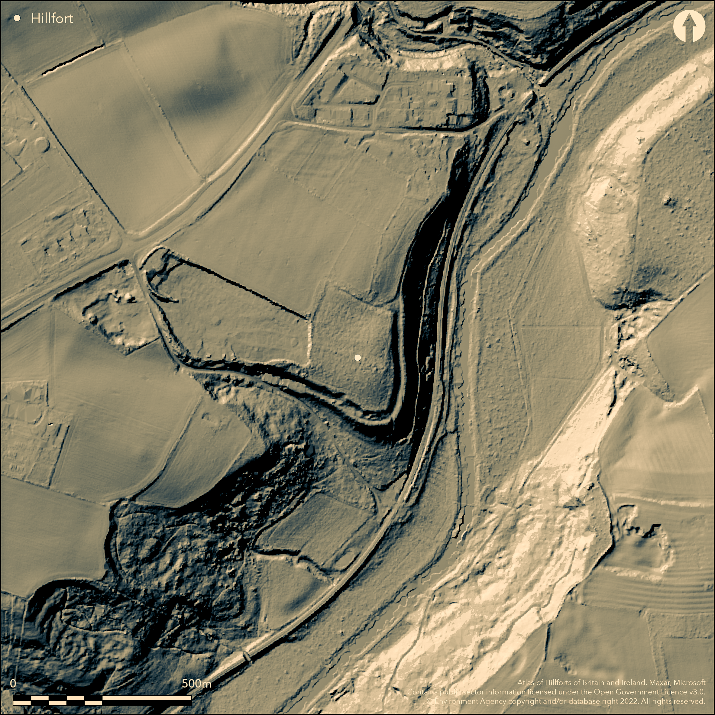
Lying within Ox Carr Wood on the west bank of the River Derwent, a univallate fort of 6.7ha on a promontory (possibly a promontory fort) (Oswald and Keenan unpublished). The site was first recorded on 1856 OS mapping and described as an intrenchment - a pre-Roman defensive earthwork. The discovery of large quantities of Roman pottery in nearby fields and the proximity to the Crambeck Roman pottery kilns led to the interpretation of the earthworks as Roman. The ditch of the earthworks in the S and E has been used for centuries as a trackway and the site is currently recorded as a Roman Camp and holloway (NMR No. SE76NW 1) and included in the scheduling Roman pottery kilns and associated features at Crambeck,. The description here as a hillfort is based on the recent survey and subsequent interpretations of Oswald and Keenan. The site comprises two sets of earthworks; one which follows the contours of the promontory in the S and E and a second which traverses the slopes to the N and W (described as 'cross-ridge' by the investigators) giving the enclosed area an approximately rectangular ground plan which reflects the natural topography. The earthworks are now partially levelled. The bank in the S and E averages 4.6m high and follows the contour below the crest of the slope. It defines the upper side of an infilled 5m wide ditch, beyond which is a bank or counterscarp which stands up to 0.6m high. A rubble core is visible where a recent track has cut through the counterscarp. Collectively the overall width is approximately 9m. In the N, the ditch terminates opposite the intersection with the 'cross-ridge' N-W earthworks, with the outer bank continuing for a further 25m. Both the ditch and bank have well-defined terminals. An excavation across a V-shaped ditch by Herman Ramm in 1964, although not accurately located, suggests a possible second earthwork set back from the escarpment. The 'cross-ridge' earthworks are represented by a broad ditch and a presumed bank on the S, which would have defended the gentler slopes of the promontory and in the W the level approach to the promontory. Within Ox Carr Wood, a 120m stretch of the defences survive in relatively good condition, with the average width of the ditch 6m wide and 0.4m deep and the bank approximately 10m wide and 0.2m high on its S side, turning abruptly at the intersection with the contour-following earthwork and running for 16m along the top of the major scarp. A possible counterscarp bank has also been observed. Where destroyed, the remainder of the earthworks have been recorded through magnetometry and on aerial photographs (Bartlett 1982). The interpretation by Oswald and Keenan is that these earthworks were designed to complement the ramparts that follow the contours except at one location where the counterscarp of the contour-following earthwork continues for some distance beyond its intersection with the 'cross-ridge' earthworks. The narrowness of the ditch would have produced a relatively small volume of soil with which to build a dump rampart and is inconsistent with the 10m wide bank leading the investigators to speculate that the construction was a timber box rampart. Possible entrances lie on the level approach at the western end and a second entrance facing NE towards the mouth of the valley of the Cram Beck. No internal features are recorded. Almost half of the site has been lost through quarrying with further areas disturbed by modern forestry operations and landscaping for 19th century estate workers' cottages. However the continuation of the defences in the N and W was confirmed by geophysical survey and partial excavation by the University of York.
Citizen Science: ✗
Reliability of Data: Unconfirmed
Reliability of Interpretation: Confirmed
X: -97512 Y: 7187776 (EPSG: 3857)
Longitude: -0.8759615499956207 Latitude: 54.09293020725118 (EPSG:4326)
Country: England; None
Current County or Unitary Authority: North Yorkshire
Historic County: Yorkshire
Current Parish/Community/Council/Townland: Welburn; Westow
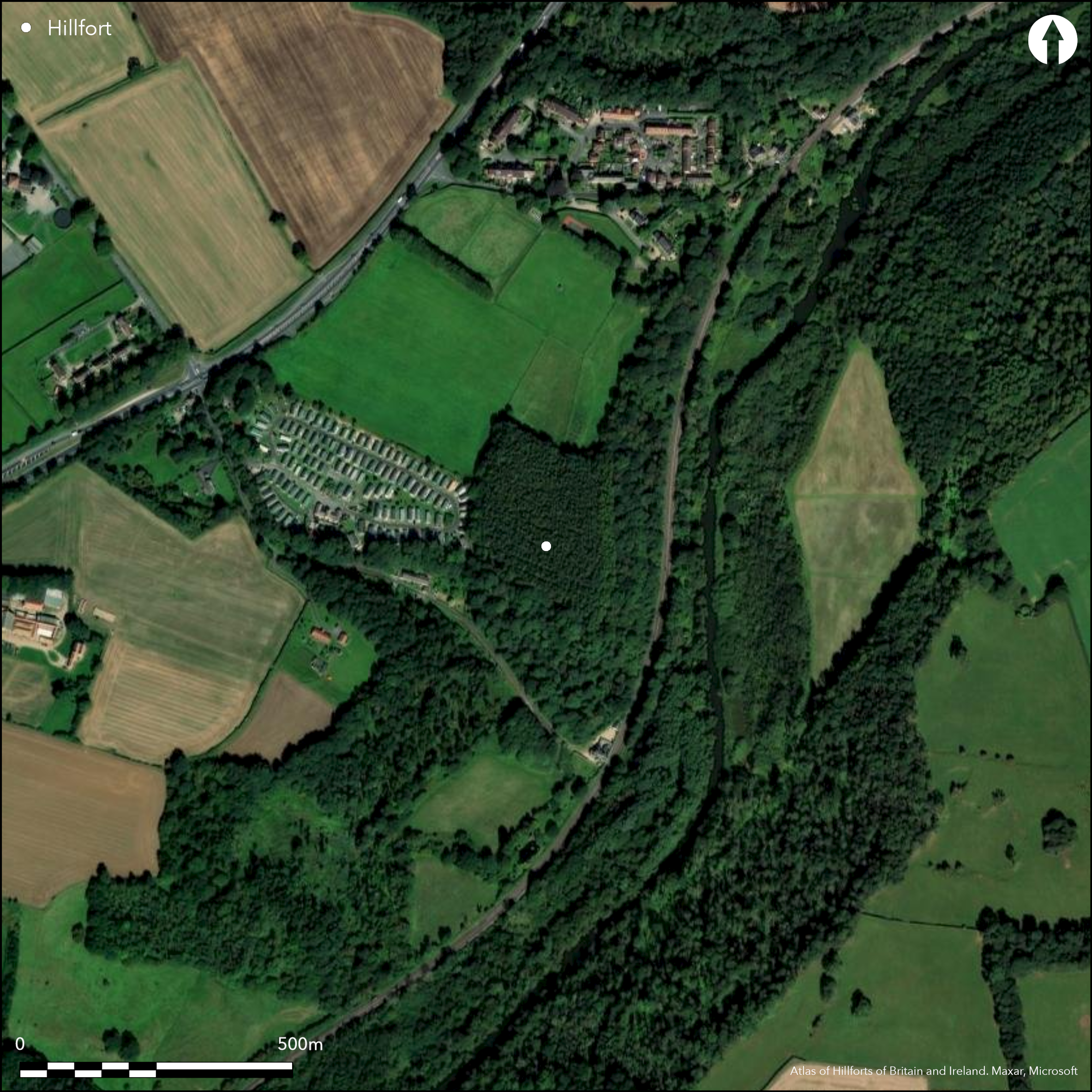
Almost half has been lost through quarrying, the remainder relatively well-preserved in woodland. Some landscaping of the bank and ditch for gardens associated with 19th century cottages
| Extant | ✓ |
| Cropmark | ✗ |
| Likely Destroyed | ✓ |
Coniferous plantation, previously occupied by ancient deciduous woodland and coppice
| Woodland | ✗ |
| Commercial Forestry Plantation | ✓ |
| Parkland | ✗ |
| Pasture (Grazing) | ✗ |
| Arable | ✗ |
| Scrub/Bracken | ✗ |
| Bare Outcrop | ✗ |
| Heather/Moorland | ✗ |
| Heath | ✗ |
| Built-up | ✗ |
| Coastal Grassland | ✗ |
| Other | ✗ |
A partial contour fort (possibly a promontory fort) occupying a steep-sided inland promontory at 50m OD
| Contour Fort | ✗ |
| Partial Contour Fort | ✓ |
| Promontory Fort | ✓ |
| Hillslope Fort | ✗ |
| Level Terrain Fort | ✗ |
| Marsh Fort | ✗ |
| Multiple Enclosure Fort | ✗ |
| Hilltop | ✓ |
| Coastal Promontory | ✗ |
| Inland Promontory | ✓ |
| Valley Bottom | ✗ |
| Knoll/Hillock/Outcrop | ✗ |
| Ridge | ✗ |
| Cliff/Plateau-edge/Scarp | ✗ |
| Hillslope | ✗ |
| Lowland | ✗ |
| Spur | ✗ |
Dominant Topographic Feature: Steep-sided inland promontory
| North | ✗ |
| Northeast | ✗ |
| East | ✗ |
| Southeast | ✓ |
| South | ✗ |
| Southwest | ✗ |
| West | ✗ |
| Northwest | ✗ |
| Level | ✗ |
Altitude: 50.0m
The River Derwent to the E forms the parish boundary between Welburn and Westow
Boundary Type: Parish/Townland
The site is undated
Reliability: D - None
| Pre 1200BC | ✗ |
| 1200BC - 800BC | ✗ |
| 800BC - 400BC | ✗ |
| 400BC - AD50 | ✗ |
| AD50 - AD400 | ✗ |
| AD400 - AD 800 | ✗ |
| Post AD800 | ✗ |
| Unknown | ✓ |
| Pre Hillfort: | None |
| Post Hillfort: | Roman pottery kilns |
Recorded on 1850 OS mapping. Described in VCH (1912) as a Roman earthwork. Excavation of ditch in 1964, Magnetometry survey in 1982. Excavation by York University. Earthwork Survey 1966; Earthwork survey in 2014 at 1:1,000 scale and the interior where accessible, at 1:2,500. Field investigation 1971. Scheduled 1997
| 1st Identified Map Depiction (1912): | None |
| 1st Identified Written Reference (1912): | None |
| Excavation (1964): | None |
| Earthwork Survey (1966): | None |
| Other (1971): | Field investigation |
| Geophysical Survey (1982): | None |
| Other (1997): | Scheduled |
| Earthwork Survey (2014): | Oswald and Keenan 2017 |
No internal features contemporary with an Iron Age enclosure are recorded.
River Derwent lies to the E
| None | ✓ |
| Spring | ✗ |
| Stream | ✗ |
| Pool | ✗ |
| Flush | ✗ |
| Well | ✗ |
| Other | ✗ |
None
| No Known Features | ✓ |
| Round Stone Structures | ✗ |
| Rectangular Stone Structures | ✗ |
| Curvilinear Platforms | ✗ |
| Other Roundhouse Evidence | ✗ |
| Pits | ✗ |
| Quarry Hollows | ✗ |
| Other | ✗ |
None
| No Known Excavation | ✓ |
| Pits | ✗ |
| Postholes | ✗ |
| Roundhouses | ✗ |
| Rectangular Structures | ✗ |
| Roads/Tracks | ✗ |
| Quarry Hollows | ✗ |
| Other | ✗ |
| Nothing Found | ✗ |
Ramparts only
| No Known Geophysics | ✓ |
| Pits | ✗ |
| Roundhouses | ✗ |
| Rectangular Structures | ✗ |
| Roads/Tracks | ✗ |
| Quarry Hollows | ✗ |
| Other | ✗ |
| Nothing Found | ✗ |
Roman pottery
| No Known Finds | ✓ |
| Pottery | ✓ |
| Metal | ✗ |
| Metalworking | ✗ |
| Human Bones | ✓ |
| Animal Bones | ✗ |
| Lithics | ✗ |
| Environmental | ✗ |
| Other | ✗ |
None
| APs Not Checked | ✓ |
| None | ✗ |
| Roundhouses | ✗ |
| Rectangular Structures | ✗ |
| Pits | ✗ |
| Postholes | ✗ |
| Roads/Tracks | ✗ |
| Other | ✗ |
Possible entrances lie on the level approach at the western end and a second entrance facing NE towards the mouth of the valley of the Cram Beck.
| None: | Unknown, two entrances are speculated |
| 2: | None |
Guard Chambers: ✗
Chevaux de Frise: ✗
Comprises two separate earthworks - a 'cross-ridge' bank, ditch and counterscarp running N-W and contour following earthworks of a bank, ditch and counterscarp below the crest of the slope
| Area 1: | 6.7ha. |
| Total: | 6.7ha. |
Total Footprint Area: Noneha.
None
| ✗ | None |
| ✓ | None |
| NE Quadrant: | 1 |
| SE Quadrant: | 1 |
| SW Quadrant: | 1 |
| NW Quadrant: | 1 |
| Total: | 1 |
| Partial Univallate | ✗ |
| Univallate | ✓ |
| Partial Bivallate | ✗ |
| Bivallate | ✗ |
| Partial Multivallate | ✗ |
| Multivallate | ✗ |
| Unknown | ✗ |
| Partial Univallate | ✗ |
| Univallate | ✗ |
| Partial Bivallate | ✗ |
| Bivallate | ✗ |
| Partial Multivallate | ✗ |
| Multivallate | ✗ |
None
| None | ✗ |
| Earthen Bank | ✓ |
| Stone Wall | ✗ |
| Rubble | ✗ |
| Wall-walk | ✗ |
| Evidence of Timber | ✗ |
| Vitrification | ✗ |
| Other Burning | ✗ |
| Palisade | ✗ |
| Counter Scarp Bank | ✓ |
| Berm | ✗ |
| Unfinished | ✗ |
| Other | ✗ |
None
| None | ✗ |
| Earthen Bank | ✗ |
| Stone Wall | ✗ |
| Murus Duplex | ✗ |
| Timber-framed | ✗ |
| Timber-laced | ✗ |
| Vitrification | ✗ |
| Other Burning | ✗ |
| Palisade | ✗ |
| Counter Scarp Bank | ✗ |
| Berm | ✗ |
| Unfinished | ✗ |
| No Known Excavation | ✓ |
| Other | ✗ |
| ✗ | None |
| ✓ | None |
Number of Ditches: 1
| ✗ | None |
Armitage, E. S. and Montgomerie, D. H. 1912. Ancient Earthworks. In W. Page (ed) The Victoria History of the Counties of England. A History of Yorkshire. Volume 2, 1- 71. London: Constable & Co.
Bartlett, A. 1982. Geophysics: Crambeck (AML Rep No 3614) Ancient Monuments Laboratory reports
Hayes, R.H. 1966. Draft Report only (no details).
Oswald, A and Keenan, E. Earthwork survey of the prehistoric promontory fort in Ox Carr Wood. Unpublished
Atlas of Hillforts:
Wikidata:
This work is licensed under CC BY-SA 4.0![]()
![]()
![]() and should be cited as:
and should be cited as:
Lock, Gary and Ralston, Ian. 2024. Atlas of Hillforts of Britain and Ireland. Available at: https://hillforts.arch.ox.ac.uk
Document Version 1.1