LiDAR 1m DTM Hillshade
Satellite Imagery
LiDAR 1m DTM Hillshade
Satellite Imagery
Scroll left/right to view further images.
HER: Dumfries & Galloway MDG3247 (None)
NMR: NX 55 NE 2 (63641)
SM: 1100
NGR: NX 5889 5601
X: 258890 Y: 556010 (OSGB36)
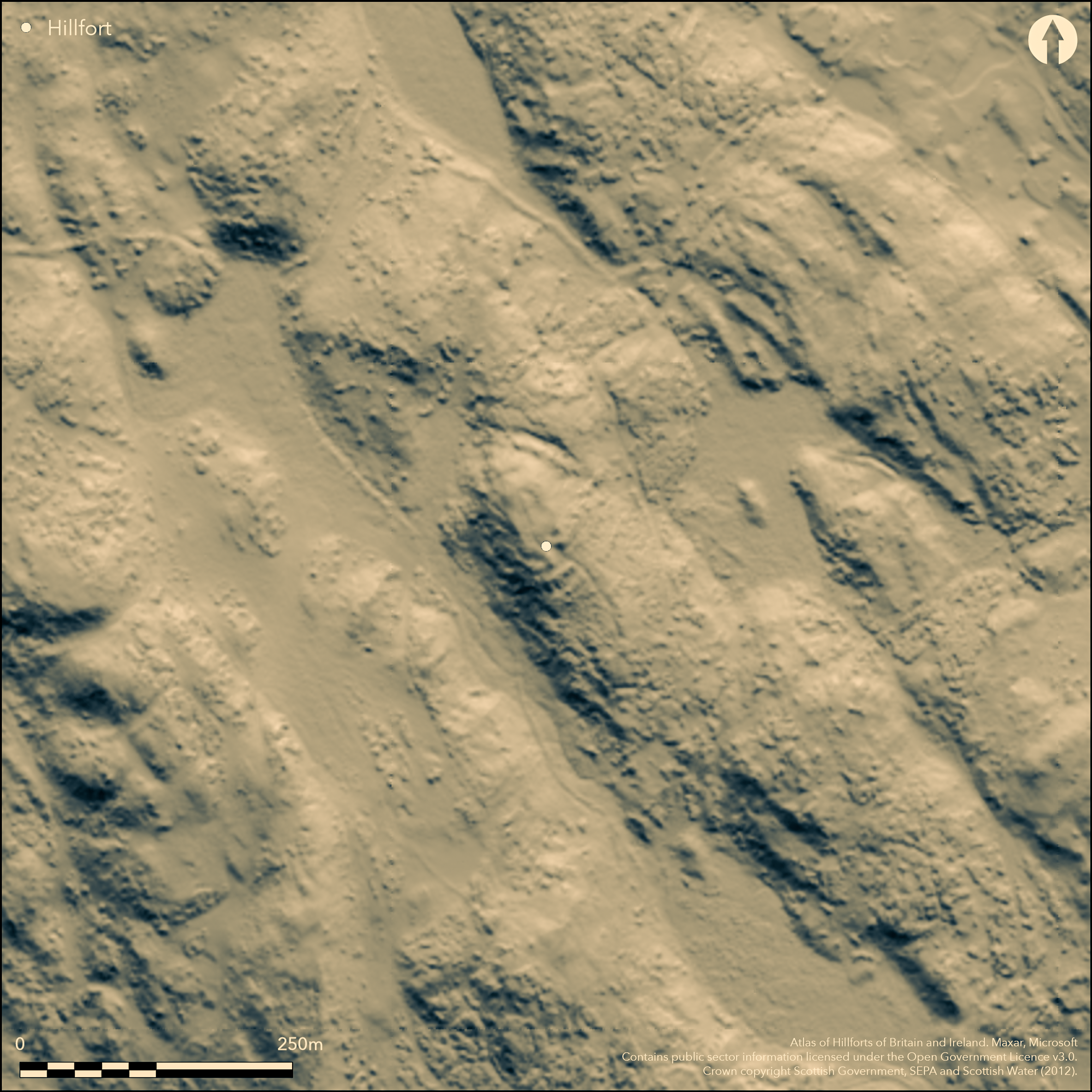
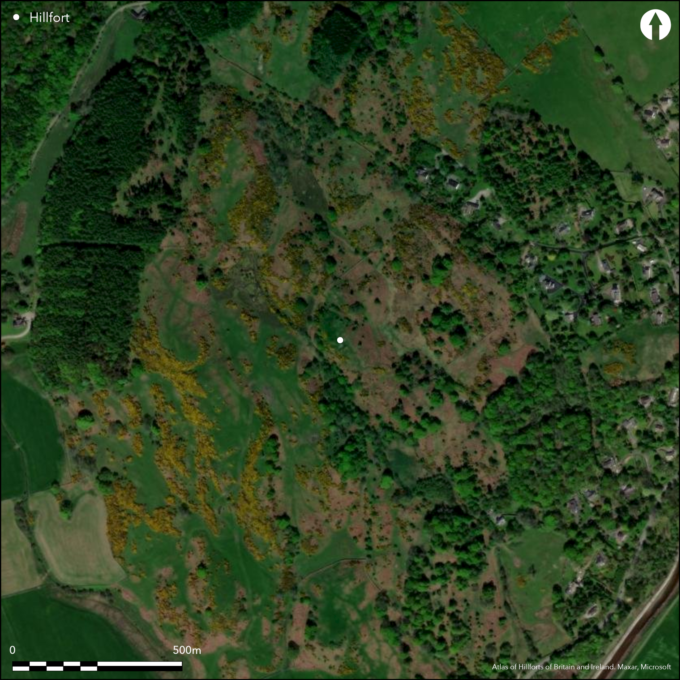
Occupying the craggiest knoll in the Boreland Hills, this small fort has been excavated twice, first in 1960 (Thomas 1961) and more recently in 2012 (https://gallowaypicts.com/wordpress/). It is roughly oval on plan and its innermost enclosure crowns the very summit of the knoll, enclosing an area measuring no more than 25m from N to S by 15m transversely (0.03ha). This innermost wall has been heavily robbed, but it was timber-laced and at least 5m in thickness, around the E forming a massive scree of rubble spilling down the flanks of the knoll; pieces of vitrified stone can be found amongst the rubble. The entrance is on the S, and gives the appearance of a ramp dropping obliquely down the slope past the well-known early medieval carvings cut into the living rock on the W, and the structure enclosing a rock-cut basin on the E. Short lengths of several outer ramparts can also be seen on the spine of the knoll on the N and SSE, essentially enhancing minor topographical features. On the SSE these comprise: a stony bank that now forms the leading edge of a platform cut into the slope above the carvings on the W side of the entrance; below which another stony scarp extends along the edge of a natural terrace; at the foot of which a ditch has been cut into the living rock and is flanked externally by a bank of upcast. On the N, about 9m beyond the inner wall, a stony scarp extends along the top of a steep slope dropping down to a terrace behind a thick stony rampart, which Thomas demonstrated was faced externally (1960) and is fronted by a rock-cut ditch some 5m in breadth. There is no visible evidence that any of the outworks at either end were linked to form continuous barriers. While one of the radiocarbon dates from the most recent excavations falls in the middle of the first millennium BC, The timber-laced wall is securely dated to the early medieval period, correlating with an extensive assemblage of imported goods and metalworking debris from the interior.
Citizen Science: ✗
Reliability of Data: Confirmed
Reliability of Interpretation: Confirmed
X: -467653 Y: 7338398 (EPSG: 3857)
Longitude: -4.20099677215068 Latitude: 54.87889983080562 (EPSG:4326)
Country: Scotland
Current County or Unitary Authority: Dumfries & Galloway
Historic County: Kirkcudbrightshire
Current Parish/Community/Council/Townland: Anwoth
None
| Extant | ✓ |
| Cropmark | ✗ |
| Likely Destroyed | ✗ |
None
| Woodland | ✗ |
| Commercial Forestry Plantation | ✗ |
| Parkland | ✗ |
| Pasture (Grazing) | ✓ |
| Arable | ✗ |
| Scrub/Bracken | ✓ |
| Bare Outcrop | ✗ |
| Heather/Moorland | ✗ |
| Heath | ✗ |
| Built-up | ✗ |
| Coastal Grassland | ✗ |
| Other | ✗ |
None
| Contour Fort | ✓ |
| Partial Contour Fort | ✗ |
| Promontory Fort | ✗ |
| Hillslope Fort | ✗ |
| Level Terrain Fort | ✗ |
| Marsh Fort | ✗ |
| Multiple Enclosure Fort | ✗ |
| Hilltop | ✗ |
| Coastal Promontory | ✗ |
| Inland Promontory | ✗ |
| Valley Bottom | ✗ |
| Knoll/Hillock/Outcrop | ✓ |
| Ridge | ✗ |
| Cliff/Plateau-edge/Scarp | ✗ |
| Hillslope | ✗ |
| Lowland | ✗ |
| Spur | ✗ |
Dominant Topographic Feature: None
| North | ✗ |
| Northeast | ✗ |
| East | ✗ |
| Southeast | ✗ |
| South | ✗ |
| Southwest | ✗ |
| West | ✗ |
| Northwest | ✗ |
| Level | ✓ |
Altitude: 60.0m
N/A
Nine radiocarbon dates with an extensive assemblage of finds including pottery and metalworking.Horn (Forthcoming) suggests hillfort start AD475-560, end 560-630, span 1-140 years. The project final report (Toolis & Bowles 2017 esp. Ch 3) states that the fortified summit was occupied between AD 475-560 and AD 560-630, with the datable artefacts intimating a compressed time spac c. 600 AD. Earlier radiocarbon determinations are believed to be residual from an iron age use of undefined character.
Reliability: A - High
| Pre 1200BC | ✗ |
| 1200BC - 800BC | ✗ |
| 800BC - 400BC | ✗ |
| 400BC - AD50 | ✓ |
| AD50 - AD400 | ✗ |
| AD400 - AD 800 | ✓ |
| Post AD800 | ✗ |
| Unknown | ✗ |
| Pre Hillfort: | None |
| Post Hillfort: | None |
| Artefactual: | None |
| C14: | None |
First depicted in 1850 on the 1st edition OS 6-inch map (Kirkcudbrightshire 1854, sheet 43), the early medieval carved symbols were brought to the attention of John Stuart (1856, 31, pl 97). Surveyed by Frederick Coles about 1892 (Coles 1893, 171-4), the fort was also described in the County Inventory for Kirkcudbrightshire (RCAHMS 1914, 14-16, Nos 13-14). Revisited by RCAHMS in 1951 and 1990, and resurveyed at 1:2500 by the OS in 1970. Excavations carried out by Charles Thomas in 1960, and in 2012 by Ronan Toolis and Chris Bowles. Prior to the most recent excavations it was surveyed again by RCAHMS.
| 1st Identified Map Depiction (1850): | Annotated Fort on the 1st edition OS 6-inch map (Kirkcudbrightshire 1854, sheet 43) |
| Other (1856): | Carved stones published by John Stuart (1856, 31, pl 97) |
| Earthwork Survey (1892): | Sketch plan and description (Coles 1893, 171-4) |
| Other (1911): | Description (RCAHMS 1914, 14-16, Nos 13-14) |
| Other (1937): | Scheduled |
| Other (1951): | Description during RCAHMS Survey of Marginal Lands |
| Excavation (1960): | Thomas 1960 |
| Other (1970): | Resurveyed at 1:2500 by the OS |
| Other (1990): | Description by RCAHMS |
| Earthwork Survey (2012): | 1:500 (RCAHMS DC49459; SC1309006 & SC1292331) |
| Excavation (2012): | Galloway Picts Project. http//gallowaypicts.com (Toolis and Bowles 2013) |
| Other (2014): | Visited by Hillfort Study Group |
Rock-cut basin within structure immediately outside the inner entrance, but within the outer defences
None
| None | ✗ |
| Spring | ✗ |
| Stream | ✗ |
| Pool | ✗ |
| Flush | ✗ |
| Well | ✓ |
| Other | ✗ |
None
| No Known Features | ✓ |
| Round Stone Structures | ✗ |
| Rectangular Stone Structures | ✗ |
| Curvilinear Platforms | ✗ |
| Other Roundhouse Evidence | ✗ |
| Pits | ✗ |
| Quarry Hollows | ✗ |
| Other | ✗ |
None
| No Known Excavation | ✗ |
| Pits | ✗ |
| Postholes | ✓ |
| Roundhouses | ✗ |
| Rectangular Structures | ✗ |
| Roads/Tracks | ✗ |
| Quarry Hollows | ✗ |
| Other | ✗ |
| Nothing Found | ✗ |
None
| No Known Geophysics | ✓ |
| Pits | ✗ |
| Roundhouses | ✗ |
| Rectangular Structures | ✗ |
| Roads/Tracks | ✗ |
| Quarry Hollows | ✗ |
| Other | ✗ |
| Nothing Found | ✗ |
None
| No Known Finds | ✗ |
| Pottery | ✓ |
| Metal | ✓ |
| Metalworking | ✓ |
| Human Bones | ✗ |
| Animal Bones | ✓ |
| Lithics | ✗ |
| Environmental | ✗ |
| Other | ✗ |
None
| APs Not Checked | ✗ |
| None | ✓ |
| Roundhouses | ✗ |
| Rectangular Structures | ✗ |
| Pits | ✗ |
| Postholes | ✗ |
| Roads/Tracks | ✗ |
| Other | ✗ |
See main summary
| 1: | None |
| 2: | None |
Guard Chambers: ✗
Chevaux de Frise: ✗
| 1. Simple Gap (South): | None |
Complete inner circuit of timberlaced wall, with limited sectors of outer ramparts and ditches
| Area 1: | 0.03ha. |
| Total: | 0.03ha. |
Total Footprint Area: 0.28ha.
None
| ✗ | None |
| ✗ | None |
| NE Quadrant: | 3 |
| SE Quadrant: | 3 |
| SW Quadrant: | 1 |
| NW Quadrant: | 1 |
| Total: | 3 |
| Partial Univallate | ✓ |
| Univallate | ✗ |
| Partial Bivallate | ✗ |
| Bivallate | ✗ |
| Partial Multivallate | ✓ |
| Multivallate | ✗ |
| Unknown | ✗ |
| Partial Univallate | ✗ |
| Univallate | ✗ |
| Partial Bivallate | ✗ |
| Bivallate | ✗ |
| Partial Multivallate | ✗ |
| Multivallate | ✗ |
None
| None | ✗ |
| Earthen Bank | ✗ |
| Stone Wall | ✗ |
| Rubble | ✗ |
| Wall-walk | ✗ |
| Evidence of Timber | ✗ |
| Vitrification | ✓ |
| Other Burning | ✗ |
| Palisade | ✗ |
| Counter Scarp Bank | ✗ |
| Berm | ✗ |
| Unfinished | ✗ |
| Other | ✗ |
None
| None | ✗ |
| Earthen Bank | ✗ |
| Stone Wall | ✓ |
| Murus Duplex | ✗ |
| Timber-framed | ✗ |
| Timber-laced | ✓ |
| Vitrification | ✓ |
| Other Burning | ✗ |
| Palisade | ✗ |
| Counter Scarp Bank | ✗ |
| Berm | ✗ |
| Unfinished | ✗ |
| No Known Excavation | ✗ |
| Other | ✗ |
| ✗ | None |
| ✓ | Two lengths at opposite ends |
Number of Ditches: 1
| ✗ | None |
Coles, F R (1893) 'The motes, forts, and doons in the east and west divisions of the Stewartry of Kirkcudbright', Proc Soc Antiq Scot 27, 92-182.
Feachem, R W (1977) Guide to prehistoric Scotland, London (p 131)
Galloway Picts Project https://gallowaypicts.com/wordpress/
Horn, J. Forthcoming. The dating of hillforts in Britain and Ireland. Unpublished PhD thesis, University of Edinburgh.
RCAHMS (1914) The Royal Commission on the Ancient and Historical Monuments and Constructions of Scotland. Fifth report and inventory of monuments and constructions in Galloway, II, county of the Stewartry of Kirkcudbright, Edinburgh
Stuart, J (1856) Sculptured stones of Scotland, vol.1. Aberdeen
Thomas, C (1960) 'Excavations at Trust's Hill, Anwoth, Kirkcudbright, 1960'. Trans Dumfriesshire Galloway Natur Hist Antiq Soc, 3 ser, 38 (1959-60), 58-70
Toolis, R and Bowles, C (2013) 'Excavations at Trusty's Hill, 2012'. Trans Dumfriesshire Galloway Natur Hist Antiq Soc, 3 ser, 87 (2012-13), 27-50
Toolis, R & Bowles, C (2017) The lost Dark Age kingdom of Rheged. The discovery of a royal stronghold at Trusty's Hill, Galloway. Oxford: Oxbow.
Atlas of Hillforts:
Wikidata:
This work is licensed under CC BY-SA 4.0![]()
![]()
![]() and should be cited as:
and should be cited as:
Lock, Gary and Ralston, Ian. 2024. Atlas of Hillforts of Britain and Ireland. Available at: https://hillforts.arch.ox.ac.uk
Document Version 1.1