LiDAR 1m DTM Hillshade
Satellite Imagery
LiDAR 1m DTM Hillshade
Satellite Imagery
Scroll left/right to view further images.
HER: Dumfries & Galloway MDG3776 (None)
NMR: NX 66 SE 5 (64185)
SM: 1119
NGR: NX 6733 6307
X: 267330 Y: 563070 (OSGB36)
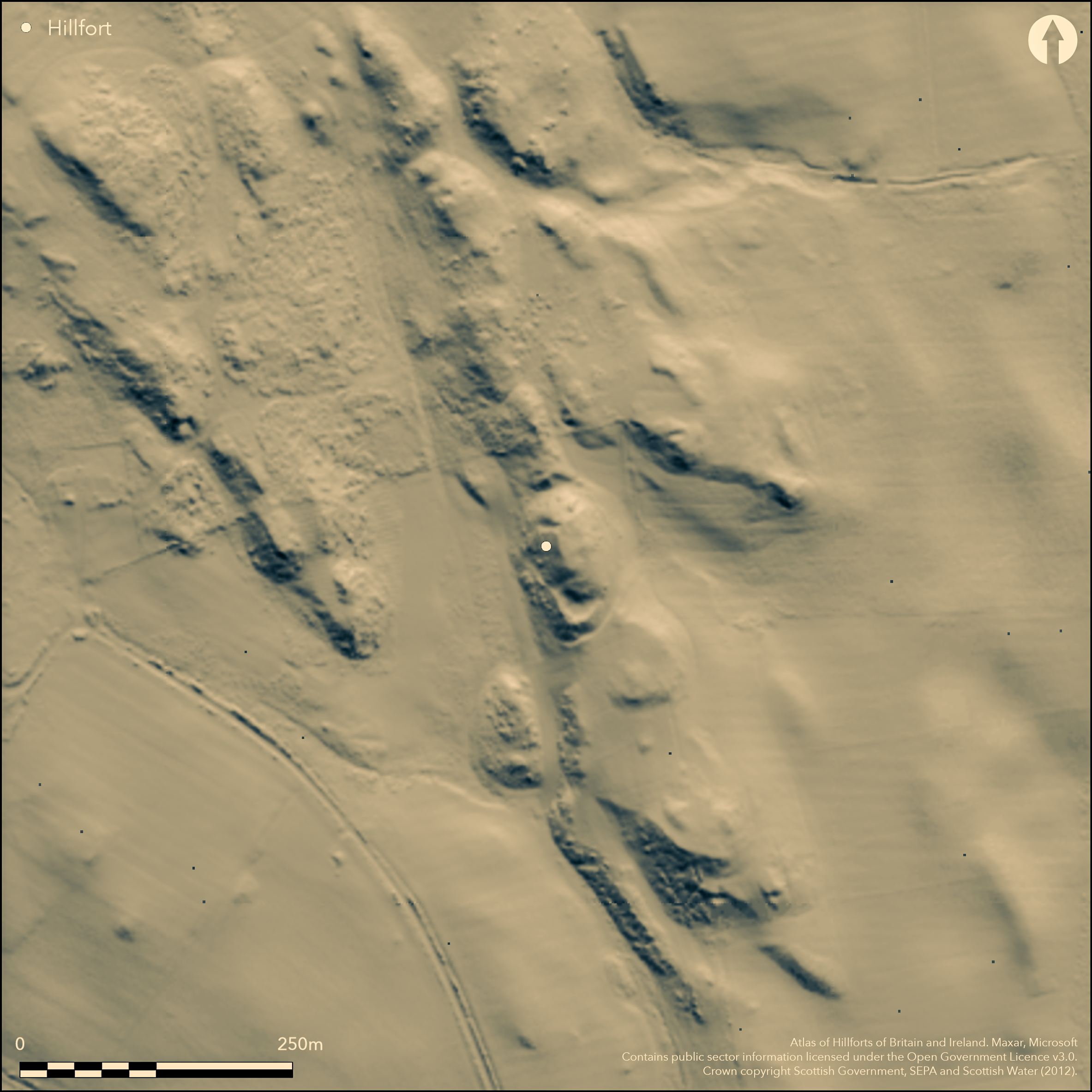
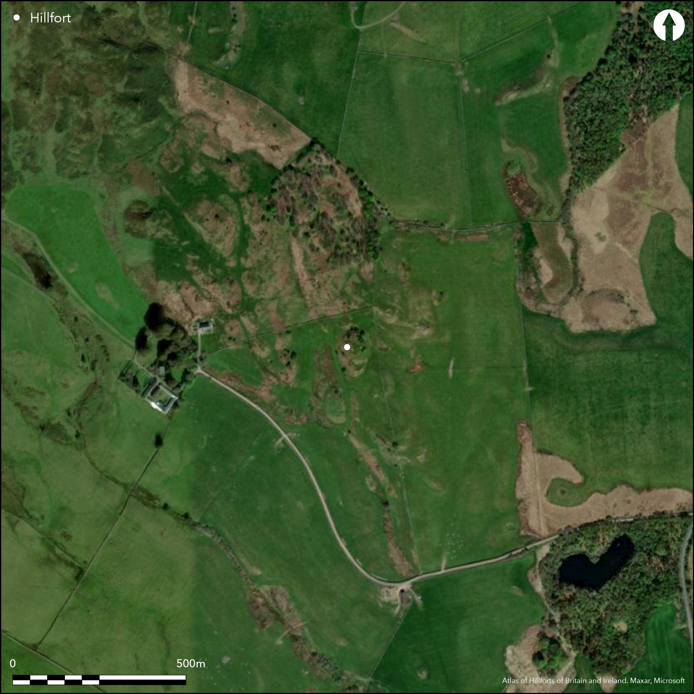
This small fortification occupies a steep-sided hillock on a low ridge, comprising a small enclosure on the summit with outworks on the N and S, the latter apparently forming a subsidiary enclosure or annexe on the flank of the knoll. Oval on plan, the innermost enclosure measures about 22m from N to S by little more than 13m transversely (0.02ha) within a mutilated stone wall; the entrance may have been in the southern end, served by a trackway that can be seen climbing the W flank of the hillock. At the foot of the hillock on the N a ditch some 4.8m in breadth by 3m in depth cuts through the spine of the ridge, while a similar feature is cut some 1.2m deep below the external ground surface on the S. Here, however, there seems to be a rampart on the slope above, forming the leading edge of what may be a partly quarried terrace about 10m below the level of the summit and up to 3.5m above the bottom of the ditch; the terrace measures about 16m from E to W by 8.5m transversely, and while its eastern end fades onto a terrace that a later OS investigator considered to be natural near the foot of the E flank of the hillock, its western end is formed by a wall of living rock. In 1911 RCAHMS investigators found several pieces of vitrified stone amongst tumbled stones towards the foot of the hillock on the E.
Citizen Science: ✗
Reliability of Data: Confirmed
Reliability of Interpretation: Confirmed
X: -453382 Y: 7351124 (EPSG: 3857)
Longitude: -4.072798434210919 Latitude: 54.944614310881875 (EPSG:4326)
Country: Scotland
Current County or Unitary Authority: Dumfries & Galloway
Historic County: Kirkcudbrightshire
Current Parish/Community/Council/Townland: Balmaghie
None
| Extant | ✓ |
| Cropmark | ✗ |
| Likely Destroyed | ✗ |
None
| Woodland | ✗ |
| Commercial Forestry Plantation | ✗ |
| Parkland | ✗ |
| Pasture (Grazing) | ✓ |
| Arable | ✗ |
| Scrub/Bracken | ✗ |
| Bare Outcrop | ✗ |
| Heather/Moorland | ✗ |
| Heath | ✗ |
| Built-up | ✗ |
| Coastal Grassland | ✗ |
| Other | ✗ |
None
| Contour Fort | ✓ |
| Partial Contour Fort | ✗ |
| Promontory Fort | ✗ |
| Hillslope Fort | ✗ |
| Level Terrain Fort | ✗ |
| Marsh Fort | ✗ |
| Multiple Enclosure Fort | ✗ |
| Hilltop | ✗ |
| Coastal Promontory | ✗ |
| Inland Promontory | ✗ |
| Valley Bottom | ✗ |
| Knoll/Hillock/Outcrop | ✓ |
| Ridge | ✗ |
| Cliff/Plateau-edge/Scarp | ✗ |
| Hillslope | ✗ |
| Lowland | ✗ |
| Spur | ✗ |
Dominant Topographic Feature: None
| North | ✗ |
| Northeast | ✗ |
| East | ✗ |
| Southeast | ✗ |
| South | ✗ |
| Southwest | ✗ |
| West | ✗ |
| Northwest | ✗ |
| Level | ✓ |
Altitude: 105.0m
N/A
While undated, comparisons have been made to the early medieval fort on Trusty's Hill (Feachem 1963, 130)
Reliability: D - None
| Pre 1200BC | ✗ |
| 1200BC - 800BC | ✗ |
| 800BC - 400BC | ✗ |
| 400BC - AD50 | ✗ |
| AD50 - AD400 | ✗ |
| AD400 - AD 800 | ✗ |
| Post AD800 | ✗ |
| Unknown | ✓ |
| Pre Hillfort: | None |
| Post Hillfort: | None |
| Morphology/Earthwork/Typology: | None |
First depicted in 1848-9 in the 1st edition OS 6-inch map (Kirkcudbrightshire 1852, sheet 38), it was sketch-planned and described by Frederick Coles about 1892 (1893,159- 61, fig 55) and was subsequently visited in 1911 by RCAHMS in preparation of the County Inventory for The Stewartry (RCAHMS 1914,35-7, no.45). It was re-surveyed by the OS at 1:2500 in 1968.
| 1st Identified Map Depiction (1849): | Named Moat in Gothic type on the 1st edition OS 6-inch map (Kirkcudbrightshire 1852, sheet 38) |
| Earthwork Survey (1892): | Sketch-plan and description (Coles 1893,159- 61, fig 55) |
| Other (1911): | Description (RCAHMS 1914,35-7, no.45) |
| Other (1962): | Scheduled |
| Other (1968): | Resurveyed at 1:2500 by the OS |
Featureless
None
| None | ✓ |
| Spring | ✗ |
| Stream | ✗ |
| Pool | ✗ |
| Flush | ✗ |
| Well | ✗ |
| Other | ✗ |
None
| No Known Features | ✓ |
| Round Stone Structures | ✗ |
| Rectangular Stone Structures | ✗ |
| Curvilinear Platforms | ✗ |
| Other Roundhouse Evidence | ✗ |
| Pits | ✗ |
| Quarry Hollows | ✗ |
| Other | ✗ |
None
| No Known Excavation | ✓ |
| Pits | ✗ |
| Postholes | ✗ |
| Roundhouses | ✗ |
| Rectangular Structures | ✗ |
| Roads/Tracks | ✗ |
| Quarry Hollows | ✗ |
| Other | ✗ |
| Nothing Found | ✗ |
None
| No Known Geophysics | ✓ |
| Pits | ✗ |
| Roundhouses | ✗ |
| Rectangular Structures | ✗ |
| Roads/Tracks | ✗ |
| Quarry Hollows | ✗ |
| Other | ✗ |
| Nothing Found | ✗ |
None
| No Known Finds | ✓ |
| Pottery | ✗ |
| Metal | ✗ |
| Metalworking | ✗ |
| Human Bones | ✗ |
| Animal Bones | ✗ |
| Lithics | ✗ |
| Environmental | ✗ |
| Other | ✗ |
None
| APs Not Checked | ✗ |
| None | ✓ |
| Roundhouses | ✗ |
| Rectangular Structures | ✗ |
| Pits | ✗ |
| Postholes | ✗ |
| Roads/Tracks | ✗ |
| Other | ✗ |
See main summary
| 0: | None |
| 2: | No entrances visible, but a trackway was observed by RCAHMS in 1911 climbing the W flank of the knoll probably to serve an entrance at the S end of the summit enclosure. |
Guard Chambers: ✗
Chevaux de Frise: ✗
A small enclosure crowning the summit of the hillock, with several outworks to the NE and SW
| Area 1: | 0.1ha. |
| Total: | 0.1ha. |
Total Footprint Area: 0.4ha.
None
| ✗ | None |
| ✓ | None |
| NE Quadrant: | 2 |
| SE Quadrant: | 2 |
| SW Quadrant: | 2 |
| NW Quadrant: | 1 |
| Total: | 2 |
| Partial Univallate | ✓ |
| Univallate | ✗ |
| Partial Bivallate | ✓ |
| Bivallate | ✗ |
| Partial Multivallate | ✗ |
| Multivallate | ✗ |
| Unknown | ✗ |
| Partial Univallate | ✗ |
| Univallate | ✗ |
| Partial Bivallate | ✗ |
| Bivallate | ✗ |
| Partial Multivallate | ✗ |
| Multivallate | ✗ |
Loose vitrifaction observed in 1911
| None | ✗ |
| Earthen Bank | ✗ |
| Stone Wall | ✗ |
| Rubble | ✓ |
| Wall-walk | ✗ |
| Evidence of Timber | ✗ |
| Vitrification | ✓ |
| Other Burning | ✗ |
| Palisade | ✗ |
| Counter Scarp Bank | ✗ |
| Berm | ✗ |
| Unfinished | ✗ |
| Other | ✗ |
None
| None | ✗ |
| Earthen Bank | ✗ |
| Stone Wall | ✗ |
| Murus Duplex | ✗ |
| Timber-framed | ✗ |
| Timber-laced | ✗ |
| Vitrification | ✗ |
| Other Burning | ✗ |
| Palisade | ✗ |
| Counter Scarp Bank | ✗ |
| Berm | ✗ |
| Unfinished | ✗ |
| No Known Excavation | ✓ |
| Other | ✗ |
| ✗ | None |
| ✓ | None |
Number of Ditches: 1
| ✓ | The outwork on the S seems to form a small subsidiary annexe to the summit enclosure, though there is no evidence of any access between them. |
Coles, F R (1893) 'The motes, forts, and doons in the east and west divisions of the Stewartry of Kirkcudbright', Proc Soc Antiq Scot 27, 92-182
Feachem, R (1963) A guide to prehistoric Scotland, London (p 130)
Feachem, R (1965) The North Britons: the prehistory of a Border people, London
RCAHMS (1914) The Royal Commission on the Ancient and Historical Monuments and Constructions of Scotland. Fifth report and inventory of monuments and constructions in Galloway, II, county of the Stewartry of Kirkcudbright, Edinburgh
Atlas of Hillforts:
Wikidata:
This work is licensed under CC BY-SA 4.0![]()
![]()
![]() and should be cited as:
and should be cited as:
Lock, Gary and Ralston, Ian. 2024. Atlas of Hillforts of Britain and Ireland. Available at: https://hillforts.arch.ox.ac.uk
Document Version 1.1