LiDAR 1m DTM Hillshade
Satellite Imagery
LiDAR 1m DTM Hillshade
Satellite Imagery
Scroll left/right to view further images.
HER: Dumfries & Galloway MDG4459 (None)
NMR: NX 85 NW 5 (64886)
SM: 2347
NGR: NX 8488 5751
X: 284880 Y: 557510 (OSGB36)
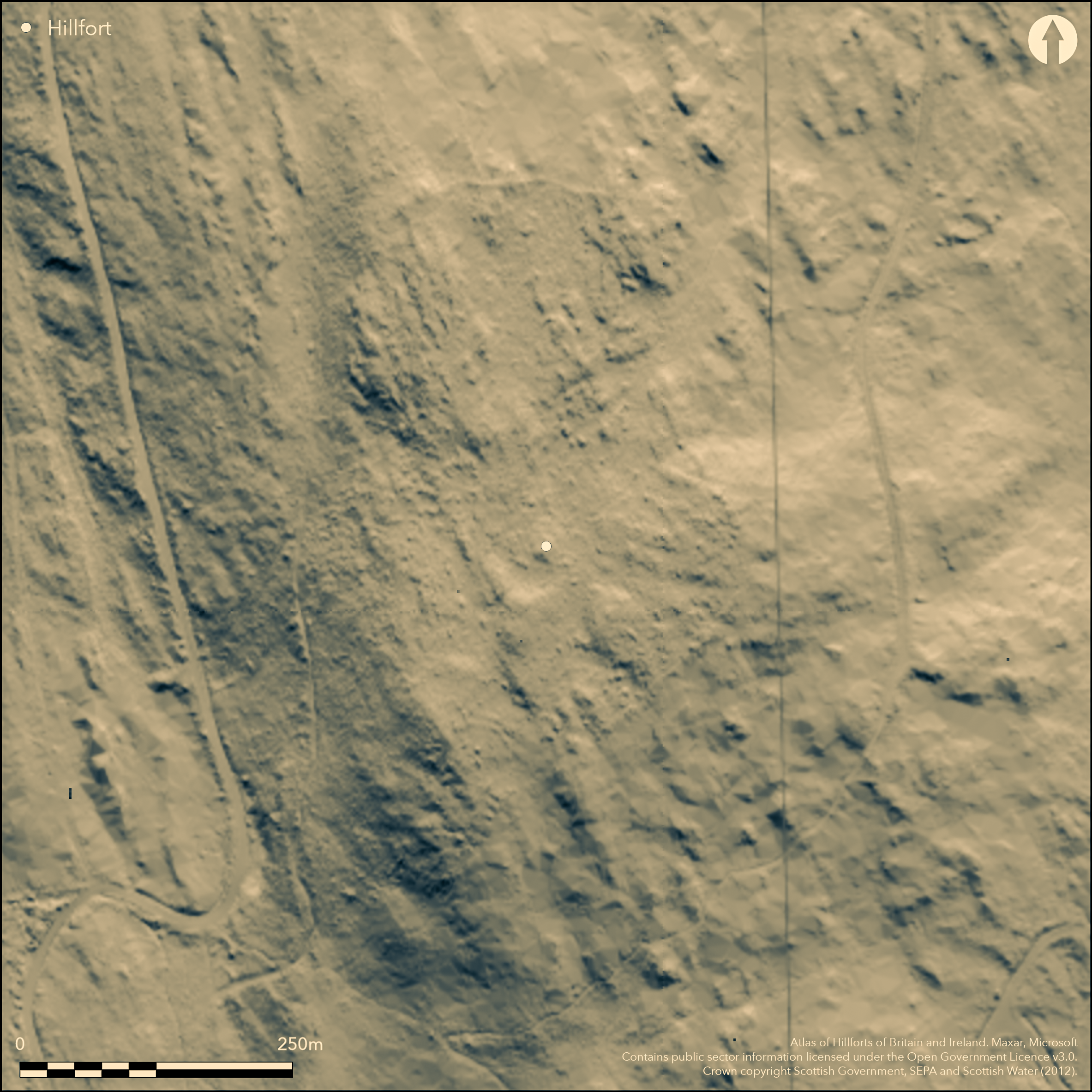
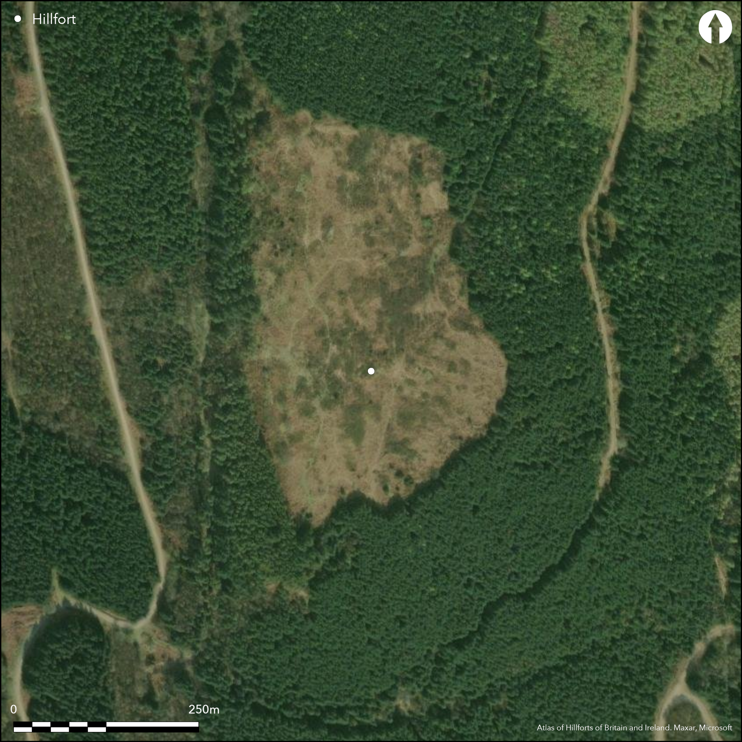
This large fort encloses the summit of Moyle Hill, a steep and precipitous hill overlooking the estuary of the Urr Water from the E. The rampart, which was probably about 2.5m in thickness, built with a core of small stones faced with large boulders, is now spread up to 4.5m in thickness, and follows the shoulder of the hill for most of its circuit. Two gaps in the line of the rampart are mentioned in the description drawn up by RCAHMS in 1955, probably on the E flank, and while one was considered modern, the other may be original and is approached by a hollow trackway. The rocky and overgrown interior measures about 290m from N to S by 160m transversely (4.4ha) and, apart from a smaller fortified enclosure at the S end, and a series of later folds and buildings, it is featureless. The small fortified enclosure at the southern end of the interior occupies a slightly elevated plateau with a steep natural scarp on the W and S, and is defended elsewhere by a rampart reduced to a stony scarp between 1.5m and 2m in height. Its entrance, which is on the E, is approached by a trackway flanked by ruined walls. The interior measures some 36m from N to S by 27m transversely (0.08ha) and is featureless. While the RCAHMS account in 1955 could detect no chronological relationship between the two forts, regarding them as a small citadel within a larger hilltop enclosure, by 1963 Richard Feachem had revised his view, not only classifying the enclosure as a large fort in its own right, but suggesting that the rampart of the larger fort overlay that of the smaller (Feachem 1963, 129; 1966, 82-4). In 1970, however, the OS surveyor revising the 1:2500 depiction was of the opinion that the smaller overlay the larger.
Citizen Science: ✗
Reliability of Data: Confirmed
Reliability of Interpretation: Confirmed
X: -422651 Y: 7342296 (EPSG: 3857)
Longitude: -3.7967386482649874 Latitude: 54.89903558221326 (EPSG:4326)
Country: Scotland
Current County or Unitary Authority: Dumfries & Galloway
Historic County: Kirkcudbrightshire
Current Parish/Community/Council/Townland: Colvend And Southwick
None
| Extant | ✓ |
| Cropmark | ✗ |
| Likely Destroyed | ✗ |
Clearing in forestry but invaded by scrub trees
| Woodland | ✓ |
| Commercial Forestry Plantation | ✗ |
| Parkland | ✗ |
| Pasture (Grazing) | ✗ |
| Arable | ✗ |
| Scrub/Bracken | ✓ |
| Bare Outcrop | ✗ |
| Heather/Moorland | ✓ |
| Heath | ✗ |
| Built-up | ✗ |
| Coastal Grassland | ✗ |
| Other | ✗ |
None
| Contour Fort | ✓ |
| Partial Contour Fort | ✗ |
| Promontory Fort | ✗ |
| Hillslope Fort | ✗ |
| Level Terrain Fort | ✗ |
| Marsh Fort | ✗ |
| Multiple Enclosure Fort | ✗ |
| Hilltop | ✓ |
| Coastal Promontory | ✗ |
| Inland Promontory | ✗ |
| Valley Bottom | ✗ |
| Knoll/Hillock/Outcrop | ✗ |
| Ridge | ✗ |
| Cliff/Plateau-edge/Scarp | ✗ |
| Hillslope | ✗ |
| Lowland | ✗ |
| Spur | ✗ |
Dominant Topographic Feature: None
| North | ✗ |
| Northeast | ✗ |
| East | ✗ |
| Southeast | ✗ |
| South | ✗ |
| Southwest | ✗ |
| West | ✗ |
| Northwest | ✗ |
| Level | ✓ |
Altitude: 140.0m
N/A
In the absence of excavation, there are neither stratified artefacts nor radiocarbon dates to provide a chronology for the defences.
Reliability: D - None
| Pre 1200BC | ✗ |
| 1200BC - 800BC | ✗ |
| 800BC - 400BC | ✗ |
| 400BC - AD50 | ✗ |
| AD50 - AD400 | ✗ |
| AD400 - AD 800 | ✗ |
| Post AD800 | ✗ |
| Unknown | ✓ |
| Pre Hillfort: | None |
| Post Hillfort: | None |
First depicted in 1849-51 as a pecked line annotated 'Old Fence' on the first edition OS 6-inch map (Kirkcudbrightshire 1854, sheet 46), about 1892 the fort was sketch-planned and described by Frederick Coles (1893, 97-101, figs 5-9). In 1893-4 the OS mapped the line of the wall in greater detail and annotated it 'Fort' on the 25-inch map (Kirkcudbrightshire 1895, sheet 50.4) and it was subsequently described in 1911 for the County Inventory for The Stewartry (RCAHMS 1914, 72, no.121). RCAHMS returned in 1955 during the Survey of Marginal Lands to prepare a plan. The OS re-surveyed the fort at 1:2500 in 1970.
| 1st Identified Map Depiction (1851): | Annotated Old Fence on the 1st edition OS 6-inch map (Kirkcudbrightshire 1854, sheet 46) |
| Earthwork Survey (1892): | Sketch-plan and description (Coles 1893, 97-101, figs 5-9) |
| Other (1894): | Annotated Fort on the 25-inch depiction (Kirkcudbrightshire 1895, sheet 50.4) |
| Other (1911): | Description (RCAHMS 1914, 72, no.121) |
| Earthwork Survey (1955): | 1:600 plan (RCAHMS KBD 16/1-2; DP148860 and 148861) |
| Other (1970): | Surveyed at 1:2500 by the OS |
| Other (2002): | Scheduled |
Featureless apart from various later folds, buildings and pens
None
| None | ✓ |
| Spring | ✗ |
| Stream | ✗ |
| Pool | ✗ |
| Flush | ✗ |
| Well | ✗ |
| Other | ✗ |
None
| No Known Features | ✗ |
| Round Stone Structures | ✗ |
| Rectangular Stone Structures | ✓ |
| Curvilinear Platforms | ✗ |
| Other Roundhouse Evidence | ✗ |
| Pits | ✗ |
| Quarry Hollows | ✗ |
| Other | ✓ |
None
| No Known Excavation | ✓ |
| Pits | ✗ |
| Postholes | ✗ |
| Roundhouses | ✗ |
| Rectangular Structures | ✗ |
| Roads/Tracks | ✗ |
| Quarry Hollows | ✗ |
| Other | ✗ |
| Nothing Found | ✗ |
None
| No Known Geophysics | ✓ |
| Pits | ✗ |
| Roundhouses | ✗ |
| Rectangular Structures | ✗ |
| Roads/Tracks | ✗ |
| Quarry Hollows | ✗ |
| Other | ✗ |
| Nothing Found | ✗ |
None
| No Known Finds | ✓ |
| Pottery | ✗ |
| Metal | ✗ |
| Metalworking | ✗ |
| Human Bones | ✗ |
| Animal Bones | ✗ |
| Lithics | ✗ |
| Environmental | ✗ |
| Other | ✗ |
None
| APs Not Checked | ✗ |
| None | ✓ |
| Roundhouses | ✗ |
| Rectangular Structures | ✗ |
| Pits | ✗ |
| Postholes | ✗ |
| Roads/Tracks | ✗ |
| Other | ✗ |
See main summary
| 2: | Two noted, probably on the E |
| 2: | None |
Guard Chambers: ✗
Chevaux de Frise: ✗
| 1. Simple Gap (East): | None |
Single rampart of the larger fort
| Area 1: | 4.4ha. |
| Total: | 4.4ha. |
Total Footprint Area: Noneha.
None
| ✓ | There are contradictory records of the sequence between the smaller and larger enclosures |
| ✓ | Of the larger fort |
| NE Quadrant: | 1 |
| SE Quadrant: | 1 |
| SW Quadrant: | 1 |
| NW Quadrant: | 1 |
| Total: | 1 |
| Partial Univallate | ✗ |
| Univallate | ✓ |
| Partial Bivallate | ✗ |
| Bivallate | ✗ |
| Partial Multivallate | ✗ |
| Multivallate | ✗ |
| Unknown | ✗ |
| Partial Univallate | ✗ |
| Univallate | ✗ |
| Partial Bivallate | ✗ |
| Bivallate | ✗ |
| Partial Multivallate | ✗ |
| Multivallate | ✗ |
None
| None | ✗ |
| Earthen Bank | ✗ |
| Stone Wall | ✓ |
| Rubble | ✗ |
| Wall-walk | ✗ |
| Evidence of Timber | ✗ |
| Vitrification | ✗ |
| Other Burning | ✗ |
| Palisade | ✗ |
| Counter Scarp Bank | ✗ |
| Berm | ✗ |
| Unfinished | ✗ |
| Other | ✗ |
None
| None | ✗ |
| Earthen Bank | ✗ |
| Stone Wall | ✗ |
| Murus Duplex | ✗ |
| Timber-framed | ✗ |
| Timber-laced | ✗ |
| Vitrification | ✗ |
| Other Burning | ✗ |
| Palisade | ✗ |
| Counter Scarp Bank | ✗ |
| Berm | ✗ |
| Unfinished | ✗ |
| No Known Excavation | ✓ |
| Other | ✗ |
| ✗ | None |
| ✗ | None |
Number of Ditches: None
| ✗ | None |
Coles, F R (1893) 'The motes, forts, and doons in the east and west divisions of the Stewartry of Kirkcudbright', Proc Soc Antiq Scot 27, 92-182
Feachem, R (1963) A guide to prehistoric Scotland, London
Feachem, R W (1966) 'The hill-forts of northern Britain', in Rivet, A L F The iron age in northern Britain Edinburgh
RCAHMS (1914) The Royal Commission on the Ancient and Historical Monuments and Constructions of Scotland. Fifth report and inventory of monuments and constructions in Galloway, II, county of the Stewartry of Kirkcudbright, Edinburgh.
Atlas of Hillforts:
Wikidata:
This work is licensed under CC BY-SA 4.0![]()
![]()
![]() and should be cited as:
and should be cited as:
Lock, Gary and Ralston, Ian. 2024. Atlas of Hillforts of Britain and Ireland. Available at: https://hillforts.arch.ox.ac.uk
Document Version 1.1