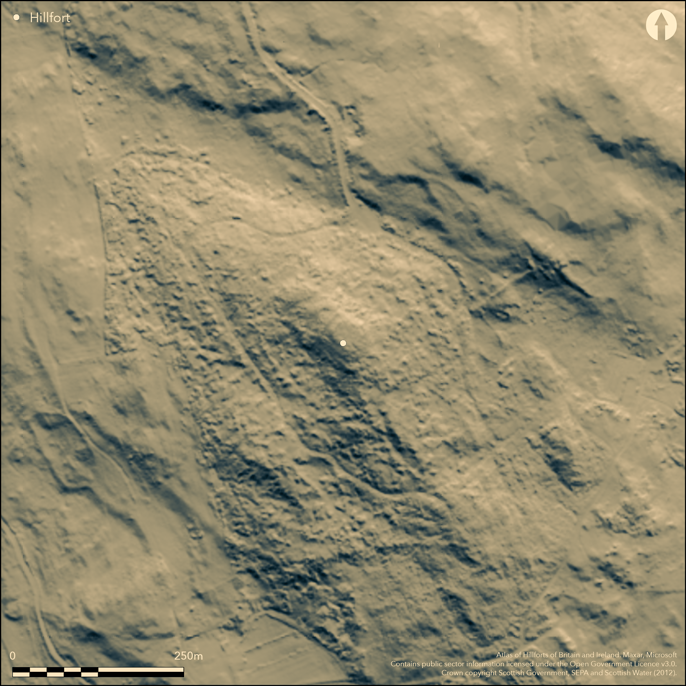
LiDAR 1m DTM Hillshade
Satellite Imagery
LiDAR 1m DTM Hillshade
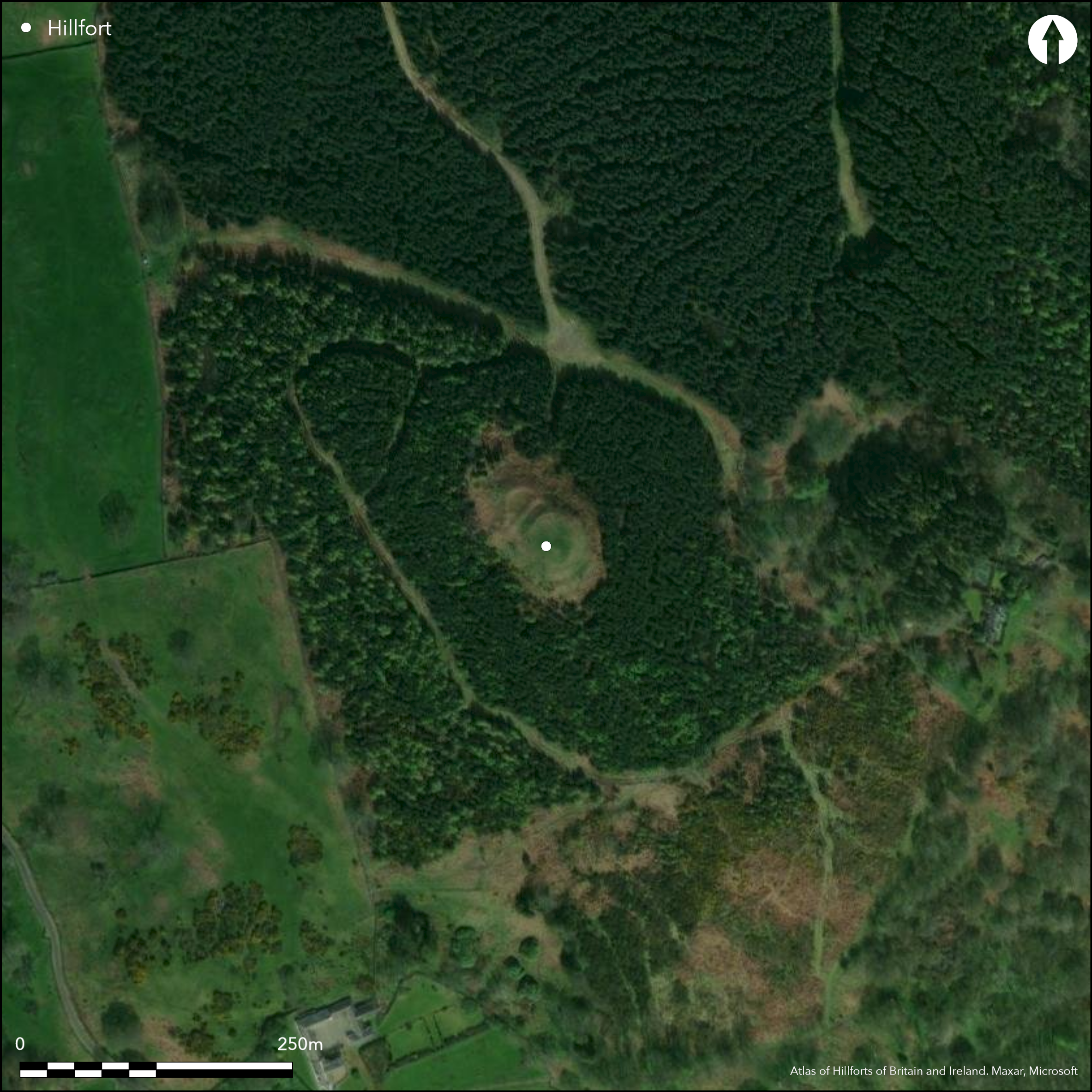
Satellite Imagery
Scroll left/right to view further images.
HER: Dumfries & Galloway MDG4485 (None)
NMR: NX 85 SW 3 (64912)
SM: 1089
NGR: NX 8265 5391
X: 282650 Y: 553910 (OSGB36)
This small fortification is situated on a rugged steep-sided hill on the peninsular between Rough Firth and Orchardton Bay, comprising an oval enclosure on the summit with outlying ramparts swinging round its flanks on the on the NW and SE. The inner, which forms a band of rubble about 2m thick, encloses an oval area measuring no more than 23m from NW to SE by 17m (0.03ha). At the NW end a second rampart some 3m in thickness can be seen following the lip of the summit on this side, but there is also a third rampart taking in a lower terrace on the NW and apparently springing from the second rampart on this side. Both the plan drawn up by Frederick Coles (1892, 128-9, fig 43) and the depiction on the OS 25-inch map (Kirkcudbrightshire 1894, sheet 50.11) suggest that the second rampart here returns along a terrace on the SW flank of the hill to meet the inner of the two outer ramparts at the SE end. The position of the entrance is unknown. While both Coles and Alexander Curle for RCAHMS identified two rough circular structures at the southern end of the interior, they were obscured by dense bracken when revisited by RCAHMS in 1951 and the OS in 1969.
Citizen Science: ✗
Reliability of Data: Confirmed
Reliability of Interpretation: Confirmed
X: -426357 Y: 7335938 (EPSG: 3857)
Longitude: -3.8300279489399385 Latitude: 54.86618162311761 (EPSG:4326)
Country: Scotland
Current County or Unitary Authority: Dumfries & Galloway
Historic County: Kirkcudbrightshire
Current Parish/Community/Council/Townland: Buittle
None
| Extant | ✓ |
| Cropmark | ✗ |
| Likely Destroyed | ✗ |
Clearing in a plantation
| Woodland | ✗ |
| Commercial Forestry Plantation | ✓ |
| Parkland | ✗ |
| Pasture (Grazing) | ✗ |
| Arable | ✗ |
| Scrub/Bracken | ✓ |
| Bare Outcrop | ✗ |
| Heather/Moorland | ✗ |
| Heath | ✗ |
| Built-up | ✗ |
| Coastal Grassland | ✗ |
| Other | ✗ |
None
| Contour Fort | ✓ |
| Partial Contour Fort | ✗ |
| Promontory Fort | ✗ |
| Hillslope Fort | ✗ |
| Level Terrain Fort | ✗ |
| Marsh Fort | ✗ |
| Multiple Enclosure Fort | ✗ |
| Hilltop | ✓ |
| Coastal Promontory | ✗ |
| Inland Promontory | ✗ |
| Valley Bottom | ✗ |
| Knoll/Hillock/Outcrop | ✗ |
| Ridge | ✗ |
| Cliff/Plateau-edge/Scarp | ✗ |
| Hillslope | ✗ |
| Lowland | ✗ |
| Spur | ✗ |
Dominant Topographic Feature: None
| North | ✗ |
| Northeast | ✗ |
| East | ✗ |
| Southeast | ✗ |
| South | ✗ |
| Southwest | ✗ |
| West | ✗ |
| Northwest | ✗ |
| Level | ✓ |
Altitude: 80.0m
N/A
Comparisons have been drawn with the early medieval fort on Trusty's Hill.In the absence of excavation, there are neither stratified artefacts nor radiocarbon dates to provide a chronology for the defences.
Reliability: D - None
| Pre 1200BC | ✗ |
| 1200BC - 800BC | ✗ |
| 800BC - 400BC | ✗ |
| 400BC - AD50 | ✗ |
| AD50 - AD400 | ✗ |
| AD400 - AD 800 | ✗ |
| Post AD800 | ✗ |
| Unknown | ✓ |
| Pre Hillfort: | None |
| Post Hillfort: | The rough circular foundations noted in the interior are probably later pens or huts. |
Depicted in 1849-51 on the 1st edition OS 6-inch map (Kirkcudbrightshire 1854, sheet 46), in 1891 the fort was sketch-planned by Frederick Coles (1892, 128-9, fig 43) and in 1911 described for the County Inventory for The Stewartry (RCAHMS 1914, 59-60, no.79). It was revisited by RCAHMS in 1951 and re-surveyed by the OS at 1:2500 in 1969.
| 1st Identified Map Depiction (1851): | Annotated Fort on the 1st edition OS 6-inch map (Kirkcudbrightshire 1854, sheet 46) |
| Earthwork Survey (1891): | Sketch-plan and description (Coles 1892, 128-9, fig 43) |
| Other (1911): | Description (RCAHMS 1914, 59-60, no.79) |
| Other (1938): | Scheduled |
| Other (1951): | Description during RCAHMS Survey of Marginal Lands |
| Other (1969): | Resurveyed at 1:2500 by the OS |
Two rough circles of stones previously identified
None
| None | ✓ |
| Spring | ✗ |
| Stream | ✗ |
| Pool | ✗ |
| Flush | ✗ |
| Well | ✗ |
| Other | ✗ |
Rough circular foundations probably later pens or huts
| No Known Features | ✗ |
| Round Stone Structures | ✗ |
| Rectangular Stone Structures | ✗ |
| Curvilinear Platforms | ✗ |
| Other Roundhouse Evidence | ✗ |
| Pits | ✗ |
| Quarry Hollows | ✗ |
| Other | ✓ |
None
| No Known Excavation | ✓ |
| Pits | ✗ |
| Postholes | ✗ |
| Roundhouses | ✗ |
| Rectangular Structures | ✗ |
| Roads/Tracks | ✗ |
| Quarry Hollows | ✗ |
| Other | ✗ |
| Nothing Found | ✗ |
None
| No Known Geophysics | ✓ |
| Pits | ✗ |
| Roundhouses | ✗ |
| Rectangular Structures | ✗ |
| Roads/Tracks | ✗ |
| Quarry Hollows | ✗ |
| Other | ✗ |
| Nothing Found | ✗ |
None
| No Known Finds | ✓ |
| Pottery | ✗ |
| Metal | ✗ |
| Metalworking | ✗ |
| Human Bones | ✗ |
| Animal Bones | ✗ |
| Lithics | ✗ |
| Environmental | ✗ |
| Other | ✗ |
None
| APs Not Checked | ✗ |
| None | ✓ |
| Roundhouses | ✗ |
| Rectangular Structures | ✗ |
| Pits | ✗ |
| Postholes | ✗ |
| Roads/Tracks | ✗ |
| Other | ✗ |
None known
| 0: | None |
| 2: | None identified |
Guard Chambers: ✗
Chevaux de Frise: ✗
Continuous inner rampart with up to two outworks
| Area 1: | 0.03ha. |
| Total: | 0.03ha. |
Total Footprint Area: 0.18ha.
None
| ✗ | None |
| ✓ | None |
| NE Quadrant: | 1 |
| SE Quadrant: | 3 |
| SW Quadrant: | 2 |
| NW Quadrant: | 3 |
| Total: | 3 |
| Partial Univallate | ✓ |
| Univallate | ✗ |
| Partial Bivallate | ✓ |
| Bivallate | ✗ |
| Partial Multivallate | ✓ |
| Multivallate | ✗ |
| Unknown | ✗ |
| Partial Univallate | ✗ |
| Univallate | ✗ |
| Partial Bivallate | ✗ |
| Bivallate | ✗ |
| Partial Multivallate | ✗ |
| Multivallate | ✗ |
None
| None | ✗ |
| Earthen Bank | ✗ |
| Stone Wall | ✗ |
| Rubble | ✓ |
| Wall-walk | ✗ |
| Evidence of Timber | ✗ |
| Vitrification | ✗ |
| Other Burning | ✗ |
| Palisade | ✗ |
| Counter Scarp Bank | ✗ |
| Berm | ✗ |
| Unfinished | ✗ |
| Other | ✗ |
None
| None | ✗ |
| Earthen Bank | ✗ |
| Stone Wall | ✗ |
| Murus Duplex | ✗ |
| Timber-framed | ✗ |
| Timber-laced | ✗ |
| Vitrification | ✗ |
| Other Burning | ✗ |
| Palisade | ✗ |
| Counter Scarp Bank | ✗ |
| Berm | ✗ |
| Unfinished | ✗ |
| No Known Excavation | ✓ |
| Other | ✗ |
| ✗ | None |
| ✗ | None |
Number of Ditches: None
| ✗ | None |
Coles, F R (1892) 'The Motes, Forts, and Doons of the Stewartry of Kirkcudbrightshire. (Part II)' Proc Soc Antiq Scot 26, 117-70
Feachem, R W (1956a) 'Iron Age and early medieval monuments in Galloway and Dumfriesshire', Trans Dumfriesshire Galloway Natur Hist Antiq Soc, 3 Ser, 33, 59-60
RCAHMS (1914) The Royal Commission on the Ancient and Historical Monuments and Constructions of Scotland. Fifth report and inventory of monuments and constructions in Galloway, II, county of the Stewartry of Kirkcudbright, Edinburgh
Atlas of Hillforts:
Wikidata:
This work is licensed under CC BY-SA 4.0![]()
![]()
![]() and should be cited as:
and should be cited as:
Lock, Gary and Ralston, Ian. 2024. Atlas of Hillforts of Britain and Ireland. Available at: https://hillforts.arch.ox.ac.uk
Document Version 1.1