LiDAR 1m DTM Hillshade
Satellite Imagery
LiDAR 1m DTM Hillshade
Satellite Imagery
Scroll left/right to view further images.
HER: Dumfries & Galloway MDG7556 (None)
NMR: NY 28 SW 7 (67227)
SM: None
NGR: NY 2431 8284
X: 324310 Y: 582840 (OSGB36)
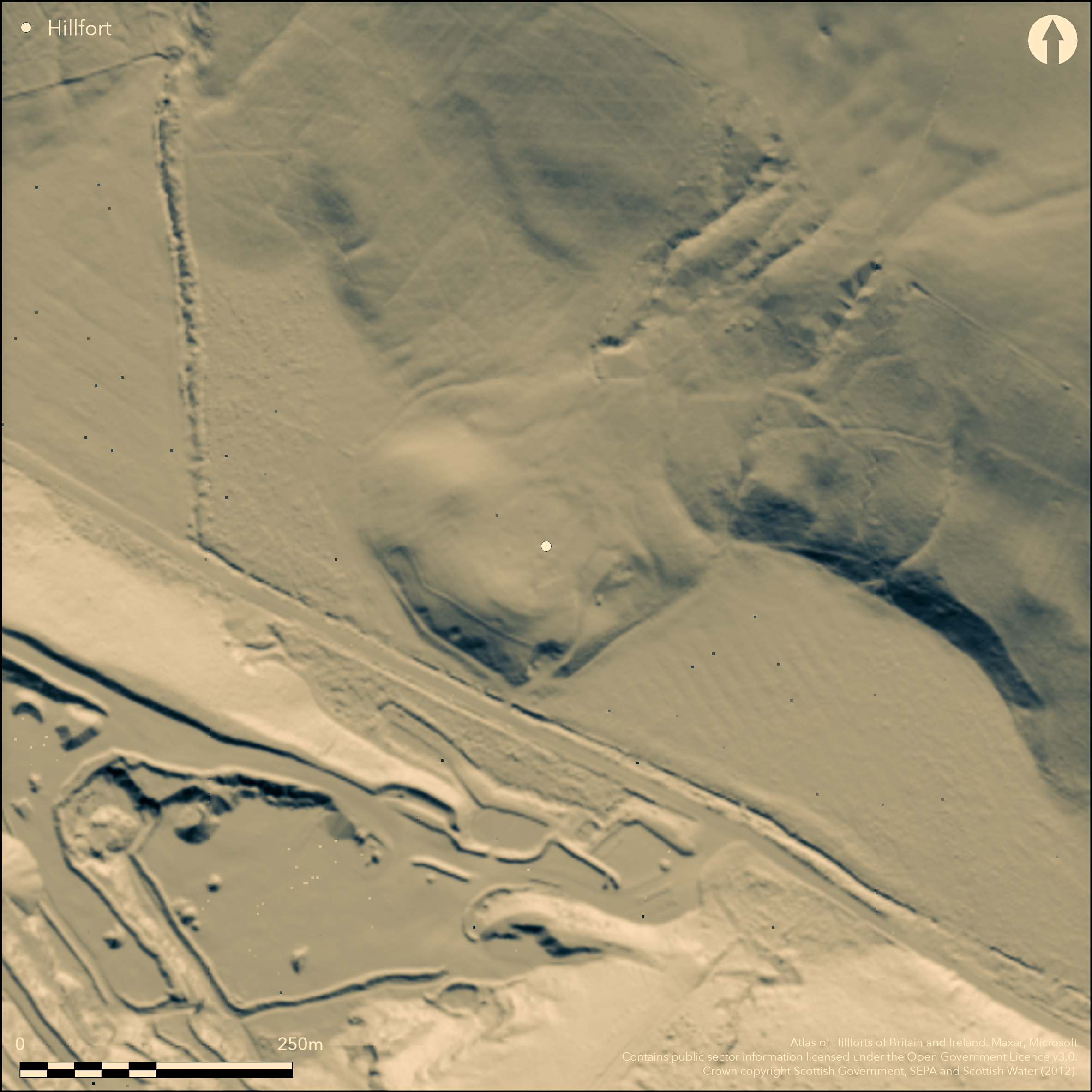
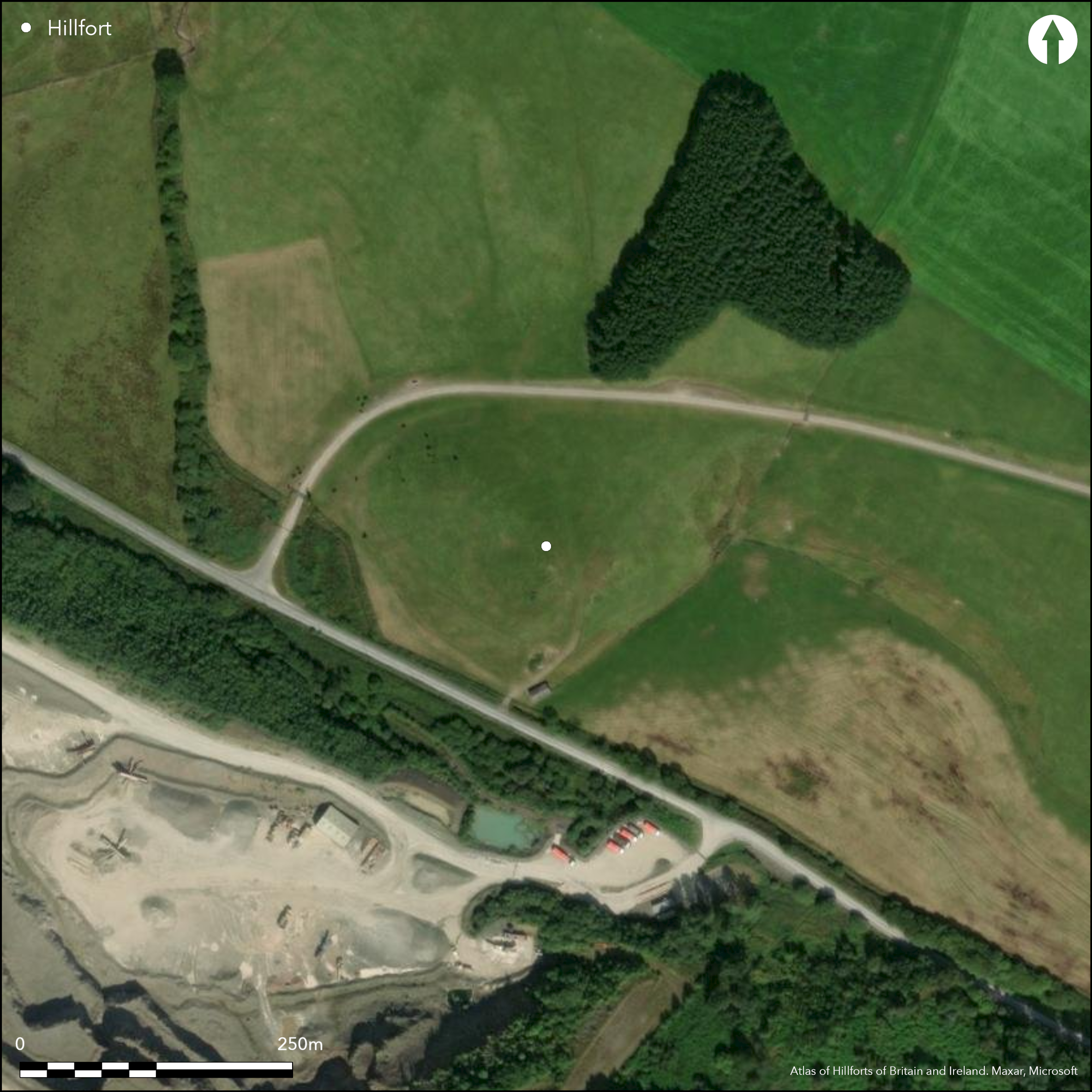
Little can now be seen of this fortified settlement, which, despite being a Scheduled monument, was levelled for a pasture improvement scheme in 1977-8. Slightly oval on plan, it measured about 54m from NE to SW by 50m transversely (0.21ha) within twin ramparts with a medial ditch, and the entrance was probably on the E. When recorded by Alexander Curle in 1912, the inner rampart stood 1.2m high internally and 1.8m above the bottom of the ditch, which was probably about 5m in breadth; the outer bank survived only on the SW quarter, but he observed traces of the ramparts uniting around the terminals of the ditch at the entrance, though by then this part had already been ploughed down. The perimeter had also been remodelled in a secondary phase, which excluded the SE third of the original enclosure by the construction of twin banks with a medial ditch across the interior from NE to SW; this ditch was cut through the inner rampart at either end, and its counterscarp bank was carried across the original ditch. An entrance causeway lay a little S of the centre of this re-aligned perimeter and there were traces of a hollowed trackway approaching up the slope from the E. While this enclosure may still be of some antiquity, in the post-medieval period a turf ring enclosure had been built on the N side of the interior and overlay the tail of the rampart; a sherd of medieval pottery was found adjacent to this ring enclosure in 1955 (Truckell 1955).
Citizen Science: ✗
Reliability of Data: Confirmed
Reliability of Interpretation: Confirmed
X: -354971 Y: 7387945 (EPSG: 3857)
Longitude: -3.188755128777931 Latitude: 55.134145466819575 (EPSG:4326)
Country: Scotland
Current County or Unitary Authority: Dumfries & Galloway
Historic County: Dumfriesshire
Current Parish/Community/Council/Townland: Tundergarth
None
| Extant | ✗ |
| Cropmark | ✓ |
| Likely Destroyed | ✗ |
None
| Woodland | ✗ |
| Commercial Forestry Plantation | ✗ |
| Parkland | ✗ |
| Pasture (Grazing) | ✓ |
| Arable | ✓ |
| Scrub/Bracken | ✗ |
| Bare Outcrop | ✗ |
| Heather/Moorland | ✗ |
| Heath | ✗ |
| Built-up | ✗ |
| Coastal Grassland | ✗ |
| Other | ✗ |
None
| Contour Fort | ✓ |
| Partial Contour Fort | ✗ |
| Promontory Fort | ✗ |
| Hillslope Fort | ✗ |
| Level Terrain Fort | ✗ |
| Marsh Fort | ✗ |
| Multiple Enclosure Fort | ✗ |
| Hilltop | ✓ |
| Coastal Promontory | ✗ |
| Inland Promontory | ✗ |
| Valley Bottom | ✗ |
| Knoll/Hillock/Outcrop | ✗ |
| Ridge | ✗ |
| Cliff/Plateau-edge/Scarp | ✗ |
| Hillslope | ✗ |
| Lowland | ✗ |
| Spur | ✗ |
Dominant Topographic Feature: None
| North | ✗ |
| Northeast | ✗ |
| East | ✗ |
| Southeast | ✗ |
| South | ✗ |
| Southwest | ✗ |
| West | ✗ |
| Northwest | ✗ |
| Level | ✓ |
Altitude: 165.0m
N/A
In the absence of excavation, there are neither stratified artefacts nor radiocarbon dates to provide a chronology for the defences.
Reliability: D - None
| Pre 1200BC | ✗ |
| 1200BC - 800BC | ✗ |
| 800BC - 400BC | ✗ |
| 400BC - AD50 | ✗ |
| AD50 - AD400 | ✗ |
| AD400 - AD 800 | ✗ |
| Post AD800 | ✗ |
| Unknown | ✓ |
| Pre Hillfort: | None |
| Post Hillfort: | Subdivided interior and overlain by a sod ring enclosure and most recently demolished in a pasture improvement scheme |
First depicted in 1857 on the 1st edition OS 25-inch map (Dumfriesshire 1862, sheet 44.14), it was described by Alexander Curle in 1912 during the preparation of the County Inventory for Dumfriesshire (RCAHMS 1920, 203-4, no.595, fig.147), though the plan drawn up at the same time is patently distorted and the north point is misaligned. George Jobey drew up a plan in the course of his work in eastern Dumfriesshire (Jobey 1971), and it was resurveyed by the OS at 1:2500 in 1970, and in 1979 revisited by them shortly after its demolition. RCAHMS revisited in 1991 and having been a Scheduled monument it was de-scheduled in 2009. Fortunately CUCAP photographed the site from the air before its demolition, and RCAHMS have photographed it on two occasions since.
| 1st Identified Map Depiction (1857): | Annotated Fort on the 1st edition OS 25-inch map (Dumfriesshire 1862, sheet 44.14) |
| Earthwork Survey (1912): | Description and distorted plan (RCAHMS 1920, 203-4, no.595, fig.147; RCAHMS DFD 19/1) |
| Earthwork Survey (1968): | George Jobey (copies in RCAHMS DFD 352/1-2 P/CO) |
| Earthwork Survey (1970): | Resurveyed at 1:2500 by the OS |
| Other (1979): | Surveyed at 1:10.000 by the OS |
Featureless
None
| None | ✓ |
| Spring | ✗ |
| Stream | ✗ |
| Pool | ✗ |
| Flush | ✗ |
| Well | ✗ |
| Other | ✗ |
None
| No Known Features | ✓ |
| Round Stone Structures | ✗ |
| Rectangular Stone Structures | ✗ |
| Curvilinear Platforms | ✗ |
| Other Roundhouse Evidence | ✗ |
| Pits | ✗ |
| Quarry Hollows | ✗ |
| Other | ✗ |
None
| No Known Excavation | ✓ |
| Pits | ✗ |
| Postholes | ✗ |
| Roundhouses | ✗ |
| Rectangular Structures | ✗ |
| Roads/Tracks | ✗ |
| Quarry Hollows | ✗ |
| Other | ✗ |
| Nothing Found | ✗ |
None
| No Known Geophysics | ✓ |
| Pits | ✗ |
| Roundhouses | ✗ |
| Rectangular Structures | ✗ |
| Roads/Tracks | ✗ |
| Quarry Hollows | ✗ |
| Other | ✗ |
| Nothing Found | ✗ |
Medieval sherd (Truckell 1955)
| No Known Finds | ✗ |
| Pottery | ✓ |
| Metal | ✗ |
| Metalworking | ✗ |
| Human Bones | ✗ |
| Animal Bones | ✗ |
| Lithics | ✗ |
| Environmental | ✗ |
| Other | ✗ |
NO APPARENT FEATURES
| APs Not Checked | ✗ |
| None | ✓ |
| Roundhouses | ✗ |
| Rectangular Structures | ✗ |
| Pits | ✗ |
| Postholes | ✗ |
| Roads/Tracks | ✗ |
| Other | ✗ |
See main summary
| 1: | Levelled |
| 2: | None |
Guard Chambers: ✗
Chevaux de Frise: ✗
| 1. Passage-way/Corridor (East): | Returns around the terminals of the ditch |
Twin ramparts with a medial ditch
| Area 1: | 0.21ha. |
| Total: | 0.21ha. |
Total Footprint Area: Noneha.
None
| ✓ | Remodelled in a secondary phase |
| ✓ | None |
| NE Quadrant: | 2 |
| SE Quadrant: | 2 |
| SW Quadrant: | 2 |
| NW Quadrant: | 2 |
| Total: | 2 |
| Partial Univallate | ✗ |
| Univallate | ✗ |
| Partial Bivallate | ✗ |
| Bivallate | ✓ |
| Partial Multivallate | ✗ |
| Multivallate | ✗ |
| Unknown | ✗ |
| Partial Univallate | ✗ |
| Univallate | ✗ |
| Partial Bivallate | ✗ |
| Bivallate | ✗ |
| Partial Multivallate | ✗ |
| Multivallate | ✗ |
None
| None | ✗ |
| Earthen Bank | ✓ |
| Stone Wall | ✗ |
| Rubble | ✗ |
| Wall-walk | ✗ |
| Evidence of Timber | ✗ |
| Vitrification | ✗ |
| Other Burning | ✗ |
| Palisade | ✗ |
| Counter Scarp Bank | ✗ |
| Berm | ✗ |
| Unfinished | ✗ |
| Other | ✗ |
None
| None | ✗ |
| Earthen Bank | ✗ |
| Stone Wall | ✗ |
| Murus Duplex | ✗ |
| Timber-framed | ✗ |
| Timber-laced | ✗ |
| Vitrification | ✗ |
| Other Burning | ✗ |
| Palisade | ✗ |
| Counter Scarp Bank | ✗ |
| Berm | ✗ |
| Unfinished | ✗ |
| No Known Excavation | ✓ |
| Other | ✗ |
| ✗ | None |
| ✓ | None |
Number of Ditches: 1
| ✗ | None |
Jobey, G (1971) 'Early settlements in eastern Dumfriesshire'. Trans Dumfriesshire Galloway Natur Hist Antiq Soc, 3 Ser, 48 (1971), 78-105
RCAHMS (1920) The Royal Commission on the Ancient and Historical Monuments of Scotland. Seventh Report with Inventory of Monuments and Constructions in the County of Dumfries. HMSO: Edinburgh
Truckell, A E (1955) 'Crawthat Cottage, Eskdalemuir', Disc Exc Scot 1955, 12
Atlas of Hillforts:
Wikidata:
This work is licensed under CC BY-SA 4.0![]()
![]()
![]() and should be cited as:
and should be cited as:
Lock, Gary and Ralston, Ian. 2024. Atlas of Hillforts of Britain and Ireland. Available at: https://hillforts.arch.ox.ac.uk
Document Version 1.1