LiDAR 1m DTM Hillshade
Satellite Imagery
LiDAR 1m DTM Hillshade
Satellite Imagery
Scroll left/right to view further images.
HER: The West of Scotland Archaeology Service 9842 (None)
NMR: NS 75 SW 10 (45727)
SM: 10727
NGR: NS 7343 5347
X: 273430 Y: 653470 (OSGB36)
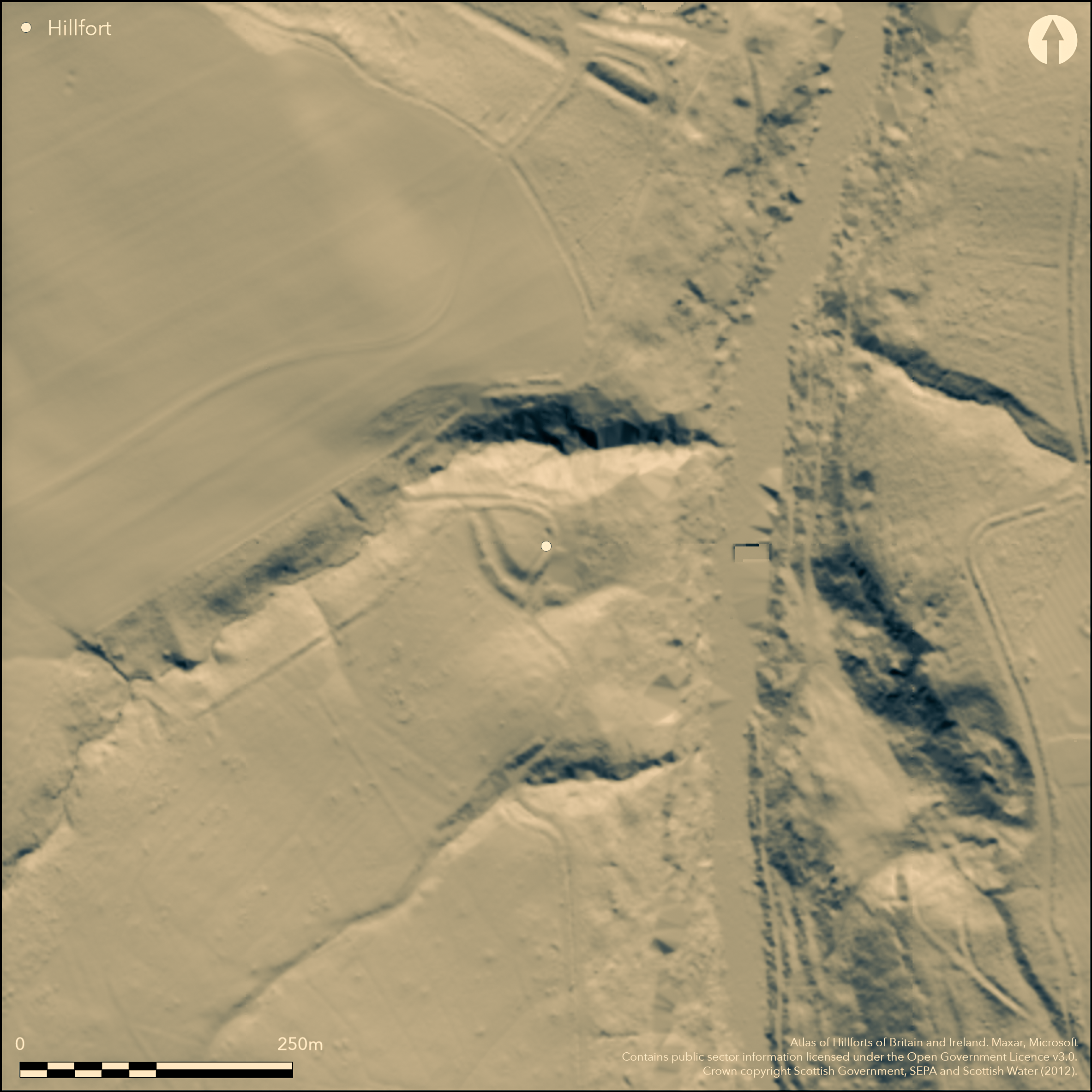
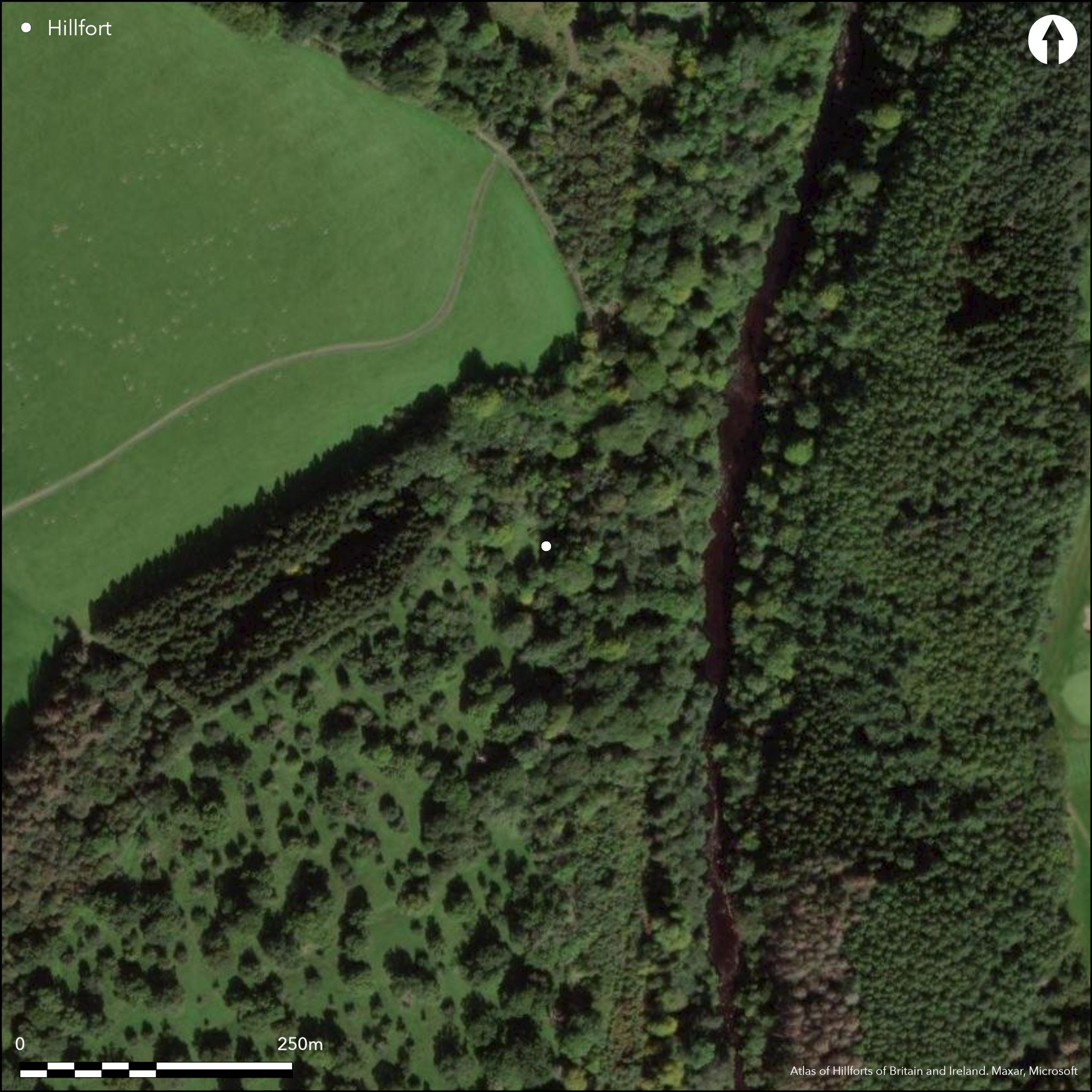
This small fortification stands on a promontory formed between Avon Water gorge on the E and the gully of a minor tributary on the N. Roughly triangular on plan, it measures a maximum of 48m from E to W by 40m transversely (0.09ha) within a heavily reduced earthwork that comprised twin banks with a medial ditch up to 9m in breadth where it cuts across the neck of the promontory on the SW. Unusually for a promontory enclosure, the defences also turn back on the E along the escarpment above the Avon Water. The entrance was probably on the N margin of the promontory, where a modern track and a field-bank ride up into the interior, traversing round the lip of the promontory and departing on the S. The interior is otherwise featureless. A section cut in 1983 across the defences at the southern angle revealed a bank some 4.5m in thickness on the inner lip of the ditch, with probable packing for timberwork marking its rear edge; the ditch was about 1m deep, and the outer bank 5m in thickness (Wallace and Talbot 1983). Other cut features were noted in subsequent excavations in the interior in 1986-7 and 1989 (Archer 1986; 1987; Archer and Henderson 1989). A silver denarius of the Emperor Marcus Aurelius (AD 161-180) was found in 1989.
Citizen Science: ✗
Reliability of Data: Confirmed
Reliability of Interpretation: Confirmed
X: -447340 Y: 7510395 (EPSG: 3857)
Longitude: -4.018522361288344 Latitude: 55.75802397492573 (EPSG:4326)
Country: Scotland
Current County or Unitary Authority: South Lanarkshire
Historic County: Lanarkshire
Current Parish/Community/Council/Townland: Hamilton
None
| Extant | ✓ |
| Cropmark | ✗ |
| Likely Destroyed | ✗ |
None
| Woodland | ✗ |
| Commercial Forestry Plantation | ✗ |
| Parkland | ✓ |
| Pasture (Grazing) | ✗ |
| Arable | ✗ |
| Scrub/Bracken | ✗ |
| Bare Outcrop | ✗ |
| Heather/Moorland | ✗ |
| Heath | ✗ |
| Built-up | ✗ |
| Coastal Grassland | ✗ |
| Other | ✗ |
None
| Contour Fort | ✗ |
| Partial Contour Fort | ✗ |
| Promontory Fort | ✓ |
| Hillslope Fort | ✗ |
| Level Terrain Fort | ✗ |
| Marsh Fort | ✗ |
| Multiple Enclosure Fort | ✗ |
| Hilltop | ✗ |
| Coastal Promontory | ✗ |
| Inland Promontory | ✓ |
| Valley Bottom | ✗ |
| Knoll/Hillock/Outcrop | ✗ |
| Ridge | ✗ |
| Cliff/Plateau-edge/Scarp | ✗ |
| Hillslope | ✗ |
| Lowland | ✗ |
| Spur | ✗ |
Dominant Topographic Feature: None
| North | ✗ |
| Northeast | ✗ |
| East | ✗ |
| Southeast | ✗ |
| South | ✗ |
| Southwest | ✗ |
| West | ✗ |
| Northwest | ✗ |
| Level | ✓ |
Altitude: 65.0m
N/A
Roman coin from an unknown context.
Reliability: C - Low
| Pre 1200BC | ✗ |
| 1200BC - 800BC | ✗ |
| 800BC - 400BC | ✗ |
| 400BC - AD50 | ✗ |
| AD50 - AD400 | ✓ |
| AD400 - AD 800 | ✗ |
| Post AD800 | ✗ |
| Unknown | ✓ |
| Pre Hillfort: | None |
| Post Hillfort: | Cut through by modern track and overlain by field-bank |
| Artefactual: | Silver denarius of Marcus Aurelius |
First noted in 1939 by O G S Crawford, it was surveyed by RCAHMS during the survey of Marginal Lands in 1955 and the plan was subsequently reviewed in 1975 for publication in the County Inventory for Lanarkshire (RCAHMS 1978, 146, no.279, fig 89). A trial excavation by M Wallace and Eric Talbot in 1983, was followed by further excavation 1986-7 an 1989 by Ed Archer and B Henderson on behalf of the Lanark and District Archaeological Society (Archer 1986; 1987; Archer and Henderson 1989). It was Scheduled in 2003. Visited by SH in 2013.
| Other (1939): | Discovered by O G S Crawford |
| Earthwork Survey (1955): | Plan and description during RCAHMS Survey of Marginal Lands (RCAHMS LAD 154/1) |
| Earthwork Survey (1975): | Earlier plan and description reviewed (RCAHMS 1978, 146, no.279, fig 89; RCAHMS LAD 154/2) |
| Excavation (1983): | Wallace and Talbot 1983 |
| Excavation (1986): | Archer 1986 |
| Excavation (1987): | Archer 1987 |
| Excavation (1989): | Archer and Henderson 1989 |
| Other (2003): | Scheduled |
| Other (2013): | Visited by S Halliday |
Featureless
None
| None | ✓ |
| Spring | ✗ |
| Stream | ✗ |
| Pool | ✗ |
| Flush | ✗ |
| Well | ✗ |
| Other | ✗ |
None
| No Known Features | ✓ |
| Round Stone Structures | ✗ |
| Rectangular Stone Structures | ✗ |
| Curvilinear Platforms | ✗ |
| Other Roundhouse Evidence | ✗ |
| Pits | ✗ |
| Quarry Hollows | ✗ |
| Other | ✗ |
None
| No Known Excavation | ✗ |
| Pits | ✓ |
| Postholes | ✓ |
| Roundhouses | ✗ |
| Rectangular Structures | ✗ |
| Roads/Tracks | ✗ |
| Quarry Hollows | ✗ |
| Other | ✗ |
| Nothing Found | ✗ |
None
| No Known Geophysics | ✓ |
| Pits | ✗ |
| Roundhouses | ✗ |
| Rectangular Structures | ✗ |
| Roads/Tracks | ✗ |
| Quarry Hollows | ✗ |
| Other | ✗ |
| Nothing Found | ✗ |
Piece of iron and a silver denarius of Marcus Aurelius
| No Known Finds | ✗ |
| Pottery | ✗ |
| Metal | ✓ |
| Metalworking | ✗ |
| Human Bones | ✗ |
| Animal Bones | ✗ |
| Lithics | ✗ |
| Environmental | ✗ |
| Other | ✓ |
NO APPARENT FEATURES
| APs Not Checked | ✗ |
| None | ✓ |
| Roundhouses | ✗ |
| Rectangular Structures | ✗ |
| Pits | ✗ |
| Postholes | ✗ |
| Roads/Tracks | ✗ |
| Other | ✗ |
See main summary
| 2: | None |
| 2: | Gap on the NW is probably the entrance but has no distinguishing features |
Guard Chambers: ✗
Chevaux de Frise: ✗
| 1. Simple Gap (North west): | None |
Twin banks with a medial ditch cutting off a promontory
| Area 1: | 0.09ha. |
| Total: | 0.09ha. |
Total Footprint Area: Noneha.
None
| ✗ | None |
| ✗ | None |
| NE Quadrant: | 0 |
| SE Quadrant: | 2 |
| SW Quadrant: | 2 |
| NW Quadrant: | 0 |
| Total: | 2 |
| Partial Univallate | ✗ |
| Univallate | ✗ |
| Partial Bivallate | ✓ |
| Bivallate | ✗ |
| Partial Multivallate | ✗ |
| Multivallate | ✗ |
| Unknown | ✗ |
| Partial Univallate | ✗ |
| Univallate | ✗ |
| Partial Bivallate | ✗ |
| Bivallate | ✗ |
| Partial Multivallate | ✗ |
| Multivallate | ✗ |
None
| None | ✗ |
| Earthen Bank | ✓ |
| Stone Wall | ✗ |
| Rubble | ✗ |
| Wall-walk | ✗ |
| Evidence of Timber | ✗ |
| Vitrification | ✗ |
| Other Burning | ✗ |
| Palisade | ✗ |
| Counter Scarp Bank | ✗ |
| Berm | ✗ |
| Unfinished | ✗ |
| Other | ✗ |
None
| None | ✗ |
| Earthen Bank | ✓ |
| Stone Wall | ✗ |
| Murus Duplex | ✗ |
| Timber-framed | ✗ |
| Timber-laced | ✗ |
| Vitrification | ✗ |
| Other Burning | ✗ |
| Palisade | ✗ |
| Counter Scarp Bank | ✓ |
| Berm | ✗ |
| Unfinished | ✗ |
| No Known Excavation | ✗ |
| Other | ✗ |
| ✗ | None |
| ✓ | None |
Number of Ditches: 1
| ✗ | None |
Archer, E (1986) 'Cadzow, earthwork'. Disc Exc Scot 1986, 36
Archer, E (1987) 'Cadzow, earthwork'. Disc Exc Scot 1987, 51
Archer and Henderson, E and B (1989) 'Cadzow earthwork (Hamilton parish), coin, foundations, post hole'. Disc Exc Scot 1989, 59
RCAHMS (1978) The Royal Commission on the Ancient and Historical Monuments of Scotland. Lanarkshire: an inventory of the prehistoric and Roman monuments. HMSO: Edinburgh
Wallace and Talbot, M and E (1983) 'Cadzow, earthwork'. Disc Exc Scot 1983, 31
Atlas of Hillforts:
Wikidata:
This work is licensed under CC BY-SA 4.0![]()
![]()
![]() and should be cited as:
and should be cited as:
Lock, Gary and Ralston, Ian. 2024. Atlas of Hillforts of Britain and Ireland. Available at: https://hillforts.arch.ox.ac.uk
Document Version 1.1