LiDAR 1m DTM Hillshade
Satellite Imagery
LiDAR 1m DTM Hillshade
Satellite Imagery
Scroll left/right to view further images.
HER: The West of Scotland Archaeology Service 5715 (None)
NMR: NS 24 SW 5 (41140)
SM: 3382
NGR: NS 2264 4374
X: 222643 Y: 643747 (OSGB36)
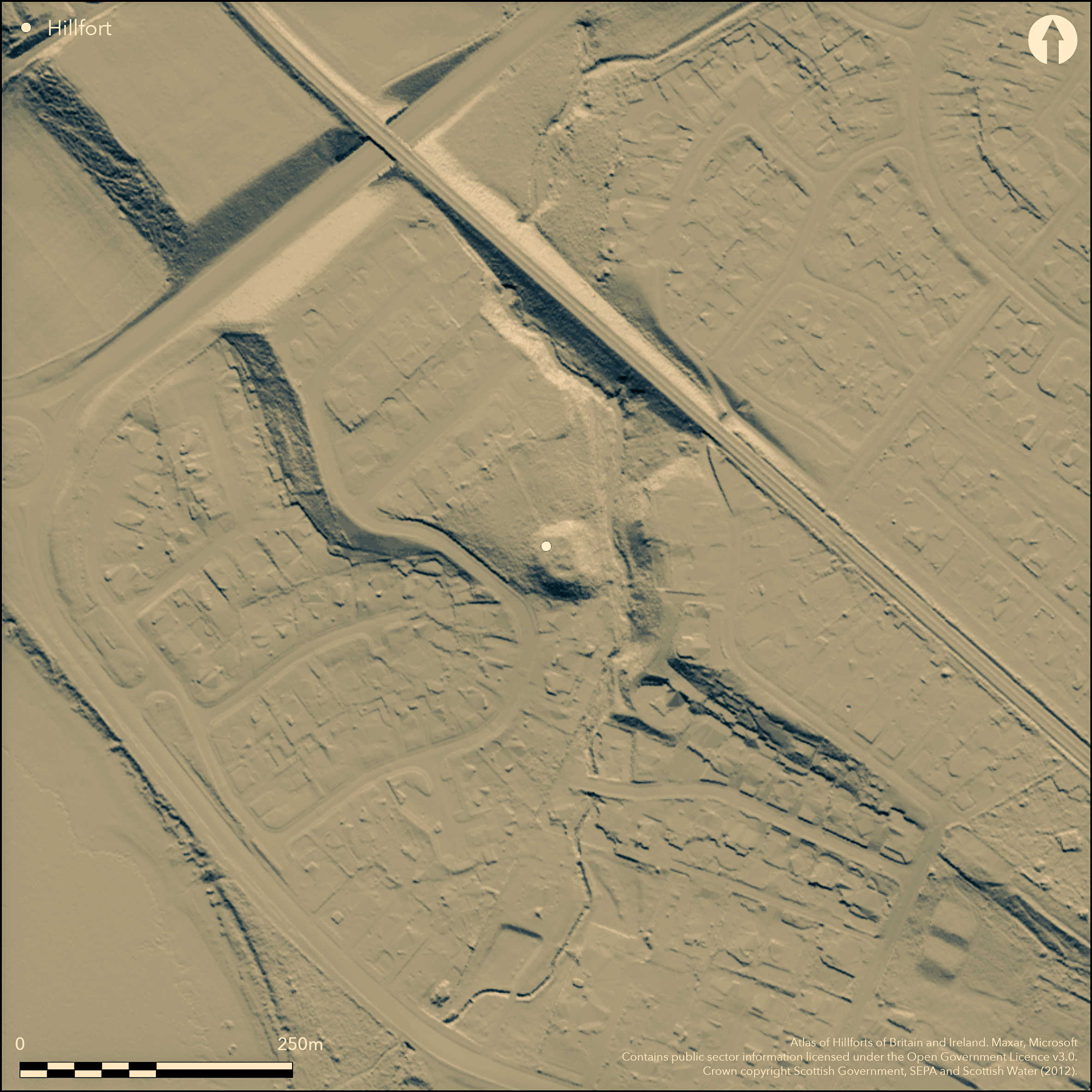
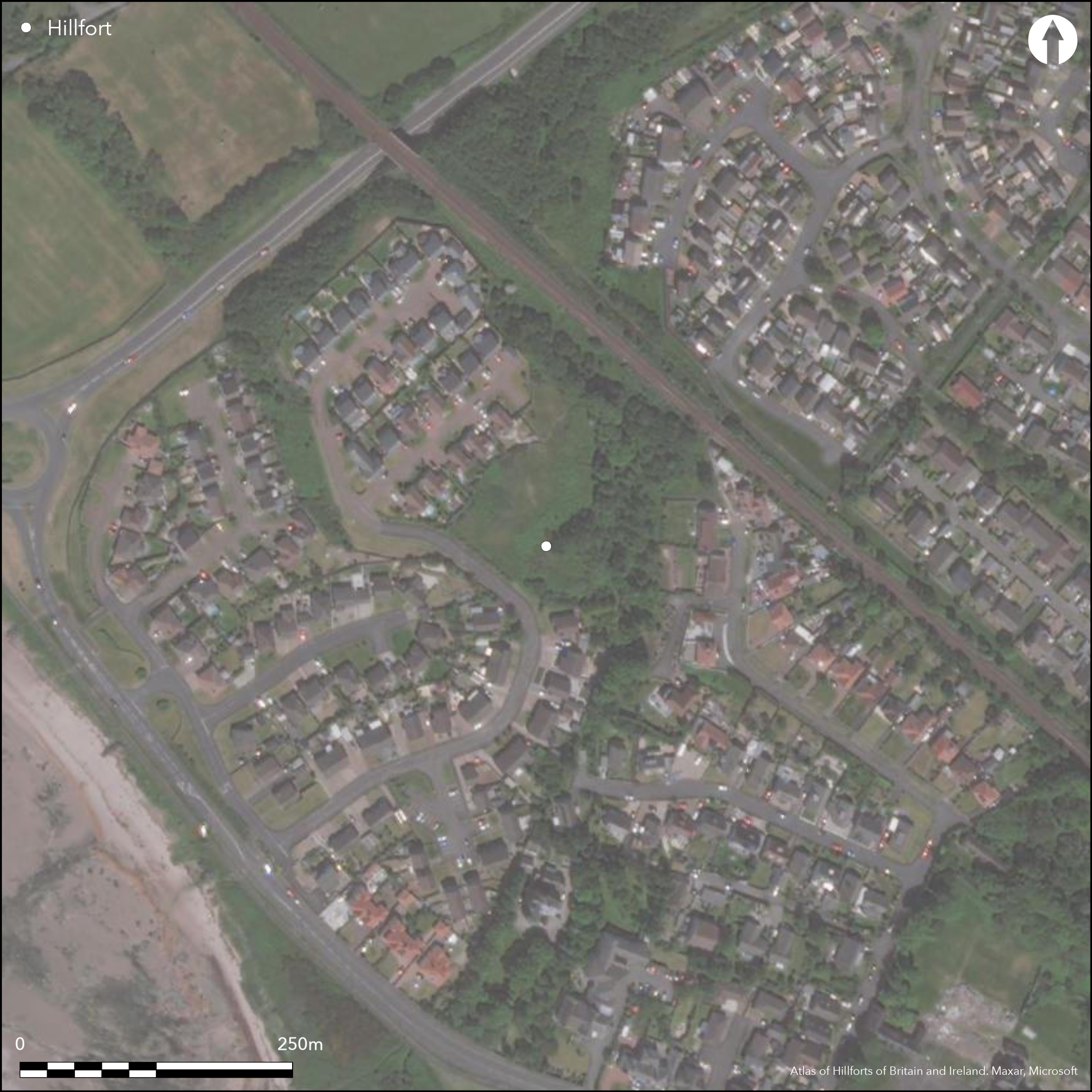
The mound known as Montfode Mount forms the tip of a promontory formed where the Montfode Burn cuts through the edge of the raised beach and debouches into the sea a short distance to the SW. It currently stands in an open space within a housing estate, but aerial photographs taken in 1977, when the surrounding ground was still under arable, revealed two concentric ditches drawn in an arc across the promontory to the NW of the mound. The mound itself has been variously interpreted as a motte, the forerunner of the late 16th century tower-house 350m to the N, or possibly the remains of a late Iron Age dun, and these ploughed outer ditches are either the remains of an earlier promontory fort or the bailey of a medieval castle. The sides of the mound are apparently scarped and the oval summit, which measures about 24m from NW to SE by 18m transversely, stands about 2.5m above the general surface of the promontory and up to 8m above the bottom of the burn gully on the E. Nothing can be seen of the ditch up to 9m broad and 2m deep which encircled the mound, but it was located by excavation in two sectors on the NNW and SSE respectively (James 1986); sections were also excavated across the two ditches of the promontory enclosure on the NNW, showing that the inner was about 6m broad, and the outer about 3.5m, cutting off a wedge-shaped area measuring up to 60m from NW to SE by a maximum of 60m transversely (1.8ha). Whereas the excavations of 1985 were designed to establish the position and character of the ditches, further evaluation and excavation prior to development in 2002 and 2006 (Stronach 2002; Dutton and Stronach 2006) was carried out on the area outside the outer ditches to the NW. Nevertheless, these located the outer end of a palisaded entrance way, while elsewhere on the terrace of the raised beach there were also several hearths and clusters of post-holes, one of which was thought to be the remains of a round-house; Bronze Age pottery was recovered from two of the features.
Citizen Science: ✗
Reliability of Data: Confirmed
Reliability of Interpretation: Confirmed
X: -536627 Y: 7490005 (EPSG: 3857)
Longitude: -4.820598570618207 Latitude: 55.65482078985262 (EPSG:4326)
Country: Scotland
Current County or Unitary Authority: North Ayrshire
Historic County: Ayrshire
Current Parish/Community/Council/Townland: Ardrossan
None
| Extant | ✓ |
| Cropmark | ✓ |
| Likely Destroyed | ✗ |
None
| Woodland | ✗ |
| Commercial Forestry Plantation | ✗ |
| Parkland | ✓ |
| Pasture (Grazing) | ✗ |
| Arable | ✗ |
| Scrub/Bracken | ✗ |
| Bare Outcrop | ✗ |
| Heather/Moorland | ✗ |
| Heath | ✗ |
| Built-up | ✓ |
| Coastal Grassland | ✗ |
| Other | ✗ |
None
| Contour Fort | ✗ |
| Partial Contour Fort | ✗ |
| Promontory Fort | ✓ |
| Hillslope Fort | ✗ |
| Level Terrain Fort | ✗ |
| Marsh Fort | ✗ |
| Multiple Enclosure Fort | ✗ |
| Hilltop | ✗ |
| Coastal Promontory | ✗ |
| Inland Promontory | ✓ |
| Valley Bottom | ✗ |
| Knoll/Hillock/Outcrop | ✗ |
| Ridge | ✗ |
| Cliff/Plateau-edge/Scarp | ✗ |
| Hillslope | ✗ |
| Lowland | ✗ |
| Spur | ✗ |
Dominant Topographic Feature: None
| North | ✗ |
| Northeast | ✗ |
| East | ✗ |
| Southeast | ✗ |
| South | ✗ |
| Southwest | ✗ |
| West | ✗ |
| Northwest | ✗ |
| Level | ✓ |
Altitude: 15.0m
N/A
No dating evidence for the defences was recovered by the excavations
Reliability: D - None
| Pre 1200BC | ✗ |
| 1200BC - 800BC | ✗ |
| 800BC - 400BC | ✗ |
| 400BC - AD50 | ✗ |
| AD50 - AD400 | ✗ |
| AD400 - AD 800 | ✗ |
| Post AD800 | ✗ |
| Unknown | ✓ |
| Pre Hillfort: | None |
| Post Hillfort: | A motte occupies the tip of the promontory and the rest of the defences have been ploughed flat. |
First depicted in 1856 on the 1st edition OS 25-inch map (Ayrshire 1860, sheet 16.1), the mound was visited by both David Christison ad John Smith in the early 1890s (Christison 1893, 394; Smith 1895, 24). Kenneth Steer visited the site in 1952 as part of the RCAHMS Survey of Marginal Lands, and was of the opinion that it was a motte, but in 1956 J L Davidson of the OS noted the foundations of a wall on the N and E, which has contributed to the subsequent confusion over its character. John Linge of the OS, who visited in 1982 and had seen most of the other dun sites in Ayrshire, was of the opinion that it was later prehistoric, but in the report on her excavations in 1985 Heather James set out the documentary context for a medieval earthwork castle hereabouts (James 1986). It was Scheduled in 1973, and the Scheduled area was excluded from the evaluation and excavation work carried out in 2002 and 2006 (Stronach 2002; Dutton and Stronach 2006).
| 1st Identified Map Depiction (1856): | Annotated Fort on the 1st edition OS 25-inch map (Ayrshire 1860, sheet 16.1) |
| Other (1891): | Description by David Christison (1893, 394) |
| Other (1895): | Description (Smith 1895, 24) |
| Other (1952): | Description during RCAHMS Survey of Marginal Lands |
| Other (1956): | Visited by the OS |
| Other (1973): | Scheduled |
| Other (1982): | Visited by the OS |
| Excavation (1985): | James 1986 |
| Excavation (2002): | Evaluation (Stronach 2002) |
| Excavation (2006): | (Dutton and Stronach 2006) |
Featureless
None
| None | ✓ |
| Spring | ✗ |
| Stream | ✗ |
| Pool | ✗ |
| Flush | ✗ |
| Well | ✗ |
| Other | ✗ |
None
| No Known Features | ✓ |
| Round Stone Structures | ✗ |
| Rectangular Stone Structures | ✗ |
| Curvilinear Platforms | ✗ |
| Other Roundhouse Evidence | ✗ |
| Pits | ✗ |
| Quarry Hollows | ✗ |
| Other | ✗ |
None
| No Known Excavation | ✓ |
| Pits | ✗ |
| Postholes | ✗ |
| Roundhouses | ✗ |
| Rectangular Structures | ✗ |
| Roads/Tracks | ✗ |
| Quarry Hollows | ✗ |
| Other | ✗ |
| Nothing Found | ✗ |
None
| No Known Geophysics | ✓ |
| Pits | ✗ |
| Roundhouses | ✗ |
| Rectangular Structures | ✗ |
| Roads/Tracks | ✗ |
| Quarry Hollows | ✗ |
| Other | ✗ |
| Nothing Found | ✗ |
None
| No Known Finds | ✓ |
| Pottery | ✗ |
| Metal | ✗ |
| Metalworking | ✗ |
| Human Bones | ✗ |
| Animal Bones | ✗ |
| Lithics | ✗ |
| Environmental | ✗ |
| Other | ✗ |
NO APPARENT FEATURES
| APs Not Checked | ✗ |
| None | ✓ |
| Roundhouses | ✗ |
| Rectangular Structures | ✗ |
| Pits | ✗ |
| Postholes | ✗ |
| Roads/Tracks | ✗ |
| Other | ✗ |
See main summary
| 1: | Ploughed flat |
| 2: | located by excavation and not visible on the aerial photographs |
Guard Chambers: ✗
Chevaux de Frise: ✗
| 1. Passage-way/Corridor (North west): | palisaded passage-way located by excavation outside the ditches |
Presumably the two ditches were accompanied by upcast ramparts cutting across the promontory
| Area 1: | 0.2ha. |
| Total: | 0.2ha. |
Total Footprint Area: 3.6ha.
None
| ✗ | None |
| ✗ | None |
| NE Quadrant: | 0 |
| SE Quadrant: | 0 |
| SW Quadrant: | 0 |
| NW Quadrant: | 2 |
| Total: | 2 |
| Partial Univallate | ✗ |
| Univallate | ✗ |
| Partial Bivallate | ✓ |
| Bivallate | ✗ |
| Partial Multivallate | ✗ |
| Multivallate | ✗ |
| Unknown | ✗ |
| Partial Univallate | ✗ |
| Univallate | ✗ |
| Partial Bivallate | ✗ |
| Bivallate | ✗ |
| Partial Multivallate | ✗ |
| Multivallate | ✗ |
None
| None | ✓ |
| Earthen Bank | ✗ |
| Stone Wall | ✗ |
| Rubble | ✗ |
| Wall-walk | ✗ |
| Evidence of Timber | ✗ |
| Vitrification | ✗ |
| Other Burning | ✗ |
| Palisade | ✗ |
| Counter Scarp Bank | ✗ |
| Berm | ✗ |
| Unfinished | ✗ |
| Other | ✗ |
Ditches
| None | ✓ |
| Earthen Bank | ✗ |
| Stone Wall | ✗ |
| Murus Duplex | ✗ |
| Timber-framed | ✗ |
| Timber-laced | ✗ |
| Vitrification | ✗ |
| Other Burning | ✗ |
| Palisade | ✓ |
| Counter Scarp Bank | ✗ |
| Berm | ✗ |
| Unfinished | ✗ |
| No Known Excavation | ✗ |
| Other | ✓ |
| ✗ | None |
| ✓ | On the assumption the ditch at the foot of the mound relates to the motte it is excluded here |
Number of Ditches: 2
| ✗ | None |
Christison, D (1893) 'The prehistoric forts of Ayrshire', Proc Soc Antiq Scot 27, 381-405
Dutton and Stronach, A and S (2006) 'Montfode Mount, Ardrossan, North Ayrshire (Adrossan parish), watching brief', Disc Exc Scot 7 (2006), 112
James, H F (1986) 'Excavation at Montfode Mount motte, Ayrshire'. Glasgow Archaeol J 13 (1986), 78-85
Smith, J (1895) Prehistoric man in Ayrshire. London
Stronach, S (2002) 'Montfode Mount, Ardrossan, North Ayrshire (Ardrossan parish), prehistoric feature', Disc Exc Scot 3 (2002), 84
Atlas of Hillforts:
Wikidata:
This work is licensed under CC BY-SA 4.0![]()
![]()
![]() and should be cited as:
and should be cited as:
Lock, Gary and Ralston, Ian. 2024. Atlas of Hillforts of Britain and Ireland. Available at: https://hillforts.arch.ox.ac.uk
Document Version 1.1