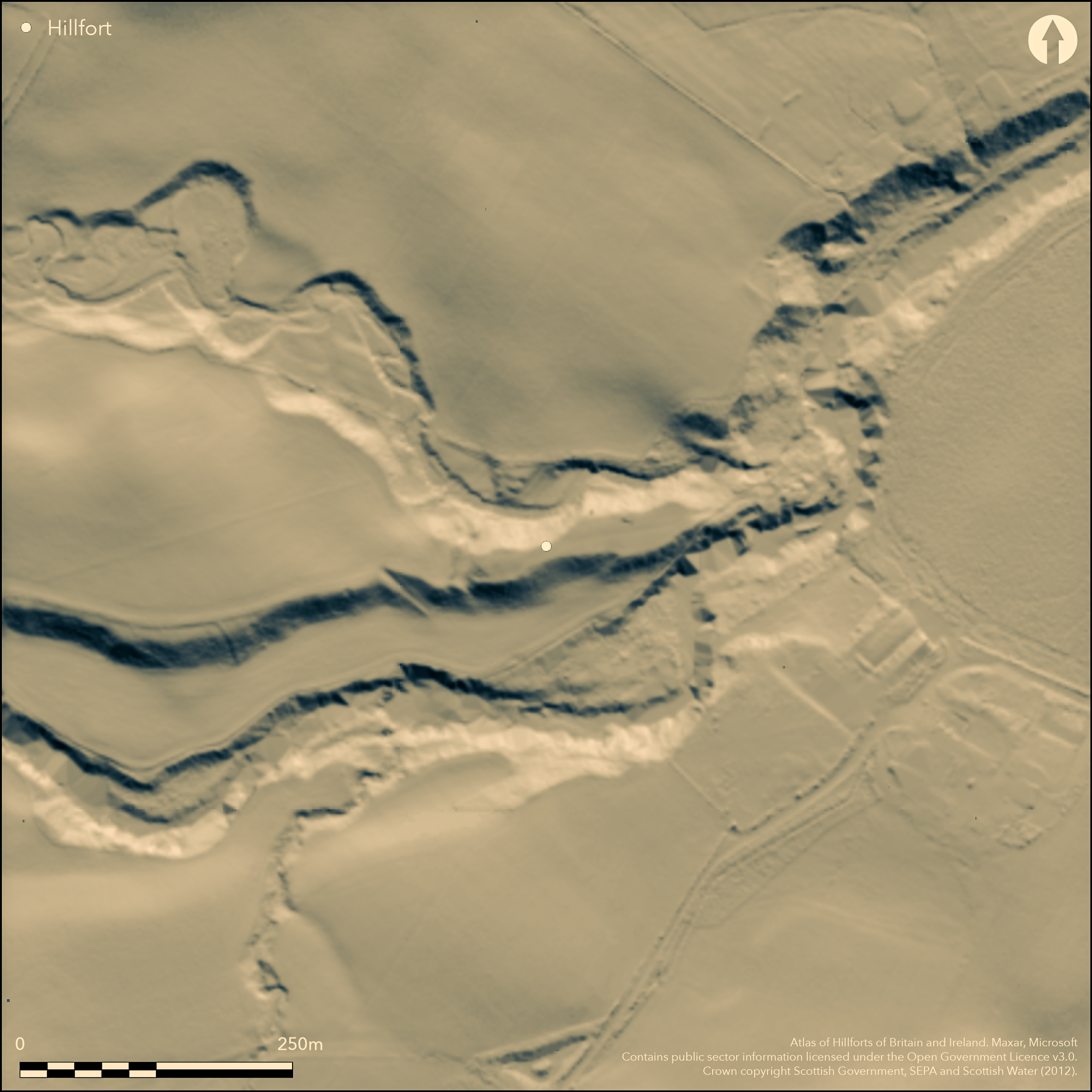
LiDAR 1m DTM Hillshade
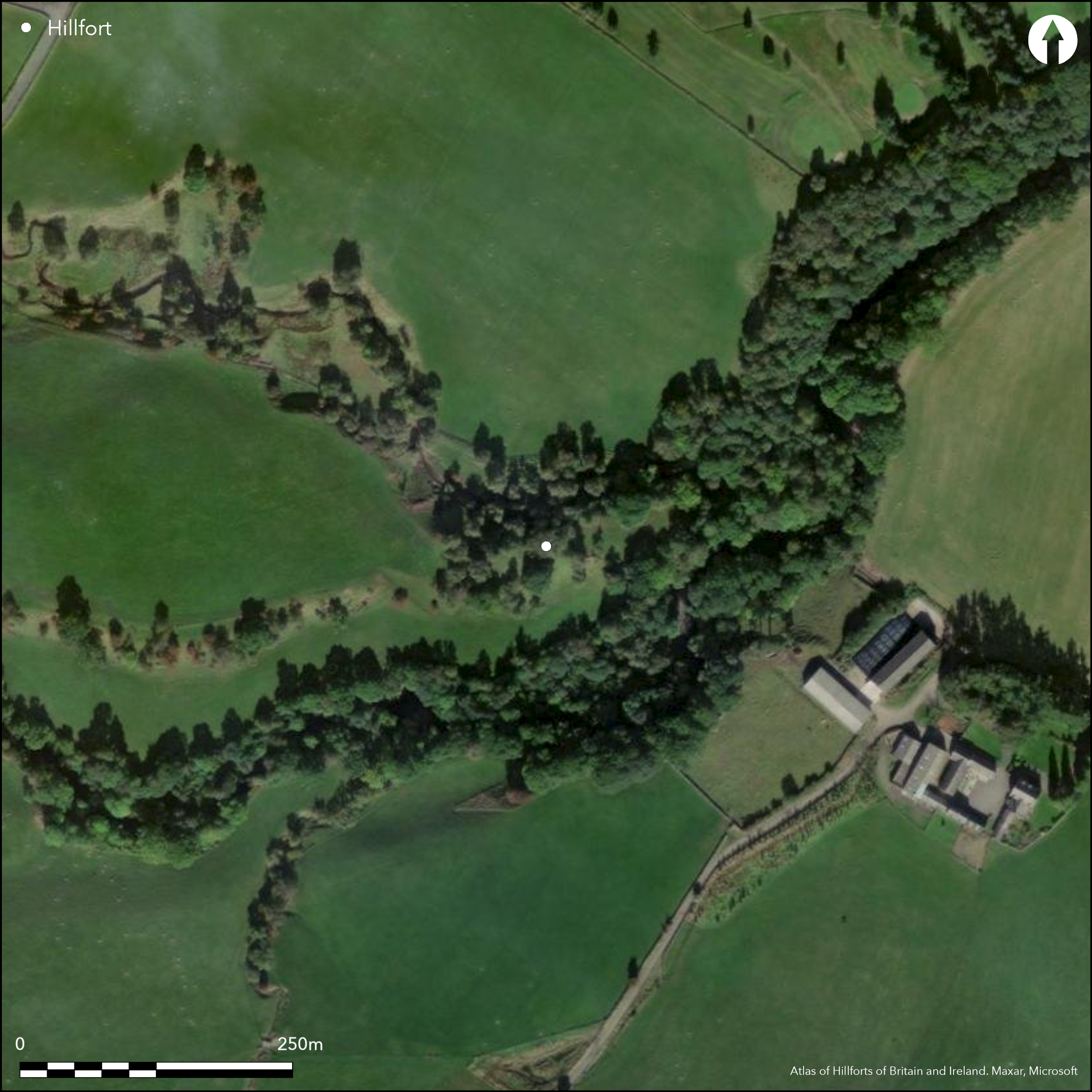
Satellite Imagery
LiDAR 1m DTM Hillshade
Satellite Imagery
Scroll left/right to view further images.
HER: Dumfries & Galloway MDG28 (None)
NMR: NS 70 NE 1 (45412)
SM: 656
NGR: NS 7728 0887
X: 277280 Y: 608870 (OSGB36)
The defences of this probable fort comprise two ditches with upcast ramparts, which have been drawn across the neck of a long narrow promontory formed between the gully of the Barr Burn and the flood plain of the Euchan Water to block access from the W. The flat top of the promontory measures about 110m from E to W by a maximum of 19m transversely (0.2ha), and there are traces of a low rampart on the leading edge of the slightly raised area at the W end, standing some 3.8m above the bottom of the inner of the two ditches. This ditch is up to 8m broad by at least 1m deep externally and is accompanied by a counterscarp rampart 4m thick and between 1m and 1.8m high. The outer defences lie a further 20m to the W and originally comprised an earthen rampart with an external ditch averaging about 6m in breadth (RCAHMS 1920, 193, no.557, fig 139), though this has been reduced by cultivation to little more than an undulation in the surface of the field. Access was probably on the S margin of the promontory. Already identified in 1856 as a vitrified fort (1st edition OS 25-inch map, Dumfriesshire 1860, sheet 6.14), excavations about 1870 are said to have revealed large masses of vitrified material (Brown 1891, 31-2), though the character of the defences visible today suggest that they are largely earthen.
Citizen Science: ✗
Reliability of Data: Confirmed
Reliability of Interpretation: Confirmed
X: -438309 Y: 7431756 (EPSG: 3857)
Longitude: -3.9373963676672323 Latitude: 55.35849365005629 (EPSG:4326)
Country: Scotland
Current County or Unitary Authority: Dumfries & Galloway
Historic County: Dumfriesshire
Current Parish/Community/Council/Townland: Sanquhar
None
| Extant | ✓ |
| Cropmark | ✗ |
| Likely Destroyed | ✗ |
None
| Woodland | ✓ |
| Commercial Forestry Plantation | ✗ |
| Parkland | ✗ |
| Pasture (Grazing) | ✓ |
| Arable | ✓ |
| Scrub/Bracken | ✗ |
| Bare Outcrop | ✗ |
| Heather/Moorland | ✗ |
| Heath | ✗ |
| Built-up | ✗ |
| Coastal Grassland | ✗ |
| Other | ✗ |
None
| Contour Fort | ✗ |
| Partial Contour Fort | ✗ |
| Promontory Fort | ✓ |
| Hillslope Fort | ✗ |
| Level Terrain Fort | ✗ |
| Marsh Fort | ✗ |
| Multiple Enclosure Fort | ✗ |
| Hilltop | ✗ |
| Coastal Promontory | ✗ |
| Inland Promontory | ✓ |
| Valley Bottom | ✗ |
| Knoll/Hillock/Outcrop | ✗ |
| Ridge | ✗ |
| Cliff/Plateau-edge/Scarp | ✗ |
| Hillslope | ✗ |
| Lowland | ✗ |
| Spur | ✗ |
Dominant Topographic Feature: None
| North | ✗ |
| Northeast | ✗ |
| East | ✗ |
| Southeast | ✗ |
| South | ✗ |
| Southwest | ✗ |
| West | ✗ |
| Northwest | ✗ |
| Level | ✓ |
Altitude: 135.0m
N/A
In the absence of modern excavation, there are neither stratified artefacts nor radiocarbon dates to provide a chronology for the defences.
Reliability: D - None
| Pre 1200BC | ✗ |
| 1200BC - 800BC | ✗ |
| 800BC - 400BC | ✗ |
| 400BC - AD50 | ✗ |
| AD50 - AD400 | ✗ |
| AD400 - AD 800 | ✗ |
| Post AD800 | ✗ |
| Unknown | ✓ |
| Pre Hillfort: | None |
| Post Hillfort: | None |
First depicted in 1856 on the 1st edition OS 25-inch map (Dumfriesshire 1860, sheet 6.14), it was annotated 'site of Kemp's Castle vitrified fort'. An excavation conducted about 1870 is reported to have encountered large vitreous masses (Brown 1891, 31-2), though no trace of vitrifaction has been observed by subsequent visitors. It was visited by Alexander Curle in 1912 during the preparation of the County Inventory for Dumfriesshire (RCAHMS 1920, 193, no.557, fig 139), and having been visited by the OS in 1954, depiction was revised at 1:2500 in 1978. It was Scheduled in 1937. RCAHMS took aerial photographs of the the site in 1984, revealing the course of the ploughed down outer defences. Visited by S Halliday in 2016
| 1st Identified Map Depiction (1856): | Named in Gothic type on the 1st edition OS 25-inch map (Dumfriesshire 1860, sheet 6.14) and annotated 'vitrified fort' |
| Excavation (1870): | (Brown 1891, 31-2) |
| Earthwork Survey (1912): | Plan and description (RCAHMS 1920, 193, no.557, fig 139) |
| Other (1937): | Scheduled |
| Other (1954): | Visited by the OS |
| Other (1978): | Revised at 1:2500 by the OS |
| Other (1984): | Cropmarks of ploughed down defences photographed by by RCAHMS Aerial Survey Programme |
| Other (2016): | Visited by S Halliday |
Raised platform at the W end of the summit, probably indicating a substantial structure and the site of the excavations of 1870 that noted large masses of vitrifaction.
None
| None | ✓ |
| Spring | ✗ |
| Stream | ✗ |
| Pool | ✗ |
| Flush | ✗ |
| Well | ✗ |
| Other | ✗ |
None
| No Known Features | ✓ |
| Round Stone Structures | ✗ |
| Rectangular Stone Structures | ✗ |
| Curvilinear Platforms | ✗ |
| Other Roundhouse Evidence | ✗ |
| Pits | ✗ |
| Quarry Hollows | ✗ |
| Other | ✗ |
Vitrifaction claimed, probably from the platform at the W end of the interior
| No Known Excavation | ✗ |
| Pits | ✗ |
| Postholes | ✗ |
| Roundhouses | ✗ |
| Rectangular Structures | ✗ |
| Roads/Tracks | ✗ |
| Quarry Hollows | ✗ |
| Other | ✓ |
| Nothing Found | ✗ |
None
| No Known Geophysics | ✓ |
| Pits | ✗ |
| Roundhouses | ✗ |
| Rectangular Structures | ✗ |
| Roads/Tracks | ✗ |
| Quarry Hollows | ✗ |
| Other | ✗ |
| Nothing Found | ✗ |
None
| No Known Finds | ✓ |
| Pottery | ✗ |
| Metal | ✗ |
| Metalworking | ✗ |
| Human Bones | ✗ |
| Animal Bones | ✗ |
| Lithics | ✗ |
| Environmental | ✗ |
| Other | ✗ |
NO APPARENT FEATURES
| APs Not Checked | ✗ |
| None | ✓ |
| Roundhouses | ✗ |
| Rectangular Structures | ✗ |
| Pits | ✗ |
| Postholes | ✗ |
| Roads/Tracks | ✗ |
| Other | ✗ |
See main summary
| 1: | None |
| 2: | None noted in the outer defences. one in inner |
Guard Chambers: ✗
Chevaux de Frise: ✗
| 1. Simple Gap (West): | Along southern margin of the promontory |
Two ditches and upcast banks cut across the neck of the promontory on the W
| Area 1: | 0.2ha. |
| Total: | 0.2ha. |
Total Footprint Area: 0.25ha.
None
| ✗ | None |
| ✗ | None |
| NE Quadrant: | 0 |
| SE Quadrant: | 0 |
| SW Quadrant: | 0 |
| NW Quadrant: | 3 |
| Total: | 3 |
| Partial Univallate | ✗ |
| Univallate | ✗ |
| Partial Bivallate | ✗ |
| Bivallate | ✗ |
| Partial Multivallate | ✓ |
| Multivallate | ✗ |
| Unknown | ✗ |
| Partial Univallate | ✗ |
| Univallate | ✗ |
| Partial Bivallate | ✗ |
| Bivallate | ✗ |
| Partial Multivallate | ✗ |
| Multivallate | ✗ |
Claimed as a vitrified fort on the 1st edition OS 6-inch map, but no trace of vitrifaction was found by S Halliday in 2016
| None | ✗ |
| Earthen Bank | ✓ |
| Stone Wall | ✗ |
| Rubble | ✗ |
| Wall-walk | ✗ |
| Evidence of Timber | ✗ |
| Vitrification | ✓ |
| Other Burning | ✗ |
| Palisade | ✗ |
| Counter Scarp Bank | ✗ |
| Berm | ✗ |
| Unfinished | ✗ |
| Other | ✗ |
Claimed in antiquarian excavations of 1870 but not substantiated by later visitors
| None | ✗ |
| Earthen Bank | ✗ |
| Stone Wall | ✗ |
| Murus Duplex | ✗ |
| Timber-framed | ✗ |
| Timber-laced | ✗ |
| Vitrification | ✓ |
| Other Burning | ✗ |
| Palisade | ✗ |
| Counter Scarp Bank | ✗ |
| Berm | ✗ |
| Unfinished | ✗ |
| No Known Excavation | ✗ |
| Other | ✗ |
| ✗ | None |
| ✓ | None |
Number of Ditches: 2
| ✗ | None |
Brown, J (1891) The history of Sanquhar, Dumfries. Edinburgh; Glasgow
Feachem, R (1963) A guide to prehistoric Scotland. Batsford: London (p 118)
RCAHMS (1920) The Royal Commission on the Ancient and Historical Monuments and Constructions of Scotland. Seventh report with inventory of monuments and constructions in the county of Dumfries. HMSO: Edinburgh
Atlas of Hillforts:
Wikidata:
This work is licensed under CC BY-SA 4.0![]()
![]()
![]() and should be cited as:
and should be cited as:
Lock, Gary and Ralston, Ian. 2024. Atlas of Hillforts of Britain and Ireland. Available at: https://hillforts.arch.ox.ac.uk
Document Version 1.1