LiDAR 1m DTM Hillshade
Satellite Imagery
LiDAR 1m DTM Hillshade
Satellite Imagery
Scroll left/right to view further images.
HER: The West of Scotland Archaeology Service 9220 (None)
NMR: NS 65 NE 18 (44867)
SM: None
NGR: NS 6569 5821
X: 265690 Y: 658210 (OSGB36)
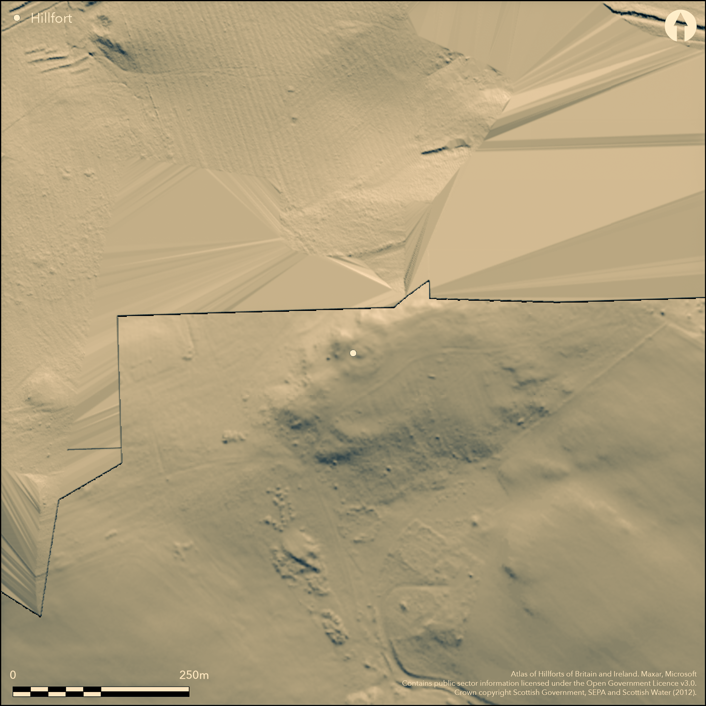
Little is now visible of the fort that occupies the central portion of Dechmont Hill, which is a ridge lying roughly ENE and WSW. As recorded by the OS in 1959, it is D-shaped on plan, backing onto the steep escarpment that forms the NNW flank of the hill. Elsewhere they traced two ramparts set some 20m apart, though for the most part these were reduced to little more than scarps on the slope, and an entrance with a hollowed track leading up to it was visible on the W. Within the interior, which measured about 80m from ENE to WSW by 65m transversely (0.4ha), there were traces of a third rampart forming a discrete enclosure about 40m in internal diameter on the summit of the hill; it is unclear whether this was associated with the outer defences or was perhaps a later enclosure inserted into the interior. The only other feature of note is a burial cairn about 10m in diameter by 0.9m in height beneath the OS triangulation Station upon the summit; notable for its encircling ditch with external bank, it is probably the site of the discovery of a Bronze Age Food Vessel donated to the National Museum of Antiquities in 1882 (Proc Soc Antiiq Scotland16, 1882, 147). Antiquarian excavations about the end of the 1780s uncovered 'the foundation of a circular building, about 24 feet in diameter' (Stat Acct, v, 1793, 264n), but it is perhaps more likely that this was part of the burial cairn on the summit rather than a domestic structure within the fort.
Citizen Science: ✓
Reliability of Data: Confirmed
Reliability of Interpretation: Confirmed
X: -461320 Y: 7518406 (EPSG: 3857)
Longitude: -4.144106009761528 Latitude: 55.798497218168976 (EPSG:4326)
Country: Scotland
Current County or Unitary Authority: South Lanarkshire
Historic County: Lanarkshire
Current Parish/Community/Council/Townland: Cambuslang
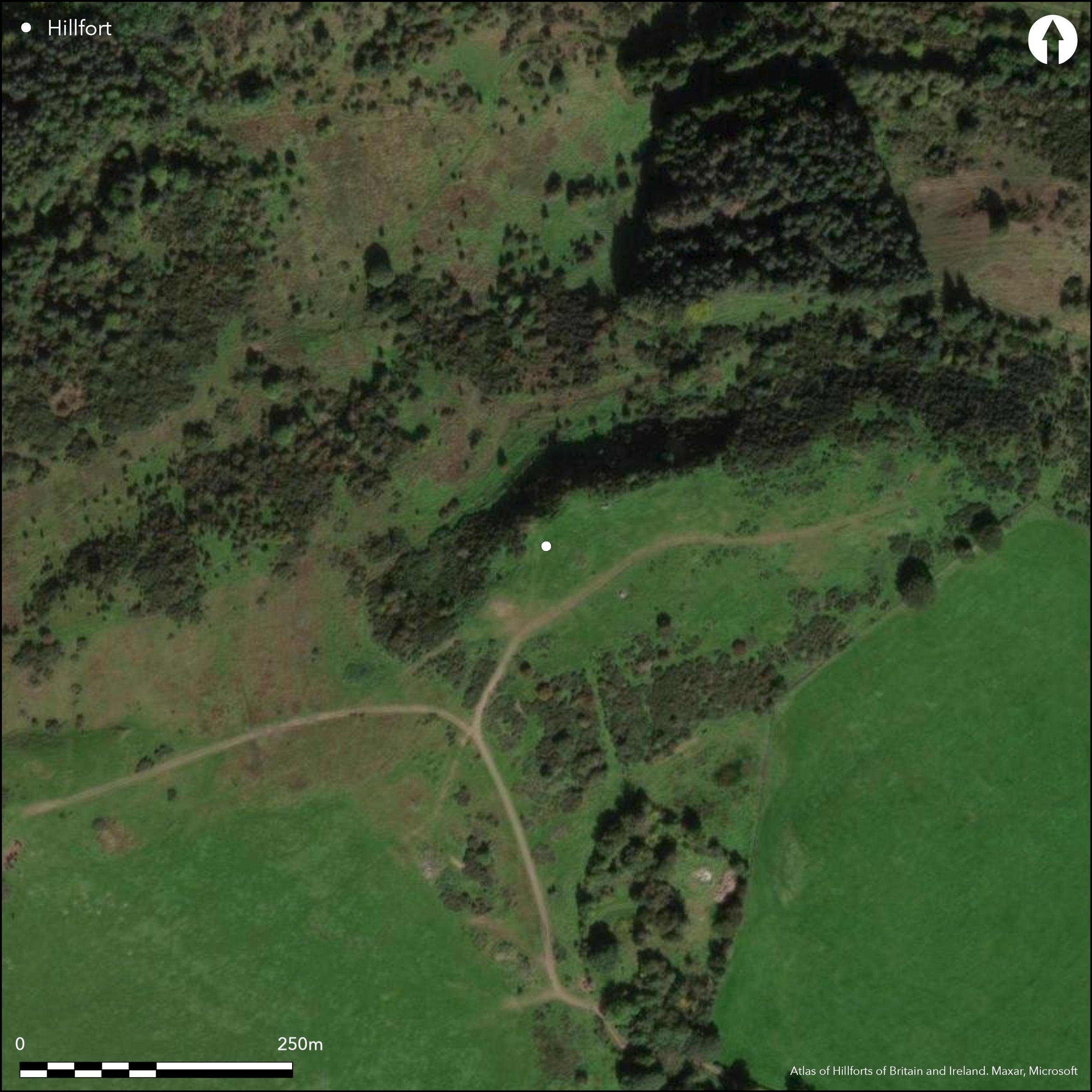
Barely visible
| Extant | ✓ |
| Cropmark | ✗ |
| Likely Destroyed | ✓ |
Isolated gorse thickets and thorn trees
| Woodland | ✗ |
| Commercial Forestry Plantation | ✗ |
| Parkland | ✗ |
| Pasture (Grazing) | ✓ |
| Arable | ✗ |
| Scrub/Bracken | ✓ |
| Bare Outcrop | ✗ |
| Heather/Moorland | ✗ |
| Heath | ✗ |
| Built-up | ✗ |
| Coastal Grassland | ✗ |
| Other | ✗ |
None
| Contour Fort | ✓ |
| Partial Contour Fort | ✗ |
| Promontory Fort | ✗ |
| Hillslope Fort | ✗ |
| Level Terrain Fort | ✗ |
| Marsh Fort | ✗ |
| Multiple Enclosure Fort | ✗ |
| Hilltop | ✓ |
| Coastal Promontory | ✗ |
| Inland Promontory | ✗ |
| Valley Bottom | ✗ |
| Knoll/Hillock/Outcrop | ✗ |
| Ridge | ✗ |
| Cliff/Plateau-edge/Scarp | ✓ |
| Hillslope | ✗ |
| Lowland | ✗ |
| Spur | ✗ |
Dominant Topographic Feature: None
| North | ✗ |
| Northeast | ✗ |
| East | ✗ |
| Southeast | ✗ |
| South | ✗ |
| Southwest | ✗ |
| West | ✗ |
| Northwest | ✗ |
| Level | ✓ |
Altitude: 180.0m
N/A
There are neither stratified artefacts nor radiocarbon dates to provide a chronology for the defences.
Reliability: D - None
| Pre 1200BC | ✗ |
| 1200BC - 800BC | ✗ |
| 800BC - 400BC | ✗ |
| 400BC - AD50 | ✗ |
| AD50 - AD400 | ✗ |
| AD400 - AD 800 | ✗ |
| Post AD800 | ✗ |
| Unknown | ✓ |
| Pre Hillfort: | Burial cairn on the summit; Food Vessel found |
| Post Hillfort: | Cultivation, stone robbing and military training |
First noted in 1793, at which time the remains of the fort were already being dug up and removed (Stat Acct, v, 1793, 264n), and again in 1836 (NSA, 6, Lanarkshire, 430), they do not appear on early OS maps and were first visited by the OS and surveyed at 1:2500 in 1959. They were visited by RCAHMS in 1974 and again in 1985.
| 1st Identified Written Reference (1793): | Description (Stat Acct, v, 1793, 264n) |
| Excavation (1793): | Antiquarian excavation some years before 1793 (Stat Acct, v, 1793, 264n) |
| Other (1836): | Noted (NSA, 6, Lanarkshire, 430) |
| 1st Identified Map Depiction (1959): | Surveyed at 1:2500 by the OS |
| Other (1974): | Description by RCAHMS |
| Other (1985): | Description by RCAHMS |
Featureless apart from the inner enclosure and burial cairn on the summit.
None
| None | ✓ |
| Spring | ✗ |
| Stream | ✗ |
| Pool | ✗ |
| Flush | ✗ |
| Well | ✗ |
| Other | ✗ |
None
| No Known Features | ✓ |
| Round Stone Structures | ✗ |
| Rectangular Stone Structures | ✗ |
| Curvilinear Platforms | ✗ |
| Other Roundhouse Evidence | ✗ |
| Pits | ✗ |
| Quarry Hollows | ✗ |
| Other | ✗ |
Circular foundation discovered before 1793
| No Known Excavation | ✗ |
| Pits | ✗ |
| Postholes | ✗ |
| Roundhouses | ✗ |
| Rectangular Structures | ✗ |
| Roads/Tracks | ✗ |
| Quarry Hollows | ✗ |
| Other | ✓ |
| Nothing Found | ✗ |
None
| No Known Geophysics | ✓ |
| Pits | ✗ |
| Roundhouses | ✗ |
| Rectangular Structures | ✗ |
| Roads/Tracks | ✗ |
| Quarry Hollows | ✗ |
| Other | ✗ |
| Nothing Found | ✗ |
None
| No Known Finds | ✓ |
| Pottery | ✗ |
| Metal | ✗ |
| Metalworking | ✗ |
| Human Bones | ✗ |
| Animal Bones | ✗ |
| Lithics | ✗ |
| Environmental | ✗ |
| Other | ✗ |
NO APPARENT FEATURES
| APs Not Checked | ✓ |
| None | ✗ |
| Roundhouses | ✗ |
| Rectangular Structures | ✗ |
| Pits | ✗ |
| Postholes | ✗ |
| Roads/Tracks | ✗ |
| Other | ✗ |
See main summary
| 1: | Heavily degraded all round the circuit |
| 2: | None |
Guard Chambers: ✗
Chevaux de Frise: ✗
| 1. Simple Gap (West): | Approached by hollow way |
Two ramparts
| Area 1: | 0.4ha. |
| Total: | 0.4ha. |
Total Footprint Area: 0.81ha.
None
| ✗ | None |
| ✗ | None |
| NE Quadrant: | 2 |
| SE Quadrant: | 2 |
| SW Quadrant: | 2 |
| NW Quadrant: | 0 |
| Total: | 2 |
| Partial Univallate | ✗ |
| Univallate | ✗ |
| Partial Bivallate | ✓ |
| Bivallate | ✗ |
| Partial Multivallate | ✗ |
| Multivallate | ✗ |
| Unknown | ✗ |
| Partial Univallate | ✗ |
| Univallate | ✗ |
| Partial Bivallate | ✗ |
| Bivallate | ✗ |
| Partial Multivallate | ✗ |
| Multivallate | ✗ |
Reduced to scarps
| None | ✗ |
| Earthen Bank | ✓ |
| Stone Wall | ✗ |
| Rubble | ✗ |
| Wall-walk | ✗ |
| Evidence of Timber | ✗ |
| Vitrification | ✗ |
| Other Burning | ✗ |
| Palisade | ✗ |
| Counter Scarp Bank | ✗ |
| Berm | ✗ |
| Unfinished | ✗ |
| Other | ✗ |
None
| None | ✗ |
| Earthen Bank | ✗ |
| Stone Wall | ✗ |
| Murus Duplex | ✗ |
| Timber-framed | ✗ |
| Timber-laced | ✗ |
| Vitrification | ✗ |
| Other Burning | ✗ |
| Palisade | ✗ |
| Counter Scarp Bank | ✗ |
| Berm | ✗ |
| Unfinished | ✗ |
| No Known Excavation | ✓ |
| Other | ✗ |
| ✗ | None |
| ✗ | None |
Number of Ditches: None
| ✗ | None |
NSA (1834-1845) The New Statistical Account of Scotland by the ministers of the respective parishes under the superintendence of a committee of the society for the benefit of the sons and daughters of the clergy, 15v Edinburgh
RCAHMS (1978) The Royal Commission on the Ancient and Historical Monuments of Scotland. Lanarkshire: an inventory of the prehistoric and Roman monuments. HMSO: Edinburgh
Stat Acct (date) Statistical Account of Scotland: Drawn up from the Communications of the Ministers of the Different Parishes (Sinclair, J ed), 1791-99
Atlas of Hillforts:
Wikidata:
This work is licensed under CC BY-SA 4.0![]()
![]()
![]() and should be cited as:
and should be cited as:
Lock, Gary and Ralston, Ian. 2024. Atlas of Hillforts of Britain and Ireland. Available at: https://hillforts.arch.ox.ac.uk
Document Version 1.1