LiDAR 1m DTM Hillshade
Satellite Imagery
LiDAR 1m DTM Hillshade
Satellite Imagery
Scroll left/right to view further images.
HER: Falkirk Community Trust, Falkirk Sites and Monuments Record 768 (None)
NMR: NS 88 SW 1 (47004)
SM: 1738
NGR: NS 8333 8498
X: 283335 Y: 684986 (OSGB36)
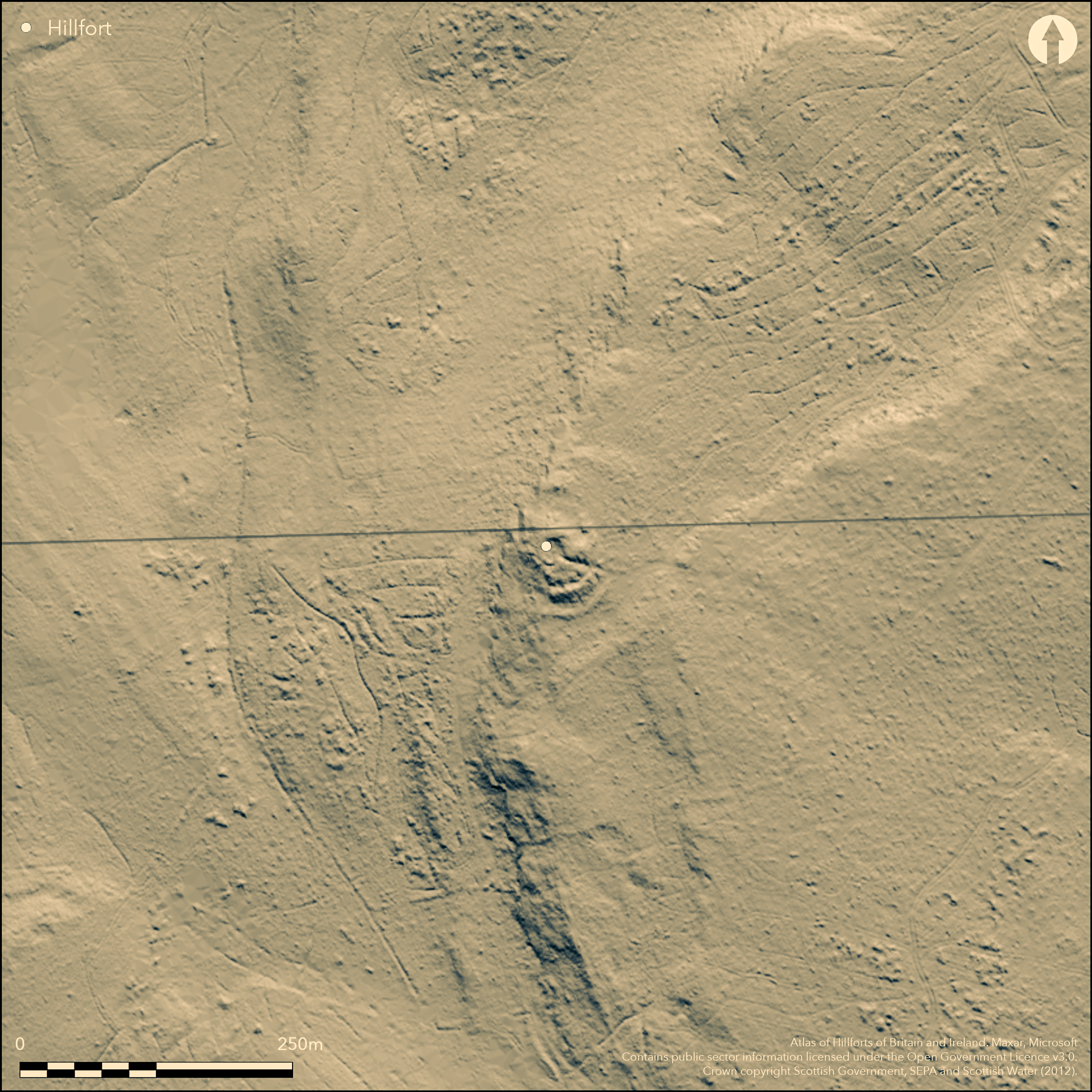
The well-known broch known as The Tappoch stands within a larger enclosure, whose two ramparts are commonly regarded as outworks to the broch. More recently, however, it has been suggested that the broch may have been erected within the interior of an earlier enclosure on the craggy hilltop, and a trial excavation carried out by Murray Cook on what has the appearance of a rib of outcrop about 20m outside the defences on the S suggests that this may also mark the line of an outer rampart, though its precise course and the extent of any enclosure it might form are uncertain. The projected circuit of the inner of the known outworks encloses an area measuring about 45m from N to S by 32m transversely (0.11ha) within a wall about 4.5m thick and 1.4m in external height on the SE, though it peters out to the NE of the broch and cannot be traced to the edge of the escarpment forming the W side of the summit. The outer, displays runs of outer face on the SE, is of lesser stature and also peters out northwards; nonetheless, its projected line takes in the whole of the natural terrace to the N of the broch, enclosing an area measuring about 63m from N to S by 38m transversely (0.18ha). The existence of a third line on the S would enclose an area in excess of 0.2ha. The entrance is on the ESE, on the same axis as that of the broch. Excavations in 1948-49 focused on the outworks, but were unable to elucidate either their date or purpose (Hunter 1949a & b).
Citizen Science: ✗
Reliability of Data: Confirmed
Reliability of Interpretation: Unconfirmed
X: -431294 Y: 7567087 (EPSG: 3857)
Longitude: -3.874380685058448 Latitude: 56.04353519086783 (EPSG:4326)
Country: Scotland
Current County or Unitary Authority: Falkirk
Historic County: Stirlingshire
Current Parish/Community/Council/Townland: Dunipace
None
| Extant | ✓ |
| Cropmark | ✗ |
| Likely Destroyed | ✗ |
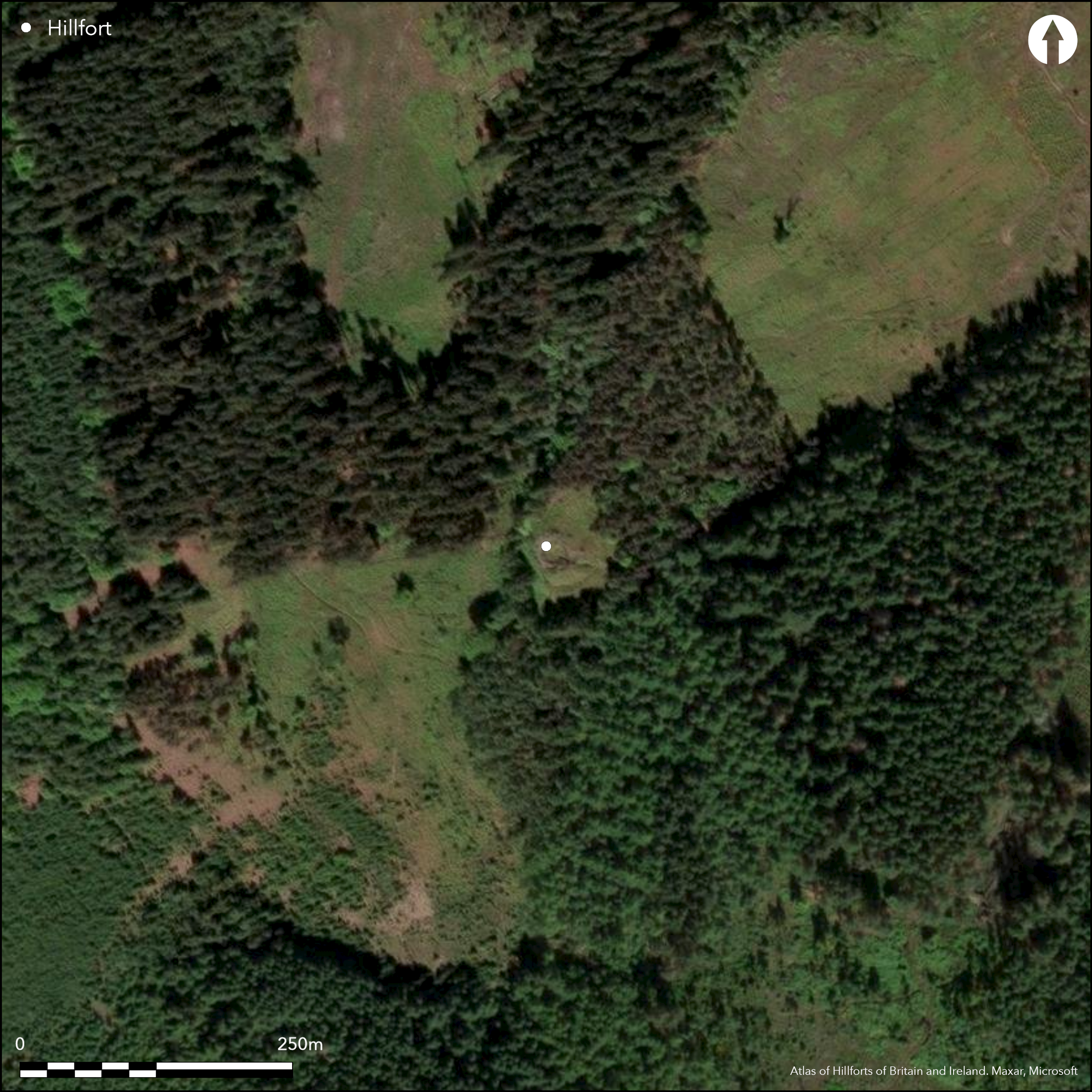
Clearing in coniferous plantation
| Woodland | ✗ |
| Commercial Forestry Plantation | ✗ |
| Parkland | ✗ |
| Pasture (Grazing) | ✗ |
| Arable | ✗ |
| Scrub/Bracken | ✓ |
| Bare Outcrop | ✗ |
| Heather/Moorland | ✗ |
| Heath | ✗ |
| Built-up | ✗ |
| Coastal Grassland | ✗ |
| Other | ✗ |
None
| Contour Fort | ✓ |
| Partial Contour Fort | ✗ |
| Promontory Fort | ✗ |
| Hillslope Fort | ✗ |
| Level Terrain Fort | ✗ |
| Marsh Fort | ✗ |
| Multiple Enclosure Fort | ✗ |
| Hilltop | ✓ |
| Coastal Promontory | ✗ |
| Inland Promontory | ✗ |
| Valley Bottom | ✗ |
| Knoll/Hillock/Outcrop | ✗ |
| Ridge | ✗ |
| Cliff/Plateau-edge/Scarp | ✓ |
| Hillslope | ✗ |
| Lowland | ✗ |
| Spur | ✗ |
Dominant Topographic Feature: None
| North | ✗ |
| Northeast | ✗ |
| East | ✗ |
| Southeast | ✗ |
| South | ✗ |
| Southwest | ✗ |
| West | ✗ |
| Northwest | ✗ |
| Level | ✓ |
Altitude: 105.0m
N/A
The broch may reasonably be dated to the early centuries AD
Reliability: D - None
| Pre 1200BC | ✗ |
| 1200BC - 800BC | ✗ |
| 800BC - 400BC | ✗ |
| 400BC - AD50 | ✗ |
| AD50 - AD400 | ✓ |
| AD400 - AD 800 | ✗ |
| Post AD800 | ✗ |
| Unknown | ✓ |
| Pre Hillfort: | None |
| Post Hillfort: | Construction of the broch |
| Morphology/Earthwork/Typology: | None |
A feature shown on Roy's Maps (1747-55) in Tor Wood is possibly a depiction of the interior of the broch, much as it was when it was depicted on the 1st edition OS 25-inch map as a Tumulus (Stirlingshire 1861, Sheet 24.5), three years before it was investigated by Col Joseph Dundas, who emptied out the interior (Dundas 1866). On the subsequent editions of the OS map the lines of the walls-faces are shown, but there is no gothic script to indicate its antiquity. Christian Maclagan prepared several drawings, probably about 1880, and the RCAHMS collection also holds plans and sections by 'Carey', which are included in the Society of Antiquaries manuscripts (RCAHMS STD 42/6, SAS 261). It was surveyed by RCAHMS in 1953 for inclusion in the County Inventory for Stirlingshire (RCAHMS 1963, 85-7, no.100, fig 24). Euan Mackie conducted a minor investigation of a chamber exposed on the wall head in 1964. The OS revised the 1:2500 depiction in 1974, and in 1979 N Aitchison noted a small lump of vitrified stone from the inner outwork on the northern side of the broch. Most recently the site has been surveyed using a ground-based scanner by G Cavers and J Hudson of AOC Archaeology (2014).
| 1st Identified Map Depiction (1755): | General William Roy's Military Map of Scotland (1747-55) |
| Other (1861): | Annotated Tumulus on the 1st edition OS 25-inch map as a Tumulus (Stirlingshire 1865, Sheet 24.5) |
| Excavation (1864): | Col Joseph Dundas (Dundas 1866) |
| Earthwork Survey (1880): | About 1880; Christian Maclagan (RCAHMS DC53001; 53008; 53010) |
| Excavation (1948): | On outworks (Hunter 1949a & b) |
| Other (1949): | Scheduled |
| Excavation (1949): | On outworks (Hunter 1949a & b) |
| Earthwork Survey (1953): | RCAHMS STD 42/1-5 & DP17039-3 |
| Excavation (1964): | Euan Mackie 1964 |
| Other (1974): | Revised at 1:2500 by the OS |
| Earthwork Survey (2014): | Including scan data (Cavers and Hudson 2014) |
| Excavation (2014): | On an outwork by Murray Cook |
Featureless apart from the broch
None
| None | ✓ |
| Spring | ✗ |
| Stream | ✗ |
| Pool | ✗ |
| Flush | ✗ |
| Well | ✗ |
| Other | ✗ |
Broch
| No Known Features | ✓ |
| Round Stone Structures | ✗ |
| Rectangular Stone Structures | ✗ |
| Curvilinear Platforms | ✗ |
| Other Roundhouse Evidence | ✗ |
| Pits | ✗ |
| Quarry Hollows | ✗ |
| Other | ✓ |
hearths
| No Known Excavation | ✗ |
| Pits | ✗ |
| Postholes | ✗ |
| Roundhouses | ✗ |
| Rectangular Structures | ✗ |
| Roads/Tracks | ✗ |
| Quarry Hollows | ✗ |
| Other | ✓ |
| Nothing Found | ✗ |
None
| No Known Geophysics | ✓ |
| Pits | ✗ |
| Roundhouses | ✗ |
| Rectangular Structures | ✗ |
| Roads/Tracks | ✗ |
| Quarry Hollows | ✗ |
| Other | ✗ |
| Nothing Found | ✗ |
These include '3 boulders carved with cup and ring marks, saddle and rotary querns, 3 hollowed pebbles, one of which resembles 1 crude version of a stone "lamp" of the type found at the nearby West Plean homestead [4, 88, no. 104], stone balls, whorls, sherds of coarse pottery (with two sherds of finer ware which may be medieval), and 2 sherds of Early Iron Age native ware' (MacKie 2007, 1318-19).
| No Known Finds | ✗ |
| Pottery | ✓ |
| Metal | ✗ |
| Metalworking | ✗ |
| Human Bones | ✗ |
| Animal Bones | ✗ |
| Lithics | ✓ |
| Environmental | ✗ |
| Other | ✗ |
NO APPARENT FEATURES
| APs Not Checked | ✓ |
| None | ✗ |
| Roundhouses | ✗ |
| Rectangular Structures | ✗ |
| Pits | ✗ |
| Postholes | ✗ |
| Roads/Tracks | ✗ |
| Other | ✗ |
See main summary
| 1: | Outworks peter out towards the N |
| 2: | None |
Guard Chambers: ✗
Chevaux de Frise: ✗
| 1. Simple Gap (South east): | None |
Either or both the supposed outworks may relate to an earlier fortification on the hilltop
| Area 1: | 0.11ha. |
| Total: | 0.11ha. |
Total Footprint Area: 0.2ha.
None
| ✗ | None |
| ✗ | None |
| NE Quadrant: | 2 |
| SE Quadrant: | 2 |
| SW Quadrant: | 2 |
| NW Quadrant: | 0 |
| Total: | 2 |
| Partial Univallate | ✗ |
| Univallate | ✗ |
| Partial Bivallate | ✓ |
| Bivallate | ✗ |
| Partial Multivallate | ✗ |
| Multivallate | ✗ |
| Unknown | ✗ |
| Partial Univallate | ✗ |
| Univallate | ✗ |
| Partial Bivallate | ✗ |
| Bivallate | ✗ |
| Partial Multivallate | ✗ |
| Multivallate | ✗ |
Piece of vitrified stone noted by Nick Aitchison (1979) in the outwork
| None | ✗ |
| Earthen Bank | ✗ |
| Stone Wall | ✓ |
| Rubble | ✗ |
| Wall-walk | ✗ |
| Evidence of Timber | ✗ |
| Vitrification | ✗ |
| Other Burning | ✗ |
| Palisade | ✗ |
| Counter Scarp Bank | ✗ |
| Berm | ✗ |
| Unfinished | ✗ |
| Other | ✗ |
None
| None | ✗ |
| Earthen Bank | ✗ |
| Stone Wall | ✓ |
| Murus Duplex | ✗ |
| Timber-framed | ✗ |
| Timber-laced | ✗ |
| Vitrification | ✗ |
| Other Burning | ✗ |
| Palisade | ✗ |
| Counter Scarp Bank | ✗ |
| Berm | ✗ |
| Unfinished | ✗ |
| No Known Excavation | ✗ |
| Other | ✗ |
| ✗ | None |
| ✗ | None |
Number of Ditches: None
| ✗ | None |
Aitchison, N (1979) 'Tappoch broch (Dunipace p), vitrified stone; daub', Disc Exc Scot 1979, 3
Cavers, G and Hudson G 2014 Torwood and Coldoch Brochs, Stirlingshire Archaeological Survey Report, 22600, 24th February 2014. AOC Archaeology for Archaeology Scotland
Dundas, J (1866) 'Note on the excavation of an ancient building at Tapock in the Torwood, Parish of Dunipace, County of Stirling'. Proc Soc Antiq Scot 6 (1964-6), 259-65
Feachem, R W (1963) Guide to prehistoric Scotland. Batsford: London (p 172)
Hunter, D M (1949a) Proc Falkirk Archaeol Natur Hist Soc 4 (1946-9), 89ff
Hunter, D M (1949b) 'Excavations at Broch of Tappoch, Tor Wood, Stirlingshire'. Proc Soc Antiq Scot 83 (1948-9), 233-5
MacKie, E W (1964) 'Torwood, the Tappoch broch', Disc Exc Scot 1964, 50
MacKie, E W (2007) The Roundhouses, Brochs and Wheelhouses of Atlantic Scotland c.700 BC-AD 500: architecture and material culture, the Northern and Southern Mainland and the Western Islands. BAR British series 444(II), 444(1). Archaeopress: Oxford
RCAHMS (1963) The Royal Commission on the Ancient and Historical Monuments of Scotland. Stirlingshire: an inventory of the ancient monuments, 2v. HMSO: Edinburgh
Atlas of Hillforts:
Wikidata:
This work is licensed under CC BY-SA 4.0![]()
![]()
![]() and should be cited as:
and should be cited as:
Lock, Gary and Ralston, Ian. 2024. Atlas of Hillforts of Britain and Ireland. Available at: https://hillforts.arch.ox.ac.uk
Document Version 1.1