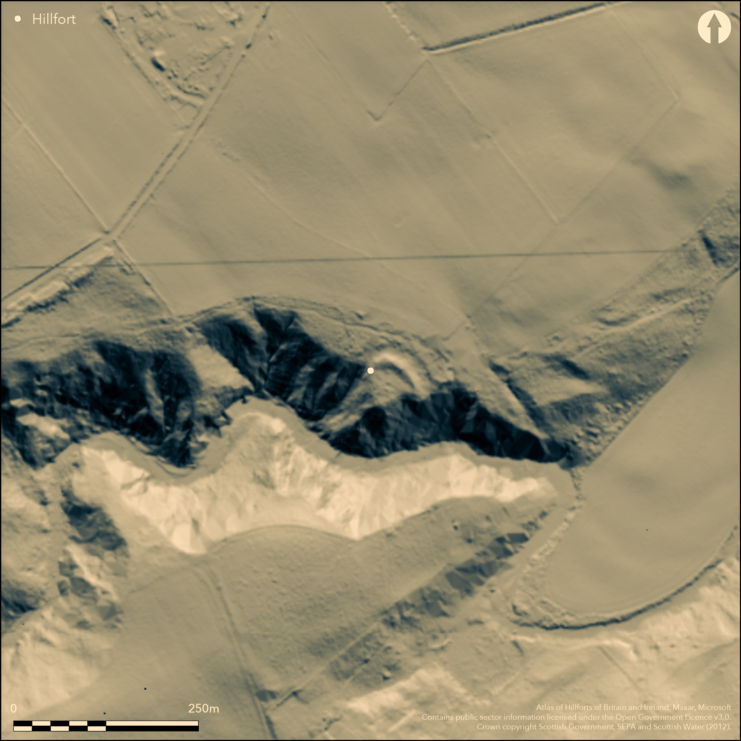
LiDAR 1m DTM Hillshade
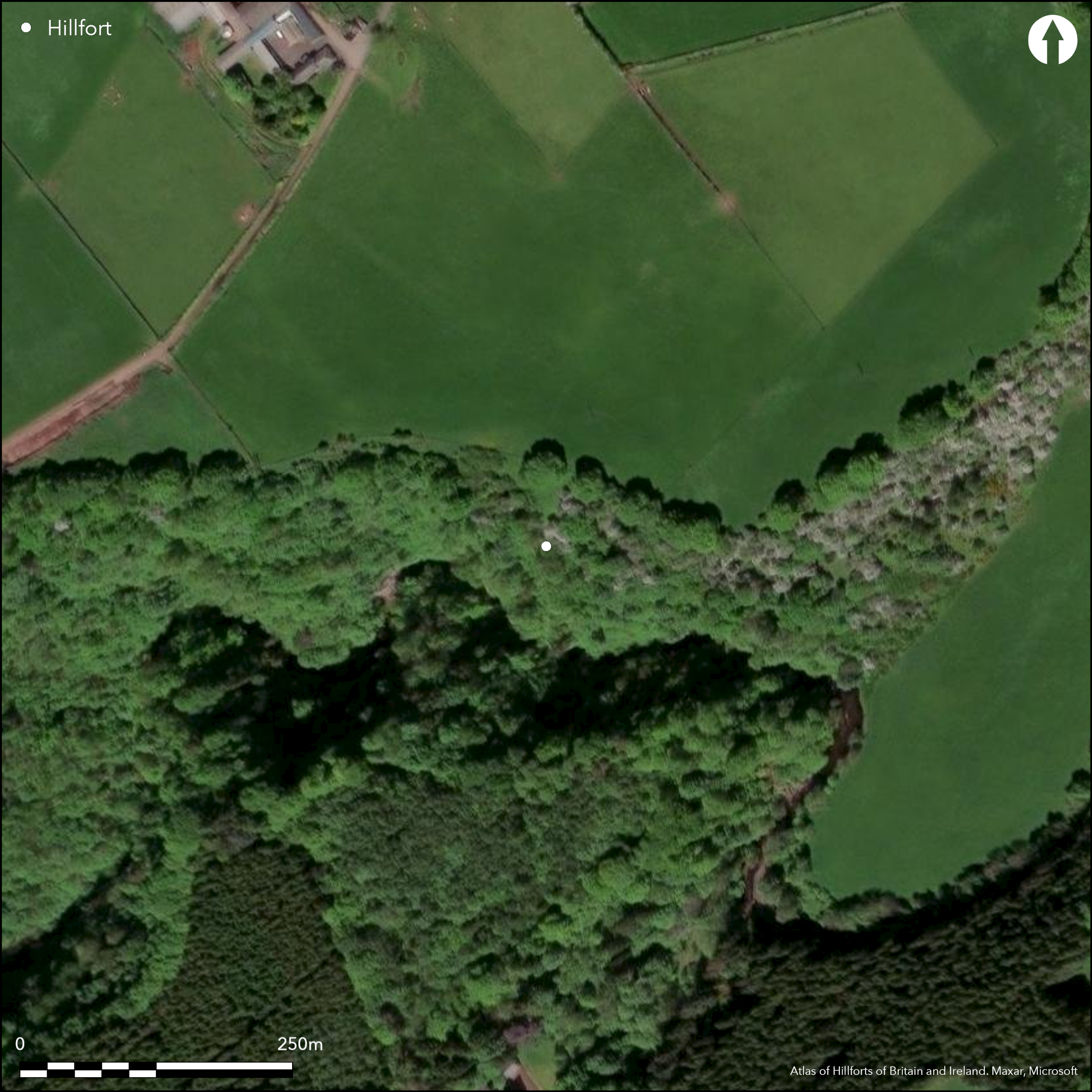
Satellite Imagery
LiDAR 1m DTM Hillshade
Satellite Imagery
Scroll left/right to view further images.
HER: The West of Scotland Archaeology Service 10194 (None)
NMR: NS 84 SE 1 (46570)
SM: 2604
NGR: NS 8739 4491
X: 287390 Y: 644910 (OSGB36)
This small promontory work, situated high up on a bluff overlooking the Mouse Water, includes features that almost certainly indicate that it is the remains of a medieval castle. Triangular on plan, the interior measures 30m from N to S by a maximum of 28m transversely (0.04ha) immediately to the rear of the substantial rampart, which has been drawn in an arc across the neck of the promontory to defend the northern and eastern approaches. The rampart is fronted by a broad ditch, and on the E there are the remains of a second, though this is lost at the edge of the arable field to the N and cannot be traced any further round to the W. On the N, the plan drawn up by RCAHMS investigators in 1973 depicts a track obliquely crossing the outer lip of the inner ditch, but this is a misunderstanding of the subtlety of the earthworks, in which the line of the outer lip of the ditch to either side appears to extend behind a break of slope lower down the counterscarp; rather than a mutilation by later trackway, these are probably the decayed remains of the abutment of a bridge spanning the ditch, possibly to an entrance over the top of the rampart. Such a feature would be unique in Iron Age fortifications, and though it does not rule out the possibility of an earlier occupation, it suggests that this is a medieval castle akin to a ringwork.
Citizen Science: ✗
Reliability of Data: Confirmed
Reliability of Interpretation: Irreconciled issues
X: -422198 Y: 7495883 (EPSG: 3857)
Longitude: -3.7926660981951734 Latitude: 55.68459911114049 (EPSG:4326)
Country: Scotland
Current County or Unitary Authority: South Lanarkshire
Historic County: Lanarkshire
Current Parish/Community/Council/Townland: Lanark
None
| Extant | ✓ |
| Cropmark | ✗ |
| Likely Destroyed | ✓ |
None
| Woodland | ✓ |
| Commercial Forestry Plantation | ✗ |
| Parkland | ✗ |
| Pasture (Grazing) | ✗ |
| Arable | ✗ |
| Scrub/Bracken | ✗ |
| Bare Outcrop | ✗ |
| Heather/Moorland | ✗ |
| Heath | ✗ |
| Built-up | ✗ |
| Coastal Grassland | ✗ |
| Other | ✗ |
None
| Contour Fort | ✗ |
| Partial Contour Fort | ✗ |
| Promontory Fort | ✓ |
| Hillslope Fort | ✗ |
| Level Terrain Fort | ✗ |
| Marsh Fort | ✗ |
| Multiple Enclosure Fort | ✗ |
| Hilltop | ✗ |
| Coastal Promontory | ✗ |
| Inland Promontory | ✓ |
| Valley Bottom | ✗ |
| Knoll/Hillock/Outcrop | ✗ |
| Ridge | ✗ |
| Cliff/Plateau-edge/Scarp | ✗ |
| Hillslope | ✗ |
| Lowland | ✗ |
| Spur | ✗ |
Dominant Topographic Feature: None
| North | ✗ |
| Northeast | ✗ |
| East | ✗ |
| Southeast | ✗ |
| South | ✗ |
| Southwest | ✗ |
| West | ✗ |
| Northwest | ✗ |
| Level | ✓ |
Altitude: 160.0m
N/A
Probably a medieval castle
Reliability: D - None
| Pre 1200BC | ✗ |
| 1200BC - 800BC | ✗ |
| 800BC - 400BC | ✗ |
| 400BC - AD50 | ✗ |
| AD50 - AD400 | ✗ |
| AD400 - AD 800 | ✗ |
| Post AD800 | ✓ |
| Unknown | ✗ |
| Pre Hillfort: | None |
| Post Hillfort: | None |
| Morphology/Earthwork/Typology: | character of entrane arrangements |
Possibly depicted on Roy's Map (1747-55), it is noted in the Statistical Account, where the minister describes the remains of drystone structures, implying that they were subterranean (Stat Acct 15, 1795, 11-12). A sketch of the site drawn in 1837 by A Archer (RCAHMS LAD 78/1) shows nothing of the earthworks, and all that appears on the 1st edition OS 25-inch map (Lanarkshire 1864, sheet 25.10) is a dashed rectangular outline annotated 'Castle Qua (Site of)'. The earthworks were planned in 1973 during the preparation of the County Inventory for Lanarkshire, but omitted from the prehistoric and Roman volume in the almost certainly correct belief that it is medieval (RCAHMS 1978, 42). It was Scheduled in 1967. A visit by SH in 2013 demonstrated that the RCAHMS investigators had not recognised some of the detail of the surviving earthworks, notably the abutment for a bridge, but essentially confirmed that this is probably an undocumented castle.
| 1st Identified Map Depiction (1755): | Roys Map (1747-55) |
| 1st Identified Written Reference (1795): | Description (Stat Acct 15, 1795, 11-12) |
| Other (1859): | Named in Gothic type on the 1st edition OS 25-inch map (Lanarkshire 1864, sheet 25.10) |
| Other (1937): | Visited by O G S Crawford |
| Other (1962): | Surveyed at 1:2500 by the OS |
| Other (1967): | Scheduled |
| Earthwork Survey (1973): | 1:300 (RCAHMS LAD 176/1; 176/2 & DP152072) |
| Other (2013): | Visited by S Halliday |
Several mounds on the W side of the interior, but no coherent structures
None
| None | ✓ |
| Spring | ✗ |
| Stream | ✗ |
| Pool | ✗ |
| Flush | ✗ |
| Well | ✗ |
| Other | ✗ |
Mounds of debris, possibly from rectangular structures
| No Known Features | ✗ |
| Round Stone Structures | ✗ |
| Rectangular Stone Structures | ✓ |
| Curvilinear Platforms | ✗ |
| Other Roundhouse Evidence | ✗ |
| Pits | ✗ |
| Quarry Hollows | ✗ |
| Other | ✓ |
None
| No Known Excavation | ✓ |
| Pits | ✗ |
| Postholes | ✗ |
| Roundhouses | ✗ |
| Rectangular Structures | ✗ |
| Roads/Tracks | ✗ |
| Quarry Hollows | ✗ |
| Other | ✗ |
| Nothing Found | ✗ |
None
| No Known Geophysics | ✓ |
| Pits | ✗ |
| Roundhouses | ✗ |
| Rectangular Structures | ✗ |
| Roads/Tracks | ✗ |
| Quarry Hollows | ✗ |
| Other | ✗ |
| Nothing Found | ✗ |
None
| No Known Finds | ✓ |
| Pottery | ✗ |
| Metal | ✗ |
| Metalworking | ✗ |
| Human Bones | ✗ |
| Animal Bones | ✗ |
| Lithics | ✗ |
| Environmental | ✗ |
| Other | ✗ |
NO APPARENT FEATURES
| APs Not Checked | ✓ |
| None | ✗ |
| Roundhouses | ✗ |
| Rectangular Structures | ✗ |
| Pits | ✗ |
| Postholes | ✗ |
| Roads/Tracks | ✗ |
| Other | ✗ |
See main summary
| 1: | None |
| 2: | None |
Guard Chambers: ✗
Chevaux de Frise: ✗
| 1. Other Forms (North): | Over the rampart via a bridge across the inner ditch |
One bold rampart with an external ditch and an outer ditch cutting off a promontory
| Area 1: | 0.04ha. |
| Total: | 0.04ha. |
Total Footprint Area: Noneha.
None
| ✗ | None |
| ✗ | None |
| NE Quadrant: | 2 |
| SE Quadrant: | 0 |
| SW Quadrant: | 0 |
| NW Quadrant: | 2 |
| Total: | 2 |
| Partial Univallate | ✗ |
| Univallate | ✗ |
| Partial Bivallate | ✓ |
| Bivallate | ✗ |
| Partial Multivallate | ✗ |
| Multivallate | ✗ |
| Unknown | ✗ |
| Partial Univallate | ✗ |
| Univallate | ✗ |
| Partial Bivallate | ✗ |
| Bivallate | ✗ |
| Partial Multivallate | ✗ |
| Multivallate | ✗ |
None
| None | ✗ |
| Earthen Bank | ✓ |
| Stone Wall | ✗ |
| Rubble | ✗ |
| Wall-walk | ✗ |
| Evidence of Timber | ✗ |
| Vitrification | ✗ |
| Other Burning | ✗ |
| Palisade | ✗ |
| Counter Scarp Bank | ✗ |
| Berm | ✗ |
| Unfinished | ✗ |
| Other | ✗ |
None
| None | ✗ |
| Earthen Bank | ✗ |
| Stone Wall | ✗ |
| Murus Duplex | ✗ |
| Timber-framed | ✗ |
| Timber-laced | ✗ |
| Vitrification | ✗ |
| Other Burning | ✗ |
| Palisade | ✗ |
| Counter Scarp Bank | ✗ |
| Berm | ✗ |
| Unfinished | ✗ |
| No Known Excavation | ✓ |
| Other | ✗ |
| ✗ | None |
| ✓ | None |
Number of Ditches: 2
| ✗ | None |
Stat Acct (date) Statistical Account of Scotland: Drawn up from the Communications of the Ministers of the Different Parishes (Sinclair, J ed), 1791-99
RCAHMS (1978) The Royal Commission on the Ancient and Historical Monuments of Scotland. Lanarkshire: an inventory of the prehistoric and Roman monuments. HMSO: Edinburgh
Atlas of Hillforts:
Wikidata:
This work is licensed under CC BY-SA 4.0![]()
![]()
![]() and should be cited as:
and should be cited as:
Lock, Gary and Ralston, Ian. 2024. Atlas of Hillforts of Britain and Ireland. Available at: https://hillforts.arch.ox.ac.uk
Document Version 1.1