
LiDAR 1m DTM Hillshade
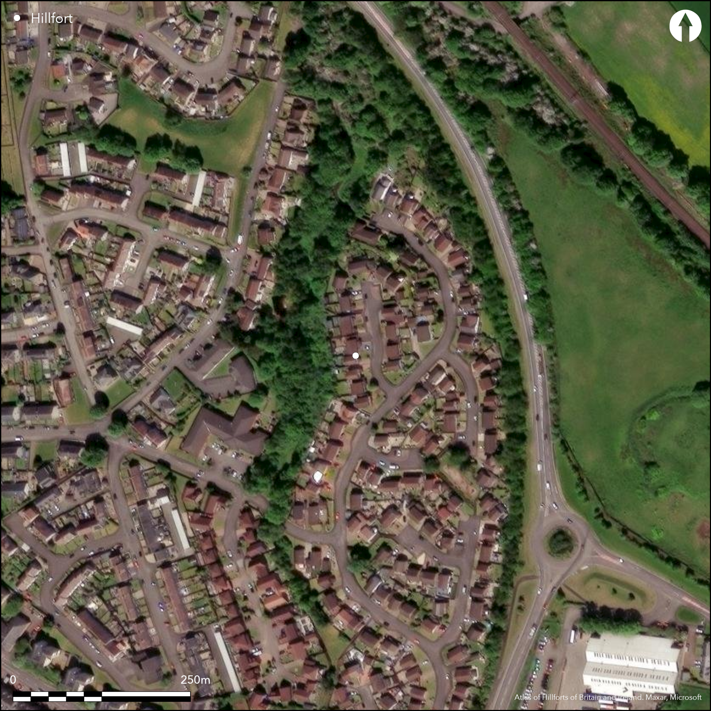
Satellite Imagery
LiDAR 1m DTM Hillshade
Satellite Imagery
Scroll left/right to view further images.
HER: Stirling 1184 (None)
NMR: NS 89 SW 12 (47244)
SM: None
NGR: NS 8159 9035
X: 281590 Y: 690350 (OSGB36)
The site of this fort, which occupied a gravel promontory formed between gullies draining into a burn that cuts through the escarpment of an ancient shoreline a little way to the N, has been subsumed into the housing estates on the eastern fringe of Bannockburn. First recorded as a promontory fort, with five ditches cutting across the neck of the promontory (RCAHMS 1963, 420, no.493), it was subject to a trial excavation in 1974 by the Stirling Field Archaeological Society, and in advance of the housing development a more extensive investigation by the Central Excavation Unit of the Scottish Development Department in 1982, 1984 and 1985 (Rideout 1996). This revealed a complex palimpsest of ditches and palisades, though it did not prove possible to elucidate the complete sequence and dates of their construction. The smallest area enclosed by a ditched defence measured little more than 35m in diameter (0.09ha) at the tip of the promontory, but if the outermost ditch on the S represented the sole defences of the fort at one stage of its development, it would have cut off an area measuring about 80m from N to S by up to 40m transversely (0.3ha). The maximum and minimum areas enclosed thus range from only 0.09ha to 0.3ha, and the complexity of the ditches indicates that there may have been a series of enclosures of different sizes between these extremes; apart from through the innermost ditches, there was consistently an entrance on the SSE, extending along the eastern margin of the promontory, but, surprisingly, machine-cut trenches on the N, E and W also revealed a complex history of scarping and defensive works around the flanks of the promontory. A substantial timber round-house was uncovered at the centre of the interior, from which there is a single radiocarbon date from a post-hole of 770-400 cal BC, and a second from a pit that cut it of 410 to 170 cal BC. An early medieval glass bead was also recovered from the interior, other finds including coarse pottery, two saddle querns and a shale ring.
Citizen Science: ✗
Reliability of Data: Confirmed
Reliability of Interpretation: Confirmed
X: -434675 Y: 7576607 (EPSG: 3857)
Longitude: -3.9047501673108926 Latitude: 56.09127432291979 (EPSG:4326)
Country: Scotland
Current County or Unitary Authority: Stirling
Historic County: Stirlingshire
Current Parish/Community/Council/Townland: St Ninians
None
| Extant | ✗ |
| Cropmark | ✓ |
| Likely Destroyed | ✓ |
None
| Woodland | ✗ |
| Commercial Forestry Plantation | ✗ |
| Parkland | ✗ |
| Pasture (Grazing) | ✗ |
| Arable | ✗ |
| Scrub/Bracken | ✗ |
| Bare Outcrop | ✗ |
| Heather/Moorland | ✗ |
| Heath | ✗ |
| Built-up | ✓ |
| Coastal Grassland | ✗ |
| Other | ✗ |
None
| Contour Fort | ✗ |
| Partial Contour Fort | ✗ |
| Promontory Fort | ✓ |
| Hillslope Fort | ✗ |
| Level Terrain Fort | ✗ |
| Marsh Fort | ✗ |
| Multiple Enclosure Fort | ✗ |
| Hilltop | ✗ |
| Coastal Promontory | ✗ |
| Inland Promontory | ✓ |
| Valley Bottom | ✗ |
| Knoll/Hillock/Outcrop | ✗ |
| Ridge | ✗ |
| Cliff/Plateau-edge/Scarp | ✗ |
| Hillslope | ✗ |
| Lowland | ✗ |
| Spur | ✗ |
Dominant Topographic Feature: None
| North | ✗ |
| Northeast | ✗ |
| East | ✗ |
| Southeast | ✗ |
| South | ✗ |
| Southwest | ✗ |
| West | ✗ |
| Northwest | ✗ |
| Level | ✓ |
Altitude: 30.0m
N/A
Only two radiocarbon dates and the lack of diagnostic artefacts mean that the chronology of the fortifications is effectively unknown, though the absence of rotary querns perhaps indicates the earlier part of the Iron Age.
Reliability: C - Low
| Pre 1200BC | ✗ |
| 1200BC - 800BC | ✗ |
| 800BC - 400BC | ✓ |
| 400BC - AD50 | ✗ |
| AD50 - AD400 | ✗ |
| AD400 - AD 800 | ✗ |
| Post AD800 | ✗ |
| Unknown | ✗ |
| Pre Hillfort: | None |
| Post Hillfort: | None |
| C14: | None |
First discovered in 1955 from vertical aerial photography (540/RAF/1645/F22: 0274-5) during the RCAHMS Survey of Marginal Lands, it was included into the County Inventory for Stirlingshire (RCAHMS 1963, 420, no.493).A trial excavation trench was dug by the Stirling Field Archaeology Society in 1974, at which time it was visited by the OS, and a further three seasons of excavations by the Central Excavation Unit of the Scottish Development Department took place 1982 (Barclay 1982), 1984 and 1985 (Rideout 1985; 1996).
| Other (1955): | Plan and description during RCAHMS Survey of Marginal Lands (RCAHMS 1963, 420, no.493; RCAHMS 1963, 420, no.493) |
| Excavation (1974): | Stirling Field Archaeological Society (1974) |
| Other (1974): | Visited by the OS |
| Excavation (1982): | (Barclay 1982; Rideout 1996) |
| Excavation (1984): | (Rideout 1996) |
| Excavation (1985): | (Rideout 1985; 1996) |
Single large round-house in the centre of the interior. Others and four-post structures were uncovered outside the defences.
None
| None | ✓ |
| Spring | ✗ |
| Stream | ✗ |
| Pool | ✗ |
| Flush | ✗ |
| Well | ✗ |
| Other | ✗ |
None
| No Known Features | ✓ |
| Round Stone Structures | ✗ |
| Rectangular Stone Structures | ✗ |
| Curvilinear Platforms | ✗ |
| Other Roundhouse Evidence | ✗ |
| Pits | ✗ |
| Quarry Hollows | ✗ |
| Other | ✗ |
None
| No Known Excavation | ✗ |
| Pits | ✓ |
| Postholes | ✓ |
| Roundhouses | ✓ |
| Rectangular Structures | ✗ |
| Roads/Tracks | ✗ |
| Quarry Hollows | ✗ |
| Other | ✗ |
| Nothing Found | ✗ |
None
| No Known Geophysics | ✓ |
| Pits | ✗ |
| Roundhouses | ✗ |
| Rectangular Structures | ✗ |
| Roads/Tracks | ✗ |
| Quarry Hollows | ✗ |
| Other | ✗ |
| Nothing Found | ✗ |
finds include coarse pottery, two saddle querns, a shale ring and an early medieval glass bead
| No Known Finds | ✓ |
| Pottery | ✓ |
| Metal | ✗ |
| Metalworking | ✗ |
| Human Bones | ✗ |
| Animal Bones | ✗ |
| Lithics | ✓ |
| Environmental | ✗ |
| Other | ✓ |
NO APPARENT FEATURES
| APs Not Checked | ✗ |
| None | ✓ |
| Roundhouses | ✗ |
| Rectangular Structures | ✗ |
| Pits | ✗ |
| Postholes | ✗ |
| Roads/Tracks | ✗ |
| Other | ✗ |
See main summary
| 1: | Ploughed flat |
| 2: | Probably other entrances at different stages in the development of the fort in slightly different positions on the S |
Guard Chambers: ✗
Chevaux de Frise: ✗
| 1. Simple Gap (South east): | None |
Multiple rampart, ditches and palisades in several configurations. The larger area enclosed by the outermost ditch is taken here for the enclosed area
| Area 1: | 0.3ha. |
| Total: | 0.3ha. |
Total Footprint Area: Noneha.
None
| ✓ | None |
| ✓ | Some probably enclosed the whole promontory. The figure below are cumulative totals and were almost certainly not all in use at the same time |
| NE Quadrant: | 1 |
| SE Quadrant: | 1 |
| SW Quadrant: | 6 |
| NW Quadrant: | 1 |
| Total: | 6 |
| Partial Univallate | ✓ |
| Univallate | ✗ |
| Partial Bivallate | ✗ |
| Bivallate | ✗ |
| Partial Multivallate | ✓ |
| Multivallate | ✗ |
| Unknown | ✗ |
| Partial Univallate | ✗ |
| Univallate | ✗ |
| Partial Bivallate | ✗ |
| Bivallate | ✗ |
| Partial Multivallate | ✗ |
| Multivallate | ✗ |
None
| None | ✓ |
| Earthen Bank | ✗ |
| Stone Wall | ✗ |
| Rubble | ✗ |
| Wall-walk | ✗ |
| Evidence of Timber | ✗ |
| Vitrification | ✗ |
| Other Burning | ✗ |
| Palisade | ✗ |
| Counter Scarp Bank | ✗ |
| Berm | ✗ |
| Unfinished | ✗ |
| Other | ✗ |
None
| None | ✓ |
| Earthen Bank | ✗ |
| Stone Wall | ✗ |
| Murus Duplex | ✗ |
| Timber-framed | ✗ |
| Timber-laced | ✗ |
| Vitrification | ✗ |
| Other Burning | ✗ |
| Palisade | ✓ |
| Counter Scarp Bank | ✗ |
| Berm | ✗ |
| Unfinished | ✗ |
| No Known Excavation | ✗ |
| Other | ✗ |
| ✗ | None |
| ✓ | Representing multiple phases |
Number of Ditches: 6
| ✗ | None |
Barclay, G J (1982) 'Bannockburn (St Ninian's p), defended promontory'. Disc Exc Scot 1982, 8
RCAHMS (1963) The Royal Commission on the Ancient and Historical Monuments of Scotland. Stirlingshire: an inventory of the ancient monuments, 2v. HMSO: Edinburgh
Rideout, J S (1985) 'Bannockburn (St Ninian's p), fort'. Disc Exc Scot 1985, 8-9
Rideout, J S (1996) 'Excavation of a promontory fort and a palisaded homestead at Lower Greenyards, Bannockburn, Stirling, 1982-5'. Proc Soc Antiq Scotland 126 (1996), 199-269
Stirling Field Archaeological Society (1974) 'Bannockburn, fortified promontory site'. Disc Exc Scot 1974, 65
Atlas of Hillforts:
Wikidata:
This work is licensed under CC BY-SA 4.0![]()
![]()
![]() and should be cited as:
and should be cited as:
Lock, Gary and Ralston, Ian. 2024. Atlas of Hillforts of Britain and Ireland. Available at: https://hillforts.arch.ox.ac.uk
Document Version 1.1