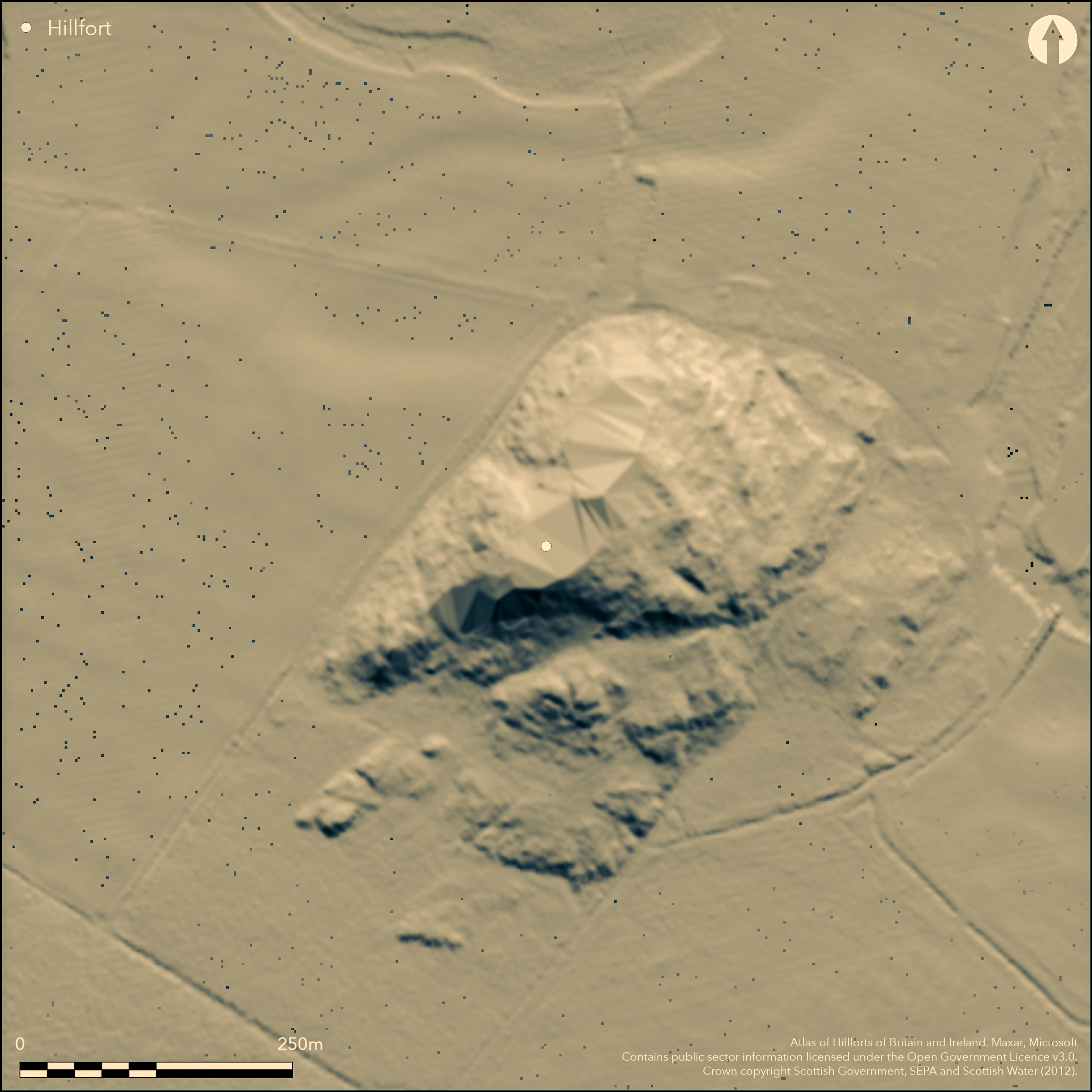
LiDAR 1m DTM Hillshade

Satellite Imagery
LiDAR 1m DTM Hillshade
Satellite Imagery
Scroll left/right to view further images.
HER: The West of Scotland Archaeology Service 4154 (None)
NMR: NR 89 SW 1 (39564)
SM: 90108
NGR: NR 8365 9356
X: 183650 Y: 693560 (OSGB36)
The fort on the summit of Dunadd is well-known as the major seat of power in the early medieval kingdom of Dalriada, and the remains include an important group of rock-carvings comprising: the incised outline of a boar; a sunken footprint; a rock-cut basin; and an ogam inscription. The remains of the fort itself, the walls of which variously stand to a height of 1m or have been reduced to mere bands of rubble, comprise four main elements: a small enclosure of no more than 0.02ha on the summit; a smaller enclosure taking in the rest of the crest of the ridge to the NE; and enclosure of about 0.05ha on a terrace below the crest on the SE; and a larger outer enclosure taking in a further 0.11ha on this flank and including the remarkable entrance passage that mounts the slope to the interior via a deep cleft in the outcrops between the terminals of the outer wall. In addition bands of rubble that may indicate the lines of other walls can be seen at various points on the W and N, while on the E lines of boulders between the outcrops may indicate the presence of a much larger outer enclosure on this side, though apparently not one bounded by a defensive wall. Excavations have been carried out on three occasions in the 20th century, firstly by David Christison in 1904-5, then by James Hewat Craw in 1929, and lastly by Alan Lane in 1980-81, these last are now fully published with an overall synthesis of the history of occupation and analyses of all the artefacts that have been recovered, which conclusively demonstrate that this was a major royal centre in the early medieval period (Lane and Campbell 2000). Excavations on the small summit enclosure or dun, however, not only revealed two early medieval phases of construction (though the earlier is possibly Roman Iron Age in date), but also rubble that may have been the remains of an earlier wall and possibly to be associated with a single radiocarbon date of 410-200 cal BC; there was also evidence of a slightly later period of occupation in the 1st century BC to the 1st century AD. The date of the construction of the inner of the lower enclosures on the SE flank is unknown, but it seems to have been in place in the 6th-7th centuries AD, while the outer enclosure seems to represent an extension of the fort in the 8th-9th centuries AD.
Citizen Science: ✗
Reliability of Data: Confirmed
Reliability of Interpretation: Confirmed
X: -609918 Y: 7575512 (EPSG: 3857)
Longitude: -5.47898856304194 Latitude: 56.08578435823439 (EPSG:4326)
Country: Scotland
Current County or Unitary Authority: Argyll & Bute
Historic County: Argyll
Current Parish/Community/Council/Townland: Kilmichael Glassary
None
| Extant | ✓ |
| Cropmark | ✗ |
| Likely Destroyed | ✗ |
None
| Woodland | ✗ |
| Commercial Forestry Plantation | ✗ |
| Parkland | ✗ |
| Pasture (Grazing) | ✓ |
| Arable | ✗ |
| Scrub/Bracken | ✓ |
| Bare Outcrop | ✗ |
| Heather/Moorland | ✓ |
| Heath | ✗ |
| Built-up | ✗ |
| Coastal Grassland | ✗ |
| Other | ✗ |
None
| Contour Fort | ✓ |
| Partial Contour Fort | ✗ |
| Promontory Fort | ✗ |
| Hillslope Fort | ✗ |
| Level Terrain Fort | ✗ |
| Marsh Fort | ✗ |
| Multiple Enclosure Fort | ✓ |
| Hilltop | ✓ |
| Coastal Promontory | ✗ |
| Inland Promontory | ✗ |
| Valley Bottom | ✗ |
| Knoll/Hillock/Outcrop | ✗ |
| Ridge | ✗ |
| Cliff/Plateau-edge/Scarp | ✗ |
| Hillslope | ✗ |
| Lowland | ✗ |
| Spur | ✗ |
Dominant Topographic Feature: None
| North | ✗ |
| Northeast | ✗ |
| East | ✗ |
| Southeast | ✗ |
| South | ✗ |
| Southwest | ✗ |
| West | ✗ |
| Northwest | ✗ |
| Level | ✓ |
Altitude: 50.0m
N/A
Main weight of dates fall AD 400-800, but two earlier dates fall on the cusp of the millennia and a third firmly in the period 400 BC-AD 50. In addition there is an extensive assemblage of early medieval artefacts. None of the walls is closely dated.
Reliability: A - High
| Pre 1200BC | ✓ |
| 1200BC - 800BC | ✗ |
| 800BC - 400BC | ✗ |
| 400BC - AD50 | ✓ |
| AD50 - AD400 | ✓ |
| AD400 - AD 800 | ✓ |
| Post AD800 | ✗ |
| Unknown | ✓ |
| Pre Hillfort: | Earlier lithics and Bronze Age pottery and a halberd |
| Post Hillfort: | None |
| Artefactual: | Large early medieval assemblage |
| C14: | Eighteen dates from various contexts |
| Other: | Literary |
RCAHMS collection also contains a wide range of photographic material and aerial photographs.
| 1st Identified Written Reference (1833): | Sketch by James Skene, who recognised its position in Dalriada (Thomas 1879, 32; RCAHMS AGD 568/2) |
| Other (1850): | Lecture by W F Skene (Christison 1904, 224-5) |
| 1st Identified Map Depiction (1865): | Annotated Fort on 1st edition OS 25-inch map (Argyll and Bute 1873, sheet 160.3) |
| 1st Identified Map Depiction (1878): | Description by Capt FWL Thomas writing on the footprint (1879) |
| Earthwork Survey (1903): | Sketch-plan and description by David Christison (1904, 224-33, figs 17-24) |
| Excavation (1904): | Directed by David Christison on behalf of the Society of Antiquaries of Scotland (1905, 292-322) |
| Excavation (1905): | Directed by David Christison on behalf of the Society of Antiquaries of Scotland (1905, 292-322) |
| Earthwork Survey (1905): | By Thomas Ross for David Christison (Christison 1905, 296. fig 20) |
| Excavation (1929): | Directed by James Hewat Craw on behalf of the Society of Antiquaries of Scotland (Craw 1930) |
| Earthwork Survey (1929): | By James Hewat Craw, but based upon the plan by Thomas Ross |
| Earthwork Survey (1955): | Plan published by Richard Feachem (1955, 81, fig 8), based on Craw's of 1929 and including observations by RBK Stevenson (Stevenson 1949, 192-4) |
| Other (1973): | Resurveyed by the OS at 1:2500 |
| Other (1977): | Resurveyed by the OS at 1:2500 |
| Excavation (1980): | Directed by Alan Lane on behalf of the Scottish Development Department (Lane 1980; Lane and Campbell 2000) |
| Excavation (1981): | Plan and description (RCAHMS 1988, 149-59, no.248: RCAHMS DC13286-8) |
| Excavation (1981): | Directed by Alan Lane on behalf of the Scottish Development Department (Lane 1981; Lane and Campbell 2000) |
| Other (1994): | Re-Scheduled |
| Other (2013): | Re-Scheduled |
Largely featureless but there are several scoops and rectangular structures in the lower enclosures
Well in the outermost enclosure. Well is undated.
| None | ✗ |
| Spring | ✗ |
| Stream | ✗ |
| Pool | ✗ |
| Flush | ✗ |
| Well | ✓ |
| Other | ✗ |
None
| No Known Features | ✗ |
| Round Stone Structures | ✗ |
| Rectangular Stone Structures | ✓ |
| Curvilinear Platforms | ✗ |
| Other Roundhouse Evidence | ✗ |
| Pits | ✗ |
| Quarry Hollows | ✗ |
| Other | ✗ |
Occupation and metalworking
| No Known Excavation | ✗ |
| Pits | ✗ |
| Postholes | ✗ |
| Roundhouses | ✗ |
| Rectangular Structures | ✗ |
| Roads/Tracks | ✗ |
| Quarry Hollows | ✗ |
| Other | ✓ |
| Nothing Found | ✗ |
None
| No Known Geophysics | ✓ |
| Pits | ✗ |
| Roundhouses | ✗ |
| Rectangular Structures | ✗ |
| Roads/Tracks | ✗ |
| Quarry Hollows | ✗ |
| Other | ✗ |
| Nothing Found | ✗ |
Excavations here on three occasions in the 20th century have produced one of the largest assemblages of early medieval artefacts found anywhere in Scotland, with a wide range of high status goods including European imports, and evidence of a major centre of metalworking. In addition, finds of earlier date include a fragment of a Bronze Age vessel, a few fragments of Samian and Roman glass, and a Neolithic stone ball.
| No Known Finds | ✗ |
| Pottery | ✓ |
| Metal | ✓ |
| Metalworking | ✓ |
| Human Bones | ✗ |
| Animal Bones | ✓ |
| Lithics | ✓ |
| Environmental | ✗ |
| Other | ✓ |
NO APPARENT FEATURES
| APs Not Checked | ✗ |
| None | ✓ |
| Roundhouses | ✗ |
| Rectangular Structures | ✗ |
| Pits | ✗ |
| Postholes | ✗ |
| Roads/Tracks | ✗ |
| Other | ✗ |
See main summary
| 1: | None |
| 2: | The only clearly defined entrance is in the outer enclosure |
Guard Chambers: ✗
Chevaux de Frise: ✗
| 1. Passage-way/Corridor (South east): | Through a deep cleft in the outcrops |
A central citadel with a series of outer enclosures
| Area 1: | 0.02ha. |
| Area 2: | 0.16ha. |
| Total: | 0.16ha. |
Total Footprint Area: 0.44ha.
None
| ✓ | None |
| ✓ | The defences do not resolve particularly well into this structure, which notes the perimeters of the three principal enclosures on the E flank |
| NE Quadrant: | 3 |
| SE Quadrant: | 1 |
| SW Quadrant: | 1 |
| NW Quadrant: | 1 |
| Total: | 3 |
| Partial Univallate | ✓ |
| Univallate | ✗ |
| Partial Bivallate | ✗ |
| Bivallate | ✗ |
| Partial Multivallate | ✓ |
| Multivallate | ✗ |
| Unknown | ✗ |
| Partial Univallate | ✗ |
| Univallate | ✓ |
| Partial Bivallate | ✗ |
| Bivallate | ✗ |
| Partial Multivallate | ✗ |
| Multivallate | ✗ |
None
| None | ✗ |
| Earthen Bank | ✗ |
| Stone Wall | ✓ |
| Rubble | ✗ |
| Wall-walk | ✗ |
| Evidence of Timber | ✗ |
| Vitrification | ✗ |
| Other Burning | ✗ |
| Palisade | ✗ |
| Counter Scarp Bank | ✗ |
| Berm | ✗ |
| Unfinished | ✗ |
| Other | ✗ |
None
| None | ✗ |
| Earthen Bank | ✗ |
| Stone Wall | ✓ |
| Murus Duplex | ✗ |
| Timber-framed | ✗ |
| Timber-laced | ✗ |
| Vitrification | ✗ |
| Other Burning | ✗ |
| Palisade | ✗ |
| Counter Scarp Bank | ✗ |
| Berm | ✗ |
| Unfinished | ✗ |
| No Known Excavation | ✗ |
| Other | ✗ |
| ✗ | None |
| ✗ | None |
Number of Ditches: None
| ✗ | The outer enclosures of the fort might be construed as annexes, though in practice they represent the interior of the fortification around a small citadel that in other terms is no more than a dun. |
Christison, D (1904) 'The forts of Kilmartin, Kilmichael Glassery, and North Knapdale, Argyll'. Proc Soc Antiq Scot 38 (1903-4), 205-55
Christison, D (1905) 'Report on the Society's excavations of forts on the Poltalloch Estate, Argyll, in 1904-5'. Proc Soc Antiq Scot 39 (1904-5), 259-325
Craw, J H (1930) 'Excavations at Dunadd and at other sites on the Poltalloch Estates, Argyll'. Proc Soc Antiq Scot 64 (1929-30), 111-46
Feachem, R W (1955) 'Fortifications'. 66-86 in Wainwright, F T (ed) The Problem of the Picts. Nelson: Edinburgh
Lane, A M (1980) 'Dunadd (Kilmichael and Glassary p), fort'. Disc Exc Scot 1980, 31
Lane, A M (1981) 'Dunadd (Glassary p), fort'. Disc Exc Scot 1981, 30-1
Lane and Campbell, A and E (2000) Dunadd: an early Dalriadic capital, Cardiff Studies in Archaeology. Oxbow: Oxford
RCAHMS (1988) The Royal Commission on the Ancient and Historical Monuments of Scotland. Argyll: an inventory of the monuments volume 6: Mid-Argyll and Cowal, prehistoric and early historic monuments. HMSO: Edinburgh
Stevenson, R B K (1949) 'The nuclear fort of Dalmahoy, Midlothian, and other Dark Age capitals'. Proc Soc Antiq Scot 83 (1948-9), 186-98
Thomas, F W L (1879) 'Dunadd, Glassary, Argyllshire; the place of inauguration of the Dalriadic Kings'. Proc Soc Antiq Scot 13 (1878-9), 28-47
Atlas of Hillforts:
Wikidata:
This work is licensed under CC BY-SA 4.0![]()
![]()
![]() and should be cited as:
and should be cited as:
Lock, Gary and Ralston, Ian. 2024. Atlas of Hillforts of Britain and Ireland. Available at: https://hillforts.arch.ox.ac.uk
Document Version 1.1