LiDAR 1m DTM Hillshade
Satellite Imagery
LiDAR 1m DTM Hillshade
Satellite Imagery
Scroll left/right to view further images.
HER: Highland HER MHG2748 (None)
NMR: NH 44 SE 10 (12382)
SM: None
NGR: NH 4716 4290
X: 247160 Y: 842900 (OSGB36)
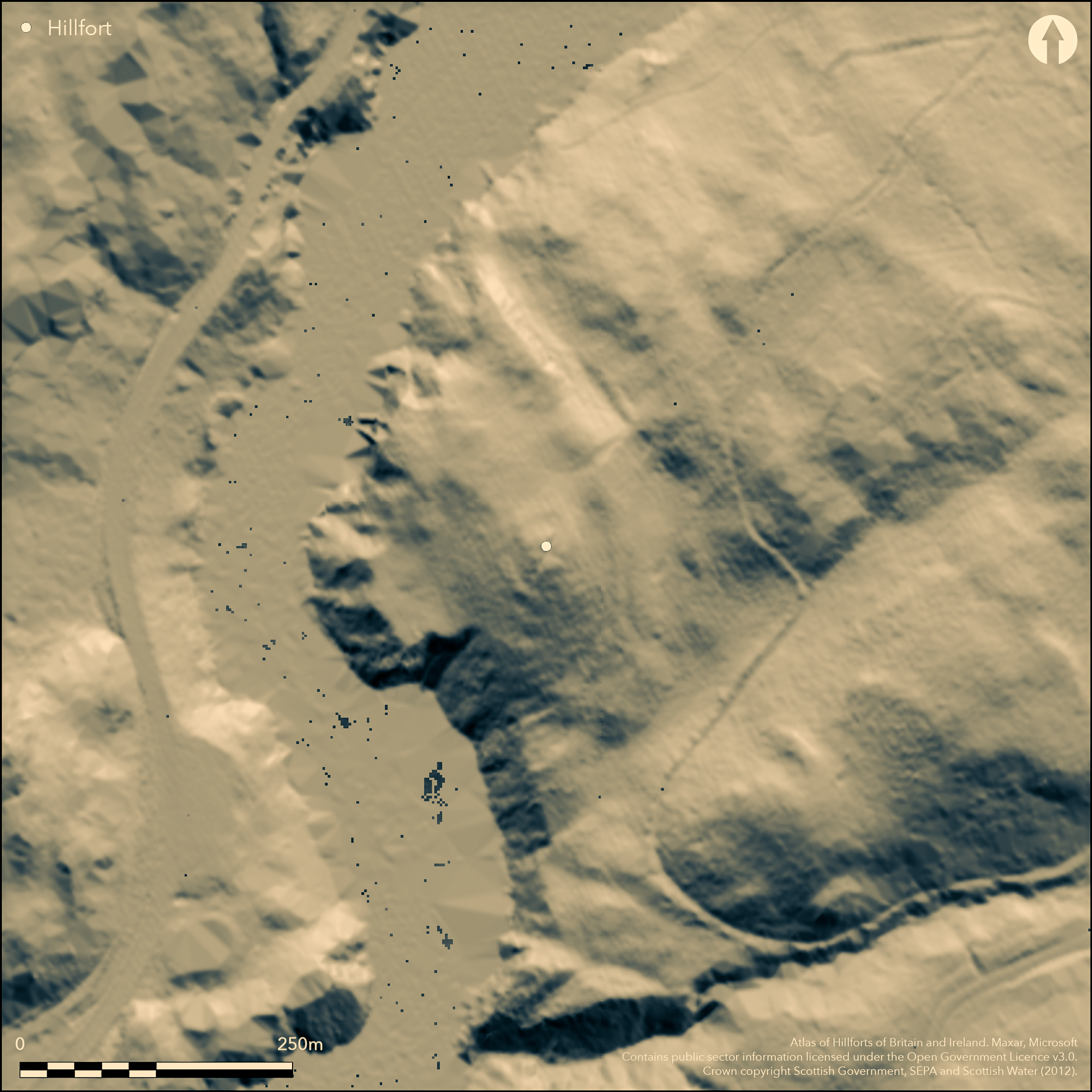
The defences of Dun Fionn, which occupies a hillock at the SW end of a low ridge with steep slopes dropping away to the River Beauly on the W and SW, comprise two elements: an inner dun with a massively virtified wall; and a series of outer defences which though possibly no more than outworks, might equally be the remains of a free-standing enclosure. The dun occupies the summit of the hillock, which is slightly oval and measures about 18m from NE to SW by 16m transversely and is defined by a scarp formed by the ruin of a vitrified wall. The full extent and plan of the outer defences is uncertain, and the observations contained in the descriptions of successive investigators vary widely. In 1957, RCAHMS investigators observed the remains of a rampart crossing the spine of the ridge on the NE, noting numerous vitrified masses along its line and suggesting that it enclosed an area up to 60m across from NW to SE (about 0.23ha). This is perhaps the terrace 2m wide noted by the OS in 1965 enclosing an area in the order of 47m from NNE to SSW by 43m transversely (0.15ha), but in a later visit Alan Ayre of the OS also found at the foot of the slope on the S at least two ditches with external banks extending for a distance of no more than 20m from the steep slopes on the W; he speculated that these may be the remains of an unfinished circuit of defences.
Citizen Science: ✗
Reliability of Data: Unconfirmed
Reliability of Interpretation: Confirmed
X: -506370 Y: 7852794 (EPSG: 3857)
Longitude: -4.548798586766425 Latitude: 57.45066637395593 (EPSG:4326)
Country: Scotland
Current County or Unitary Authority: Highland
Historic County: Inverness-shire
Current Parish/Community/Council/Townland: Kiltarlity And Convinth
None
| Extant | ✓ |
| Cropmark | ✗ |
| Likely Destroyed | ✗ |
None
| Woodland | ✓ |
| Commercial Forestry Plantation | ✗ |
| Parkland | ✗ |
| Pasture (Grazing) | ✗ |
| Arable | ✗ |
| Scrub/Bracken | ✓ |
| Bare Outcrop | ✗ |
| Heather/Moorland | ✗ |
| Heath | ✗ |
| Built-up | ✗ |
| Coastal Grassland | ✗ |
| Other | ✗ |
None
| Contour Fort | ✓ |
| Partial Contour Fort | ✗ |
| Promontory Fort | ✗ |
| Hillslope Fort | ✗ |
| Level Terrain Fort | ✗ |
| Marsh Fort | ✗ |
| Multiple Enclosure Fort | ✓ |
| Hilltop | ✗ |
| Coastal Promontory | ✗ |
| Inland Promontory | ✗ |
| Valley Bottom | ✗ |
| Knoll/Hillock/Outcrop | ✓ |
| Ridge | ✗ |
| Cliff/Plateau-edge/Scarp | ✗ |
| Hillslope | ✗ |
| Lowland | ✗ |
| Spur | ✗ |
Dominant Topographic Feature: None
| North | ✗ |
| Northeast | ✗ |
| East | ✗ |
| Southeast | ✗ |
| South | ✗ |
| Southwest | ✗ |
| West | ✗ |
| Northwest | ✗ |
| Level | ✓ |
Altitude: 90.0m
N/A
In the absence of modern excavation, there are neither stratified artefacts nor radiocarbon dates to provide a chronology for the defences.
Reliability: D - None
| Pre 1200BC | ✗ |
| 1200BC - 800BC | ✗ |
| 800BC - 400BC | ✗ |
| 400BC - AD50 | ✗ |
| AD50 - AD400 | ✗ |
| AD400 - AD 800 | ✗ |
| Post AD800 | ✗ |
| Unknown | ✓ |
| Pre Hillfort: | None |
| Post Hillfort: | None |
None
| Excavation (1825): | By Lord Lovat about 60 years before 1886 (Wallace 1886, 346) |
| 1st Identified Map Depiction (1875): | Named in Gothic type and annotated Vitrified Fort on the 1st edition OS 25-inch map (Inverness-shire 1880, sheet 10.9) |
| Earthwork Survey (1886): | Description and sketch-plan (Wallace 1886, 346; 192103-51) |
| Other (1943): | Description by Angus Graham and Gordon Childe for RCAHMS wartime Emergency Surveys |
| Other (1957): | Description for RCAHMS Survey of Marginal Lands |
| Other (1965): | Visited by the OS |
| Other (1972): | Revised at 1:2500 by the OS |
| Other (1979): | Description by RCAHMS, conducted in deep snow |
| Other (1981): | Visited by the OS |
| Other (2013): | Description in Highland HER |
The vitrified dun
None
| None | ✓ |
| Spring | ✗ |
| Stream | ✗ |
| Pool | ✗ |
| Flush | ✗ |
| Well | ✗ |
| Other | ✗ |
The vitrified dun
| No Known Features | ✗ |
| Round Stone Structures | ✗ |
| Rectangular Stone Structures | ✗ |
| Curvilinear Platforms | ✗ |
| Other Roundhouse Evidence | ✗ |
| Pits | ✗ |
| Quarry Hollows | ✗ |
| Other | ✓ |
Vitrified wall
| No Known Excavation | ✗ |
| Pits | ✗ |
| Postholes | ✗ |
| Roundhouses | ✗ |
| Rectangular Structures | ✗ |
| Roads/Tracks | ✗ |
| Quarry Hollows | ✗ |
| Other | ✓ |
| Nothing Found | ✗ |
None
| No Known Geophysics | ✓ |
| Pits | ✗ |
| Roundhouses | ✗ |
| Rectangular Structures | ✗ |
| Roads/Tracks | ✗ |
| Quarry Hollows | ✗ |
| Other | ✗ |
| Nothing Found | ✗ |
None
| No Known Finds | ✓ |
| Pottery | ✗ |
| Metal | ✗ |
| Metalworking | ✗ |
| Human Bones | ✗ |
| Animal Bones | ✗ |
| Lithics | ✗ |
| Environmental | ✗ |
| Other | ✗ |
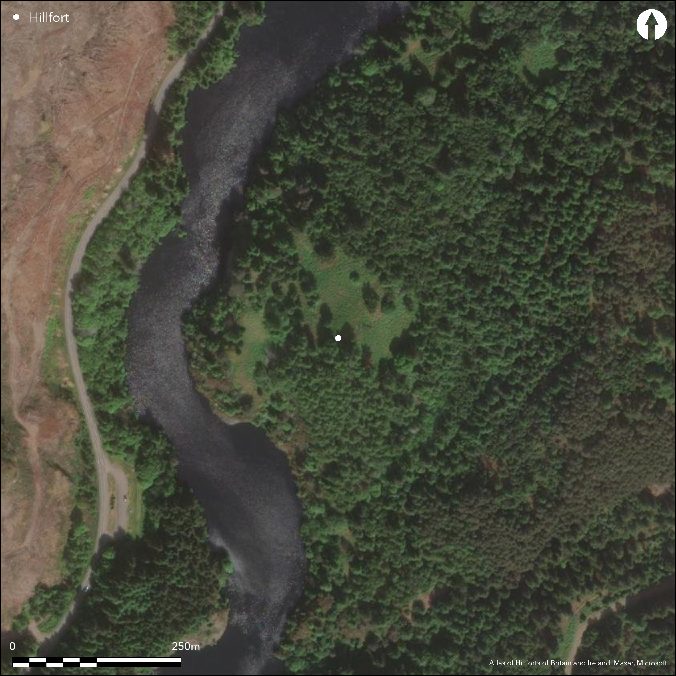
Obscured by trees
| APs Not Checked | ✗ |
| None | ✓ |
| Roundhouses | ✗ |
| Rectangular Structures | ✗ |
| Pits | ✗ |
| Postholes | ✗ |
| Roads/Tracks | ✗ |
| Other | ✗ |
No clear records
| 0: | None |
| 2: | No clear records |
Guard Chambers: ✗
Chevaux de Frise: ✗
At least one vitrified wall has been claimed outside the inner dun, but this has not been confirmed by the most recent fieldwork
| Area 1: | 0.15ha. |
| Total: | 0.15ha. |
Total Footprint Area: Noneha.
None
| ✓ | None |
| ✓ | Excludes the dun |
| NE Quadrant: | 1 |
| SE Quadrant: | 1 |
| SW Quadrant: | 3 |
| NW Quadrant: | 1 |
| Total: | 3 |
| Partial Univallate | ✓ |
| Univallate | ✗ |
| Partial Bivallate | ✗ |
| Bivallate | ✗ |
| Partial Multivallate | ✓ |
| Multivallate | ✗ |
| Unknown | ✗ |
| Partial Univallate | ✗ |
| Univallate | ✓ |
| Partial Bivallate | ✗ |
| Bivallate | ✗ |
| Partial Multivallate | ✗ |
| Multivallate | ✗ |
The OS speculated the outer defences on the W were unfinished The dun has been burnt and displays massive vitrifaction, but claims that some of the outer defences also contain vitrified stones has not been confirmed by the most recent fieldwork.
| None | ✗ |
| Earthen Bank | ✗ |
| Stone Wall | ✗ |
| Rubble | ✓ |
| Wall-walk | ✗ |
| Evidence of Timber | ✗ |
| Vitrification | ✗ |
| Other Burning | ✗ |
| Palisade | ✗ |
| Counter Scarp Bank | ✗ |
| Berm | ✗ |
| Unfinished | ✓ |
| Other | ✗ |
None
| None | ✗ |
| Earthen Bank | ✗ |
| Stone Wall | ✓ |
| Murus Duplex | ✗ |
| Timber-framed | ✗ |
| Timber-laced | ✗ |
| Vitrification | ✓ |
| Other Burning | ✗ |
| Palisade | ✗ |
| Counter Scarp Bank | ✗ |
| Berm | ✗ |
| Unfinished | ✗ |
| No Known Excavation | ✗ |
| Other | ✗ |
| ✗ | None |
| ✓ | in one short sector on the S |
Number of Ditches: 2
| ✗ | None |
Wallace, T (1886) 'Notes on ancient remains in the Beauly Valley, Inverness-shire'. Proc Soc Antiq Scot 20 (1985-6), 340-55
Wallace, T (1921) 'Archaeological notes'. Trans Inverness Sci Soc Fld Club 8 (1921), 119
Atlas of Hillforts:
Wikidata:
This work is licensed under CC BY-SA 4.0![]()
![]()
![]() and should be cited as:
and should be cited as:
Lock, Gary and Ralston, Ian. 2024. Atlas of Hillforts of Britain and Ireland. Available at: https://hillforts.arch.ox.ac.uk
Document Version 1.1