Satellite Imagery
Satellite Imagery
HER: Highland HER MHG3411 (None)
NMR: NH 54 SW 10 (12734)
SM: 2423
NGR: NH 5343 4290
X: 253430 Y: 842900 (OSGB36)
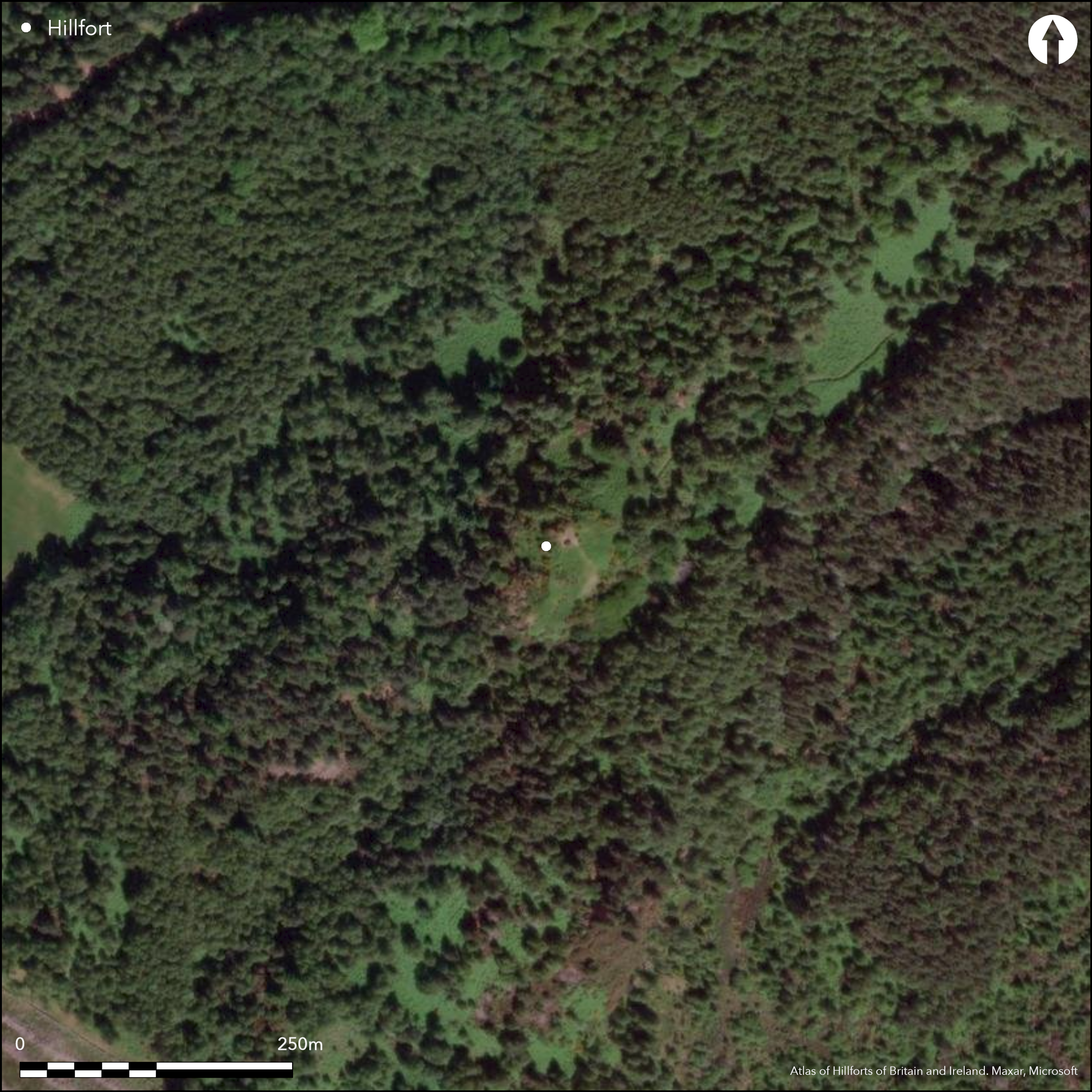
This fort comprises two main elements: an upper enclosure occupying the summit of the NE spur of Phoineas Hill; and a lower enclosure extending down its sloping spine to the NE. The position is a strong one, girt with crags around the S flank of the summit and down the NE flank, and elsewhere with steep rocky slopes. The upper enclosure follows the irregular contour of the summit, describing an irregular oval with a deep re-entrant in its NW side and measures internally about 56m from NE to SW by 27m transversely (0.11ha). Its wall is heavily denuded, but short runs of the outer face are visible around the circuit and several vitrified masses have been observed in its core. The entrance is on the E, but the line of approach up the spur from the NE is also blocked by an outer defence comprising two low banks with a shallow medial ditch. As planned by RCAHMS investigators in 1957, on the SE this outwork interrupts the perimeter of the lower enclosure, which they traced along the edge of the crag over a distance of 140m, returning along the crest of slope on the opposing flank to take in a rough and uneven area measuring about 140m in length by 40m in breadth (0.5ha). Described at the time as little more than occasional stones and blocks, subsequent investigators from both the RCAHMS and the OS have struggled to find any trace of this enclosure in the dense bracken and scrub beneath an open birch canopy, and it is also omitted from the Scheduled area, but it was also identified in the early 20th century by T Wallace (1918, 95-7) and its existence should perhaps be given the benefit of the doubt. Whether the remains of a large annexe to the relatively small summit enclosure, or perhaps an earlier fort that once enclosed the whole summit and spur, an area measuring 180m from NE to SW by up to 40m transversely (0.6ha), can only be demonstrated by further fieldwork; in 1957 the RCAHMS investigators preferred the latter interpretation.
Citizen Science: ✗
Reliability of Data: Confirmed
Reliability of Interpretation: Confirmed
X: -494750 Y: 7853222 (EPSG: 3857)
Longitude: -4.444416124026108 Latitude: 57.45273443888676 (EPSG:4326)
Country: Scotland
Current County or Unitary Authority: Highland
Historic County: Inverness-shire
Current Parish/Community/Council/Townland: Kiltarlity And Convinth
None
| Extant | ✓ |
| Cropmark | ✗ |
| Likely Destroyed | ✗ |
None
| Woodland | ✓ |
| Commercial Forestry Plantation | ✗ |
| Parkland | ✗ |
| Pasture (Grazing) | ✗ |
| Arable | ✗ |
| Scrub/Bracken | ✓ |
| Bare Outcrop | ✗ |
| Heather/Moorland | ✓ |
| Heath | ✗ |
| Built-up | ✗ |
| Coastal Grassland | ✗ |
| Other | ✗ |
None
| Contour Fort | ✓ |
| Partial Contour Fort | ✓ |
| Promontory Fort | ✗ |
| Hillslope Fort | ✗ |
| Level Terrain Fort | ✗ |
| Marsh Fort | ✗ |
| Multiple Enclosure Fort | ✓ |
| Hilltop | ✓ |
| Coastal Promontory | ✗ |
| Inland Promontory | ✗ |
| Valley Bottom | ✗ |
| Knoll/Hillock/Outcrop | ✗ |
| Ridge | ✗ |
| Cliff/Plateau-edge/Scarp | ✗ |
| Hillslope | ✓ |
| Lowland | ✗ |
| Spur | ✓ |
Dominant Topographic Feature: None
| North | ✗ |
| Northeast | ✗ |
| East | ✗ |
| Southeast | ✗ |
| South | ✗ |
| Southwest | ✗ |
| West | ✗ |
| Northwest | ✗ |
| Level | ✓ |
Altitude: 150.0m
N/A
In the absence of excavation, there are neither stratified artefacts nor radiocarbon dates to provide a chronology for the defences.
Reliability: D - None
| Pre 1200BC | ✗ |
| 1200BC - 800BC | ✗ |
| 800BC - 400BC | ✗ |
| 400BC - AD50 | ✗ |
| AD50 - AD400 | ✗ |
| AD400 - AD 800 | ✗ |
| Post AD800 | ✗ |
| Unknown | ✓ |
| Pre Hillfort: | None |
| Post Hillfort: | Planted with trees |
None
| 1st Identified Map Depiction (1872): | Named in Gothic type on the 1st edition OS 25-inch map (Inverness-shire 1876, sheet 10.12) |
| Earthwork Survey (1913): | Plan and description (Wallace 1918) |
| Other (1943): | Description by Angus Graham and Gordon Childe for RCAHMS wartime Emergency Surveys |
| Earthwork Survey (1957): | Plan and description for RCAHMS Survey of Marginal Lands (RCAHMS IND 92/1-2; Feachem 1963, 126) |
| Other (1964): | Scheduled |
| Other (1965): | Resurveyed at 1:2500 by the OS |
| Other (1970): | Visited by the OS |
| Other (1979): | Visited by RCAHMS |
Featureless apart from a damp patch at the foot of a rock-outcrop that is possibly a well or spring
Damp patch possibly marking a well or spring
| None | ✗ |
| Spring | ✗ |
| Stream | ✗ |
| Pool | ✗ |
| Flush | ✗ |
| Well | ✓ |
| Other | ✗ |
None
| No Known Features | ✓ |
| Round Stone Structures | ✗ |
| Rectangular Stone Structures | ✗ |
| Curvilinear Platforms | ✗ |
| Other Roundhouse Evidence | ✗ |
| Pits | ✗ |
| Quarry Hollows | ✗ |
| Other | ✗ |
None
| No Known Excavation | ✓ |
| Pits | ✗ |
| Postholes | ✗ |
| Roundhouses | ✗ |
| Rectangular Structures | ✗ |
| Roads/Tracks | ✗ |
| Quarry Hollows | ✗ |
| Other | ✗ |
| Nothing Found | ✗ |
None
| No Known Geophysics | ✓ |
| Pits | ✗ |
| Roundhouses | ✗ |
| Rectangular Structures | ✗ |
| Roads/Tracks | ✗ |
| Quarry Hollows | ✗ |
| Other | ✗ |
| Nothing Found | ✗ |
None
| No Known Finds | ✓ |
| Pottery | ✗ |
| Metal | ✗ |
| Metalworking | ✗ |
| Human Bones | ✗ |
| Animal Bones | ✗ |
| Lithics | ✗ |
| Environmental | ✗ |
| Other | ✗ |
NO APPARENT FEATURES
| APs Not Checked | ✓ |
| None | ✗ |
| Roundhouses | ✗ |
| Rectangular Structures | ✗ |
| Pits | ✗ |
| Postholes | ✗ |
| Roads/Tracks | ✗ |
| Other | ✗ |
See main summary
| 1: | None |
| 2: | The relationship between the inner and outer enclosures is unknown |
Guard Chambers: ✗
Chevaux de Frise: ✗
| 1. Simple Gap (East): | In summit enclosure |
| 2. Simple Gap (East): | In outwork |
Single vitrified wall around summit, with twin ramparts with a medial ditch barring the approach from the NE, and traces of what may be an earlier enclosure or annexe extending down the spur.
| Area 1: | 0.11ha. |
| Area 2: | 0.6ha. |
| Total: | 0.6ha. |
Total Footprint Area: 0.6ha.
None
| ✗ | None |
| ✓ | None |
| NE Quadrant: | 3 |
| SE Quadrant: | 1 |
| SW Quadrant: | 1 |
| NW Quadrant: | 1 |
| Total: | 3 |
| Partial Univallate | ✓ |
| Univallate | ✗ |
| Partial Bivallate | ✗ |
| Bivallate | ✗ |
| Partial Multivallate | ✓ |
| Multivallate | ✗ |
| Unknown | ✗ |
| Partial Univallate | ✗ |
| Univallate | ✓ |
| Partial Bivallate | ✗ |
| Bivallate | ✗ |
| Partial Multivallate | ✗ |
| Multivallate | ✗ |
None
| None | ✗ |
| Earthen Bank | ✗ |
| Stone Wall | ✓ |
| Rubble | ✓ |
| Wall-walk | ✗ |
| Evidence of Timber | ✗ |
| Vitrification | ✓ |
| Other Burning | ✗ |
| Palisade | ✗ |
| Counter Scarp Bank | ✗ |
| Berm | ✗ |
| Unfinished | ✗ |
| Other | ✗ |
None
| None | ✗ |
| Earthen Bank | ✗ |
| Stone Wall | ✗ |
| Murus Duplex | ✗ |
| Timber-framed | ✗ |
| Timber-laced | ✗ |
| Vitrification | ✗ |
| Other Burning | ✗ |
| Palisade | ✗ |
| Counter Scarp Bank | ✗ |
| Berm | ✗ |
| Unfinished | ✗ |
| No Known Excavation | ✓ |
| Other | ✗ |
| ✗ | None |
| ✓ | Outwork to the upper enclosure |
Number of Ditches: 1
| ✓ | Unknown whether this is an annexe of about 0.5ha extending down the NE spur or the remains of a larger fort taking in the spur and summit. |
Feachem, R (1963) A guide to prehistoric Scotland. Batsford: London
Wallace, T (1918) 'Notes on the parish of Petty'. Trans Inverness Sci Soc Fld Club 8 (1912-18), 87-136
Atlas of Hillforts:
Wikidata:
This work is licensed under CC BY-SA 4.0![]()
![]()
![]() and should be cited as:
and should be cited as:
Lock, Gary and Ralston, Ian. 2024. Atlas of Hillforts of Britain and Ireland. Available at: https://hillforts.arch.ox.ac.uk
Document Version 1.1