LiDAR 1m DTM Hillshade

Satellite Imagery
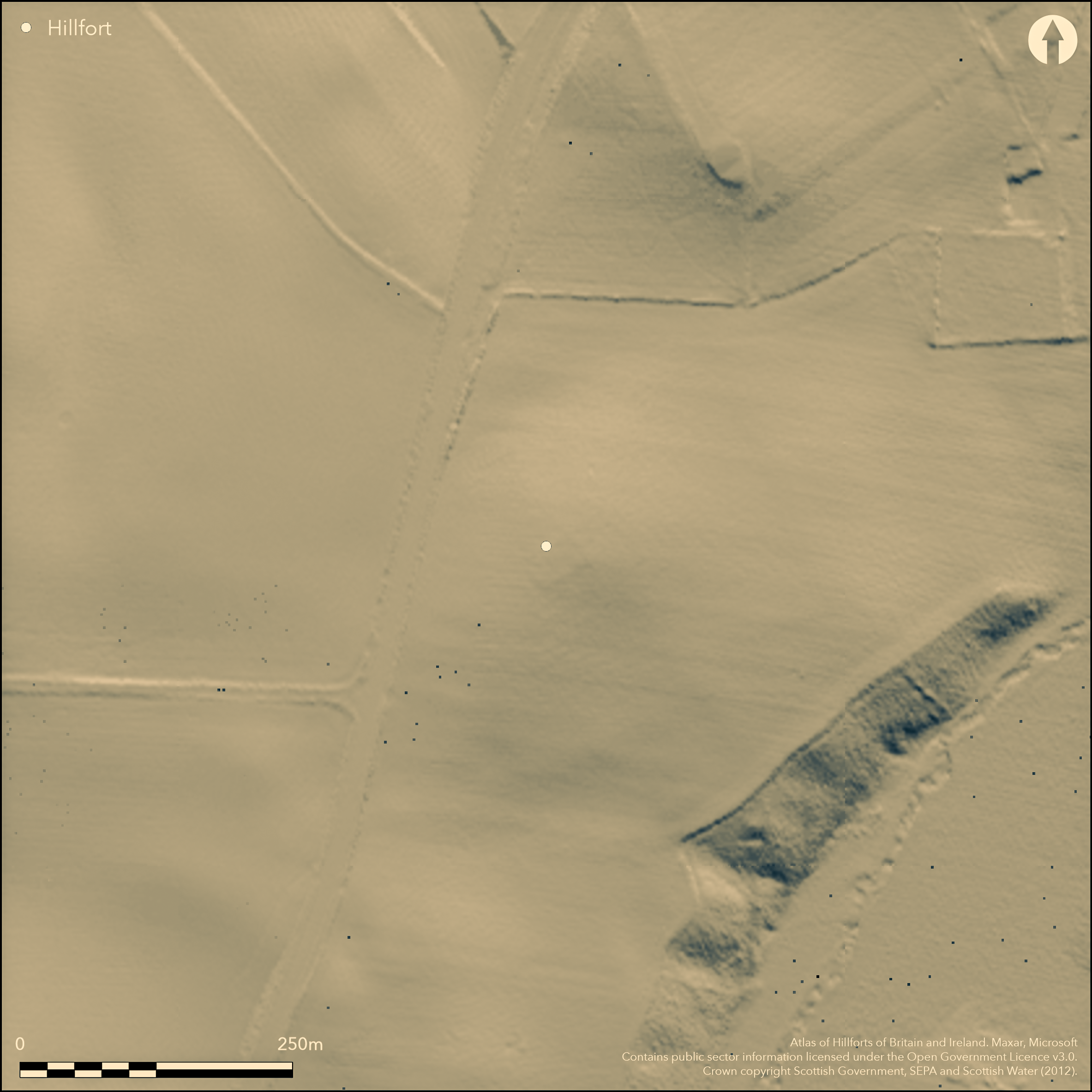
LiDAR 1m DTM Hillshade
Satellite Imagery
Scroll left/right to view further images.
HER: Aberdeenshire Historic Environment Record NJ42NE0047 (None)
NMR: NJ 42 NE 54 & 217 (17220)
SM: 69
NGR: NJ 4970 2635
X: 349700 Y: 826350 (OSGB36)
Cropmarks have revealed the site of a fortification now known to be of early medieval date on a low spur of a terrace above Rhynie old burial-ground, its position marked by the Pictish symbol stone known as the Craw Stane. In all, three concentric lines of defence can be seen on the aerial photographs, the two inner represented by ditches and the outermost by a palisade trench apparently accompanied by an internal line of pits. The innermost ditch, which is only intermittently visible, encloses an oval area measuring no more than 30m from NE to SW by 20m transversely (0.05ha), while the rather bolder mark of the second ditch, 4m in breadth and some 7m outside it, encloses an area measuring 45m by 32m (0.11ha). The enclosure formed by the palisade trench measures 62m by 48m (0.23ha). Excavations directed by Aberdeen University have concentrated on stripping and mapping the enclosures, coupled with more limited excavation. The palisade trench held squared planks with a supporting row of timbers in the pits to its rear and was evidently a timber rampart rather than a simple fence. Nevertheless, this work has demonstrated that all three circuits, while not necessarily directly contemporary with each other, are of early medieval date, with evidence of phases of destruction and reconstruction, and the presence of substantial rectangular timber buildings. The Craw Stane itself seems to have formed part of an elaborate entrance on the E. Artefacts recovered include sherds from probably two different types of imported Late Roman Amphorae of 6th-century date, a fragment of 6th-century continental glass, bronze and iron pins, metalworking moulds for pins and a brooch, glass-working and metalworking debris, iron tongs, an iron axe and amber beads.
Citizen Science: ✗
Reliability of Data: Confirmed
Reliability of Interpretation: Confirmed
X: -315806 Y: 7826834 (EPSG: 3857)
Longitude: -2.8369362826719184 Latitude: 57.32498112004115 (EPSG:4326)
Country: Scotland
Current County or Unitary Authority: Aberdeenshire
Historic County: Aberdeenshire
Current Parish/Community/Council/Townland: Rhynie
None
| Extant | ✗ |
| Cropmark | ✓ |
| Likely Destroyed | ✗ |
None
| Woodland | ✗ |
| Commercial Forestry Plantation | ✗ |
| Parkland | ✗ |
| Pasture (Grazing) | ✓ |
| Arable | ✓ |
| Scrub/Bracken | ✗ |
| Bare Outcrop | ✗ |
| Heather/Moorland | ✗ |
| Heath | ✗ |
| Built-up | ✗ |
| Coastal Grassland | ✗ |
| Other | ✗ |
None
| Contour Fort | ✗ |
| Partial Contour Fort | ✗ |
| Promontory Fort | ✗ |
| Hillslope Fort | ✗ |
| Level Terrain Fort | ✓ |
| Marsh Fort | ✗ |
| Multiple Enclosure Fort | ✗ |
| Hilltop | ✗ |
| Coastal Promontory | ✗ |
| Inland Promontory | ✗ |
| Valley Bottom | ✗ |
| Knoll/Hillock/Outcrop | ✗ |
| Ridge | ✗ |
| Cliff/Plateau-edge/Scarp | ✓ |
| Hillslope | ✗ |
| Lowland | ✗ |
| Spur | ✗ |
Dominant Topographic Feature: None
| North | ✗ |
| Northeast | ✗ |
| East | ✗ |
| Southeast | ✗ |
| South | ✗ |
| Southwest | ✗ |
| West | ✗ |
| Northwest | ✗ |
| Level | ✓ |
Altitude: 210.0m
N/A
In addition to unpublished radiocarbon dates, artefacts recovered include sherds from probably two different types of imported Late Roman Amphorae of 6th-century date, and a fragment of 6th-century continental glass.
Reliability: D - None
| Pre 1200BC | ✗ |
| 1200BC - 800BC | ✗ |
| 800BC - 400BC | ✗ |
| 400BC - AD50 | ✗ |
| AD50 - AD400 | ✗ |
| AD400 - AD 800 | ✓ |
| Post AD800 | ✗ |
| Unknown | ✗ |
| Pre Hillfort: | None |
| Post Hillfort: | None |
| Artefactual: | wide-ranging assemblage |
| C14: | Unpublished dates |
None
| Other (1923): | Craw Stane Scheduled |
| Other (1961): | Craw Stane re-scheduled |
| 1st Identified Written Reference (1978): | First photographed (Aberdeen Archaeological Surveys 1979) |
| Other (2000): | Visit and transcription (Halliday 2007, 94 fig 6.20, 100) |
| Other (2004): | Schedule extended to the enclosure |
| Geophysical Survey (2005): | Magnetometer survey as part of Rhynie Environs Archaeological Project; excavation of a structure outside the enclosures (Roberts, Noble and Gondek 2005) |
| Geophysical Survey (2006): | Resistivity Survey Rhynie Environs Archaeological Project (Gondek and Noble, M and G 2006; 2007) |
| Excavation (2011): | Evaluation (Gondeck and Noble 2011) |
| Excavation (2012): | Strip and map (Gondeck and Noble 2012; Current Archaeology 289, April 2014) |
Evidently multiperiod occupation in a fairly short chronology and including rectangular buildings
None
| None | ✓ |
| Spring | ✗ |
| Stream | ✗ |
| Pool | ✗ |
| Flush | ✗ |
| Well | ✗ |
| Other | ✗ |
None
| No Known Features | ✓ |
| Round Stone Structures | ✗ |
| Rectangular Stone Structures | ✗ |
| Curvilinear Platforms | ✗ |
| Other Roundhouse Evidence | ✗ |
| Pits | ✗ |
| Quarry Hollows | ✗ |
| Other | ✗ |
None
| No Known Excavation | ✗ |
| Pits | ✓ |
| Postholes | ✓ |
| Roundhouses | ✗ |
| Rectangular Structures | ✓ |
| Roads/Tracks | ✗ |
| Quarry Hollows | ✗ |
| Other | ✗ |
| Nothing Found | ✗ |
None
| No Known Geophysics | ✓ |
| Pits | ✗ |
| Roundhouses | ✗ |
| Rectangular Structures | ✗ |
| Roads/Tracks | ✗ |
| Quarry Hollows | ✗ |
| Other | ✗ |
| Nothing Found | ✗ |
Artefacts recovered include sherds from probably two different types of imported Late Roman Amphorae of 6th-century date, a fragment of 6th-century continental glass, bronze and iron pins, metalworking moulds for pins and a brooch, glass-working and metalworking debris, iron tongs and amber beads.
| No Known Finds | ✗ |
| Pottery | ✓ |
| Metal | ✓ |
| Metalworking | ✓ |
| Human Bones | ✗ |
| Animal Bones | ✗ |
| Lithics | ✓ |
| Environmental | ✗ |
| Other | ✓ |
NO APPARENT FEATURES
| APs Not Checked | ✓ |
| None | ✗ |
| Roundhouses | ✗ |
| Rectangular Structures | ✗ |
| Pits | ✗ |
| Postholes | ✗ |
| Roads/Tracks | ✗ |
| Other | ✗ |
See main summary
| 1: | Ploughed flat |
| 2: | None |
Guard Chambers: ✗
Chevaux de Frise: ✗
| 1. Other Forms (East): | Apparently elaborate, but no published detail |
Two ditches, presumably accompanied by ramparts, and a timber rampart with a continuous front of squared timbers and supporting uprights to the rear, possibly for a raised walkway.
| Area 1: | 0.05ha. |
| Area 2: | 0.11ha. |
| Area 3: | 0.23ha. |
| Total: | 0.23ha. |
Total Footprint Area: Noneha.
None
| ✗ | No allowance has been made for the thickness of the ramparts |
| ✓ | None |
| NE Quadrant: | 3 |
| SE Quadrant: | 3 |
| SW Quadrant: | 3 |
| NW Quadrant: | 3 |
| Total: | 3 |
| Partial Univallate | ✗ |
| Univallate | ✗ |
| Partial Bivallate | ✗ |
| Bivallate | ✗ |
| Partial Multivallate | ✗ |
| Multivallate | ✓ |
| Unknown | ✗ |
| Partial Univallate | ✗ |
| Univallate | ✗ |
| Partial Bivallate | ✗ |
| Bivallate | ✗ |
| Partial Multivallate | ✗ |
| Multivallate | ✗ |
None
| None | ✓ |
| Earthen Bank | ✗ |
| Stone Wall | ✗ |
| Rubble | ✗ |
| Wall-walk | ✗ |
| Evidence of Timber | ✗ |
| Vitrification | ✗ |
| Other Burning | ✗ |
| Palisade | ✗ |
| Counter Scarp Bank | ✗ |
| Berm | ✗ |
| Unfinished | ✗ |
| Other | ✗ |
Ditches
| None | ✓ |
| Earthen Bank | ✗ |
| Stone Wall | ✗ |
| Murus Duplex | ✗ |
| Timber-framed | ✗ |
| Timber-laced | ✗ |
| Vitrification | ✗ |
| Other Burning | ✓ |
| Palisade | ✓ |
| Counter Scarp Bank | ✗ |
| Berm | ✗ |
| Unfinished | ✗ |
| No Known Excavation | ✗ |
| Other | ✓ |
| ✗ | None |
| ✓ | None |
Number of Ditches: 2
| ✗ | None |
Aberdeen Archaeological Surveys (1979) 'Aerial reconnaissance'. Disc Exc Scot (1979), 12
Gondek and Noble, M and G (2006) 'The Craw Stane / Barflat, Rhynie, Aberdeenshire, geophysical survey'. Disc Exc Scot, New Ser, 7 (2006), 21
Gondek and Noble, M and G (2007) 'Rhynie Environs Archaeological Project - The Craw Stane/Barflat, Rhynie, Aberdeenshire (Rhynie parish), geophysical survey'. Disc Exc Scot, New Ser, 8 (2007), 28-9
Gondeck, M and Noble, G (2011) REAP 2011 Excavation of cropmarks in association with the Craw Stane, Rhynie, Aberdeenshire: Data Structure Report. https://www.reaparch.blogspot.co.uk/
Gondeck, M and Noble, G (2012) REAP 2012 Excavation of a palisaded and ditched enclosure and timber buildings in association with the Craw Stane, Rhynie, Aberdeenshire: Data Structure Report. https://www.reaparch.blogspot.co.uk/
Gondeck, M and Noble, G 2014 Current Archaeology 289, April 2014
Halliday, S P (2007) The later prehistoric landscape. In RCAHMS (2007) In the Shadow of Bennachie: A Field Archaeology of Donside, Aberdeenshire. RCAHMS & Society of Antiquaries of Scotland: Edinburgh
Roberts, Noble and Gondek, S, G and M (2005) 'The Craw Stane/Barflat, Rhynie (Rhynie parish), geophysical survey'. Disc Exc Scot, New Ser, 6 (2005), 18-19
Atlas of Hillforts:
Wikidata:
This work is licensed under CC BY-SA 4.0![]()
![]()
![]() and should be cited as:
and should be cited as:
Lock, Gary and Ralston, Ian. 2024. Atlas of Hillforts of Britain and Ireland. Available at: https://hillforts.arch.ox.ac.uk
Document Version 1.1