LiDAR 1m DTM Hillshade
Satellite Imagery
LiDAR 1m DTM Hillshade
Satellite Imagery
Scroll left/right to view further images.
HER: Angus SMR per Aberdeenshire Council NO43NW0022 (None)
NMR: NO 43 NW 22 (33365)
SM: 3038
NGR: NO 4326 3586
X: 343262 Y: 735862 (OSGB36)
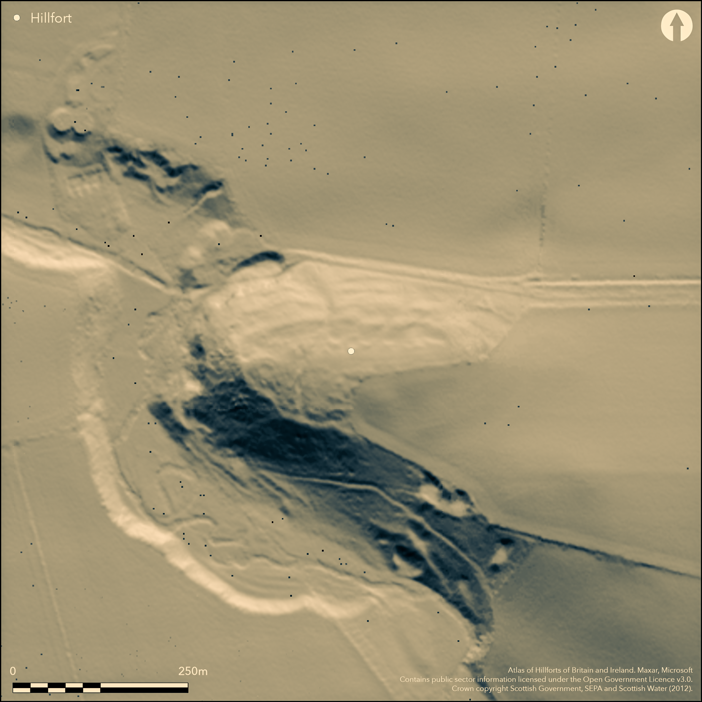
This fort, and the broch within the W end of its interior, occupies the summit of Craig Hill, which forms the W end of a long ridge of hard rock with steep slopes falling away on the W and along the S flank. The slopes are particularly steep around the W end, where the summit area rises no more than 10m across the crest of the ridge, providing a strong position for the fort, which is oval on plan and measures internally about 180m from E to W by 70m transversely (1.2ha). Under trees throughout the 19th and early 20th centuries, it was first discovered by RCAHMS investigators, who drew a plan showing at least two ramparts reduced to stony scarps extending the length of the N flank, with fragments of two others on the slope below, while oblique aerial photography since has revealed the cropmarks of three or four concentric ditches cutting back across the crest of the ridge on the E to return along the S flank, where otherwise no trace of the defences has survived cultivation and quarrying. No less than four old trackways can be seen climbing the slope, three on the N and one on the S, but there is no evidence that any is an original entrance and the three on the N may have been servicing the quarries visible along this side of the interior. These quarries are probably responsible for removing the N end of what is assumed to be an outwork to the broch, partitioning off the W extremity of the interior. Comprising a stone-faced rampart spread about 4.5m in thickness by 0.6m in height, with an external rock-cut ditch 4m in breadth by 1.2m in depth, this forms a triangular enclosure in the W end of the fort measuring a maximum of 68m from N to S by 48m transversely (0.2ha). An entrance causeway in the middle of the E side faces directly towards the broch, which measures 10.6m in diameter within a wall 4.5m in thickness. While the supposed earthwork might be contemporary with the broch, it may just as easily be the remains of a free-standing defensive enclosure utilising the earlier fortifications. The OS noted three possible hut-circle immediately to the N of the broch, but this impression may have been caused by the probable quarrying in this area.
Citizen Science: ✗
Reliability of Data: Confirmed
Reliability of Interpretation: Confirmed
X: -325447 Y: 7660908 (EPSG: 3857)
Longitude: -2.9235406233071393 Latitude: 56.51143121089168 (EPSG:4326)
Country: Scotland
Current County or Unitary Authority: Angus
Historic County: Angus
Current Parish/Community/Council/Townland: Murroes
None
| Extant | ✓ |
| Cropmark | ✗ |
| Likely Destroyed | ✗ |
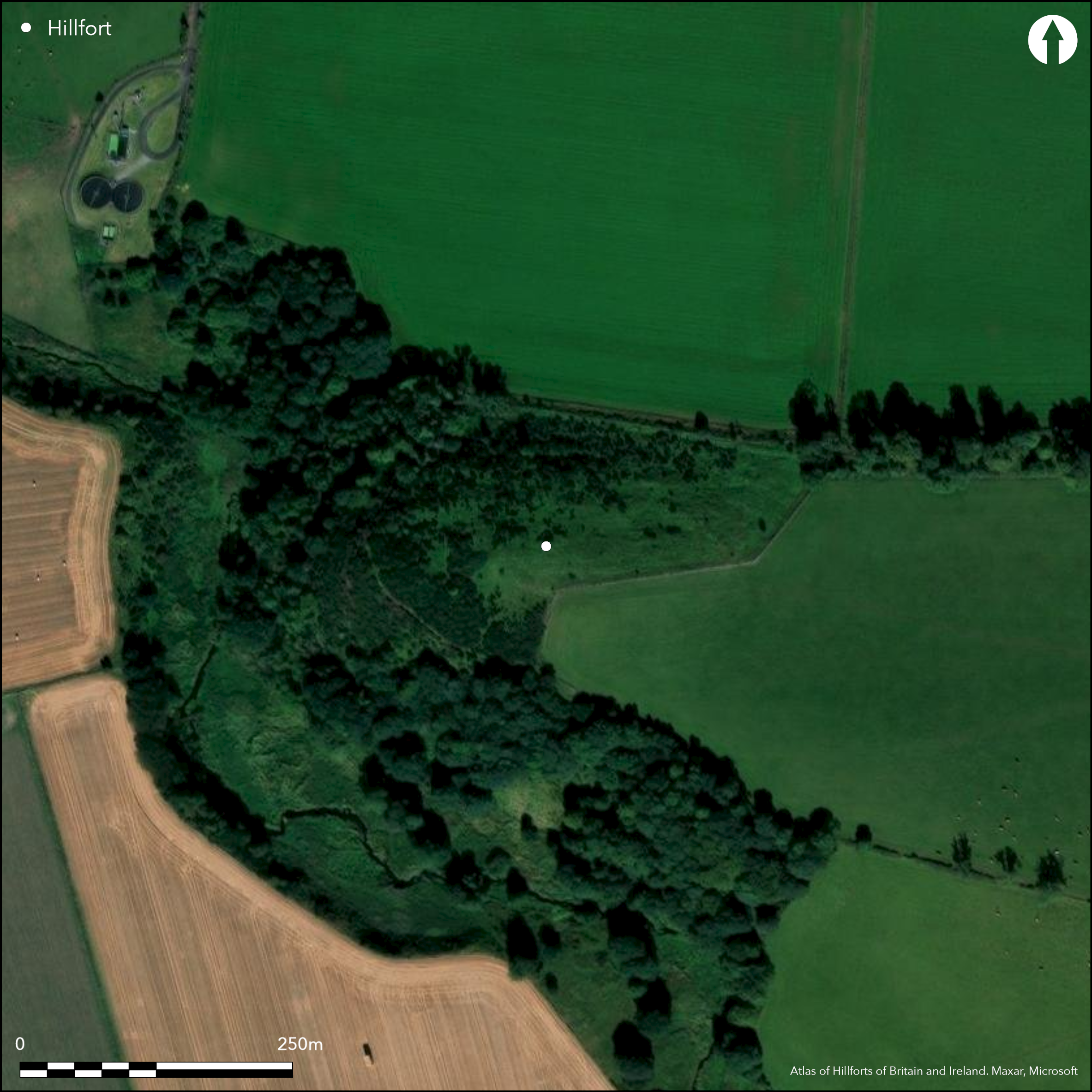
Areas of later quarrying both wihtin the interior and elsewhere on the flanks of the hill
| Woodland | ✗ |
| Commercial Forestry Plantation | ✗ |
| Parkland | ✗ |
| Pasture (Grazing) | ✓ |
| Arable | ✗ |
| Scrub/Bracken | ✓ |
| Bare Outcrop | ✗ |
| Heather/Moorland | ✓ |
| Heath | ✗ |
| Built-up | ✗ |
| Coastal Grassland | ✗ |
| Other | ✗ |
None
| Contour Fort | ✓ |
| Partial Contour Fort | ✗ |
| Promontory Fort | ✗ |
| Hillslope Fort | ✗ |
| Level Terrain Fort | ✗ |
| Marsh Fort | ✗ |
| Multiple Enclosure Fort | ✗ |
| Hilltop | ✓ |
| Coastal Promontory | ✗ |
| Inland Promontory | ✗ |
| Valley Bottom | ✗ |
| Knoll/Hillock/Outcrop | ✗ |
| Ridge | ✗ |
| Cliff/Plateau-edge/Scarp | ✗ |
| Hillslope | ✗ |
| Lowland | ✗ |
| Spur | ✗ |
Dominant Topographic Feature: None
| North | ✗ |
| Northeast | ✗ |
| East | ✗ |
| Southeast | ✗ |
| South | ✗ |
| Southwest | ✗ |
| West | ✗ |
| Northwest | ✗ |
| Level | ✓ |
Altitude: 130.0m
N/A
The dating of the broch to probably the 1st/2nd centuries AD demonstrates that the fort here dates from the pre-Roman Iron Age
Reliability: D - None
| Pre 1200BC | ✗ |
| 1200BC - 800BC | ✗ |
| 800BC - 400BC | ✗ |
| 400BC - AD50 | ✗ |
| AD50 - AD400 | ✗ |
| AD400 - AD 800 | ✗ |
| Post AD800 | ✗ |
| Unknown | ✓ |
| Pre Hillfort: | Possible cupmarked stone lies outside the entrance to the broch |
| Post Hillfort: | Overlain by a broch and later planted with trees throughout the 19th and early 20th centuries |
| Morphology/Earthwork/Typology: | Broch overlies |
Photographed from the air in 1972 by John Dewar and subsequently in 1976, 1983 and 1984 by RCAHMS Aerial Survey Programme
| Earthwork Survey (1957): | Plan and description during RCAHMS Survey of Marginal Lands (RCAHMS AND 2/1-7 & DP147379; Steer 1957) |
| 1st Identified Map Depiction (1958): | Visited by the OS |
| Other (1972): | Scheduled |
| Other (1994): | Re-Scheduled |
| Other (1994): | Visited by the Hill-Fort Study Group |
Featureless apart from the broch and later quarrying
None
| None | ✓ |
| Spring | ✗ |
| Stream | ✗ |
| Pool | ✗ |
| Flush | ✗ |
| Well | ✗ |
| Other | ✗ |
Broch
| No Known Features | ✗ |
| Round Stone Structures | ✗ |
| Rectangular Stone Structures | ✗ |
| Curvilinear Platforms | ✗ |
| Other Roundhouse Evidence | ✗ |
| Pits | ✗ |
| Quarry Hollows | ✗ |
| Other | ✓ |
None
| No Known Excavation | ✓ |
| Pits | ✗ |
| Postholes | ✗ |
| Roundhouses | ✗ |
| Rectangular Structures | ✗ |
| Roads/Tracks | ✗ |
| Quarry Hollows | ✗ |
| Other | ✗ |
| Nothing Found | ✗ |
None
| No Known Geophysics | ✓ |
| Pits | ✗ |
| Roundhouses | ✗ |
| Rectangular Structures | ✗ |
| Roads/Tracks | ✗ |
| Quarry Hollows | ✗ |
| Other | ✗ |
| Nothing Found | ✗ |
None
| No Known Finds | ✓ |
| Pottery | ✗ |
| Metal | ✗ |
| Metalworking | ✗ |
| Human Bones | ✗ |
| Animal Bones | ✗ |
| Lithics | ✗ |
| Environmental | ✗ |
| Other | ✗ |
NO APPARENT FEATURES
| APs Not Checked | ✗ |
| None | ✓ |
| Roundhouses | ✗ |
| Rectangular Structures | ✗ |
| Pits | ✗ |
| Postholes | ✗ |
| Roads/Tracks | ✗ |
| Other | ✗ |
See main summary
| 4: | but large sectors of the defences have also been removed |
| 2: | None known |
Guard Chambers: ✗
Chevaux de Frise: ✗
Up to four ramparts, on the E accompanied by ditches, and with an inner enclosure around the broch at the W end
| Area 1: | 1.2ha. |
| Area 2: | 0.2ha. |
| Total: | 1.2ha. |
Total Footprint Area: Noneha.
None
| ✗ | None |
| ✗ | None |
| NE Quadrant: | 2 |
| SE Quadrant: | 4 |
| SW Quadrant: | 0 |
| NW Quadrant: | 2 |
| Total: | 4 |
| Partial Univallate | ✗ |
| Univallate | ✗ |
| Partial Bivallate | ✓ |
| Bivallate | ✗ |
| Partial Multivallate | ✓ |
| Multivallate | ✗ |
| Unknown | ✗ |
| Partial Univallate | ✗ |
| Univallate | ✗ |
| Partial Bivallate | ✗ |
| Bivallate | ✗ |
| Partial Multivallate | ✗ |
| Multivallate | ✗ |
None
| None | ✗ |
| Earthen Bank | ✗ |
| Stone Wall | ✓ |
| Rubble | ✓ |
| Wall-walk | ✗ |
| Evidence of Timber | ✗ |
| Vitrification | ✗ |
| Other Burning | ✗ |
| Palisade | ✗ |
| Counter Scarp Bank | ✗ |
| Berm | ✗ |
| Unfinished | ✗ |
| Other | ✗ |
None
| None | ✗ |
| Earthen Bank | ✗ |
| Stone Wall | ✗ |
| Murus Duplex | ✗ |
| Timber-framed | ✗ |
| Timber-laced | ✗ |
| Vitrification | ✗ |
| Other Burning | ✗ |
| Palisade | ✗ |
| Counter Scarp Bank | ✗ |
| Berm | ✗ |
| Unfinished | ✗ |
| No Known Excavation | ✓ |
| Other | ✗ |
| ✗ | None |
| ✓ | Only visible as cropmarks |
Number of Ditches: 4
| ✗ | None |
MacKie, E W. (2007) The Roundhouses, Brochs and Wheelhouses of Atlantic Scotland c.700 BC-AD 500: architecture and material culture, the Northern and Southern Mainland and the Western Islands. BAR: Oxford
Steer, K A. (1957) Craighill, Angus'. Disc Exc Scot (1957), 39.
Atlas of Hillforts:
Wikidata:
This work is licensed under CC BY-SA 4.0![]()
![]()
![]() and should be cited as:
and should be cited as:
Lock, Gary and Ralston, Ian. 2024. Atlas of Hillforts of Britain and Ireland. Available at: https://hillforts.arch.ox.ac.uk
Document Version 1.1