LiDAR 1m DTM Hillshade
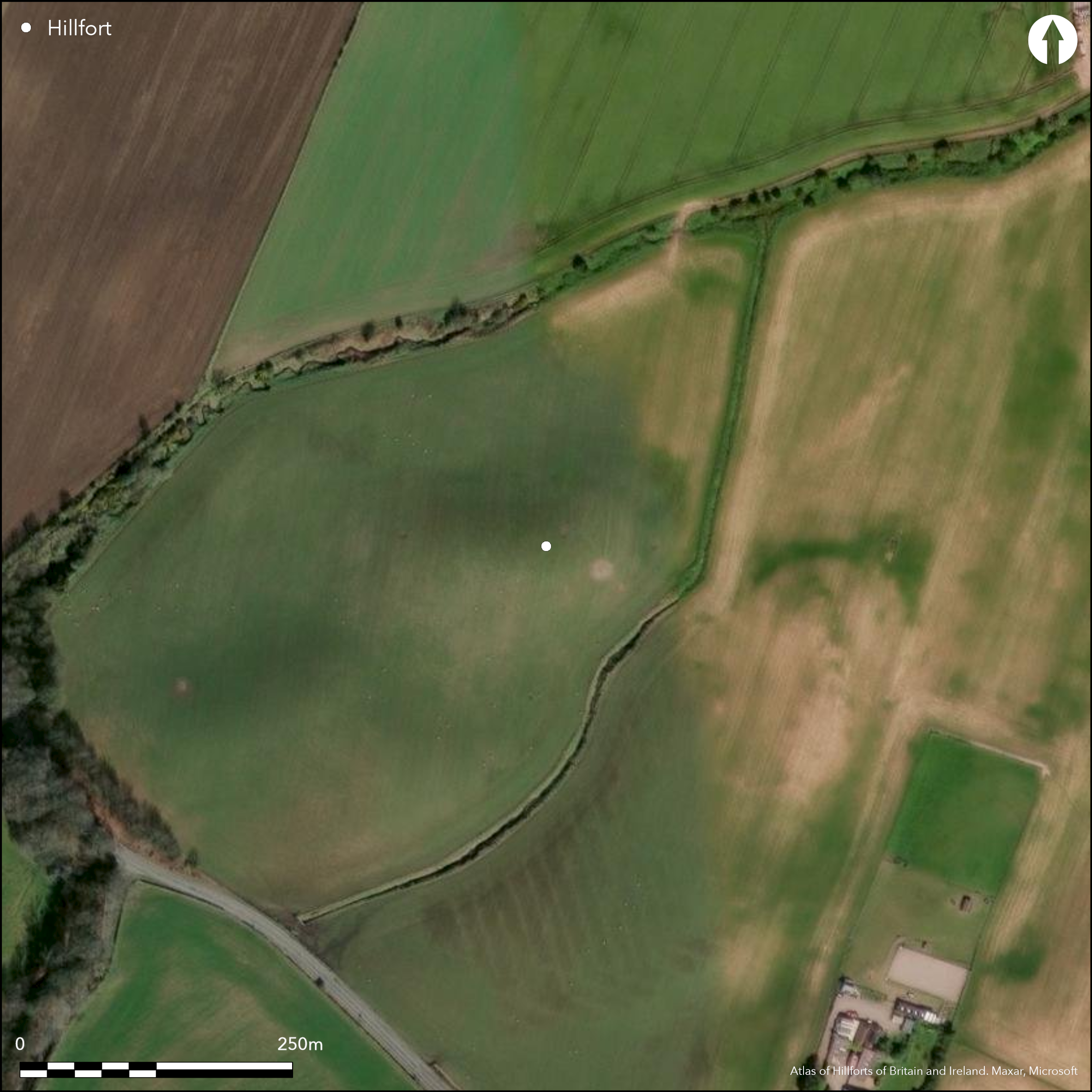
Satellite Imagery
LiDAR 1m DTM Hillshade
Satellite Imagery
Scroll left/right to view further images.
HER: Fife Council None (None)
NMR: NO 20 NE 97 (29864)
SM: 6937
NGR: NO 2743 0628
X: 327434 Y: 706283 (OSGB36)
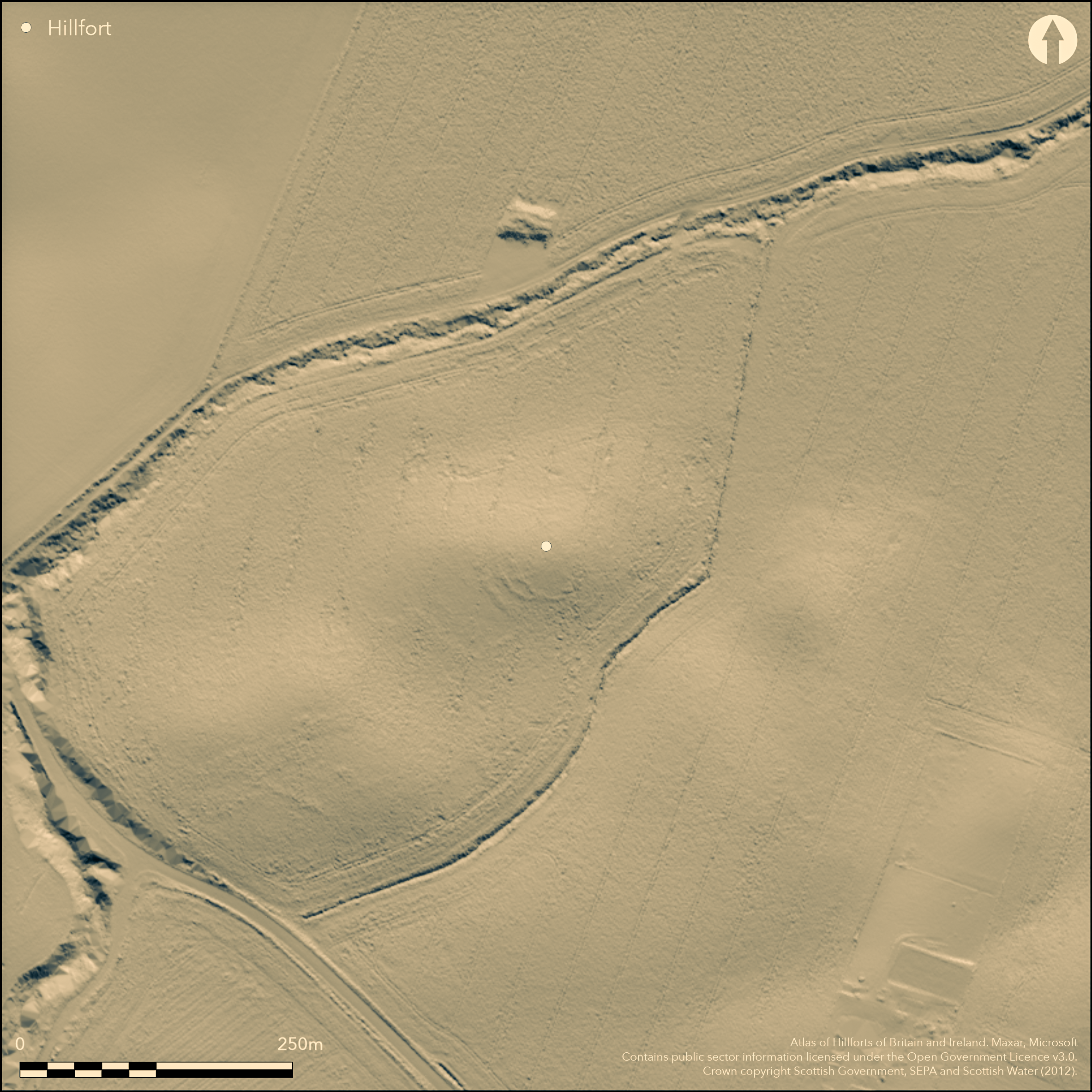
Cropmarks have revealed a small fortification occupying a low hillock that forms part of a spur dropping down the slope between two burn gullies NW of Nether Drum. The overall configuration of the defences is unclear, but in the shallow saddle on the uphill side, three ditches are clearly visible on the photographs, extending SE from terminals flanking what must be one side of an entrance on the WSW. The inner and middle ditch, which are between 2m and 3m in breadth, converge and merge into one on the S, and while there are traces of two ditches continuing round the E and N, it is not certain to which circuits they belong. Nevertheless, their projected circuits roughly oppose the terminals of the inner and middle ditches at the entrance, suggesting that they represent two successive enclosures, one measuring internally about 44m from ESE to WNE by 36m transversely (0.12ha), and the other 50m by 36m respectively (0.14ha); both would be considerably smaller when allowance is made for an internal bank, giving measurements of roughly 0.9ha and 0.1ha. The outer ditch lies concentrically to the middle ditch but is visible only around the S and W, where it appears to be in the order of 5m in breadth, though a bleached line in the cropmark about 2m within its inner lip may indicate that this too is a conflation of two ditches. The interior is featureless and the changing character of the cropmarks across the hillock suggests that large areas have been heavily truncated.
Citizen Science: ✗
Reliability of Data: Confirmed
Reliability of Interpretation: Confirmed
X: -353160 Y: 7607056 (EPSG: 3857)
Longitude: -3.172490201700948 Latitude: 56.24356268494357 (EPSG:4326)
Country: Scotland
Current County or Unitary Authority: Fife
Historic County: Fife
Current Parish/Community/Council/Townland: Falkland
None
| Extant | ✗ |
| Cropmark | ✓ |
| Likely Destroyed | ✗ |
None
| Woodland | ✗ |
| Commercial Forestry Plantation | ✗ |
| Parkland | ✗ |
| Pasture (Grazing) | ✗ |
| Arable | ✓ |
| Scrub/Bracken | ✗ |
| Bare Outcrop | ✗ |
| Heather/Moorland | ✗ |
| Heath | ✗ |
| Built-up | ✗ |
| Coastal Grassland | ✗ |
| Other | ✗ |
None
| Contour Fort | ✓ |
| Partial Contour Fort | ✗ |
| Promontory Fort | ✗ |
| Hillslope Fort | ✗ |
| Level Terrain Fort | ✗ |
| Marsh Fort | ✗ |
| Multiple Enclosure Fort | ✗ |
| Hilltop | ✗ |
| Coastal Promontory | ✗ |
| Inland Promontory | ✗ |
| Valley Bottom | ✗ |
| Knoll/Hillock/Outcrop | ✓ |
| Ridge | ✗ |
| Cliff/Plateau-edge/Scarp | ✗ |
| Hillslope | ✗ |
| Lowland | ✗ |
| Spur | ✗ |
Dominant Topographic Feature: None
| North | ✗ |
| Northeast | ✗ |
| East | ✗ |
| Southeast | ✗ |
| South | ✗ |
| Southwest | ✗ |
| West | ✗ |
| Northwest | ✗ |
| Level | ✓ |
Altitude: 95.0m
N/A
In the absence of excavation, there are neither stratified artefacts nor radiocarbon dates to provide a chronology for the defences.
Reliability: D - None
| Pre 1200BC | ✗ |
| 1200BC - 800BC | ✗ |
| 800BC - 400BC | ✗ |
| 400BC - AD50 | ✗ |
| AD50 - AD400 | ✗ |
| AD400 - AD 800 | ✗ |
| Post AD800 | ✗ |
| Unknown | ✓ |
| Pre Hillfort: | None |
| Post Hillfort: | Ploughed flat |
First photographed by CUCAP in 1979, and re-photographed on three occasions by RCAHMS Aerial Survey Programme in 1984, 1994 and 1995
| 1st Identified Written Reference (1979): | First photographed by CUCAP |
Featureless
None
| None | ✓ |
| Spring | ✗ |
| Stream | ✗ |
| Pool | ✗ |
| Flush | ✗ |
| Well | ✗ |
| Other | ✗ |
None
| No Known Features | ✓ |
| Round Stone Structures | ✗ |
| Rectangular Stone Structures | ✗ |
| Curvilinear Platforms | ✗ |
| Other Roundhouse Evidence | ✗ |
| Pits | ✗ |
| Quarry Hollows | ✗ |
| Other | ✗ |
None
| No Known Excavation | ✓ |
| Pits | ✗ |
| Postholes | ✗ |
| Roundhouses | ✗ |
| Rectangular Structures | ✗ |
| Roads/Tracks | ✗ |
| Quarry Hollows | ✗ |
| Other | ✗ |
| Nothing Found | ✗ |
None
| No Known Geophysics | ✓ |
| Pits | ✗ |
| Roundhouses | ✗ |
| Rectangular Structures | ✗ |
| Roads/Tracks | ✗ |
| Quarry Hollows | ✗ |
| Other | ✗ |
| Nothing Found | ✗ |
None
| No Known Finds | ✓ |
| Pottery | ✗ |
| Metal | ✗ |
| Metalworking | ✗ |
| Human Bones | ✗ |
| Animal Bones | ✗ |
| Lithics | ✗ |
| Environmental | ✗ |
| Other | ✗ |
NO APPARENT FEATURES
| APs Not Checked | ✗ |
| None | ✓ |
| Roundhouses | ✗ |
| Rectangular Structures | ✗ |
| Pits | ✗ |
| Postholes | ✗ |
| Roads/Tracks | ✗ |
| Other | ✗ |
See main summary
| 1: | Ploughed flat |
| 2: | None |
Guard Chambers: ✗
Chevaux de Frise: ✗
| 1. Simple Gap (West): | None |
Three ditches, two of which form complete circuits but probably represent separate periods of construction.
| Area 1: | 0.09ha. |
| Area 2: | 0.1ha. |
| Total: | 0.1ha. |
Total Footprint Area: 0.35ha.
None
| ✓ | None |
| ✓ | None |
| NE Quadrant: | 2 |
| SE Quadrant: | 2 |
| SW Quadrant: | 3 |
| NW Quadrant: | 1 |
| Total: | 3 |
| Partial Univallate | ✓ |
| Univallate | ✗ |
| Partial Bivallate | ✓ |
| Bivallate | ✗ |
| Partial Multivallate | ✓ |
| Multivallate | ✗ |
| Unknown | ✗ |
| Partial Univallate | ✗ |
| Univallate | ✗ |
| Partial Bivallate | ✗ |
| Bivallate | ✗ |
| Partial Multivallate | ✗ |
| Multivallate | ✗ |
None
| None | ✓ |
| Earthen Bank | ✗ |
| Stone Wall | ✗ |
| Rubble | ✗ |
| Wall-walk | ✗ |
| Evidence of Timber | ✗ |
| Vitrification | ✗ |
| Other Burning | ✗ |
| Palisade | ✗ |
| Counter Scarp Bank | ✗ |
| Berm | ✗ |
| Unfinished | ✗ |
| Other | ✗ |
None
| None | ✗ |
| Earthen Bank | ✗ |
| Stone Wall | ✗ |
| Murus Duplex | ✗ |
| Timber-framed | ✗ |
| Timber-laced | ✗ |
| Vitrification | ✗ |
| Other Burning | ✗ |
| Palisade | ✗ |
| Counter Scarp Bank | ✗ |
| Berm | ✗ |
| Unfinished | ✗ |
| No Known Excavation | ✓ |
| Other | ✗ |
| ✗ | None |
| ✓ | None |
Number of Ditches: 3
| ✗ | None |
No related records
Atlas of Hillforts:
Wikidata:
This work is licensed under CC BY-SA 4.0![]()
![]()
![]() and should be cited as:
and should be cited as:
Lock, Gary and Ralston, Ian. 2024. Atlas of Hillforts of Britain and Ireland. Available at: https://hillforts.arch.ox.ac.uk
Document Version 1.1