LiDAR 1m DTM Hillshade
Satellite Imagery
LiDAR 1m DTM Hillshade
Satellite Imagery
Scroll left/right to view further images.
HER: Fife Council None (None)
NMR: NO 31 SE 27 (31508)
SM: 812
NGR: NO 3563 1031
X: 335630 Y: 710310 (OSGB36)
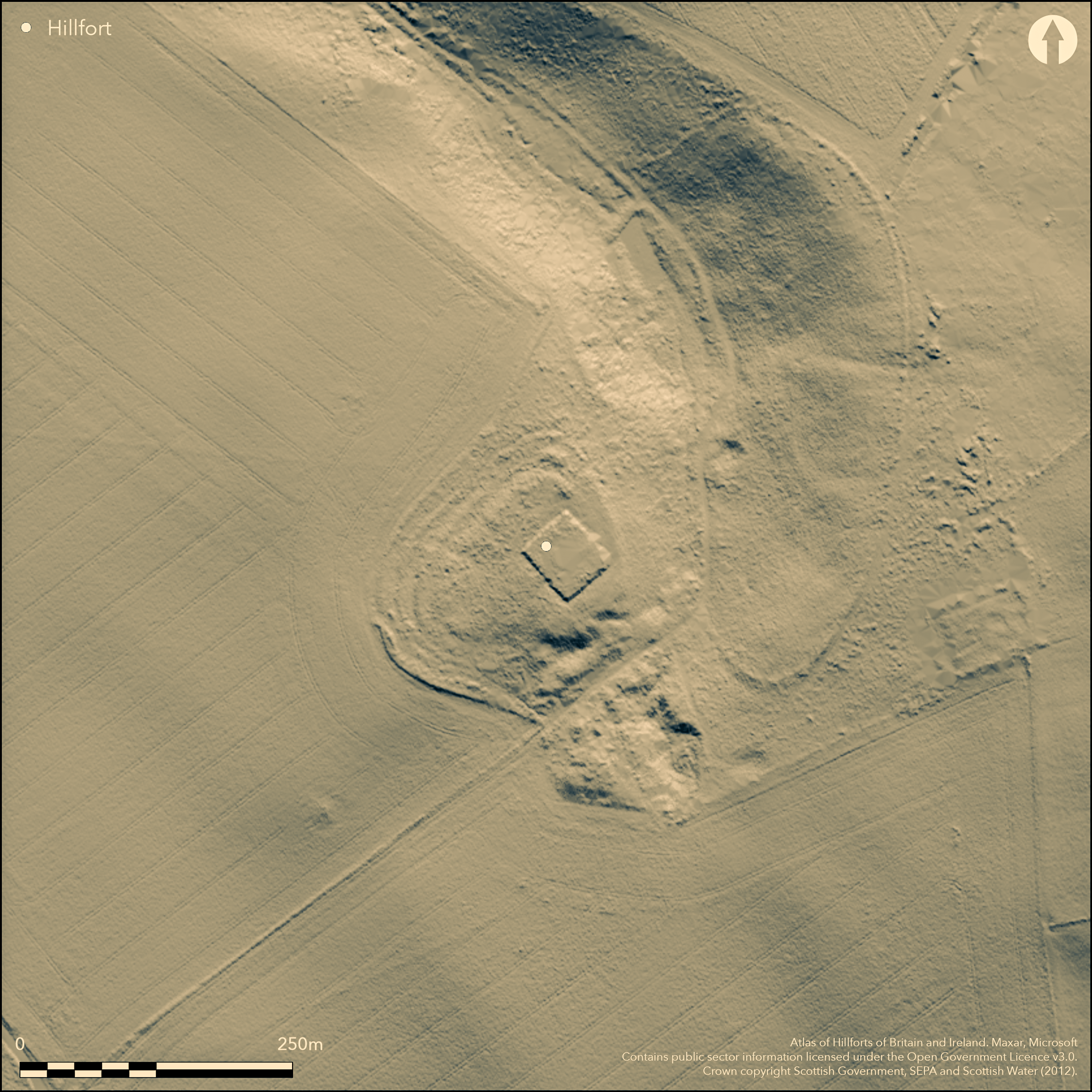
This fort occupies the crest of a spur that projects W from lower slopes of Walton Hill. Although directly overlooked by Walton Hill, the ground falls away steeply on the W, while a gully climbing the slope from the NW serves to separate the spur from the main bulk of the hill. The ramparts of the fort have been heavily reduced, and further damage has been caused by quarrying on the S flank and the insertion of a burial-vault for the Crawford family into the interior, but enough remains on the NW flank to show that its defences comprised three ramparts stepping down the slope in a belt about 22m deep. The innermost has been reduced to no more than a scarp, and an external ditch is visible accompanying the outermost. The size of the interior is difficult to estimate, but on the assumption that the defences were originally set out concentrically round the whole circuit, it measures about 85m from NE to SW by a minimum of 40m (0.3ha) and possibly as much 75m transversely (0.5ha); the depiction on the 1st edition of the OS 6-inch map, when the defences appear to have been more complete on the S, suggest the latter. There is a possible entrance through the outer defences on the NW, where the plan drawn up by RCAHMS investigators in 1925 shows the outer rampart turning slightly inwards to either side of the gap, but there is no equivalent gap in the innermost rampart. For what it is worth the map omits the gap in the outer defences on the NW, but appears to show an entrance on the S.
Citizen Science: ✗
Reliability of Data: Confirmed
Reliability of Interpretation: Confirmed
X: -338550 Y: 7614543 (EPSG: 3857)
Longitude: -3.0412491180785723 Latitude: 56.28091934592134 (EPSG:4326)
Country: Scotland
Current County or Unitary Authority: Fife
Historic County: Fife
Current Parish/Community/Council/Townland: Cults
None
| Extant | ✓ |
| Cropmark | ✗ |
| Likely Destroyed | ✗ |
None
| Woodland | ✓ |
| Commercial Forestry Plantation | ✓ |
| Parkland | ✗ |
| Pasture (Grazing) | ✗ |
| Arable | ✗ |
| Scrub/Bracken | ✗ |
| Bare Outcrop | ✗ |
| Heather/Moorland | ✗ |
| Heath | ✗ |
| Built-up | ✗ |
| Coastal Grassland | ✗ |
| Other | ✗ |
None
| Contour Fort | ✓ |
| Partial Contour Fort | ✗ |
| Promontory Fort | ✗ |
| Hillslope Fort | ✗ |
| Level Terrain Fort | ✗ |
| Marsh Fort | ✗ |
| Multiple Enclosure Fort | ✗ |
| Hilltop | ✗ |
| Coastal Promontory | ✗ |
| Inland Promontory | ✗ |
| Valley Bottom | ✗ |
| Knoll/Hillock/Outcrop | ✗ |
| Ridge | ✗ |
| Cliff/Plateau-edge/Scarp | ✗ |
| Hillslope | ✗ |
| Lowland | ✗ |
| Spur | ✓ |
Dominant Topographic Feature: None
| North | ✗ |
| Northeast | ✗ |
| East | ✗ |
| Southeast | ✗ |
| South | ✗ |
| Southwest | ✗ |
| West | ✗ |
| Northwest | ✗ |
| Level | ✓ |
Altitude: 88.0m
N/A
In the absence of excavation, there are neither stratified artefacts nor radiocarbon dates to provide a chronology for the defences.
Reliability: D - None
| Pre 1200BC | ✗ |
| 1200BC - 800BC | ✗ |
| 800BC - 400BC | ✗ |
| 400BC - AD50 | ✗ |
| AD50 - AD400 | ✗ |
| AD400 - AD 800 | ✗ |
| Post AD800 | ✗ |
| Unknown | ✓ |
| Pre Hillfort: | None |
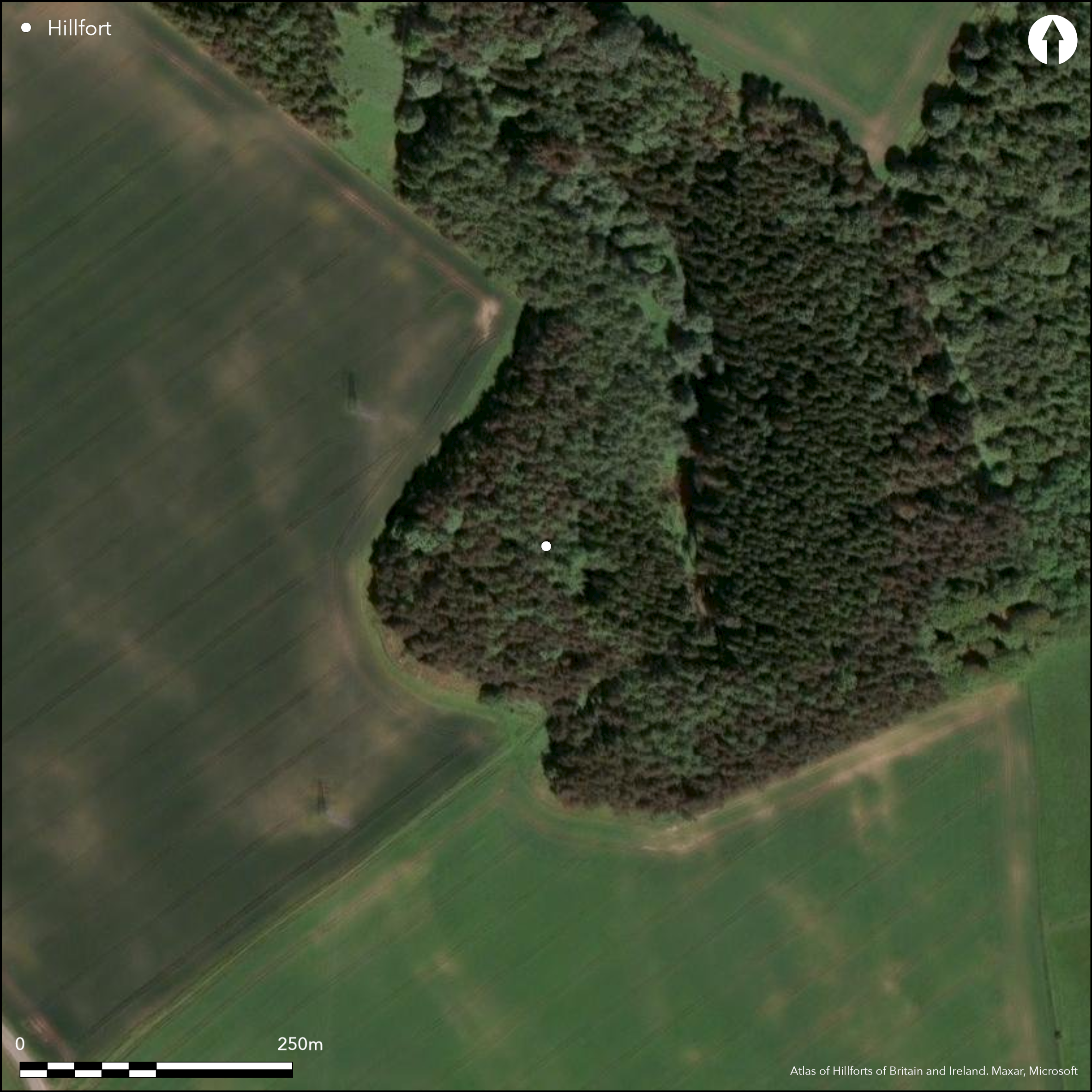
| Post Hillfort: | Quarried, planted with trees and overlain by the Crawford Burial Vault |
Photographed by RCAHMS Aerial Survey Programme
| 1st Identified Map Depiction (1854): | Annotated Fort on 1st edition OS 6-inch map (Fife 1856, sheet 17) |
| Other (1894): | Depiction on the 25-inch map (Fifeshire 1895, sheet 13.11) |
| Earthwork Survey (1925): | Plan and description (RCAHMS 1933, 86-7, no.166, fig 193; RCAHMS FID 29/1-2) |
| Other (1935): | Scheduled |
| Other (1947): | Noted by Gerhard Bersu (1948, 257) |
| Other (1951): | Visited during RCAHMS Survey of Marginal Lands |
| Other (1956): | Visited by the OS |
| Other (1964): | Revised at 1:2500 by the OS |
| Other (1978): | Visited by the OS |
Featureless apart from the Crawford family vault
None
| None | ✓ |
| Spring | ✗ |
| Stream | ✗ |
| Pool | ✗ |
| Flush | ✗ |
| Well | ✗ |
| Other | ✗ |
None
| No Known Features | ✓ |
| Round Stone Structures | ✗ |
| Rectangular Stone Structures | ✗ |
| Curvilinear Platforms | ✗ |
| Other Roundhouse Evidence | ✗ |
| Pits | ✗ |
| Quarry Hollows | ✗ |
| Other | ✗ |
None
| No Known Excavation | ✓ |
| Pits | ✗ |
| Postholes | ✗ |
| Roundhouses | ✗ |
| Rectangular Structures | ✗ |
| Roads/Tracks | ✗ |
| Quarry Hollows | ✗ |
| Other | ✗ |
| Nothing Found | ✗ |
None
| No Known Geophysics | ✓ |
| Pits | ✗ |
| Roundhouses | ✗ |
| Rectangular Structures | ✗ |
| Roads/Tracks | ✗ |
| Quarry Hollows | ✗ |
| Other | ✗ |
| Nothing Found | ✗ |
None
| No Known Finds | ✓ |
| Pottery | ✗ |
| Metal | ✗ |
| Metalworking | ✗ |
| Human Bones | ✗ |
| Animal Bones | ✗ |
| Lithics | ✗ |
| Environmental | ✗ |
| Other | ✗ |
NO APPARENT FEATURES
| APs Not Checked | ✗ |
| None | ✓ |
| Roundhouses | ✗ |
| Rectangular Structures | ✗ |
| Pits | ✗ |
| Postholes | ✗ |
| Roads/Tracks | ✗ |
| Other | ✗ |
See main summary
| 2: | Large sectors of the ramparts levelled |
| 2: | None |
Guard Chambers: ✗
Chevaux de Frise: ✗
| 1. Simple Gap (South): | Shown on OS map in 1854 |
| 2. Simple Gap (North west): | None |
At least three ramparts on one side, but it is unclear if these all formed complete circuits
| Area 1: | 0.3ha. |
| Area 2: | 0.5ha. |
| Total: | 0.5ha. |
Total Footprint Area: 1.5ha.
None
| ✗ | The minimum and maximum sizes of the interior are included above |
| ✓ | None |
| NE Quadrant: | 1 |
| SE Quadrant: | 1 |
| SW Quadrant: | 3 |
| NW Quadrant: | 3 |
| Total: | 3 |
| Partial Univallate | ✓ |
| Univallate | ✗ |
| Partial Bivallate | ✗ |
| Bivallate | ✗ |
| Partial Multivallate | ✓ |
| Multivallate | ✗ |
| Unknown | ✗ |
| Partial Univallate | ✗ |
| Univallate | ✗ |
| Partial Bivallate | ✗ |
| Bivallate | ✗ |
| Partial Multivallate | ✗ |
| Multivallate | ✗ |
None
| None | ✗ |
| Earthen Bank | ✓ |
| Stone Wall | ✗ |
| Rubble | ✗ |
| Wall-walk | ✗ |
| Evidence of Timber | ✗ |
| Vitrification | ✗ |
| Other Burning | ✗ |
| Palisade | ✗ |
| Counter Scarp Bank | ✗ |
| Berm | ✗ |
| Unfinished | ✗ |
| Other | ✗ |
None
| None | ✗ |
| Earthen Bank | ✗ |
| Stone Wall | ✗ |
| Murus Duplex | ✗ |
| Timber-framed | ✗ |
| Timber-laced | ✗ |
| Vitrification | ✗ |
| Other Burning | ✗ |
| Palisade | ✗ |
| Counter Scarp Bank | ✗ |
| Berm | ✗ |
| Unfinished | ✗ |
| No Known Excavation | ✓ |
| Other | ✗ |
| ✗ | None |
| ✓ | It is likely that all three ramparts are accompanied by external ditches, but only the outermost remains visible |
Number of Ditches: 1
| ✗ | None |
Bersu, G (1948) ' "Fort" at Scotstarvit Covert, Fife'. Proc Soc Antiq Scot 82 (1947-80, 241-63
RCAHMS (1933) The Royal Commission on the Ancient and Historical Monuments and Constructions of Scotland. Eleventh report with inventory of monuments and constructions in the counties of Fife, Kinross, and Clackmannan. HMSO: Edinburgh
Atlas of Hillforts:
Wikidata:
This work is licensed under CC BY-SA 4.0![]()
![]()
![]() and should be cited as:
and should be cited as:
Lock, Gary and Ralston, Ian. 2024. Atlas of Hillforts of Britain and Ireland. Available at: https://hillforts.arch.ox.ac.uk
Document Version 1.1