LiDAR 1m DTM Hillshade
Satellite Imagery
LiDAR 1m DTM Hillshade
Satellite Imagery
Scroll left/right to view further images.
HER: Fife Council None (None)
NMR: NO 41 SE 5 (33011)
SM: 2380
NGR: NO 4561 1370
X: 345610 Y: 713700 (OSGB36)
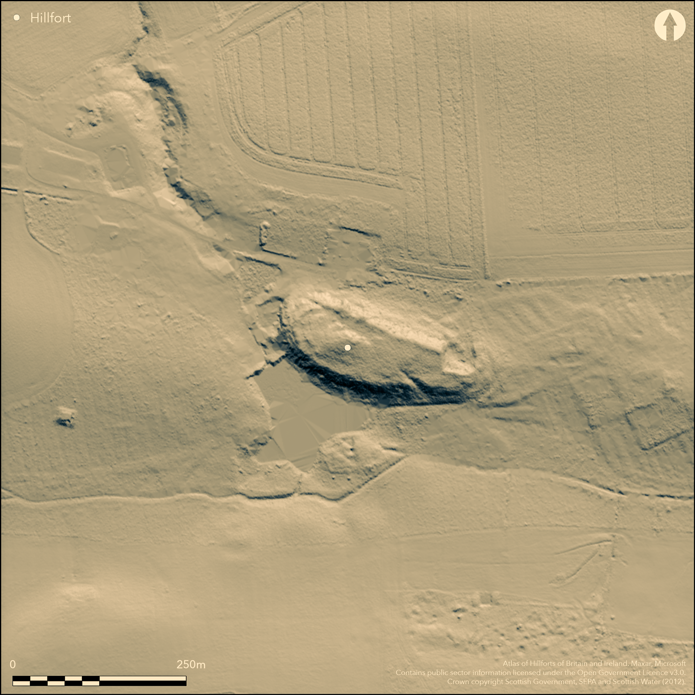
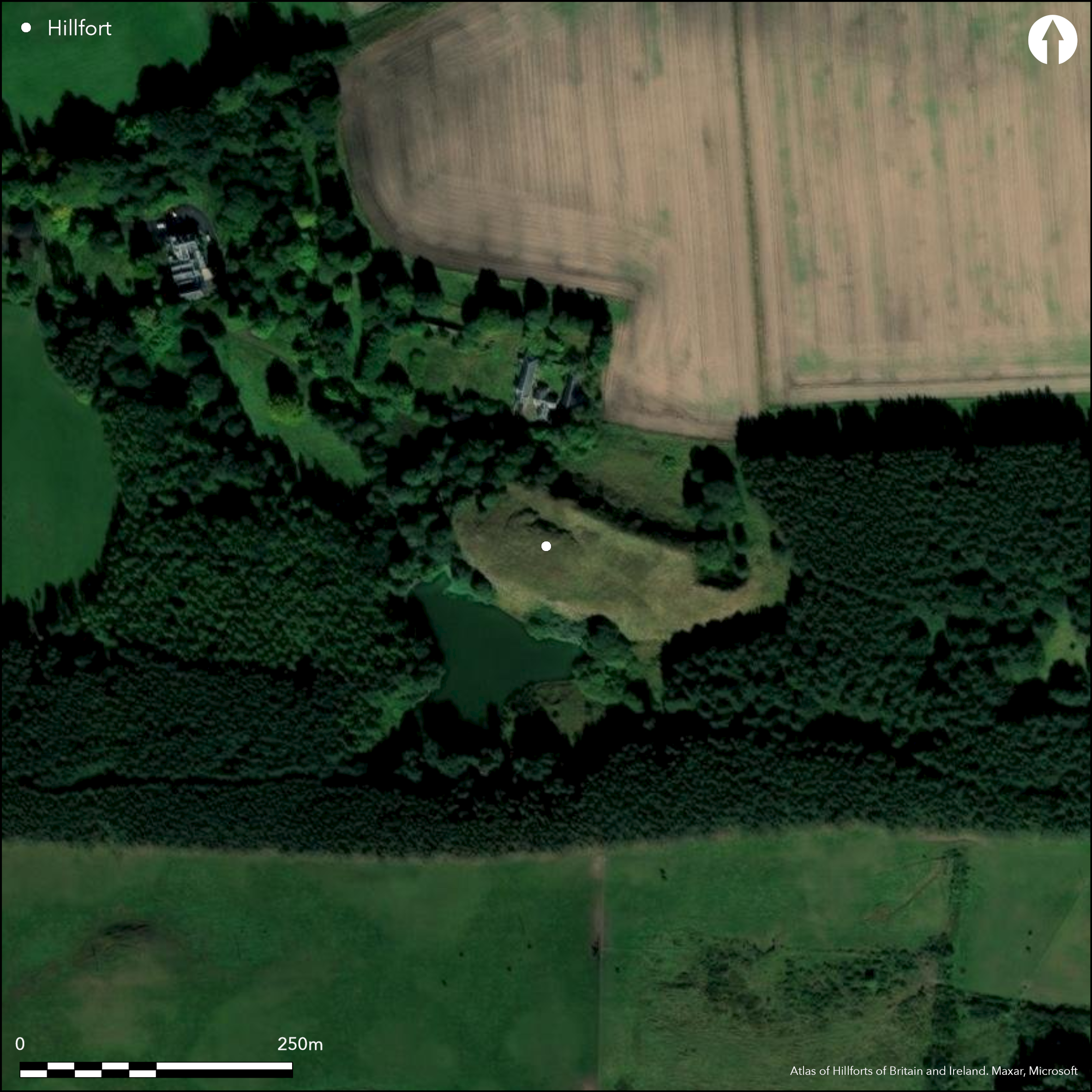
This fort is situated on a craggy hillock which has been quarried for rock at both the E and W ends. Roughly oval on plan, it measures about 142m from ESE to WNW by 41m transversely (0.5ha) within a heavily-robbed wall about 3.7m in thickness. Both faces are visible for a short distance on the WNW, where the outer face still stands 1m high in three courses, while the line of the outer face can be traced along parts of the S side to the W of an entrance passage that has been cut obliquely through the rocks forming the lip of the crag on the SE. What is probably a second entrance has been cut in a similar fashion through the edge of the crag on the WNW, but has been reworked with a modern flight of steps. Outcrop lies immediately below the turf across much of the interior, which is otherwise featureless. First recorded during the RCAHMS Survey of Marginal Lands, a subsequent visit by RCAHMS investigators in 2012 noted a possible outer rampart reduced to a stony bank on the slope below the wall at the E end.
Citizen Science: ✗
Reliability of Data: Confirmed
Reliability of Interpretation: Confirmed
X: -320687 Y: 7620904 (EPSG: 3857)
Longitude: -2.880781193973795 Latitude: 56.31262338700567 (EPSG:4326)
Country: Scotland
Current County or Unitary Authority: Fife
Historic County: Fife
Current Parish/Community/Council/Townland: Cameron
None
| Extant | ✓ |
| Cropmark | ✗ |
| Likely Destroyed | ✗ |
None
| Woodland | ✗ |
| Commercial Forestry Plantation | ✗ |
| Parkland | ✗ |
| Pasture (Grazing) | ✓ |
| Arable | ✗ |
| Scrub/Bracken | ✗ |
| Bare Outcrop | ✗ |
| Heather/Moorland | ✓ |
| Heath | ✗ |
| Built-up | ✗ |
| Coastal Grassland | ✗ |
| Other | ✗ |
None
| Contour Fort | ✓ |
| Partial Contour Fort | ✗ |
| Promontory Fort | ✗ |
| Hillslope Fort | ✗ |
| Level Terrain Fort | ✗ |
| Marsh Fort | ✗ |
| Multiple Enclosure Fort | ✗ |
| Hilltop | ✗ |
| Coastal Promontory | ✗ |
| Inland Promontory | ✗ |
| Valley Bottom | ✗ |
| Knoll/Hillock/Outcrop | ✓ |
| Ridge | ✗ |
| Cliff/Plateau-edge/Scarp | ✗ |
| Hillslope | ✗ |
| Lowland | ✗ |
| Spur | ✗ |
Dominant Topographic Feature: None
| North | ✗ |
| Northeast | ✗ |
| East | ✗ |
| Southeast | ✗ |
| South | ✗ |
| Southwest | ✗ |
| West | ✗ |
| Northwest | ✗ |
| Level | ✓ |
Altitude: 160.0m
N/A
In the absence of excavation, there are neither stratified artefacts nor radiocarbon dates to provide a chronology for the defences.
Reliability: D - None
| Pre 1200BC | ✗ |
| 1200BC - 800BC | ✗ |
| 800BC - 400BC | ✗ |
| 400BC - AD50 | ✗ |
| AD50 - AD400 | ✗ |
| AD400 - AD 800 | ✗ |
| Post AD800 | ✗ |
| Unknown | ✓ |
| Pre Hillfort: | None |
| Post Hillfort: | Quaries cut into the fort on the W and NE and steps inserted into the entrance on the WNW |
None
| Earthwork Survey (1952): | Plan and description by RCAHMS for Survey of Marginal Lands (RCAHMS FID 11/1 & DP 158225; Feachem 1963, 125-6) |
| 1st Identified Written Reference (1952): | The dimensions given by Feachem (1963, 126) are at variance with those noted in the RCAHMS description by being 4.5m shorter in length and 4.5m longer in breadth. The RCAHMS measurements appear to be correct, though the investigators in 2012 mistakenly present them as overall dimensions. |
| Earthwork Survey (1955): | Inked plan by Richard Feachem based on RCAHMS plan (1955, 83) |
| 1st Identified Map Depiction (1956): | Visited by the OS |
| Other (1964): | Visited by the OS |
| Other (1964): | Scheduled |
| Other (1974): | Revised at 1:2500 by the OS |
| Other (2012): | Visited by RCAHMS |
| Other (2013): | Re-Scheduled |
Featureless
None
| None | ✓ |
| Spring | ✗ |
| Stream | ✗ |
| Pool | ✗ |
| Flush | ✗ |
| Well | ✗ |
| Other | ✗ |
None
| No Known Features | ✓ |
| Round Stone Structures | ✗ |
| Rectangular Stone Structures | ✗ |
| Curvilinear Platforms | ✗ |
| Other Roundhouse Evidence | ✗ |
| Pits | ✗ |
| Quarry Hollows | ✗ |
| Other | ✗ |
None
| No Known Excavation | ✓ |
| Pits | ✗ |
| Postholes | ✗ |
| Roundhouses | ✗ |
| Rectangular Structures | ✗ |
| Roads/Tracks | ✗ |
| Quarry Hollows | ✗ |
| Other | ✗ |
| Nothing Found | ✗ |
None
| No Known Geophysics | ✓ |
| Pits | ✗ |
| Roundhouses | ✗ |
| Rectangular Structures | ✗ |
| Roads/Tracks | ✗ |
| Quarry Hollows | ✗ |
| Other | ✗ |
| Nothing Found | ✗ |
None
| No Known Finds | ✓ |
| Pottery | ✗ |
| Metal | ✗ |
| Metalworking | ✗ |
| Human Bones | ✗ |
| Animal Bones | ✗ |
| Lithics | ✗ |
| Environmental | ✗ |
| Other | ✗ |
NO APPARENT FEATURES
| APs Not Checked | ✗ |
| None | ✓ |
| Roundhouses | ✗ |
| Rectangular Structures | ✗ |
| Pits | ✗ |
| Postholes | ✗ |
| Roads/Tracks | ✗ |
| Other | ✗ |
See main summary
| 2: | Heavily robbed and eroded in several other places |
| 2: | None |
Guard Chambers: ✗
Chevaux de Frise: ✗
| 1. Oblique (South east): | Rock-cut passage cutting obliquely across the line of the wall to expose the visitors right side |
| 1. Simple Gap (South east): | None |
| 1. Hollow Way (South east): | None |
| 2. Oblique (North west): | Rock-cut passage cutting obliquely across the line of the wall to expose the visitors right side, and containing modern steps |
| 2. Simple Gap (North west): | None |
Single wall enclosing summit area
| Area 1: | 0.5ha. |
| Total: | 0.5ha. |
Total Footprint Area: 0.7ha.
None
| ✗ | None |
| ✓ | None |
| NE Quadrant: | 1 |
| SE Quadrant: | 1 |
| SW Quadrant: | 1 |
| NW Quadrant: | 1 |
| Total: | 1 |
| Partial Univallate | ✗ |
| Univallate | ✓ |
| Partial Bivallate | ✗ |
| Bivallate | ✗ |
| Partial Multivallate | ✗ |
| Multivallate | ✗ |
| Unknown | ✗ |
| Partial Univallate | ✗ |
| Univallate | ✗ |
| Partial Bivallate | ✗ |
| Bivallate | ✗ |
| Partial Multivallate | ✗ |
| Multivallate | ✗ |
None
| None | ✗ |
| Earthen Bank | ✗ |
| Stone Wall | ✓ |
| Rubble | ✗ |
| Wall-walk | ✗ |
| Evidence of Timber | ✗ |
| Vitrification | ✗ |
| Other Burning | ✗ |
| Palisade | ✗ |
| Counter Scarp Bank | ✗ |
| Berm | ✗ |
| Unfinished | ✗ |
| Other | ✗ |
None
| None | ✗ |
| Earthen Bank | ✗ |
| Stone Wall | ✗ |
| Murus Duplex | ✗ |
| Timber-framed | ✗ |
| Timber-laced | ✗ |
| Vitrification | ✗ |
| Other Burning | ✗ |
| Palisade | ✗ |
| Counter Scarp Bank | ✗ |
| Berm | ✗ |
| Unfinished | ✗ |
| No Known Excavation | ✓ |
| Other | ✗ |
| ✗ | None |
| ✗ | None |
Number of Ditches: None
| ✗ | None |
Feachem, R. (1963) A guide to prehistoric Scotland. Batsford: London
Feachem, R (1955) 'Fortifications'. In Wainwright, F T (ed.) (1955) The problem of the Picts, Studies in History and Archaeology. Edinburgh
Atlas of Hillforts:
Wikidata:
This work is licensed under CC BY-SA 4.0![]()
![]()
![]() and should be cited as:
and should be cited as:
Lock, Gary and Ralston, Ian. 2024. Atlas of Hillforts of Britain and Ireland. Available at: https://hillforts.arch.ox.ac.uk
Document Version 1.1