LiDAR 1m DTM Hillshade
Satellite Imagery
LiDAR 1m DTM Hillshade
Satellite Imagery
Scroll left/right to view further images.
HER: Fife Council None (None)
NMR: NT 28 NW 8 (52860)
SM: 2471
NGR: NT 2114 8729
X: 321140 Y: 687290 (OSGB36)
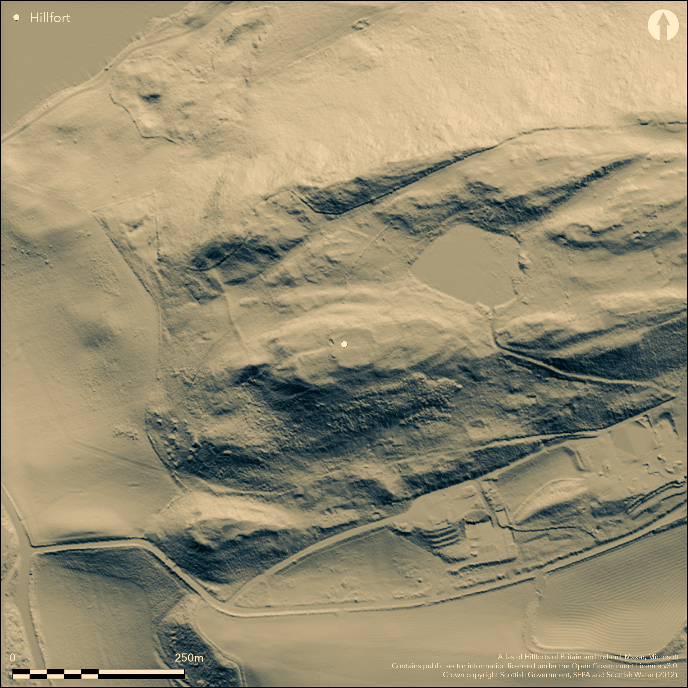
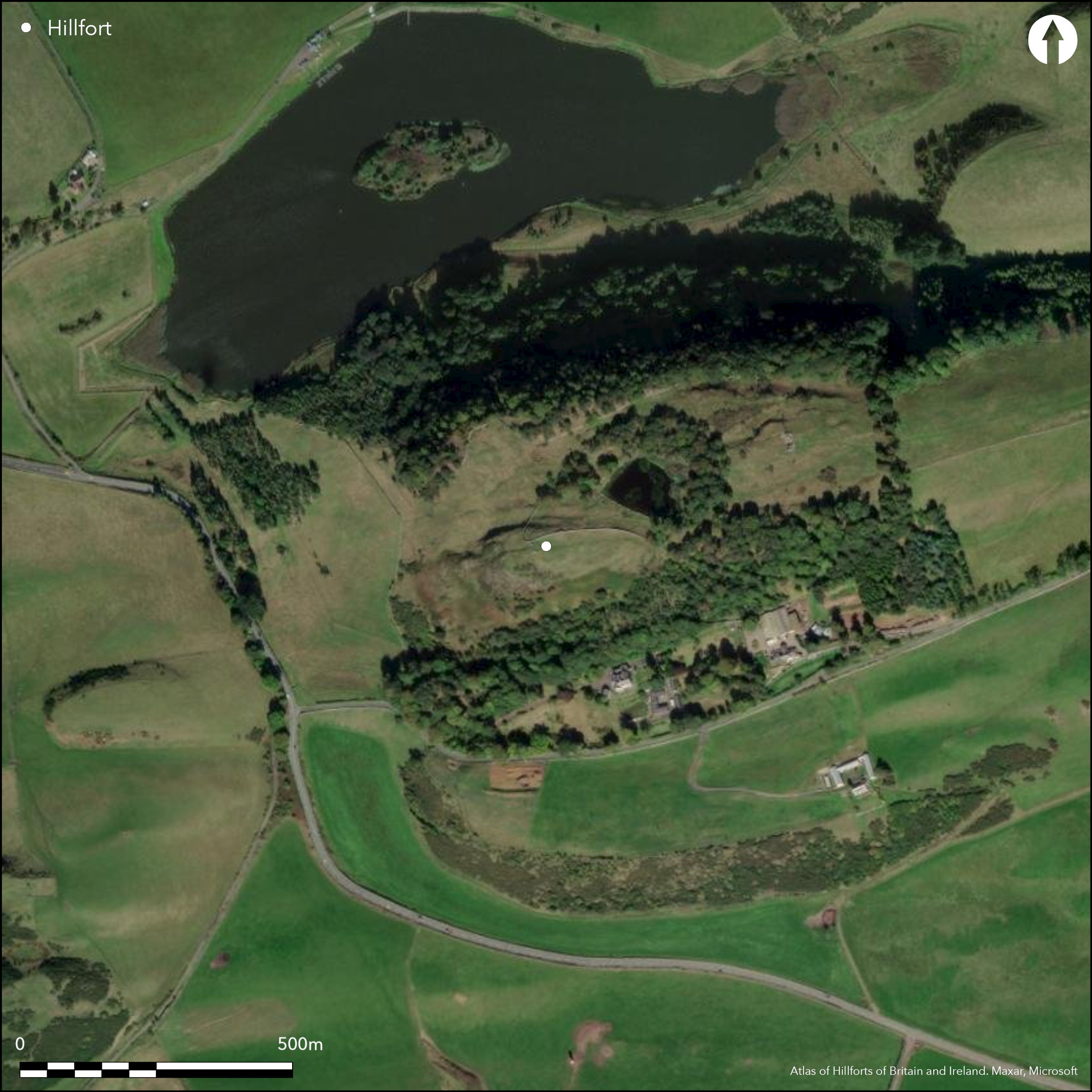
The remains of this fort are situated on the summit formed by the SW spur of Dunearn Hill, its defences comprising two main elements, namely a circular enclosure on the summit, and an earlier oval enclosure taking in the whole of the crest of the spur. The circular enclosure on the summit measures about 32m in diameter (0.08ha) within its wall and probably has an entrance on the E. The wall, which has been a substantial structure, is spread about 4m in thickness and has long runs of outer-facing-stones around its S flank and intermittently elsewhere on the E and N. The enclosure is set astride the interior of the earlier fort a little W of its centre, though the link between the two ends is not particularly clear on the plan drawn up by RCAHMS investigators in 1952 and the relationship between the two ends might prove more complex on excavation. Nevertheless, assuming that the two ends belong to the same defensive scheme, the interior of the earlier fort measures 120m from E to W by a maximum of 44m in breadth at the W end, its eastern portion tapering from 33m in breadth to 16m at the E end (0.39ha). Its defences comprise two ramparts, the inner following a sinuous line along the margin of the summit area of the hill, and the outer, which can be traced around the N, E and S flanks, an irregular course along terraces on the slopes below. A trackway which mounts the slope obliquely on the SE, piercing both ramparts, is probably an original entrance and exposes the visitor's right side. Little of the faces of either of these two ramparts can be seen, but at the entrance through the outer the face turns inwards on either side of the gap. Other gaps in the defences at the E end are probably more recent. Apart from an old observation post and a circular enclosure around a flagstaff overlying the W side of the circular summit enclosure, the interior is featureless. On a terrace on the NW, however, probably overlying the outer rampart of the fort, there is a contiguous row of at least three hut-circles; the OS surveyor revising the depiction in 1974 claimed to find a fourth.
Citizen Science: ✗
Reliability of Data: Confirmed
Reliability of Interpretation: Confirmed
X: -363835 Y: 7572753 (EPSG: 3857)
Longitude: -3.2683876831206624 Latitude: 56.071955887983016 (EPSG:4326)
Country: Scotland
Current County or Unitary Authority: Fife
Historic County: Fife
Current Parish/Community/Council/Townland: Burntisland
None
| Extant | ✓ |
| Cropmark | ✗ |
| Likely Destroyed | ✗ |
None
| Woodland | ✓ |
| Commercial Forestry Plantation | ✗ |
| Parkland | ✗ |
| Pasture (Grazing) | ✓ |
| Arable | ✗ |
| Scrub/Bracken | ✓ |
| Bare Outcrop | ✗ |
| Heather/Moorland | ✓ |
| Heath | ✗ |
| Built-up | ✗ |
| Coastal Grassland | ✗ |
| Other | ✗ |
None
| Contour Fort | ✓ |
| Partial Contour Fort | ✗ |
| Promontory Fort | ✗ |
| Hillslope Fort | ✗ |
| Level Terrain Fort | ✗ |
| Marsh Fort | ✗ |
| Multiple Enclosure Fort | ✗ |
| Hilltop | ✓ |
| Coastal Promontory | ✗ |
| Inland Promontory | ✗ |
| Valley Bottom | ✗ |
| Knoll/Hillock/Outcrop | ✗ |
| Ridge | ✗ |
| Cliff/Plateau-edge/Scarp | ✗ |
| Hillslope | ✗ |
| Lowland | ✗ |
| Spur | ✗ |
Dominant Topographic Feature: None
| North | ✗ |
| Northeast | ✗ |
| East | ✗ |
| Southeast | ✗ |
| South | ✗ |
| Southwest | ✗ |
| West | ✗ |
| Northwest | ✗ |
| Level | ✓ |
Altitude: 221.0m
N/A
In the absence of excavation, there are neither stratified artefacts nor radiocarbon dates to provide a chronology for the defences.
Reliability: D - None
| Pre 1200BC | ✗ |
| 1200BC - 800BC | ✗ |
| 800BC - 400BC | ✗ |
| 400BC - AD50 | ✗ |
| AD50 - AD400 | ✗ |
| AD400 - AD 800 | ✗ |
| Post AD800 | ✗ |
| Unknown | ✓ |
| Pre Hillfort: | None |
| Post Hillfort: | None |
Photographed by RCAHMS Aerial Survey Programme in 1989, and more recent drone pictures by George Geddes in 2015.
| 1st Identified Written Reference (1792): | Noted as Agricola's Camp (Stat Acct ii, 1792 429) |
| 1st Identified Map Depiction (1854): | Annotated Fort on the 1st edition OS 6-inch map (Fife 1856, sheet 36) |
| Other (1925): | Description (RCAHMS 1933, 42-3, no.75) |
| Earthwork Survey (1952): | Plan and description for RCAHMS Survey of Marginal Lands; the varoius plans have been inked with the N point facing S, and it is clear from edits on the typescript description that Kenneth Steer was confused (RCAHMS FID 5/1-4 & DP158212-15; Feachem 1955, 75; 1963, 124-5) |
| Other (1964): | Scheduled |
| Other (1974): | Revised at 1:2500 by the OS |
Featureless apart from the hut-circles probably overlying the outer rampart on a terrace to the NW
None
| None | ✓ |
| Spring | ✗ |
| Stream | ✗ |
| Pool | ✗ |
| Flush | ✗ |
| Well | ✗ |
| Other | ✗ |
At least three and possibly four hut-circles probably overlie the outer rampart on the NW
| No Known Features | ✗ |
| Round Stone Structures | ✓ |
| Rectangular Stone Structures | ✗ |
| Curvilinear Platforms | ✗ |
| Other Roundhouse Evidence | ✗ |
| Pits | ✗ |
| Quarry Hollows | ✗ |
| Other | ✗ |
None
| No Known Excavation | ✓ |
| Pits | ✗ |
| Postholes | ✗ |
| Roundhouses | ✗ |
| Rectangular Structures | ✗ |
| Roads/Tracks | ✗ |
| Quarry Hollows | ✗ |
| Other | ✗ |
| Nothing Found | ✗ |
None
| No Known Geophysics | ✓ |
| Pits | ✗ |
| Roundhouses | ✗ |
| Rectangular Structures | ✗ |
| Roads/Tracks | ✗ |
| Quarry Hollows | ✗ |
| Other | ✗ |
| Nothing Found | ✗ |
None
| No Known Finds | ✓ |
| Pottery | ✗ |
| Metal | ✗ |
| Metalworking | ✗ |
| Human Bones | ✗ |
| Animal Bones | ✗ |
| Lithics | ✗ |
| Environmental | ✗ |
| Other | ✗ |
NO APPARENT FEATURES
| APs Not Checked | ✗ |
| None | ✓ |
| Roundhouses | ✗ |
| Rectangular Structures | ✗ |
| Pits | ✗ |
| Postholes | ✗ |
| Roads/Tracks | ✗ |
| Other | ✗ |
See main summary
| 2: | None |
| 2: | None |
Guard Chambers: ✗
Chevaux de Frise: ✗
| 1. Oblique (South east): | Staggered gaps. Oblique approach exposing right side |
| 1. Simple Gap (South east): | None |
Two ramparts, and an overlying enclosure
| Area 1: | 0.08ha. |
| Area 2: | 0.39ha. |
| Total: | 0.39ha. |
Total Footprint Area: Noneha.
None
| ✓ | None |
| ✓ | This omits the overlying summit enclosure |
| NE Quadrant: | 2 |
| SE Quadrant: | 2 |
| SW Quadrant: | 1 |
| NW Quadrant: | 2 |
| Total: | 2 |
| Partial Univallate | ✓ |
| Univallate | ✗ |
| Partial Bivallate | ✓ |
| Bivallate | ✗ |
| Partial Multivallate | ✗ |
| Multivallate | ✗ |
| Unknown | ✗ |
| Partial Univallate | ✗ |
| Univallate | ✗ |
| Partial Bivallate | ✗ |
| Bivallate | ✗ |
| Partial Multivallate | ✗ |
| Multivallate | ✗ |
None
| None | ✗ |
| Earthen Bank | ✗ |
| Stone Wall | ✓ |
| Rubble | ✗ |
| Wall-walk | ✗ |
| Evidence of Timber | ✗ |
| Vitrification | ✗ |
| Other Burning | ✗ |
| Palisade | ✗ |
| Counter Scarp Bank | ✗ |
| Berm | ✗ |
| Unfinished | ✗ |
| Other | ✗ |
None
| None | ✗ |
| Earthen Bank | ✗ |
| Stone Wall | ✗ |
| Murus Duplex | ✗ |
| Timber-framed | ✗ |
| Timber-laced | ✗ |
| Vitrification | ✗ |
| Other Burning | ✗ |
| Palisade | ✗ |
| Counter Scarp Bank | ✗ |
| Berm | ✗ |
| Unfinished | ✗ |
| No Known Excavation | ✓ |
| Other | ✗ |
| ✗ | None |
| ✗ | None |
Number of Ditches: None
| ✗ | None |
Feachem, R W (1963) A guide to prehistoric Scotland. Batsford: London
Feachem, R W (1955) 'Fortifications'. In Wainwright, F T (ed.) The Problem of the Picts. Edinburgh
RCAHMS (1933) The Royal Commission on the Ancient and Historical Monuments and Constructions of Scotland. Eleventh report with inventory of monuments and constructions in the counties of Fife, Kinross, and Clackmannan. HMSO: Edinburgh
Atlas of Hillforts:
Wikidata:
This work is licensed under CC BY-SA 4.0![]()
![]()
![]() and should be cited as:
and should be cited as:
Lock, Gary and Ralston, Ian. 2024. Atlas of Hillforts of Britain and Ireland. Available at: https://hillforts.arch.ox.ac.uk
Document Version 1.1