LiDAR 1m DTM Hillshade
Satellite Imagery
LiDAR 1m DTM Hillshade
Satellite Imagery
Scroll left/right to view further images.
HER: Perth and Kinross Heritage Trust MPK5637 (None)
NMR: NT 19 NW 7 (51074)
SM: 7601
NGR: NT 1490 9770
X: 314900 Y: 697700 (OSGB36)
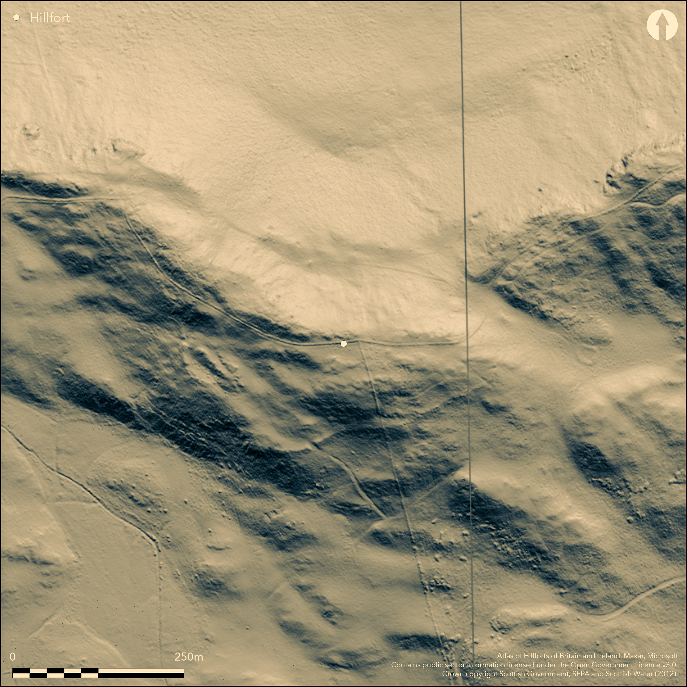
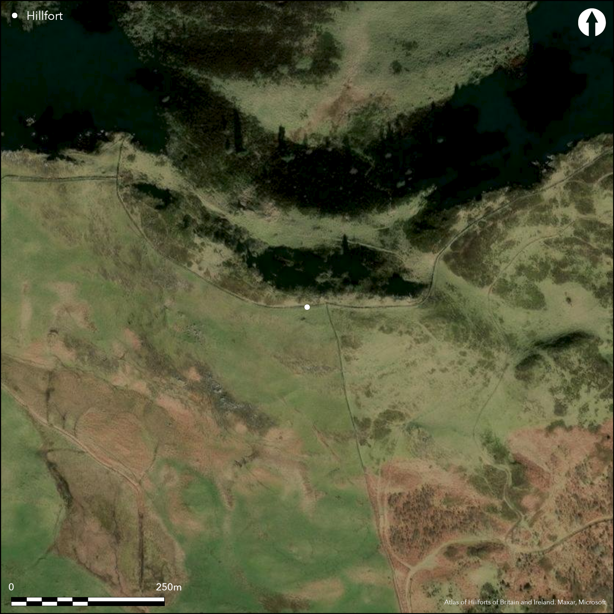
This fort is situated above Castle Craig, on a local summit midway between the steep western shoulder of Benarty Hill and the true summit surmounted by the OS triangulation Station. The N flank, where the ground falls away steeply in a high escarpment, has been left undefended, but elsewhere the ruin of a massively constructed wall can be traced, following a series of natural terraces around the SE and SW faces of the hill to enclose an irregular area measuring a maximum of 280m from ESE to WNW by 100m transversely (2.2ha). The wall has been extensively robbed, presumably to build the dykes which separate Fife to the E from Kinross to the W and N, and the parishes of Cleish, Portmoak and Ballingry, but a series of huge grounders have been left in place, one of them a block 2.7m in length. There are at least three entrances, situated on the E, S and W respectively, and in 1954 RCAHMS investigators speculated that there may have been a fourth where the wall peters out short of the edge of the escarpment on the WNW; the entrances on the E and W are approached by hollowed trackways. The featureless interior is rough and broken.
Citizen Science: ✗
Reliability of Data: Confirmed
Reliability of Interpretation: Confirmed
X: -375360 Y: 7591211 (EPSG: 3857)
Longitude: -3.371920468061308 Latitude: 56.16438936090387 (EPSG:4326)
Country: Scotland
Current County or Unitary Authority: Perth & Kinross
Historic County: Kinross-shire
Current Parish/Community/Council/Townland: Cleish
None
| Extant | ✓ |
| Cropmark | ✗ |
| Likely Destroyed | ✗ |
None
| Woodland | ✗ |
| Commercial Forestry Plantation | ✗ |
| Parkland | ✗ |
| Pasture (Grazing) | ✓ |
| Arable | ✗ |
| Scrub/Bracken | ✗ |
| Bare Outcrop | ✗ |
| Heather/Moorland | ✓ |
| Heath | ✗ |
| Built-up | ✗ |
| Coastal Grassland | ✗ |
| Other | ✗ |
None
| Contour Fort | ✓ |
| Partial Contour Fort | ✗ |
| Promontory Fort | ✗ |
| Hillslope Fort | ✗ |
| Level Terrain Fort | ✗ |
| Marsh Fort | ✗ |
| Multiple Enclosure Fort | ✗ |
| Hilltop | ✓ |
| Coastal Promontory | ✗ |
| Inland Promontory | ✗ |
| Valley Bottom | ✗ |
| Knoll/Hillock/Outcrop | ✗ |
| Ridge | ✗ |
| Cliff/Plateau-edge/Scarp | ✗ |
| Hillslope | ✗ |
| Lowland | ✗ |
| Spur | ✗ |
Dominant Topographic Feature: None
| North | ✗ |
| Northeast | ✗ |
| East | ✗ |
| Southeast | ✗ |
| South | ✗ |
| Southwest | ✗ |
| West | ✗ |
| Northwest | ✗ |
| Level | ✓ |
Altitude: 345.0m
N/A
In the absence of excavation, there are neither stratified artefacts nor radiocarbon dates to provide a chronology for the defences.
Reliability: D - None
| Pre 1200BC | ✗ |
| 1200BC - 800BC | ✗ |
| 800BC - 400BC | ✗ |
| 400BC - AD50 | ✗ |
| AD50 - AD400 | ✗ |
| AD400 - AD 800 | ✗ |
| Post AD800 | ✗ |
| Unknown | ✓ |
| Pre Hillfort: | None |
| Post Hillfort: | None |
None
| 1st Identified Written Reference (1650): | Mentioned by James Balfour In the 17th century (Sibbald 1803, 279-80) |
| 1st Identified Map Depiction (1854): | Annotated Camp on the 1st edition OS 6-inch map (Fife 1856, sheet 30) |
| Other (1927): | Description (RCAHMS 1933, 306-7, no.583) |
| Earthwork Survey (1954): | Plan and description (RCAHMS FID 14/1-3 & DP 158229-31; Feachem 1963, 128) |
| Other (1959): | Visited by the OS |
| Other (1991): | Visited by RCAHMS (SH) |
| Other (2000): | Scheduled |
Featureless
None
| None | ✓ |
| Spring | ✗ |
| Stream | ✗ |
| Pool | ✗ |
| Flush | ✗ |
| Well | ✗ |
| Other | ✗ |
None
| No Known Features | ✓ |
| Round Stone Structures | ✗ |
| Rectangular Stone Structures | ✗ |
| Curvilinear Platforms | ✗ |
| Other Roundhouse Evidence | ✗ |
| Pits | ✗ |
| Quarry Hollows | ✗ |
| Other | ✗ |
None
| No Known Excavation | ✓ |
| Pits | ✗ |
| Postholes | ✗ |
| Roundhouses | ✗ |
| Rectangular Structures | ✗ |
| Roads/Tracks | ✗ |
| Quarry Hollows | ✗ |
| Other | ✗ |
| Nothing Found | ✗ |
None
| No Known Geophysics | ✓ |
| Pits | ✗ |
| Roundhouses | ✗ |
| Rectangular Structures | ✗ |
| Roads/Tracks | ✗ |
| Quarry Hollows | ✗ |
| Other | ✗ |
| Nothing Found | ✗ |
None
| No Known Finds | ✓ |
| Pottery | ✗ |
| Metal | ✗ |
| Metalworking | ✗ |
| Human Bones | ✗ |
| Animal Bones | ✗ |
| Lithics | ✗ |
| Environmental | ✗ |
| Other | ✗ |
NO APPARENT FEATURES
| APs Not Checked | ✗ |
| None | ✓ |
| Roundhouses | ✗ |
| Rectangular Structures | ✗ |
| Pits | ✗ |
| Postholes | ✗ |
| Roads/Tracks | ✗ |
| Other | ✗ |
See main summary
| 4: | Heavily robbed all along its course |
| 2: | None |
Guard Chambers: ✗
Chevaux de Frise: ✗
| 1. Simple Gap (East): | Approached by a hollowed trackway |
| 1. Hollow Way (East): | None |
| 2. Simple Gap (South): | Mentioned by RCAHMS in 1954; probably on the line of the modern path |
| 3. Simple Gap (West): | Opens into a shallow hollow |
| 3. Hollow Way (West): | None |
| 4. Simple Gap (North west): | RCAHMS in 1954 speculated that there was an entrance where the wall petered out at the WNW extremity |
Single wall round the SE and SW quarters, backing onto a steep escarpment on the N
| Area 1: | 2.2ha. |
| Total: | 2.2ha. |
Total Footprint Area: Noneha.
None
| ✗ | None |
| ✗ | None |
| NE Quadrant: | 0 |
| SE Quadrant: | 1 |
| SW Quadrant: | 1 |
| NW Quadrant: | 0 |
| Total: | 1 |
| Partial Univallate | ✓ |
| Univallate | ✗ |
| Partial Bivallate | ✗ |
| Bivallate | ✗ |
| Partial Multivallate | ✗ |
| Multivallate | ✗ |
| Unknown | ✗ |
| Partial Univallate | ✗ |
| Univallate | ✗ |
| Partial Bivallate | ✗ |
| Bivallate | ✗ |
| Partial Multivallate | ✗ |
| Multivallate | ✗ |
None
| None | ✗ |
| Earthen Bank | ✗ |
| Stone Wall | ✓ |
| Rubble | ✗ |
| Wall-walk | ✗ |
| Evidence of Timber | ✗ |
| Vitrification | ✗ |
| Other Burning | ✗ |
| Palisade | ✗ |
| Counter Scarp Bank | ✗ |
| Berm | ✗ |
| Unfinished | ✗ |
| Other | ✗ |
None
| None | ✗ |
| Earthen Bank | ✗ |
| Stone Wall | ✗ |
| Murus Duplex | ✗ |
| Timber-framed | ✗ |
| Timber-laced | ✗ |
| Vitrification | ✗ |
| Other Burning | ✗ |
| Palisade | ✗ |
| Counter Scarp Bank | ✗ |
| Berm | ✗ |
| Unfinished | ✗ |
| No Known Excavation | ✓ |
| Other | ✗ |
| ✗ | None |
| ✗ | None |
Number of Ditches: None
| ✗ | None |
Feachem, R W (1963) A guide to prehistoric Scotland. Batsford: London
RCAHMS. (1933) The Royal Commission on the Ancient and Historical Monuments and Constructions of Scotland. Eleventh report with inventory of monuments and constructions in the counties of Fife, Kinross, and Clackmannan. HMSO: Edinburgh
Sibbald, R (1803) The history, ancient and modern, of the sheriffdoms of Fife and Kinross with a description of both, and of the Firths of Forth and Tay and the islands in them; in which there is an account of the royal seats and castles; and of the royal burghs and ports; and of the religious houses and schools; and of the most remarkable houses of the nobility and gentry, with an account of the natural products of the land and waters. (New Ed) Cupar
Atlas of Hillforts:
Wikidata:
This work is licensed under CC BY-SA 4.0![]()
![]()
![]() and should be cited as:
and should be cited as:
Lock, Gary and Ralston, Ian. 2024. Atlas of Hillforts of Britain and Ireland. Available at: https://hillforts.arch.ox.ac.uk
Document Version 1.1