LiDAR 1m DTM Hillshade
Satellite Imagery
LiDAR 1m DTM Hillshade
Satellite Imagery
Scroll left/right to view further images.
HER: Dumfries & Galloway MDG402 (None)
NMR: NT 10 NW 6 (49727)
SM: 12694
NGR: NT 1160 0515
X: 311600 Y: 605150 (OSGB36)
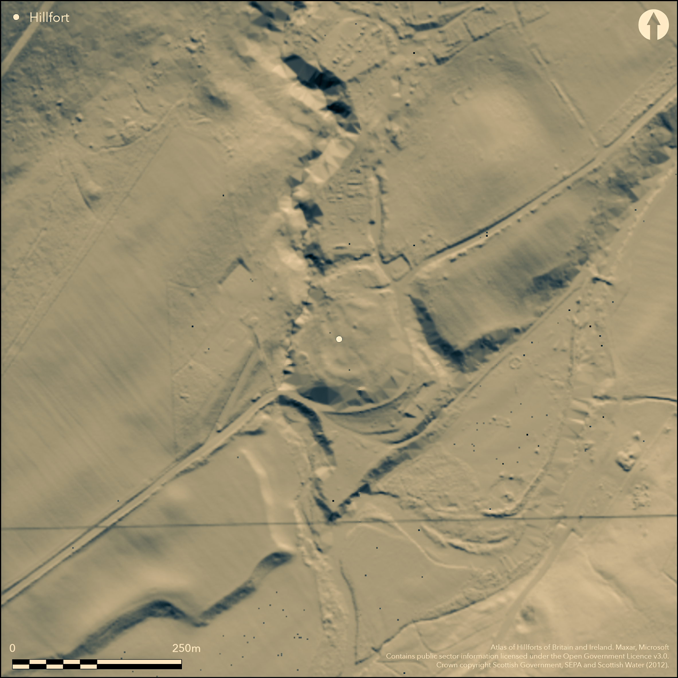
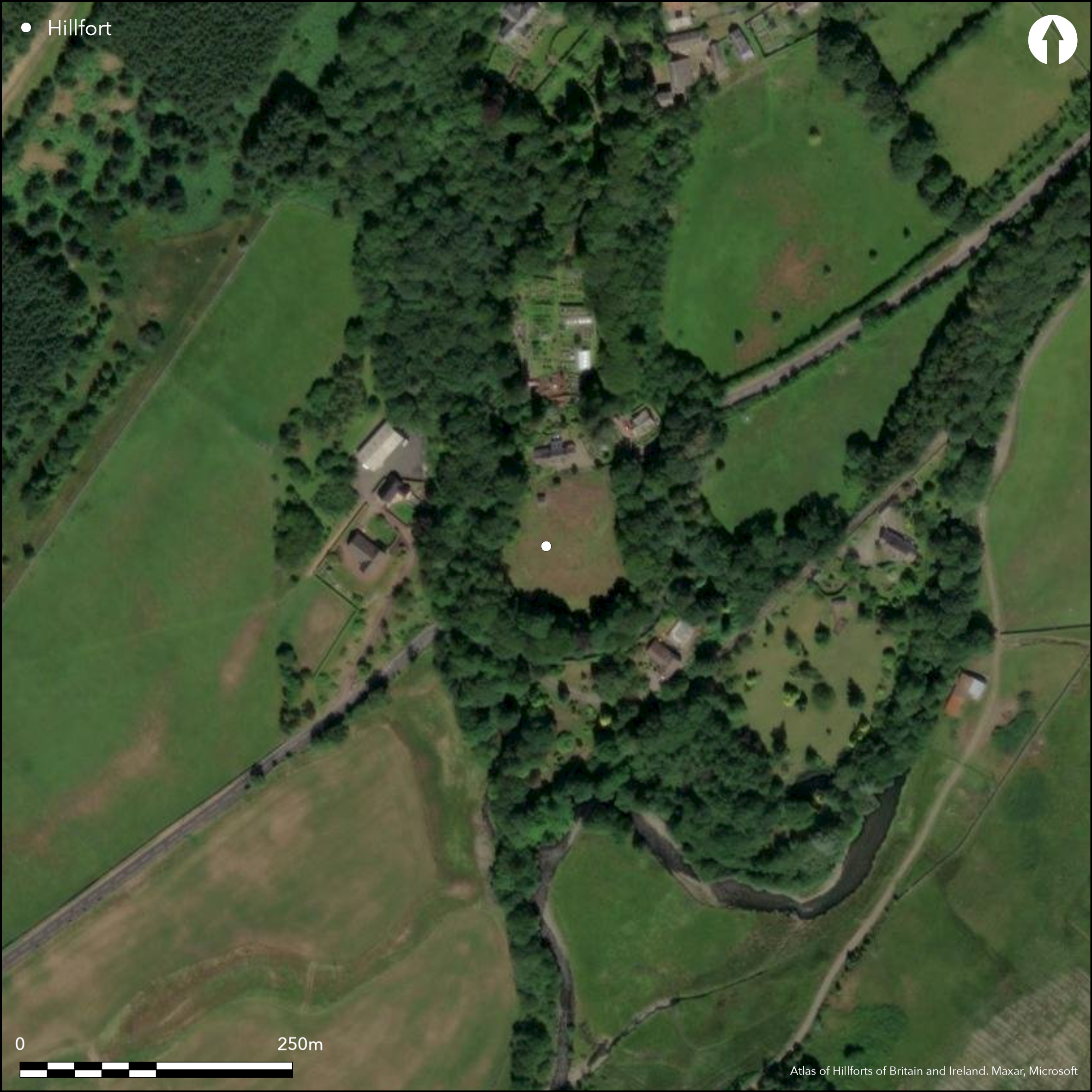
A heavily mutilated fort is situated on a steep-sided promontory which rises from the E bank of the Craigie Burn and projects out into the valley above the Moffat Water, so much so that the public road is forced to detour around its foot at the S tip. The principal defences of the fort comprise a massive ditch at least 12m in breadth by 1m in depth cutting across the neck of the promontory to the N of a cottage built within the interior, and elsewhere by a thick rampart, which can be traced round the margins of the promontory to enclose an area measuring about 75m from N to S by 53m transversely (0.31ha). To the S of the cottage, however, a stony bank 7.5m in thickness by 0.5m in height can be seen cutting across the interior from E to W, and may represent the perimeter of a later settlement that reuses the rampart around the S end of the promontory to create a roughly circular enclosure measuring a little over 50m in internal diameter. A well formed entrance on the S, which is pierced by a hollow trackway, may well have been an original entrance into the fort. At least five house=platforms can be discerned within the area of the settlement, but the northern of two particularly well formed ones on the NW side seems to overly both the perimeter of the settlement and the earlier rampart, thus suggesting the presence of a final phase of unenclosed settlement on the promontory.
Citizen Science: ✗
Reliability of Data: Confirmed
Reliability of Interpretation: Confirmed
X: -377936 Y: 7426658 (EPSG: 3857)
Longitude: -3.395052828635788 Latitude: 55.33245679117162 (EPSG:4326)
Country: Scotland
Current County or Unitary Authority: Dumfries & Galloway
Historic County: Dumfriesshire
Current Parish/Community/Council/Townland: Moffat
None
| Extant | ✓ |
| Cropmark | ✗ |
| Likely Destroyed | ✗ |
None
| Woodland | ✗ |
| Commercial Forestry Plantation | ✗ |
| Parkland | ✓ |
| Pasture (Grazing) | ✗ |
| Arable | ✗ |
| Scrub/Bracken | ✗ |
| Bare Outcrop | ✗ |
| Heather/Moorland | ✗ |
| Heath | ✗ |
| Built-up | ✗ |
| Coastal Grassland | ✗ |
| Other | ✗ |
None
| Contour Fort | ✓ |
| Partial Contour Fort | ✗ |
| Promontory Fort | ✗ |
| Hillslope Fort | ✗ |
| Level Terrain Fort | ✗ |
| Marsh Fort | ✗ |
| Multiple Enclosure Fort | ✗ |
| Hilltop | ✗ |
| Coastal Promontory | ✗ |
| Inland Promontory | ✓ |
| Valley Bottom | ✗ |
| Knoll/Hillock/Outcrop | ✗ |
| Ridge | ✗ |
| Cliff/Plateau-edge/Scarp | ✗ |
| Hillslope | ✗ |
| Lowland | ✗ |
| Spur | ✗ |
Dominant Topographic Feature: None
| North | ✗ |
| Northeast | ✗ |
| East | ✗ |
| Southeast | ✗ |
| South | ✗ |
| Southwest | ✗ |
| West | ✗ |
| Northwest | ✗ |
| Level | ✓ |
Altitude: 135.0m
N/A
In the absence of excavation, there are neither stratified artefacts nor radiocarbon dates to provide a chronology for the defences.
Reliability: D - None
| Pre 1200BC | ✗ |
| 1200BC - 800BC | ✗ |
| 800BC - 400BC | ✗ |
| 400BC - AD50 | ✗ |
| AD50 - AD400 | ✗ |
| AD400 - AD 800 | ✗ |
| Post AD800 | ✗ |
| Unknown | ✓ |
| Pre Hillfort: | None |
| Post Hillfort: | Overlain by late Iron Age settlement enclosure, as well as a later cottage and garden |
None
| 1st Identified Map Depiction (1857): | Annotated Fort on the 1st edition OS 25-inch map (Dumfries 1861, sheet 16.8) |
| Other (1890): | Description by David Christison (1890, 239) |
| Other (1912): | Description by Alexander Curle (RCAHMS 1920, 176, no.500) |
| Other (1971): | Surveyed at 1:2500 by the OS |
| Earthwork Survey (1990): | Plan and description (RCAHMS 1997, 153, fig 154; RCAHMS DC32327 & SC1346096, DC32513 & SC1243796) |
| Other (2010): | Scheduled |
Partly occupied by a cottage and garden, but the southern tip is occupied by the overlying settlement enclosure, within which there are traces of at least five house-platforms; the northern of the two best preserved, however, overlies the perimeter
None
| None | ✓ |
| Spring | ✗ |
| Stream | ✗ |
| Pool | ✗ |
| Flush | ✗ |
| Well | ✗ |
| Other | ✗ |
None
| No Known Features | ✗ |
| Round Stone Structures | ✗ |
| Rectangular Stone Structures | ✗ |
| Curvilinear Platforms | ✓ |
| Other Roundhouse Evidence | ✗ |
| Pits | ✗ |
| Quarry Hollows | ✗ |
| Other | ✗ |
None
| No Known Excavation | ✓ |
| Pits | ✗ |
| Postholes | ✗ |
| Roundhouses | ✗ |
| Rectangular Structures | ✗ |
| Roads/Tracks | ✗ |
| Quarry Hollows | ✗ |
| Other | ✗ |
| Nothing Found | ✗ |
None
| No Known Geophysics | ✓ |
| Pits | ✗ |
| Roundhouses | ✗ |
| Rectangular Structures | ✗ |
| Roads/Tracks | ✗ |
| Quarry Hollows | ✗ |
| Other | ✗ |
| Nothing Found | ✗ |
None
| No Known Finds | ✓ |
| Pottery | ✗ |
| Metal | ✗ |
| Metalworking | ✗ |
| Human Bones | ✗ |
| Animal Bones | ✗ |
| Lithics | ✗ |
| Environmental | ✗ |
| Other | ✗ |
NO APPARENT FEATURES
| APs Not Checked | ✗ |
| None | ✓ |
| Roundhouses | ✗ |
| Rectangular Structures | ✗ |
| Pits | ✗ |
| Postholes | ✗ |
| Roads/Tracks | ✗ |
| Other | ✗ |
See main summary
| 1: | The perimeter is heavily degraded |
| 2: | None |
Guard Chambers: ✗
Chevaux de Frise: ✗
| 1. Simple Gap (South): | Pierced by a hollowed trackway, one branch of which is certainly later and traverses the interior to wards the NNE |
Single rampart and ditch
| Area 1: | 0.31ha. |
| Total: | 0.31ha. |
Total Footprint Area: Noneha.
None
| ✓ | The sequence, however, cannot be securely demonstrated |
| ✓ | This omits the wall of the overlying settlement |
| NE Quadrant: | 1 |
| SE Quadrant: | 1 |
| SW Quadrant: | 1 |
| NW Quadrant: | 1 |
| Total: | 1 |
| Partial Univallate | ✗ |
| Univallate | ✓ |
| Partial Bivallate | ✗ |
| Bivallate | ✗ |
| Partial Multivallate | ✗ |
| Multivallate | ✗ |
| Unknown | ✗ |
| Partial Univallate | ✗ |
| Univallate | ✗ |
| Partial Bivallate | ✗ |
| Bivallate | ✗ |
| Partial Multivallate | ✗ |
| Multivallate | ✗ |
None
| None | ✗ |
| Earthen Bank | ✓ |
| Stone Wall | ✗ |
| Rubble | ✗ |
| Wall-walk | ✗ |
| Evidence of Timber | ✗ |
| Vitrification | ✗ |
| Other Burning | ✗ |
| Palisade | ✗ |
| Counter Scarp Bank | ✗ |
| Berm | ✗ |
| Unfinished | ✗ |
| Other | ✗ |
None
| None | ✗ |
| Earthen Bank | ✗ |
| Stone Wall | ✗ |
| Murus Duplex | ✗ |
| Timber-framed | ✗ |
| Timber-laced | ✗ |
| Vitrification | ✗ |
| Other Burning | ✗ |
| Palisade | ✗ |
| Counter Scarp Bank | ✗ |
| Berm | ✗ |
| Unfinished | ✗ |
| No Known Excavation | ✓ |
| Other | ✗ |
| ✗ | None |
| ✓ | None |
Number of Ditches: 1
| ✗ | None |
Christison, D (1891) 'A general view of the forts, camps, and motes of Dumfriesshire, with a detailed description of those in Upper Annandale, and an introduction to the study of Scottish motes', Proc Soc Antiq Scot 25 (1890-91), 198-256
RCAHMS (1920) The Royal Commission on the Ancient and Historical Monuments and Constructions of Scotland. Seventh report with inventory of monuments and constructions in the county of Dumfries. HMSO: Edinburgh
RCAHMS (1997) Eastern Dumfriesshire: an archaeological landscape. HMSO: Edinburgh
Atlas of Hillforts:
Wikidata:
This work is licensed under CC BY-SA 4.0![]()
![]()
![]() and should be cited as:
and should be cited as:
Lock, Gary and Ralston, Ian. 2024. Atlas of Hillforts of Britain and Ireland. Available at: https://hillforts.arch.ox.ac.uk
Document Version 1.1