LiDAR 1m DTM Hillshade
Satellite Imagery
LiDAR 1m DTM Hillshade
Satellite Imagery
Scroll left/right to view further images.
HER: The West of Scotland Archaeology Service 11176 (None)
NMR: NT 14 NW 11 (49995)
SM: None
NGR: NT 1001 4741
X: 310010 Y: 647410 (OSGB36)
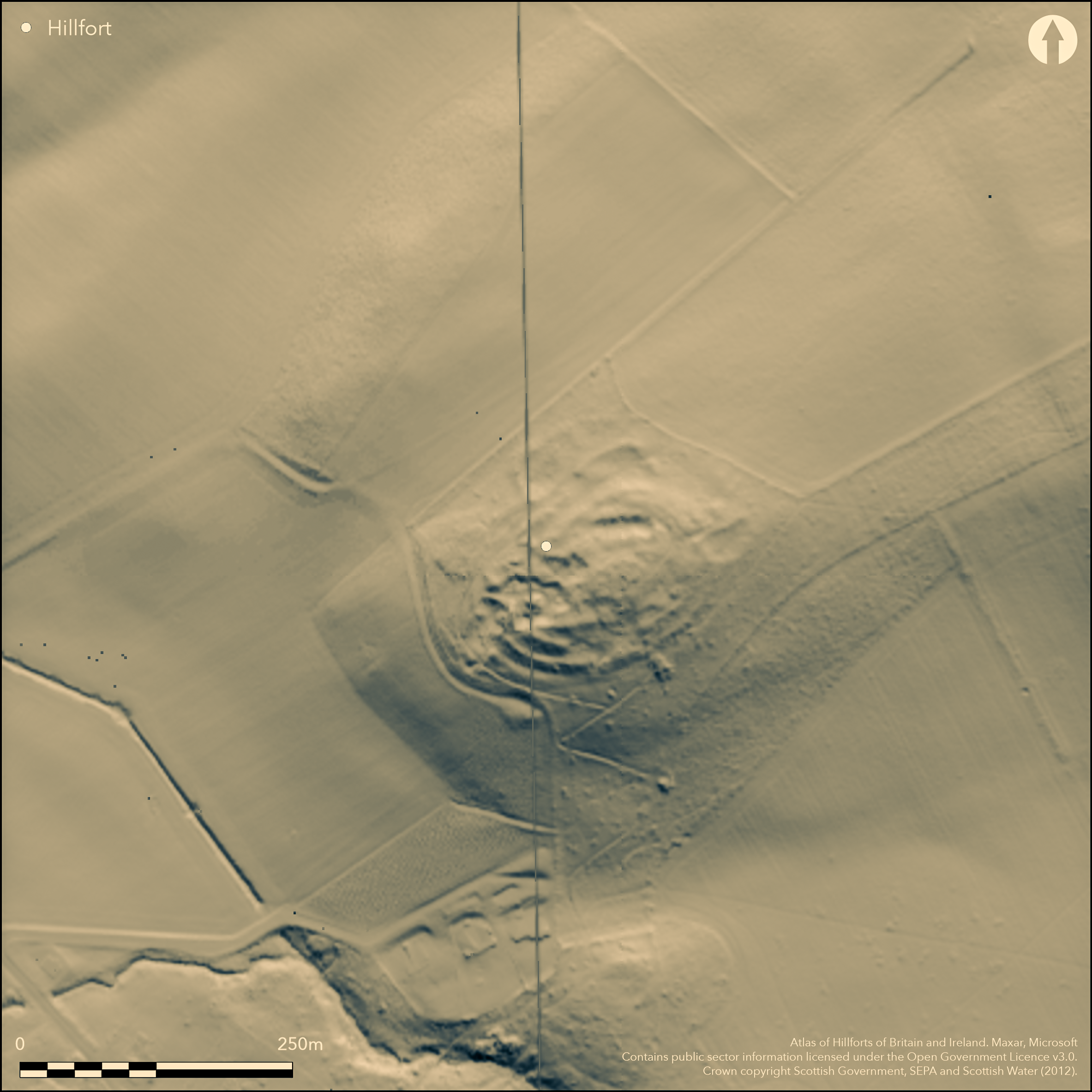
The remains of a fort are situated in the woodland on the summit of Keir Hill, but have been heavily mutilated by quarrying, so much so that the defences have been completely destroyed along large sectors of the W and E, along with the greater part of the W half of the interior. Nevertheless, the fort is oval on plan and has measured about 95m from ENE to WSW by 61m transversely within no fewer than three ramparts forming a belt some 24m deep. In the surviving sectors around the S flank and on the N, the ramparts have been reduced to stony scarps little more than 0.3m high. In view of the scale of disturbance that has taken place here, the possible entrances identified by RCAHMS investigators on the S and N can only be demonstrated by excavation. The surviving portion of the interior is featureless, but immediately E of the entrance proposed on the N a small enclosure measuring about 30m by 20m internally rides over the belt of defences, while on the W side what may be a second overlies the outer rampart; while their date and purpose are unknown, they may be the remains of late Iron Age settlement enclosures.
Citizen Science: ✗
Reliability of Data: Confirmed
Reliability of Interpretation: Confirmed
X: -382254 Y: 7501252 (EPSG: 3857)
Longitude: -3.4338493841107107 Latitude: 55.71178037588218 (EPSG:4326)
Country: Scotland
Current County or Unitary Authority: South Lanarkshire
Historic County: Lanarkshire
Current Parish/Community/Council/Townland: Dolphinton
Extensive quarrying has destroyed areas of the interior and sectors of the defences
| Extant | ✓ |
| Cropmark | ✗ |
| Likely Destroyed | ✓ |
None
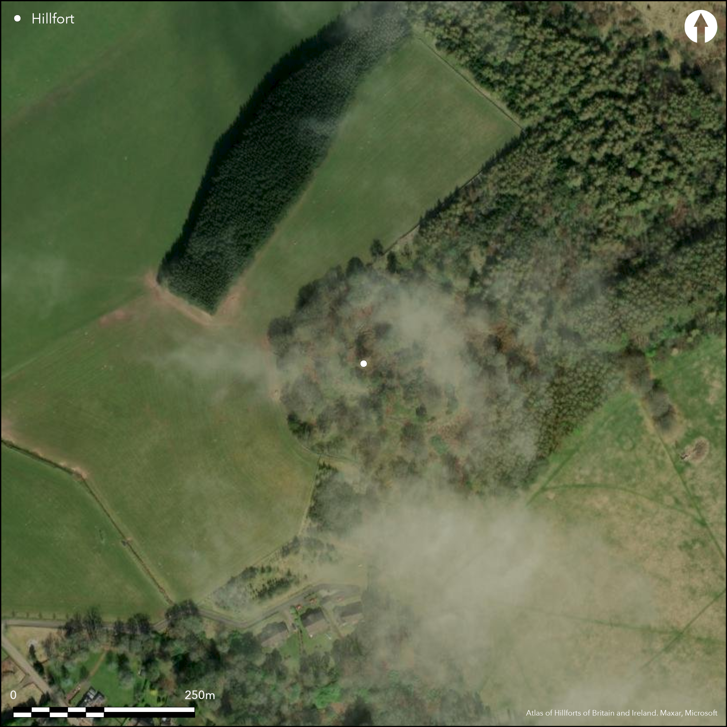
| Woodland | ✓ |
| Commercial Forestry Plantation | ✗ |
| Parkland | ✗ |
| Pasture (Grazing) | ✗ |
| Arable | ✗ |
| Scrub/Bracken | ✗ |
| Bare Outcrop | ✗ |
| Heather/Moorland | ✗ |
| Heath | ✗ |
| Built-up | ✗ |
| Coastal Grassland | ✗ |
| Other | ✗ |
None
| Contour Fort | ✓ |
| Partial Contour Fort | ✗ |
| Promontory Fort | ✗ |
| Hillslope Fort | ✗ |
| Level Terrain Fort | ✗ |
| Marsh Fort | ✗ |
| Multiple Enclosure Fort | ✗ |
| Hilltop | ✓ |
| Coastal Promontory | ✗ |
| Inland Promontory | ✗ |
| Valley Bottom | ✗ |
| Knoll/Hillock/Outcrop | ✗ |
| Ridge | ✗ |
| Cliff/Plateau-edge/Scarp | ✗ |
| Hillslope | ✗ |
| Lowland | ✗ |
| Spur | ✗ |
Dominant Topographic Feature: None
| North | ✗ |
| Northeast | ✗ |
| East | ✗ |
| Southeast | ✗ |
| South | ✗ |
| Southwest | ✗ |
| West | ✗ |
| Northwest | ✗ |
| Level | ✓ |
Altitude: 304.0m
N/A
In the absence of excavation, there are neither stratified artefacts nor radiocarbon dates to provide a chronology for the defences.
Reliability: D - None
| Pre 1200BC | ✗ |
| 1200BC - 800BC | ✗ |
| 800BC - 400BC | ✗ |
| 400BC - AD50 | ✗ |
| AD50 - AD400 | ✗ |
| AD400 - AD 800 | ✗ |
| Post AD800 | ✗ |
| Unknown | ✓ |
| Pre Hillfort: | None |
| Post Hillfort: | Heavily quarried and subsumed into woodland |
None
| 1st Identified Map Depiction (1816): | Annotated Camp on William Forrest's map of The County of Lanark from actual survey (1816) |
| Other (1859): | Annotated Camp on the 1st edition OS 25-inch map (Lanark 1864, sheet 27.4) |
| Other (1889): | Description by David Christison (1890, 337) |
| Earthwork Survey (1959): | Plan (RCAHMS LAD 140/1) |
| Earthwork Survey (1969): | Plan based on 1959 and description (RCAHMS 1978, 102-3, no.233, fig 59; RCAHMS LAD 140/2) |
| Other (1972): | Surveyed at 1:2500 by the OS |
Heavily quarried and otherwise featureless
None
| None | ✓ |
| Spring | ✗ |
| Stream | ✗ |
| Pool | ✗ |
| Flush | ✗ |
| Well | ✗ |
| Other | ✗ |
Quarried and under plantation
| No Known Features | ✓ |
| Round Stone Structures | ✗ |
| Rectangular Stone Structures | ✗ |
| Curvilinear Platforms | ✗ |
| Other Roundhouse Evidence | ✗ |
| Pits | ✗ |
| Quarry Hollows | ✗ |
| Other | ✗ |
None
| No Known Excavation | ✓ |
| Pits | ✗ |
| Postholes | ✗ |
| Roundhouses | ✗ |
| Rectangular Structures | ✗ |
| Roads/Tracks | ✗ |
| Quarry Hollows | ✗ |
| Other | ✗ |
| Nothing Found | ✗ |
None
| No Known Geophysics | ✓ |
| Pits | ✗ |
| Roundhouses | ✗ |
| Rectangular Structures | ✗ |
| Roads/Tracks | ✗ |
| Quarry Hollows | ✗ |
| Other | ✗ |
| Nothing Found | ✗ |
None
| No Known Finds | ✓ |
| Pottery | ✗ |
| Metal | ✗ |
| Metalworking | ✗ |
| Human Bones | ✗ |
| Animal Bones | ✗ |
| Lithics | ✗ |
| Environmental | ✗ |
| Other | ✗ |
Obscured by trees
| APs Not Checked | ✗ |
| None | ✓ |
| Roundhouses | ✗ |
| Rectangular Structures | ✗ |
| Pits | ✗ |
| Postholes | ✗ |
| Roads/Tracks | ✗ |
| Other | ✗ |
See main summary
| 2: | Large sectors of the circuit on the NE and W have been destroyed |
| 2: | The defences are too destroyed to be certain without excavation that either of these is an entrance |
Guard Chambers: ✗
Chevaux de Frise: ✗
| 1. Simple Gap (North): | Gap through all three ramparts adjacent to overlying enclosures |
| 2. Simple Gap (South): | Fragmentary gap in middle rampart suggested by RCAHMS investigators |
Three ramparts, all reduced to fragmentary scarps
| Area 1: | 0.46ha. |
| Total: | 0.46ha. |
Total Footprint Area: Noneha.
None
| ✓ | The overlying enclosures on the N are possibly late Iron Age settlements |
| ✓ | All three ramparts have probably been continuous but have been reduced to fragments by quarrying |
| NE Quadrant: | 2 |
| SE Quadrant: | 3 |
| SW Quadrant: | 3 |
| NW Quadrant: | 3 |
| Total: | 3 |
| Partial Univallate | ✗ |
| Univallate | ✗ |
| Partial Bivallate | ✓ |
| Bivallate | ✗ |
| Partial Multivallate | ✓ |
| Multivallate | ✗ |
| Unknown | ✗ |
| Partial Univallate | ✗ |
| Univallate | ✗ |
| Partial Bivallate | ✗ |
| Bivallate | ✗ |
| Partial Multivallate | ✗ |
| Multivallate | ✗ |
None
| None | ✗ |
| Earthen Bank | ✓ |
| Stone Wall | ✗ |
| Rubble | ✗ |
| Wall-walk | ✗ |
| Evidence of Timber | ✗ |
| Vitrification | ✗ |
| Other Burning | ✗ |
| Palisade | ✗ |
| Counter Scarp Bank | ✗ |
| Berm | ✗ |
| Unfinished | ✗ |
| Other | ✗ |
None
| None | ✗ |
| Earthen Bank | ✗ |
| Stone Wall | ✗ |
| Murus Duplex | ✗ |
| Timber-framed | ✗ |
| Timber-laced | ✗ |
| Vitrification | ✗ |
| Other Burning | ✗ |
| Palisade | ✗ |
| Counter Scarp Bank | ✗ |
| Berm | ✗ |
| Unfinished | ✗ |
| No Known Excavation | ✓ |
| Other | ✗ |
| ✗ | None |
| ✗ | None |
Number of Ditches: None
| ✗ | None |
Christison, D (1890) 'Forts, camps, and motes of the Upper Ward of Lanarkshire'. Proc Soc Antiq Scot 24 (1889-90), 281-352
RCAHMS. (1978) The Royal Commission on the Ancient and Historical Monuments of Scotland. Lanarkshire: an inventory of the prehistoric and Roman monuments. HMSO: Edinburgh
Atlas of Hillforts:
Wikidata:
This work is licensed under CC BY-SA 4.0![]()
![]()
![]() and should be cited as:
and should be cited as:
Lock, Gary and Ralston, Ian. 2024. Atlas of Hillforts of Britain and Ireland. Available at: https://hillforts.arch.ox.ac.uk
Document Version 1.1