LiDAR 1m DTM Hillshade
Satellite Imagery
LiDAR 1m DTM Hillshade
Satellite Imagery
Scroll left/right to view further images.
HER: Scottish Borders 54017 (None)
NMR: NT 40 NE 18 (54017)
SM: 2169
NGR: NT 4681 0616
X: 346810 Y: 606160 (OSGB36)
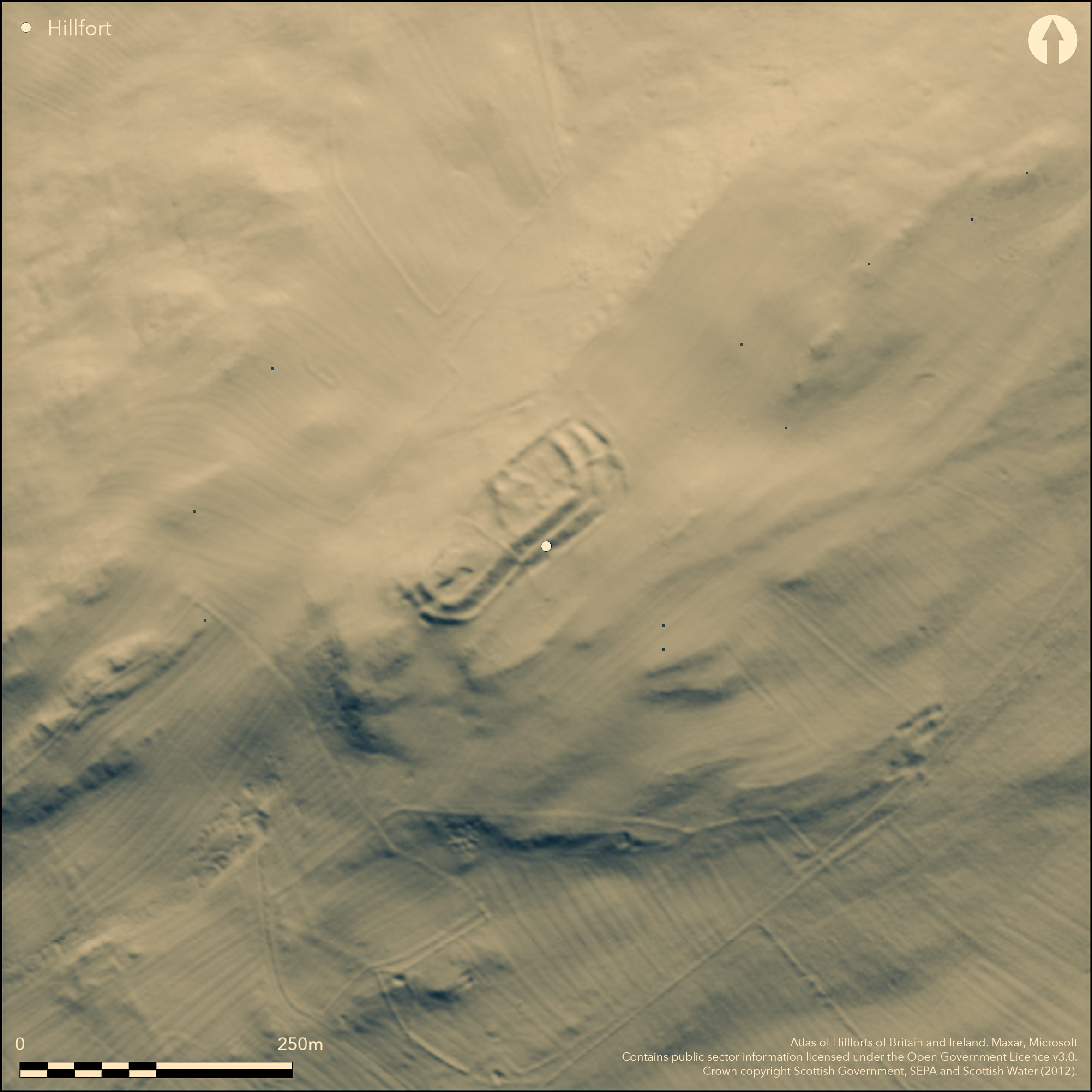
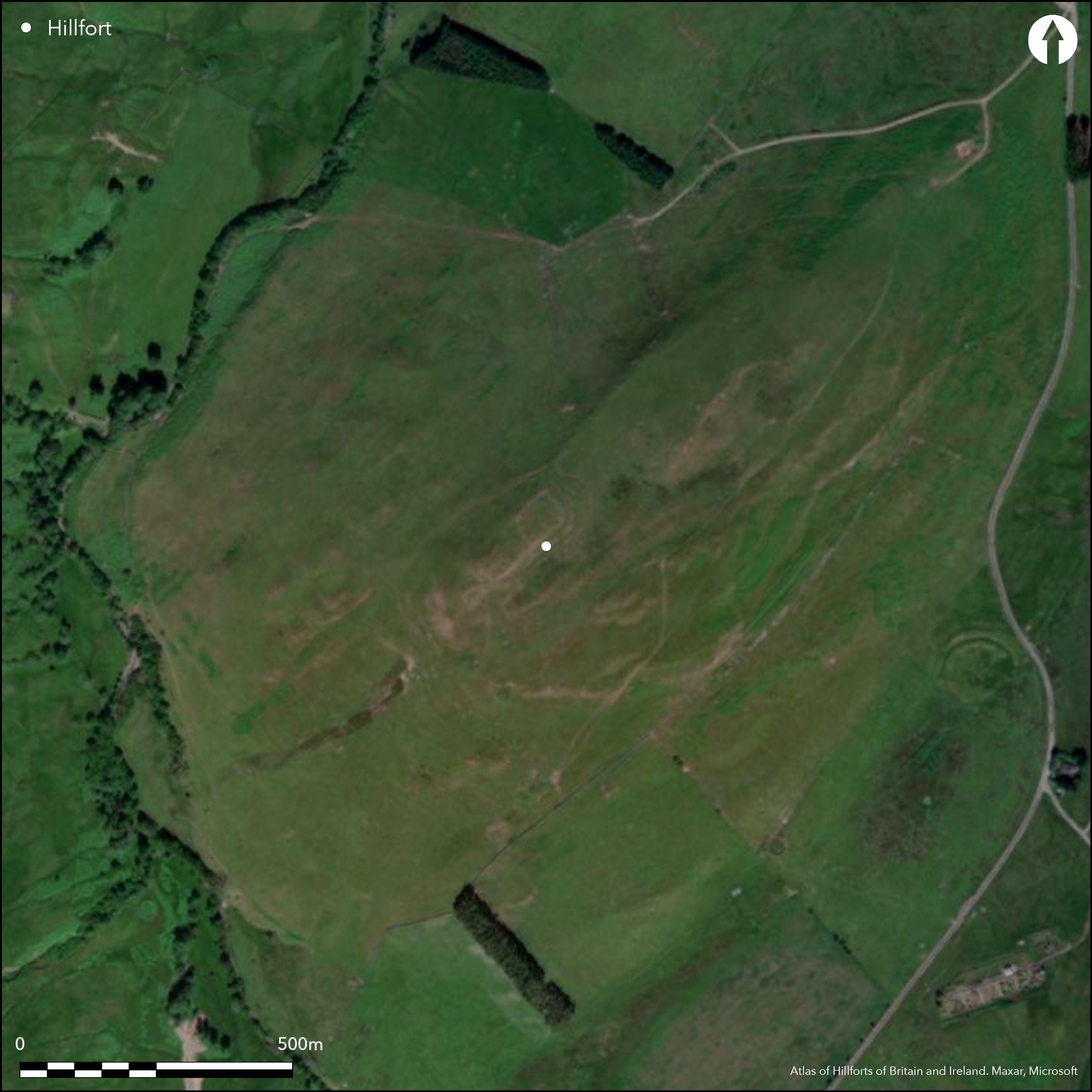
This fort occupies the rocky ridge forming the SW end of the elongated summit of Burgh Hill. Rectilinear on plan by virtue of the topography, it measures 98m from NE to SW by between 23m and 30m transversely (0.24ha) within twin ramparts with external ditches everywhere except the NW, where the flank of the hills drops away steeply. The inner rampart has been reduced to a stony bank some 9m in thickness, but while it is no more than 0.6m in internal height, externally it falls some 3m into the bottom of the external ditch. Likewise the outer, which is 7.5m in thickness falls about 2.8m into the outer ditch, though this disappears beneath traces of later cultivation around the SW end of the fort; where better preserved at the NE end there is also a counterscarp bank. There are entrances at both ends, that on the NE formed between the terminals of the ramparts and the steep NW flank of the hill, while at the SW end the gaps in the ramparts are staggered to expose the visitor's left side. All that is visible within the SW half of the interior are traces of small quarries, but the NE end has been incorporated into a late Iron Age settlement enclosure bounded on the NE and SE by the inner rampart and elsewhere by a thick stony bank; sub-rectangular on plan it measures about 40m from NE to SW by 30m transversely and contains the footings of at least three round-houses terraced into the slope.
Citizen Science: ✗
Reliability of Data: Confirmed
Reliability of Interpretation: Confirmed
X: -316180 Y: 7429428 (EPSG: 3857)
Longitude: -2.840293791741869 Latitude: 55.346607107002406 (EPSG:4326)
Country: Scotland
Current County or Unitary Authority: Scottish Borders
Historic County: Roxburghshire
Current Parish/Community/Council/Townland: Teviothead
None
| Extant | ✓ |
| Cropmark | ✗ |
| Likely Destroyed | ✗ |
None
| Woodland | ✗ |
| Commercial Forestry Plantation | ✗ |
| Parkland | ✗ |
| Pasture (Grazing) | ✓ |
| Arable | ✗ |
| Scrub/Bracken | ✗ |
| Bare Outcrop | ✗ |
| Heather/Moorland | ✓ |
| Heath | ✗ |
| Built-up | ✗ |
| Coastal Grassland | ✗ |
| Other | ✗ |
None
| Contour Fort | ✓ |
| Partial Contour Fort | ✗ |
| Promontory Fort | ✗ |
| Hillslope Fort | ✗ |
| Level Terrain Fort | ✗ |
| Marsh Fort | ✗ |
| Multiple Enclosure Fort | ✗ |
| Hilltop | ✓ |
| Coastal Promontory | ✗ |
| Inland Promontory | ✗ |
| Valley Bottom | ✗ |
| Knoll/Hillock/Outcrop | ✗ |
| Ridge | ✗ |
| Cliff/Plateau-edge/Scarp | ✗ |
| Hillslope | ✗ |
| Lowland | ✗ |
| Spur | ✗ |
Dominant Topographic Feature: None
| North | ✗ |
| Northeast | ✗ |
| East | ✗ |
| Southeast | ✗ |
| South | ✗ |
| Southwest | ✗ |
| West | ✗ |
| Northwest | ✗ |
| Level | ✓ |
Altitude: 314.0m
N/A
In the absence of excavation, there are neither stratified artefacts nor radiocarbon dates to provide a chronology for the defences.
Reliability: D - None
| Pre 1200BC | ✗ |
| 1200BC - 800BC | ✗ |
| 800BC - 400BC | ✗ |
| 400BC - AD50 | ✗ |
| AD50 - AD400 | ✗ |
| AD400 - AD 800 | ✗ |
| Post AD800 | ✗ |
| Unknown | ✓ |
| Pre Hillfort: | None |
| Post Hillfort: | Overlain by a late Iron Age settlement |
Possibly the fort called Brouch Castle noted by Alexander Gordon on his way past Doecleuch and Skelfhill (1726, 103). Photographed by RCAHMS Aerial Survey Programme in 1979, 1981, 1984 and 2010
| 1st Identified Written Reference (1726): | Possibly noted by Alexander Gordon (1726, 103) |
| 1st Identified Map Depiction (1770): | Possibly shown but not annotated on Mathew Stobie's A Map of Roxburghshire or Tiviotdale (1770) |
| Other (1858): | Annotated Fort on the 1st edition OS 25-inch map (Roxburgh 1863, sheet 32.10) |
| Earthwork Survey (1949): | Plan and description (RCAHMS 1956, 439-41, no.991, fig 579; RCAHMS RXD 197/1-2) |
| Other (1961): | Scheduled |
| Other (1965): | Resurveyed at 1:2500 by the OS |
| Other (1979): | Surveyed at 1:10,000 by the OS |
The footings of at least three round-houses scooped into the slope within a later settlement enclosure occupying the NE end of the fort
None
| None | ✓ |
| Spring | ✗ |
| Stream | ✗ |
| Pool | ✗ |
| Flush | ✗ |
| Well | ✗ |
| Other | ✗ |
None
| No Known Features | ✗ |
| Round Stone Structures | ✓ |
| Rectangular Stone Structures | ✗ |
| Curvilinear Platforms | ✗ |
| Other Roundhouse Evidence | ✗ |
| Pits | ✗ |
| Quarry Hollows | ✓ |
| Other | ✗ |
None
| No Known Excavation | ✓ |
| Pits | ✗ |
| Postholes | ✗ |
| Roundhouses | ✗ |
| Rectangular Structures | ✗ |
| Roads/Tracks | ✗ |
| Quarry Hollows | ✗ |
| Other | ✗ |
| Nothing Found | ✗ |
None
| No Known Geophysics | ✓ |
| Pits | ✗ |
| Roundhouses | ✗ |
| Rectangular Structures | ✗ |
| Roads/Tracks | ✗ |
| Quarry Hollows | ✗ |
| Other | ✗ |
| Nothing Found | ✗ |
None
| No Known Finds | ✓ |
| Pottery | ✗ |
| Metal | ✗ |
| Metalworking | ✗ |
| Human Bones | ✗ |
| Animal Bones | ✗ |
| Lithics | ✗ |
| Environmental | ✗ |
| Other | ✗ |
NO APPARENT FEATURES
| APs Not Checked | ✗ |
| None | ✗ |
| Roundhouses | ✓ |
| Rectangular Structures | ✗ |
| Pits | ✗ |
| Postholes | ✗ |
| Roads/Tracks | ✗ |
| Other | ✗ |
See main summary
| 2: | None |
| 2: | None |
Guard Chambers: ✗
Chevaux de Frise: ✗
| 1. Simple Gap (North east): | None |
| 2. Oblique (South west): | Staggered gaps. Oblique approach exposing left side |
| 2. Simple Gap (South west): | Opposed terminals in both ramparts |
Twin ramparts and ditches around three sides
| Area 1: | 0.24ha. |
| Total: | 0.24ha. |
Total Footprint Area: 65.0ha.
None
| ✓ | Overlain by the late Iron Age settlement |
| ✗ | None |
| NE Quadrant: | 2 |
| SE Quadrant: | 2 |
| SW Quadrant: | 2 |
| NW Quadrant: | 0 |
| Total: | 2 |
| Partial Univallate | ✗ |
| Univallate | ✗ |
| Partial Bivallate | ✓ |
| Bivallate | ✗ |
| Partial Multivallate | ✗ |
| Multivallate | ✗ |
| Unknown | ✗ |
| Partial Univallate | ✗ |
| Univallate | ✗ |
| Partial Bivallate | ✗ |
| Bivallate | ✗ |
| Partial Multivallate | ✗ |
| Multivallate | ✗ |
None
| None | ✗ |
| Earthen Bank | ✓ |
| Stone Wall | ✗ |
| Rubble | ✗ |
| Wall-walk | ✗ |
| Evidence of Timber | ✗ |
| Vitrification | ✗ |
| Other Burning | ✗ |
| Palisade | ✗ |
| Counter Scarp Bank | ✓ |
| Berm | ✗ |
| Unfinished | ✗ |
| Other | ✗ |
None
| None | ✗ |
| Earthen Bank | ✗ |
| Stone Wall | ✗ |
| Murus Duplex | ✗ |
| Timber-framed | ✗ |
| Timber-laced | ✗ |
| Vitrification | ✗ |
| Other Burning | ✗ |
| Palisade | ✗ |
| Counter Scarp Bank | ✗ |
| Berm | ✗ |
| Unfinished | ✗ |
| No Known Excavation | ✓ |
| Other | ✗ |
| ✗ | None |
| ✓ | None |
Number of Ditches: 2
| ✗ | None |
Gordon, A (1726) Itinerarium Septentrionale: or A Journey Thro' most of the Counties of Scotland And Those in the North of England. London
RCAHMS (1956) The Royal Commission on the Ancient and Historical Monuments of Scotland. An inventory of the ancient and historical monuments of Roxburghshire: with the fourteenth report of the Commission, 2v. HMSO: Edinburgh
Atlas of Hillforts:
Wikidata:
This work is licensed under CC BY-SA 4.0![]()
![]()
![]() and should be cited as:
and should be cited as:
Lock, Gary and Ralston, Ian. 2024. Atlas of Hillforts of Britain and Ireland. Available at: https://hillforts.arch.ox.ac.uk
Document Version 1.1