LiDAR 1m DTM Hillshade
Satellite Imagery
LiDAR 1m DTM Hillshade
Satellite Imagery
Scroll left/right to view further images.
HER: Scottish Borders 48734 (None)
NMR: NT 03 SE 4 (48734)
SM: 876
NGR: NT 0927 3351
X: 309270 Y: 633510 (OSGB36)
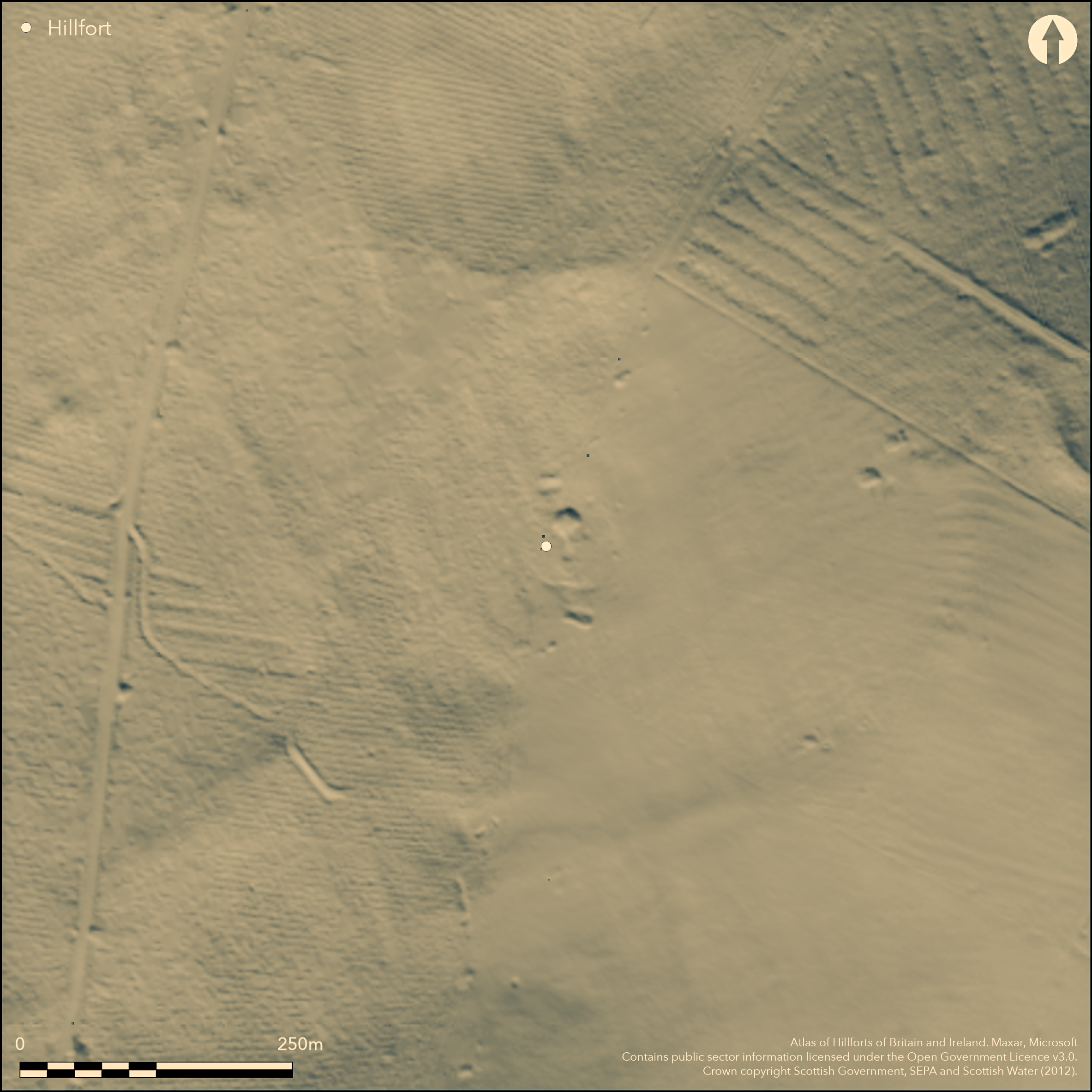
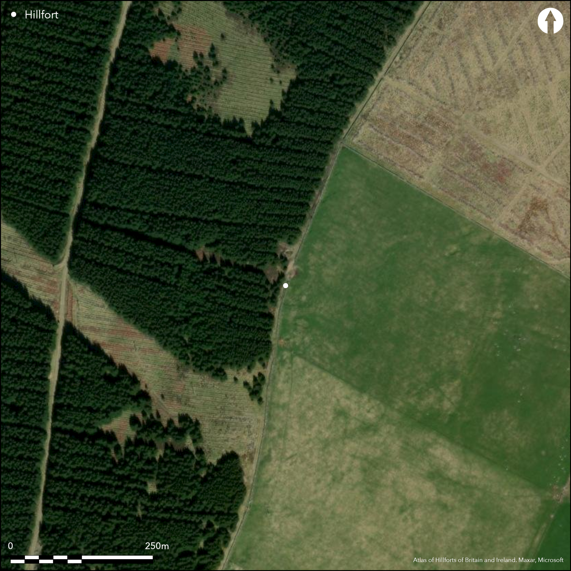
This enclosure, which is recorded as an unfinished fort, is situated high on the SW spur of the unnamed hill forming the watershed behind Cardon. Bisected by the stone dyke forming the property boundary running up the crest of the spur, the western side, falling on the flank of the hill known as Rough Side, was ploughed for a conifer plantation in 1985 and is now clothed in rough heather and sporadic trees, but the eastern half lies in improved pasture, revealing detail that was not observed when the earthworks were first surveyed by RCAHMS in 1956. In short, the 'marker trench' enclosing an oval area measuring 50m from ESE to WNW by 39m transversely (0.15ha), is more probably a palisade trench, within which two ring-ditch houses can be seen; the entrance is probably represented by a gap on the E. The isolated ring of quarry pits with mounds of upcast on their inner lips that surrounds the inner enclosure at a distance of about 10m may yet be the remains of an unfinished rampart and ditch, but it should be noted that there is no evidence for any form of linking marker, and thus insufficient continuity between them to be sure that they were conceived as an enclosure. At the two larger segments, on the N and S respectively, the crest of the mound of upcast stands 1.8m above the bottom of the supposed ditch, which is between 3m and 5m in breadth. If indeed an unfinished rampart, it would have enclosed an area about 65m in diameter, a little in excess of 0.3ha.
Citizen Science: ✗
Reliability of Data: Confirmed
Reliability of Interpretation: Confirmed
X: -383054 Y: 7476592 (EPSG: 3857)
Longitude: -3.4410300143337045 Latitude: 55.58678522309304 (EPSG:4326)
Country: Scotland
Current County or Unitary Authority: Scottish Borders
Historic County: Peeblesshire
Current Parish/Community/Council/Townland: Broughton, Glenholm And Kilbucho
None
| Extant | ✓ |
| Cropmark | ✗ |
| Likely Destroyed | ✗ |
None
| Woodland | ✗ |
| Commercial Forestry Plantation | ✓ |
| Parkland | ✗ |
| Pasture (Grazing) | ✓ |
| Arable | ✗ |
| Scrub/Bracken | ✗ |
| Bare Outcrop | ✗ |
| Heather/Moorland | ✗ |
| Heath | ✗ |
| Built-up | ✗ |
| Coastal Grassland | ✗ |
| Other | ✗ |
None
| Contour Fort | ✓ |
| Partial Contour Fort | ✗ |
| Promontory Fort | ✗ |
| Hillslope Fort | ✗ |
| Level Terrain Fort | ✗ |
| Marsh Fort | ✗ |
| Multiple Enclosure Fort | ✗ |
| Hilltop | ✗ |
| Coastal Promontory | ✗ |
| Inland Promontory | ✗ |
| Valley Bottom | ✗ |
| Knoll/Hillock/Outcrop | ✗ |
| Ridge | ✗ |
| Cliff/Plateau-edge/Scarp | ✗ |
| Hillslope | ✗ |
| Lowland | ✗ |
| Spur | ✓ |
Dominant Topographic Feature: None
| North | ✗ |
| Northeast | ✗ |
| East | ✗ |
| Southeast | ✗ |
| South | ✗ |
| Southwest | ✗ |
| West | ✗ |
| Northwest | ✗ |
| Level | ✓ |
Altitude: 365.0m
N/A
In the absence of excavation, there are neither stratified artefacts nor radiocarbon dates to provide a chronology for the defences.
Reliability: D - None
| Pre 1200BC | ✗ |
| 1200BC - 800BC | ✗ |
| 800BC - 400BC | ✗ |
| 400BC - AD50 | ✗ |
| AD50 - AD400 | ✗ |
| AD400 - AD 800 | ✗ |
| Post AD800 | ✗ |
| Unknown | ✓ |
| Pre Hillfort: | None |
| Post Hillfort: | A more recent quarry is cut into the interior and clips the palisade trench on the N; the W side has been ploughed for forestry |
None
| Earthwork Survey (1956): | Plan and description (RCAHMS 1967, 140-1, no.315, fig 130; RCAHMS PBD 138/1-2) |
| Other (1972): | Scheduled |
| Other (1972): | Re-surveyed at 1:2500 |
| Earthwork Survey (1985): | Visited by S Halliday prior to plan by Peter Hill on behalf of Historic Scotland (Hill 1985) |
Palisade trench around two ring-ditch houses
None
| None | ✓ |
| Spring | ✗ |
| Stream | ✗ |
| Pool | ✗ |
| Flush | ✗ |
| Well | ✗ |
| Other | ✗ |
Ring-ditch houses
| No Known Features | ✗ |
| Round Stone Structures | ✗ |
| Rectangular Stone Structures | ✗ |
| Curvilinear Platforms | ✗ |
| Other Roundhouse Evidence | ✓ |
| Pits | ✗ |
| Quarry Hollows | ✗ |
| Other | ✗ |
None
| No Known Excavation | ✓ |
| Pits | ✗ |
| Postholes | ✗ |
| Roundhouses | ✗ |
| Rectangular Structures | ✗ |
| Roads/Tracks | ✗ |
| Quarry Hollows | ✗ |
| Other | ✗ |
| Nothing Found | ✗ |
None
| No Known Geophysics | ✓ |
| Pits | ✗ |
| Roundhouses | ✗ |
| Rectangular Structures | ✗ |
| Roads/Tracks | ✗ |
| Quarry Hollows | ✗ |
| Other | ✗ |
| Nothing Found | ✗ |
None
| No Known Finds | ✓ |
| Pottery | ✗ |
| Metal | ✗ |
| Metalworking | ✗ |
| Human Bones | ✗ |
| Animal Bones | ✗ |
| Lithics | ✗ |
| Environmental | ✗ |
| Other | ✗ |
NO APPARENT FEATURES
| APs Not Checked | ✗ |
| None | ✓ |
| Roundhouses | ✗ |
| Rectangular Structures | ✗ |
| Pits | ✗ |
| Postholes | ✗ |
| Roads/Tracks | ✗ |
| Other | ✗ |
Not known
| 0: | None |
| 2: | The line of the supposed rampart is to sparse to consider in this framework |
Guard Chambers: ✗
Chevaux de Frise: ✗
The palisade trench is evidently a relatively minor settlement enclosure, around which there is a ring of pits with upcast that may be an unfinished line of defence; the area the latter would have enclosed is a little over 0.3ha, but in view of its discontinuous character this is a very crude estimate
| Area 1: | 0.3ha. |
| Total: | 0.3ha. |
Total Footprint Area: Noneha.
None
| ✗ | None |
| ✗ | Too discontinuous to be considered in this way, but if an unfinished rampart, almost certainly a complete circuit |
| NE Quadrant: | 0 |
| SE Quadrant: | 0 |
| SW Quadrant: | 0 |
| NW Quadrant: | 0 |
| Total: | 0 |
| Partial Univallate | ✗ |
| Univallate | ✗ |
| Partial Bivallate | ✗ |
| Bivallate | ✗ |
| Partial Multivallate | ✗ |
| Multivallate | ✗ |
| Unknown | ✓ |
| Partial Univallate | ✗ |
| Univallate | ✗ |
| Partial Bivallate | ✗ |
| Bivallate | ✗ |
| Partial Multivallate | ✗ |
| Multivallate | ✗ |
Supposedly unfinished earthwork, but insufficient to be convincing
| None | ✗ |
| Earthen Bank | ✓ |
| Stone Wall | ✗ |
| Rubble | ✗ |
| Wall-walk | ✗ |
| Evidence of Timber | ✗ |
| Vitrification | ✗ |
| Other Burning | ✗ |
| Palisade | ✓ |
| Counter Scarp Bank | ✗ |
| Berm | ✗ |
| Unfinished | ✓ |
| Other | ✗ |
None
| None | ✗ |
| Earthen Bank | ✗ |
| Stone Wall | ✗ |
| Murus Duplex | ✗ |
| Timber-framed | ✗ |
| Timber-laced | ✗ |
| Vitrification | ✗ |
| Other Burning | ✗ |
| Palisade | ✗ |
| Counter Scarp Bank | ✗ |
| Berm | ✗ |
| Unfinished | ✗ |
| No Known Excavation | ✓ |
| Other | ✗ |
| ✗ | None |
| ✓ | No more than a ring of quarry pits with upcast |
Number of Ditches: 1
| ✗ | None |
Hill, P H (1985) 'Rough Side (Broughton, Glenholm and Kilbucho p), hilltop settlement'. Disc Exc Scot (1985), 3
RCAHMS (1967) The Royal Commission on the Ancient and Historical Monuments of Scotland. Peeblesshire: an inventory of the ancient monuments, 2v. HMSO: Edinburgh
Atlas of Hillforts:
Wikidata:
This work is licensed under CC BY-SA 4.0![]()
![]()
![]() and should be cited as:
and should be cited as:
Lock, Gary and Ralston, Ian. 2024. Atlas of Hillforts of Britain and Ireland. Available at: https://hillforts.arch.ox.ac.uk
Document Version 1.1