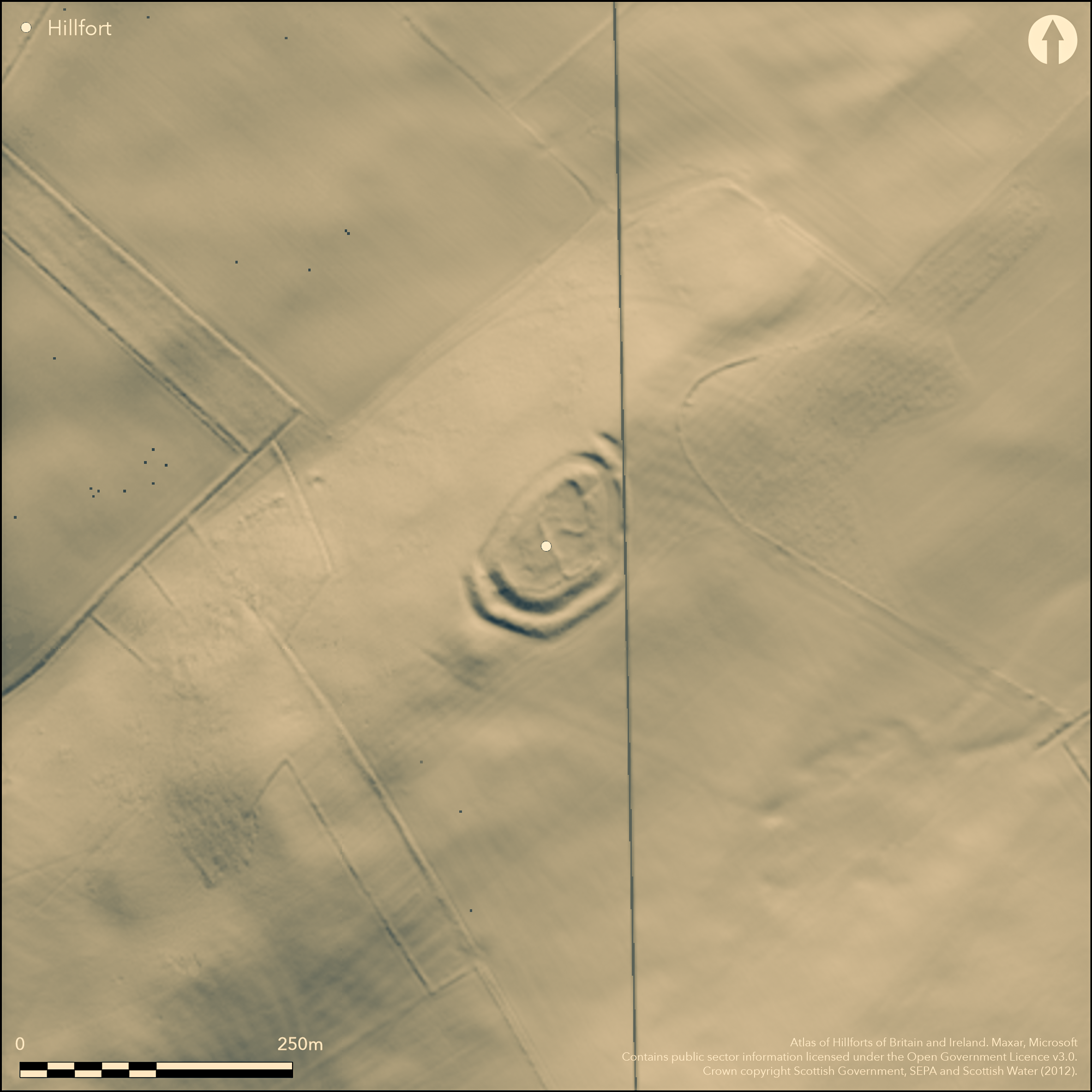
LiDAR 1m DTM Hillshade
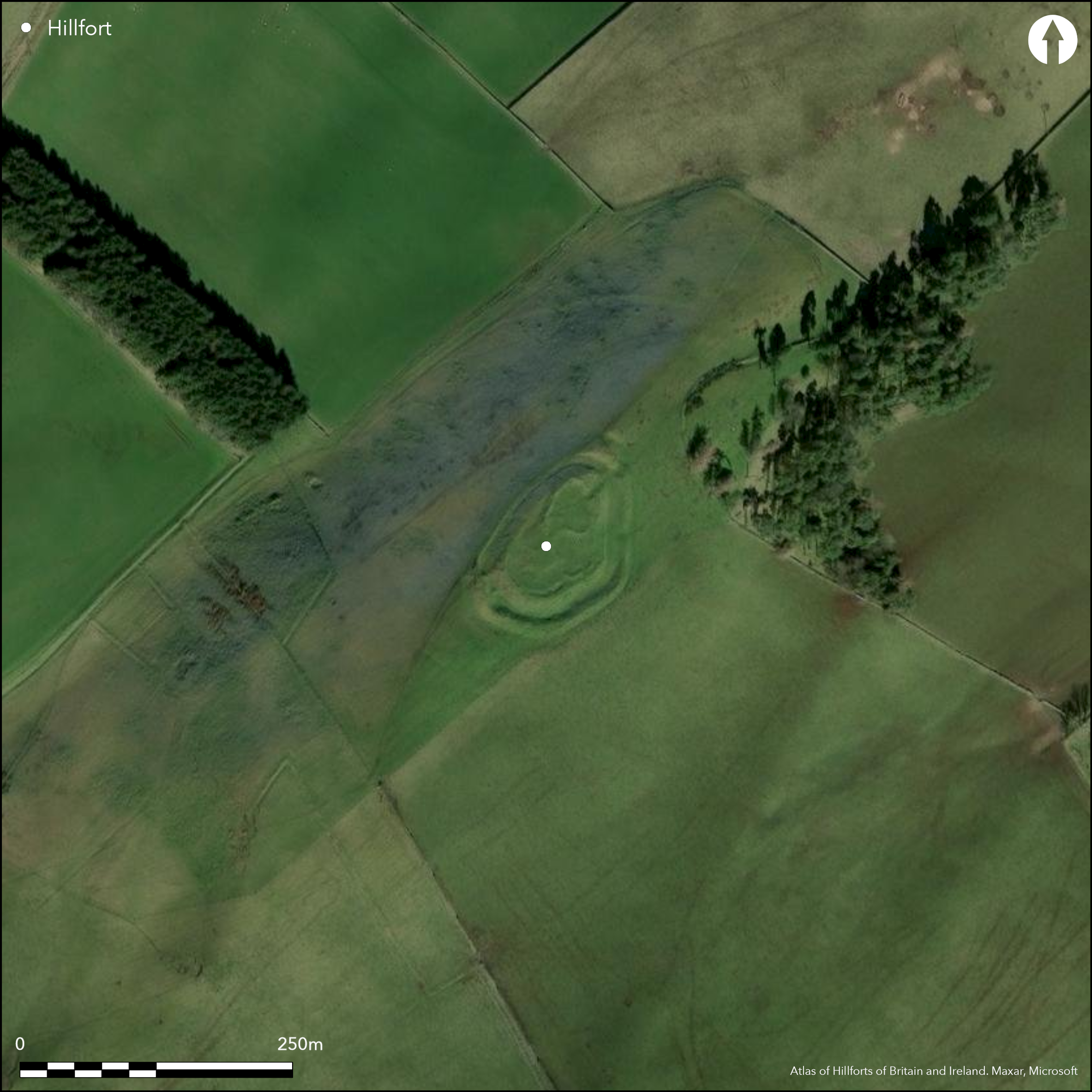
Satellite Imagery
LiDAR 1m DTM Hillshade
Satellite Imagery
Scroll left/right to view further images.
HER: Scottish Borders 50030 (None)
NMR: NT 14 NW 8 (50030)
SM: 2840
NGR: NT 1496 4597
X: 314960 Y: 645970 (OSGB36)
This fort is situated on the N spur of Henderland Hill, at the top of a steep slope dropping away to the NW, and from the road at Mountain Cross the defences cut a striking profile on the skyline. Oval on plan, it measures about 67m from NE to SW by 43m transversely (0.22ha) within twin ramparts with external ditches. These defences are amongst the most impressive in the whole district, particularly approached across the level ground from the SW, for while the inner rampart rises little more than 0.6m above the interior, its crest stands up to 3.6m above the bottom of the inner ditch; the outer rampart and ditch here are of comparable stature and the counterscarp of the latter is still 1.6m deep. Elsewhere the outer ditch has suffered from later cultivation, entirely disappearing on the E, but though the RCAHMS investigators who drew up a plan in 1959 were uncertain whether it had ever continued around the steep NW flank, more recent oblique aerial photography has revealed traces of its course. The entrance is on the NE and was adapted for secondary use when a scooped settlement was inserted into the NE end of the interior. Two more crescentic scarps indicate the platforms of timber round-houses immediately outside the settlement on the SW, where there are also two small ring-ditch houses tucked into what appears to be a quarry scoop to the rear of the inner rampart.
Citizen Science: ✓
Reliability of Data: Confirmed
Reliability of Interpretation: Confirmed
X: -373437 Y: 7498873 (EPSG: 3857)
Longitude: -3.3546423482433534 Latitude: 55.69973945495392 (EPSG:4326)
Country: Scotland
Current County or Unitary Authority: Scottish Borders
Historic County: Peeblesshire
Current Parish/Community/Council/Townland: Newlands
None
| Extant | ✓ |
| Cropmark | ✗ |
| Likely Destroyed | ✗ |
None
| Woodland | ✗ |
| Commercial Forestry Plantation | ✗ |
| Parkland | ✗ |
| Pasture (Grazing) | ✓ |
| Arable | ✗ |
| Scrub/Bracken | ✗ |
| Bare Outcrop | ✗ |
| Heather/Moorland | ✗ |
| Heath | ✗ |
| Built-up | ✗ |
| Coastal Grassland | ✗ |
| Other | ✗ |
None
| Contour Fort | ✓ |
| Partial Contour Fort | ✗ |
| Promontory Fort | ✗ |
| Hillslope Fort | ✗ |
| Level Terrain Fort | ✗ |
| Marsh Fort | ✗ |
| Multiple Enclosure Fort | ✗ |
| Hilltop | ✗ |
| Coastal Promontory | ✗ |
| Inland Promontory | ✗ |
| Valley Bottom | ✗ |
| Knoll/Hillock/Outcrop | ✗ |
| Ridge | ✗ |
| Cliff/Plateau-edge/Scarp | ✗ |
| Hillslope | ✗ |
| Lowland | ✗ |
| Spur | ✓ |
Dominant Topographic Feature: None
| North | ✗ |
| Northeast | ✗ |
| East | ✗ |
| Southeast | ✗ |
| South | ✗ |
| Southwest | ✗ |
| West | ✗ |
| Northwest | ✗ |
| Level | ✓ |
Altitude: 319.0m
N/A
In the absence of excavation, there are neither stratified artefacts nor radiocarbon dates to provide a chronology for the defences, though the overlying scooped settlement suggest that they belong in the pre-Roman Iron Age
Reliability: D - None
| Pre 1200BC | ✗ |
| 1200BC - 800BC | ✗ |
| 800BC - 400BC | ✗ |
| 400BC - AD50 | ✗ |
| AD50 - AD400 | ✗ |
| AD400 - AD 800 | ✗ |
| Post AD800 | ✗ |
| Unknown | ✓ |
| Pre Hillfort: | None |
| Post Hillfort: | Overlain by a scooped settlement of probable late Iron Age or Roman Iron Age date. |
Photographed by CUCAP in 1969, and RCAHMS Aerial Survey Programme in 1980, 1981, 1991, 2006 and 2009.
| 1st Identified Written Reference (1726): | Almost certainly Cow-Throple, noted by Alexander Gordon (1726, 115) |
| 1st Identified Map Depiction (1775): | Concentric ring symbol on Mostyn Armstrong's map of The County of Peebles or Tweedale (1775) |
| Other (1856): | Annotated Fort on the 1st edition OS 25-inch map (Peebles 1859, sheet 8.10) |
| Other (1863): | Description by William Chambers (1864, 30, 34-5) |
| Earthwork Survey (1886): | Sketch-plan and description by David Christison (1887, 34-7, figs 21-2) |
| Earthwork Survey (1959): | Plan and description (RCAHMS 1967, 122, no.287, fig 104; RCAHMS PBD 113/1-2) |
| Other (1964): | Visited by the OS |
| Other (1969): | Scheduled |
| Other (1975): | Visited by the OS |
The backs of four platforms and two ring-ditch -houses are visible. Twoof the platforms lie within the scooped settlement that occupies the NE half of the interior
None
| None | ✓ |
| Spring | ✗ |
| Stream | ✗ |
| Pool | ✗ |
| Flush | ✗ |
| Well | ✗ |
| Other | ✗ |
Ring-ditch houses
| No Known Features | ✗ |
| Round Stone Structures | ✗ |
| Rectangular Stone Structures | ✗ |
| Curvilinear Platforms | ✓ |
| Other Roundhouse Evidence | ✓ |
| Pits | ✗ |
| Quarry Hollows | ✗ |
| Other | ✗ |
None
| No Known Excavation | ✓ |
| Pits | ✗ |
| Postholes | ✗ |
| Roundhouses | ✗ |
| Rectangular Structures | ✗ |
| Roads/Tracks | ✗ |
| Quarry Hollows | ✗ |
| Other | ✗ |
| Nothing Found | ✗ |
None
| No Known Geophysics | ✓ |
| Pits | ✗ |
| Roundhouses | ✗ |
| Rectangular Structures | ✗ |
| Roads/Tracks | ✗ |
| Quarry Hollows | ✗ |
| Other | ✗ |
| Nothing Found | ✗ |
None
| No Known Finds | ✓ |
| Pottery | ✗ |
| Metal | ✗ |
| Metalworking | ✗ |
| Human Bones | ✗ |
| Animal Bones | ✗ |
| Lithics | ✗ |
| Environmental | ✗ |
| Other | ✗ |
And the scooped settlement
| APs Not Checked | ✗ |
| None | ✗ |
| Roundhouses | ✓ |
| Rectangular Structures | ✗ |
| Pits | ✗ |
| Postholes | ✗ |
| Roads/Tracks | ✗ |
| Other | ✓ |
See main summary
| 2: | A gap in the outer rampart in the sector where the outer ditch has been ploughed out |
| 2: | None |
Guard Chambers: ✗
Chevaux de Frise: ✗
| 1. Simple Gap (North east): | None |
Twin ramparts with external ditches
| Area 1: | 0.22ha. |
| Total: | 0.22ha. |
Total Footprint Area: 0.77ha.
None
| ✓ | The inner ramaprt is overlain by the perimeter of the scooped settlement |
| ✓ | None |
| NE Quadrant: | 2 |
| SE Quadrant: | 2 |
| SW Quadrant: | 2 |
| NW Quadrant: | 2 |
| Total: | 2 |
| Partial Univallate | ✗ |
| Univallate | ✗ |
| Partial Bivallate | ✗ |
| Bivallate | ✓ |
| Partial Multivallate | ✗ |
| Multivallate | ✗ |
| Unknown | ✗ |
| Partial Univallate | ✗ |
| Univallate | ✗ |
| Partial Bivallate | ✗ |
| Bivallate | ✗ |
| Partial Multivallate | ✗ |
| Multivallate | ✗ |
None
| None | ✗ |
| Earthen Bank | ✓ |
| Stone Wall | ✗ |
| Rubble | ✗ |
| Wall-walk | ✗ |
| Evidence of Timber | ✗ |
| Vitrification | ✗ |
| Other Burning | ✗ |
| Palisade | ✗ |
| Counter Scarp Bank | ✗ |
| Berm | ✗ |
| Unfinished | ✗ |
| Other | ✗ |
None
| None | ✗ |
| Earthen Bank | ✗ |
| Stone Wall | ✗ |
| Murus Duplex | ✗ |
| Timber-framed | ✗ |
| Timber-laced | ✗ |
| Vitrification | ✗ |
| Other Burning | ✗ |
| Palisade | ✗ |
| Counter Scarp Bank | ✗ |
| Berm | ✗ |
| Unfinished | ✗ |
| No Known Excavation | ✓ |
| Other | ✗ |
| ✗ | None |
| ✓ | None |
Number of Ditches: 2
| ✗ | None |
Chambers, W (1864) A History of Peeblesshire. William and Robert Chambers: Edinburgh and London
Christison, D (1887) 'The prehistoric forts of Peeblesshire'. Proc Soc Antiq Scot 21 (1886-7), 13-82
Gordon, A (1726) Itinerarium Septentrionale: or A Journey Thro most of the Counties of Scotland And Those in the North of England. London
RCAHMS (1967) The Royal Commission on the Ancient and Historical Monuments of Scotland. Peeblesshire: an inventory of the ancient monuments, 2v. HMSO: Edinburgh
Atlas of Hillforts:
Wikidata:
This work is licensed under CC BY-SA 4.0

 and should be cited as:
Lock, Gary and Ralston, Ian. 2024. Atlas of Hillforts of Britain and Ireland. Available at: https://hillforts.arch.ox.ac.uk
Document Version 1.1