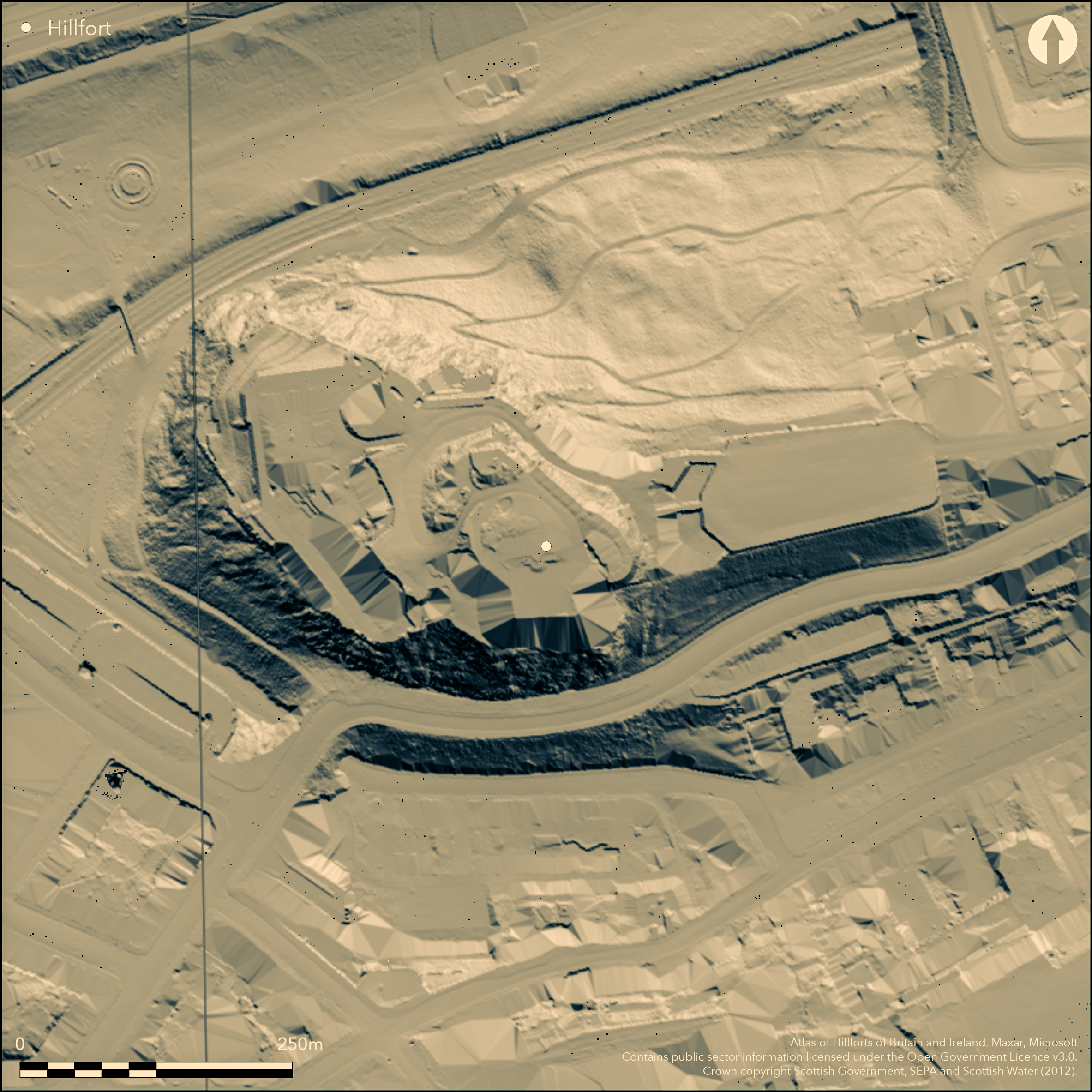
LiDAR 1m DTM Hillshade

Satellite Imagery
LiDAR 1m DTM Hillshade
Satellite Imagery
Scroll left/right to view further images.
HER: City of Edinburgh No record found (None)
NMR: NT 27 SE 1.32 (74095)
SM: 90130
NGR: NT 2518 7346
X: 325180 Y: 673463 (OSGB36)
The appearance of Din Eidyn in the poem The Gododdin, and the documented siege of Din Etin about AD 638, have been interpreted as evidence of an early medieval fortress on the Castle Rock beneath Edinburgh Castle (summarised by Alcock 1981, 165-6), an identification to some extent confirmed by the discovery of early medieval midden deposits in excavations carried out 1988-91 (Driscoll and Yeoman 1997), albeit that no defences of this date have been uncovered. With such major construction works in the erection of the later castle defences, this is perhaps no more than can be expected, and, in view of its topographical setting, girt with cliffs and easily accessible only from the Esplanade on the E, there is every reason to include the Castle Rock in the Hillfort Atlas. The topography of the summit area, with the true summit forming a boss dominating the approach from the E along the edge of the NE cliffs, determines the maximum overall extent of the fort, roughly coincident with the castle and covering an area measuring some 230m from ESE to WNW by 140m (2.4ha). By the same token, the discovery in the excavations to the NW of the summit boss of middens apparently spanning the Roman Iron Age and early medieval period with no discernible hiatus, and beneath them elements of three round-houses and extensive paved surfaces, has been interpreted by the excavators as evidence of an earlier fort on the site. The chronology of these accumulated deposits, however, is not particularly clear, the contexts of the seven radiocarbon dates obtained, spanning from the 2nd century BC to the 7th century AD, possibly suggesting the deposits may have been much more mixed than the various analyses suggest. Numerous Roman items found in the middens, with up to 50 vessels represented, are overwhelmingly dated to the 1st or 2nd centuries, with only two sherds of fine wares that are probably later, and a sherd of glass probably of 4th century date. As such, the majority of the evidence here reflects patterns seen more widely across the Border Counties and Northumberland, where late Iron Age or Early Roman Iron Age settlements overlie the defences of earlier forts, albeit that no defences are known here. Even more tenuous would be the assertion that the summit was also enclosed in the Late Bronze Age on the grounds of the pits, hearths and cobbled surfaces found at the bottom of the sequence, though a very similar pattern of Late Bronze Age and late Iron Age / Roman Iron Age occupation has been established at the large hilltop enclosure on Traprain Law in East Lothian.
Citizen Science: ✗
Reliability of Data: Confirmed
Reliability of Interpretation: Confirmed
X: -356183 Y: 7548150 (EPSG: 3857)
Longitude: -3.199649462657475 Latitude: 55.948399366179004 (EPSG:4326)
Country: Scotland
Current County or Unitary Authority: City of Edinburgh
Historic County: Midlothian
Current Parish/Community/Council/Townland: Edinburgh
None
| Extant | ✗ |
| Cropmark | ✗ |
| Likely Destroyed | ✓ |
None
| Woodland | ✗ |
| Commercial Forestry Plantation | ✗ |
| Parkland | ✗ |
| Pasture (Grazing) | ✗ |
| Arable | ✗ |
| Scrub/Bracken | ✗ |
| Bare Outcrop | ✗ |
| Heather/Moorland | ✗ |
| Heath | ✗ |
| Built-up | ✓ |
| Coastal Grassland | ✗ |
| Other | ✗ |
Character of any earlier fortifications is unknown
| Contour Fort | ✗ |
| Partial Contour Fort | ✗ |
| Promontory Fort | ✗ |
| Hillslope Fort | ✗ |
| Level Terrain Fort | ✗ |
| Marsh Fort | ✗ |
| Multiple Enclosure Fort | ✗ |
| Hilltop | ✓ |
| Coastal Promontory | ✗ |
| Inland Promontory | ✗ |
| Valley Bottom | ✗ |
| Knoll/Hillock/Outcrop | ✗ |
| Ridge | ✗ |
| Cliff/Plateau-edge/Scarp | ✗ |
| Hillslope | ✗ |
| Lowland | ✗ |
| Spur | ✗ |
Dominant Topographic Feature: None
| North | ✗ |
| Northeast | ✗ |
| East | ✗ |
| Southeast | ✗ |
| South | ✗ |
| Southwest | ✗ |
| West | ✗ |
| Northwest | ✗ |
| Level | ✓ |
Altitude: 131.0m
N/A
While documentary sources alluding to the importance of the Castle Rock in early medieval geography are to some extent confirmed by the excavation of middens of this date, no structural remains of any defences have been uncovered. Likewise for the rich assemblage of Roman goods recovered from earlier middens, and indeed the late Iron Age round-houses that preceded them, and the late Bronze Age pits uncovered in excavation, it is an assumption that the precipitous character of the location implies a defended settlement of some description.
Reliability: D - None
| Pre 1200BC | ✗ |
| 1200BC - 800BC | ✓ |
| 800BC - 400BC | ✗ |
| 400BC - AD50 | ✗ |
| AD50 - AD400 | ✓ |
| AD400 - AD 800 | ✓ |
| Post AD800 | ✗ |
| Unknown | ✗ |
| Pre Hillfort: | None |
| Post Hillfort: | None |
| Artefactual: | Extensive assemblage of Roman goods, including over 50 vessels, two sherds of glass and several brooches, the overwhelming majority of which dates from the 1st / 2nd century AD, with two fine ware sherds and a fragment of glass probably being later. Early medieval material from the upper levels of the middens, which also contained occasional Roman sherds, was restricted to three items: a decorated antler comb (possibly 7th -10th century); a bronze buckle (7th -13th century); and fragment of fire steel (7th -9th century). |
| C14: | Eight radiocarbon dates, and while the earliest from the LBA pits seems secure, the contexts of the other seven, spanning from 2nd century BC to the 7th century AD suggest very mixed deposits in the middens overlying the remains of round-houses |
| Other: | Documentary; appears in the Gododdin and in annal entries |
The absence of any visibly earlier remains in the recording of the castle has rendered discussion of the presence of an earlier work here to historians (summarised by: RCAHMS 1951, xxxv, 1, no.1; Alcock 1981, 165-6; Driscoll and Yeoman 1997, 26-70). 1993). Numerous other interventions and watching briefs relating to the medieval and later castle and its works have been excluded here.
| Excavation (1988): | Yeoman 1988; Driscoll and Yeoman 1997, 26-70 |
| Excavation (1989): | Yeoman 1989; Driscoll and Yeoman 1997, 26-70 |
| Excavation (1990): | Driscoll and Yeoman 1997, 26-70 |
| Excavation (1991): | Driscoll and Yeoman 1997, 26-70 |
| Other (1993): | Scheduled |
Deep deposits of midden found in excavation overlying late Iron Age round-houses and Late Bronze Age pits
None
| None | ✓ |
| Spring | ✗ |
| Stream | ✗ |
| Pool | ✗ |
| Flush | ✗ |
| Well | ✗ |
| Other | ✗ |
None
| No Known Features | ✓ |
| Round Stone Structures | ✗ |
| Rectangular Stone Structures | ✗ |
| Curvilinear Platforms | ✗ |
| Other Roundhouse Evidence | ✗ |
| Pits | ✗ |
| Quarry Hollows | ✗ |
| Other | ✗ |
Middens overlying round-houses
| No Known Excavation | ✗ |
| Pits | ✓ |
| Postholes | ✓ |
| Roundhouses | ✓ |
| Rectangular Structures | ✗ |
| Roads/Tracks | ✗ |
| Quarry Hollows | ✗ |
| Other | ✓ |
| Nothing Found | ✗ |
None
| No Known Geophysics | ✓ |
| Pits | ✗ |
| Roundhouses | ✗ |
| Rectangular Structures | ✗ |
| Roads/Tracks | ✗ |
| Quarry Hollows | ✗ |
| Other | ✗ |
| Nothing Found | ✗ |
LBA: pottery recovered from pits at the bottom of the stratigraphy Late Iron Age to Roman Iron Age: coarse pottery; coarse stone tools (two saddle querns and a rubber, three rotary quern fragments, four whetstones, four stone discs, hammerstones, two fragments of shale bracelets fragment; shale gaming piece; several spindle whorls; stone ball), antler handles; few iron implements. Slight evidence of iron working. Cattle sheep and pigs. Roman: Denarius of Hadrian, two sherds of glass, coarse and fine wares representing 50 vessels, and several brooches and pins; the greater mass of Roman materiel is 1st/2nd century with a few sherds probably later. Early medieval: possibly some of the coarse pottery; a decorated antler comb (possibly 7th -10th century); a bronze buckle (7th -13th century); and fragment of fire steel (7th -9th century).
| No Known Finds | ✗ |
| Pottery | ✓ |
| Metal | ✓ |
| Metalworking | ✓ |
| Human Bones | ✗ |
| Animal Bones | ✓ |
| Lithics | ✓ |
| Environmental | ✗ |
| Other | ✗ |
Beneath castle
| APs Not Checked | ✗ |
| None | ✓ |
| Roundhouses | ✗ |
| Rectangular Structures | ✗ |
| Pits | ✗ |
| Postholes | ✗ |
| Roads/Tracks | ✗ |
| Other | ✗ |
Not known
| 0: | None |
| 2: | None known, but probably on the E |
Guard Chambers: ✗
Chevaux de Frise: ✗
None known
| Area 1: | Noneha. |
| Total: | Noneha. |
Total Footprint Area: 2.4ha.
None
| ✗ | None |
| ✗ | None |
| NE Quadrant: | 0 |
| SE Quadrant: | 0 |
| SW Quadrant: | 0 |
| NW Quadrant: | 0 |
| Total: | 0 |
| Partial Univallate | ✗ |
| Univallate | ✗ |
| Partial Bivallate | ✗ |
| Bivallate | ✗ |
| Partial Multivallate | ✗ |
| Multivallate | ✗ |
| Unknown | ✓ |
| Partial Univallate | ✗ |
| Univallate | ✗ |
| Partial Bivallate | ✗ |
| Bivallate | ✗ |
| Partial Multivallate | ✗ |
| Multivallate | ✗ |
None
| None | ✓ |
| Earthen Bank | ✗ |
| Stone Wall | ✗ |
| Rubble | ✗ |
| Wall-walk | ✗ |
| Evidence of Timber | ✗ |
| Vitrification | ✗ |
| Other Burning | ✗ |
| Palisade | ✗ |
| Counter Scarp Bank | ✗ |
| Berm | ✗ |
| Unfinished | ✗ |
| Other | ✗ |
None
| None | ✓ |
| Earthen Bank | ✗ |
| Stone Wall | ✗ |
| Murus Duplex | ✗ |
| Timber-framed | ✗ |
| Timber-laced | ✗ |
| Vitrification | ✗ |
| Other Burning | ✗ |
| Palisade | ✗ |
| Counter Scarp Bank | ✗ |
| Berm | ✗ |
| Unfinished | ✗ |
| No Known Excavation | ✗ |
| Other | ✗ |
| ✗ | None |
| ✗ | None |
Number of Ditches: None
| ✗ | None |
Alcock, L (1981) 'Early historic fortifications in Scotland'. 150-80 (bibliography 182-201) in Guilbert, G (1981) Hill-Fort Studies: Essays for A. H. A. Hogg. Leicester University Press: Leicester
Driscoll and Yeoman, S T and P A (1997) Excavations within Edinburgh Castle in 1988-91. Society of Antiquaries of Scotland, Monograph No.12: Edinburgh 26-70
RCAHMS (1951) The Royal Commission on the Ancient Monuments of Scotland. An inventory of the ancient and historical monuments of the city of Edinburgh with the thirteenth report of the Commission. HMSO: Edinburgh
Yeoman, P (1988) 'Edinburgh Castle (Edinburgh parish), foundations, industrial activity, Roman and native pottery, comb'. Disc Exc Scot (1988), 18-19
Yeoman, P (1989) 'Edinburgh Castle (Edinburgh parish)'. Disc Exc Scot (1989), 50-1
Yeoman, P A (1990) 'Edinburgh Castle: Iron Age fort to garrison fortress'. Fortress 4 (1990), 22-6
Yeoman and Driscoll, P A and S T (1992) 'Edinburgh Castle'. Curr Archaeol 11, 11, 1992, October
Atlas of Hillforts:
Wikidata:
This work is licensed under CC BY-SA 4.0![]()
![]()
![]() and should be cited as:
and should be cited as:
Lock, Gary and Ralston, Ian. 2024. Atlas of Hillforts of Britain and Ireland. Available at: https://hillforts.arch.ox.ac.uk
Document Version 1.1