LiDAR 1m DTM Hillshade
Satellite Imagery
LiDAR 1m DTM Hillshade
Satellite Imagery
Scroll left/right to view further images.
HER: East Lothian Council MEL505 (None)
NMR: NT 47 NW 19 (54928)
SM: 6191
NGR: NT 4250 7536
X: 342505 Y: 675369 (OSGB36)
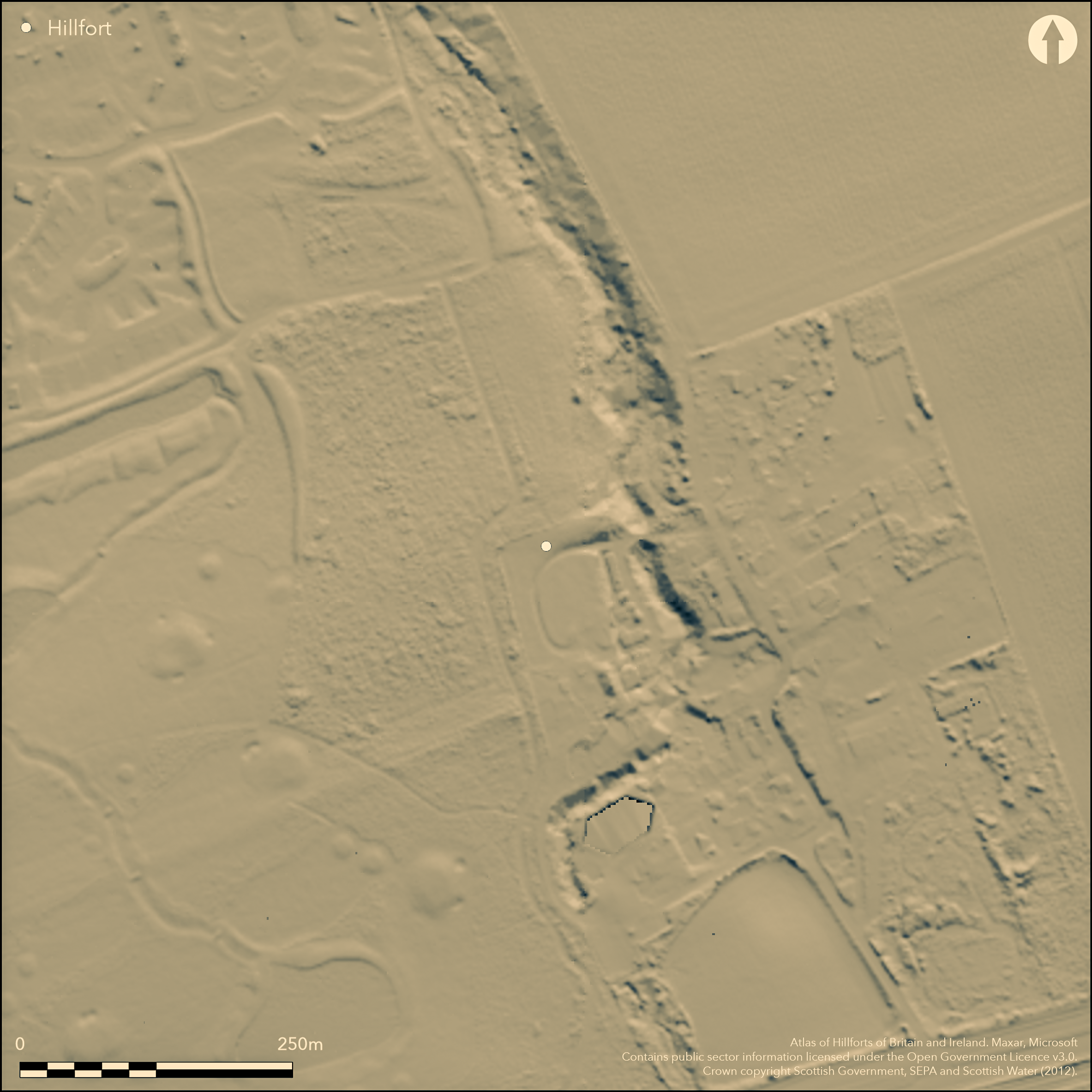
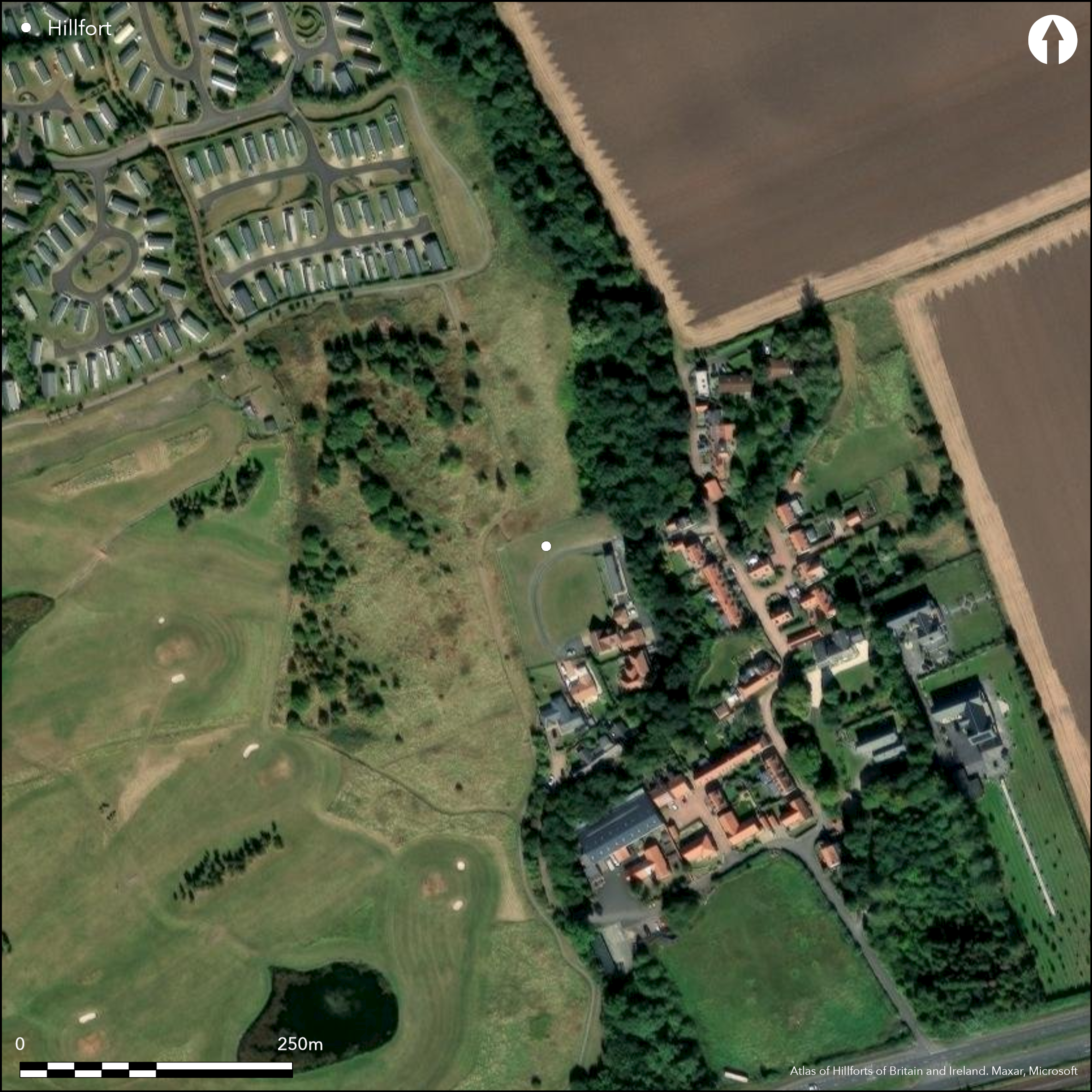
The site of this fort or fortified settlement lies on the W side of the gully of the minor burn that formerly fed the mill in the old steading at Seton Mains, which lay to the SE and has now been largely developed for residential housing. Protected by Scheduling, and subject to several evaluations around its edges, the site of the fort remains undeveloped, albeit that it partly lies within garden ground. Nothing can be seen of its defences on the ground, but cropmarks reveal that its principal line of defence was a ditch between 4m and 7m in breadth, presumably accompanied by an internal rampart. On the NNW the ditch extends in a straight line from the edge of the gully before turning S and then doglegging outwards to form the N side of an entrance causeway about 7m broad; from the S side of the causeway the ditch returns ESE to the edge of the gully, quickly expanding to its broadest span. On plan, the enclosure is thus roughly D-shaped on plan, backing onto the gully on the E and measuring about 100m along the chord by a maximum of 90m transversely (0.7ha) within the ditch. The interior will have been rather smaller, perhaps roughly matching the area enclosed by a palisade trench set some 4m within the ditch on the NNW, and 7m on the S, and taking in about 0.5ha; the relationship between the ditch and the palisade trench is unknown, and while they are roughly concentric along the flanks, the palisade evidently did not follow the more elaborate path of the ditch at the entrance. Other evidence, however, indicates a complex sequence of occupation and enclosure here, for the palisade trench intersects one timber round-house that lies in the entrance to the ditched enclosure and encloses at least two others. Furthermore, there are traces of the perimeters of at least two smaller enclosures within the interior, one an arc of ditch up to 2m broad on the W and S, and the other a pair of palisade trenches on the NNW. These latter are set at much the same interval as the tractor marks in the field, but while they might be modern features, they can also be detected on photographs taken 15 years apart.
Citizen Science: ✗
Reliability of Data: Confirmed
Reliability of Interpretation: Confirmed
X: -325351 Y: 7552030 (EPSG: 3857)
Longitude: -2.9226801783004572 Latitude: 55.96791053776491 (EPSG:4326)
Country: Scotland
Current County or Unitary Authority: East Lothian
Historic County: East Lothian
Current Parish/Community/Council/Townland: Tranent
None
| Extant | ✗ |
| Cropmark | ✓ |
| Likely Destroyed | ✗ |
None
| Woodland | ✗ |
| Commercial Forestry Plantation | ✗ |
| Parkland | ✓ |
| Pasture (Grazing) | ✗ |
| Arable | ✓ |
| Scrub/Bracken | ✗ |
| Bare Outcrop | ✗ |
| Heather/Moorland | ✗ |
| Heath | ✗ |
| Built-up | ✓ |
| Coastal Grassland | ✗ |
| Other | ✗ |
None
| Contour Fort | ✗ |
| Partial Contour Fort | ✗ |
| Promontory Fort | ✗ |
| Hillslope Fort | ✗ |
| Level Terrain Fort | ✓ |
| Marsh Fort | ✗ |
| Multiple Enclosure Fort | ✗ |
| Hilltop | ✗ |
| Coastal Promontory | ✗ |
| Inland Promontory | ✗ |
| Valley Bottom | ✗ |
| Knoll/Hillock/Outcrop | ✗ |
| Ridge | ✗ |
| Cliff/Plateau-edge/Scarp | ✗ |
| Hillslope | ✗ |
| Lowland | ✓ |
| Spur | ✗ |
Dominant Topographic Feature: None
| North | ✗ |
| Northeast | ✗ |
| East | ✗ |
| Southeast | ✗ |
| South | ✗ |
| Southwest | ✗ |
| West | ✗ |
| Northwest | ✗ |
| Level | ✓ |
Altitude: 25.0m
N/A
In the absence of excavation, there are neither stratified artefacts nor radiocarbon dates to provide a chronology for the defences.
Reliability: D - None
| Pre 1200BC | ✗ |
| 1200BC - 800BC | ✗ |
| 800BC - 400BC | ✗ |
| 400BC - AD50 | ✗ |
| AD50 - AD400 | ✗ |
| AD400 - AD 800 | ✗ |
| Post AD800 | ✗ |
| Unknown | ✓ |
| Pre Hillfort: | None |
| Post Hillfort: | Ploughed flat |
Photographed by RCAHMS Aerial Survey Programme in 1976, 1979, 1990, 1994 and 1996 1995
| 1st Identified Written Reference (1976): | First photographed by the RCAHMS Aerial Survey Programme |
| Earthwork Survey (1994): | Plot of environs prior to Scheduling (CFA 1994) |
| Other (1995): | Evaluations in the immediate vicinity (Alexander 1995) |
| Other (2011): | Evaluation in the vicinity by AOC Archaeology (Dunbar 2011) |
Traces of palisade trenches and a ditch representing at least two phases of enclosure are visible within the interior, together with several timber round-houses, two defined by ring-rooves and one by a macula with possibly a concentric ring-groove
None
| None | ✓ |
| Spring | ✗ |
| Stream | ✗ |
| Pool | ✗ |
| Flush | ✗ |
| Well | ✗ |
| Other | ✗ |
None
| No Known Features | ✓ |
| Round Stone Structures | ✗ |
| Rectangular Stone Structures | ✗ |
| Curvilinear Platforms | ✗ |
| Other Roundhouse Evidence | ✗ |
| Pits | ✗ |
| Quarry Hollows | ✗ |
| Other | ✗ |
None
| No Known Excavation | ✓ |
| Pits | ✗ |
| Postholes | ✗ |
| Roundhouses | ✗ |
| Rectangular Structures | ✗ |
| Roads/Tracks | ✗ |
| Quarry Hollows | ✗ |
| Other | ✗ |
| Nothing Found | ✗ |
None
| No Known Geophysics | ✓ |
| Pits | ✗ |
| Roundhouses | ✗ |
| Rectangular Structures | ✗ |
| Roads/Tracks | ✗ |
| Quarry Hollows | ✗ |
| Other | ✗ |
| Nothing Found | ✗ |
None
| No Known Finds | ✓ |
| Pottery | ✗ |
| Metal | ✗ |
| Metalworking | ✗ |
| Human Bones | ✗ |
| Animal Bones | ✗ |
| Lithics | ✗ |
| Environmental | ✗ |
| Other | ✗ |
Round-houses and palisades in a multiperiod sequence
| APs Not Checked | ✗ |
| None | ✗ |
| Roundhouses | ✓ |
| Rectangular Structures | ✗ |
| Pits | ✗ |
| Postholes | ✗ |
| Roads/Tracks | ✗ |
| Other | ✓ |
See main summary
| 1: | The whole perimeter is ploughed flat |
| 2: | None |
Guard Chambers: ✗
Chevaux de Frise: ✗
| 1. Simple Gap (West): | While the entrance has been elaborated by the dogleg in the ditch, the ditch terminals are directly opposed |
Single broad ditch, presumably with an upcast rampart, but also with a partly concentric internal palisade trench and evidence of at least two other enclosures
| Area 1: | 0.5ha. |
| Total: | 0.5ha. |
Total Footprint Area: Noneha.
None
| ✓ | The internal palisade trench intersects one of the round-houses. Its lack of concentricity to the ditch at the entrance may indicate it is of different date. |
| ✗ | None |
| NE Quadrant: | 0 |
| SE Quadrant: | 0 |
| SW Quadrant: | 1 |
| NW Quadrant: | 1 |
| Total: | 1 |
| Partial Univallate | ✓ |
| Univallate | ✗ |
| Partial Bivallate | ✗ |
| Bivallate | ✗ |
| Partial Multivallate | ✗ |
| Multivallate | ✗ |
| Unknown | ✗ |
| Partial Univallate | ✗ |
| Univallate | ✗ |
| Partial Bivallate | ✗ |
| Bivallate | ✗ |
| Partial Multivallate | ✗ |
| Multivallate | ✗ |
Not visible on the surface; palisade trenches revealed by cropmarks in a multiperiod sequence
| None | ✗ |
| Earthen Bank | ✗ |
| Stone Wall | ✗ |
| Rubble | ✗ |
| Wall-walk | ✗ |
| Evidence of Timber | ✗ |
| Vitrification | ✗ |
| Other Burning | ✗ |
| Palisade | ✓ |
| Counter Scarp Bank | ✗ |
| Berm | ✗ |
| Unfinished | ✗ |
| Other | ✗ |
None
| None | ✗ |
| Earthen Bank | ✗ |
| Stone Wall | ✗ |
| Murus Duplex | ✗ |
| Timber-framed | ✗ |
| Timber-laced | ✗ |
| Vitrification | ✗ |
| Other Burning | ✗ |
| Palisade | ✗ |
| Counter Scarp Bank | ✗ |
| Berm | ✗ |
| Unfinished | ✗ |
| No Known Excavation | ✓ |
| Other | ✗ |
| ✗ | None |
| ✓ | None |
Number of Ditches: 1
| ✗ | None |
Alexander, D (1995) 'Seton mains (Tranent parish), later prehistoric enclosure'. Disc Exc Scot (1995), 51-52
CFA (1994j) 'Seton Mains (Tranent parish): later prehistoric enclosure'. Disc Exc Scot (1994), 47
Dunbar, L (2011) «Stepping Stones». Seton Mains, Longniddry, East Lothian (Tranent parish), evaluation'. Disc Exc Scot, New Ser, 12 (2011), 69
Atlas of Hillforts:
Wikidata:
This work is licensed under CC BY-SA 4.0![]()
![]()
![]() and should be cited as:
and should be cited as:
Lock, Gary and Ralston, Ian. 2024. Atlas of Hillforts of Britain and Ireland. Available at: https://hillforts.arch.ox.ac.uk
Document Version 1.1